Tours
Activities
Places of interest
Where to eat
Where to sleep

Adventures at Domaine des Chênes Blancs in Saint-Saturnin-les-Apt

Are you the owner?
Welcome to Domaine des Chênes Blancs, perfectly located in Saint-Saturnin-les-Apt, in the beautiful Vaucluse department of Provence-Alpes-Côte d'Azur. Discover a region brimming with activities and cultural heritage that will make your stay unforgettable. Start with a visit to the picturesque village of Saint-Saturnin-les-Apt, where charming streets, a ruinous castle, and historic mills will trans...See more

Walking around DOMAINE DES CHENES BLANCS

See more suggestions
Walk through the natural landscapes of DOMAINE DES CHENES BLANCS.
See more suggestions
Underground water tanks in Travignon
665 m

Underground water tanks in Travignon

Starting at the hilltop village of Saint-Saturnin-lès-Apt, a great trip on the Sentier des Aiguiers, the top of Mount Cluyer and the ruins of Travignon. Back turned to the ''Information Point", next to the post office and pharmacy, go left then right onto the Rue Victor Hugo on 50m. Begin to the left on the Rue de la Combe and take a quick left under the puppet. Climb the cobblestone to the mill. Go up the path to the right on the edge of the plateau. Then take a right, cross the dam, pass through the castrum and turn left into the castle. Bypass the chapel on the left. 1 - At the crossroads, go straight across. Continue to the right and climb to the Chemin des Gavaniols. Continue straight. Leave several roads to your left and right leading to houses. Pass a sloping ledge and reach the Aiguiers Bessons. 2 - Rise to the right onto the path. At the 1st (new alternative route) then 2nd crossing, continue on the path in front. Leave a track going to the right and reach the rocky ledge. Climb the East ridge (markings barely visible), reach a small covered aiguier (Provençal underground water tank) and continue right to the Mount Cluyer dome. Pass the viewpoint and reach the summit plateau (milestone). 3 - Descend the trail due north, continue on the path under the pines and come out on La Liguière track. Follow the track for 150m and at the Y-like crossroad, continue left on the Chemin de la cassette (private pathway!). Bypass the farm to the right (gate) and reach the track below. Turn right (GR®) and after the aiguiers of Gayeoux, turn right. Go down 400m and leave a path to the left. 4 - Take a sharp left (milestone). Climb the small mountain pass of Travignon and switch to the aiguiers upstream the hamlet. Descend to the right on the rocky path, then turn left. Go through the ruins of Travignon, take a sharp right at the exit of the hamlet and immediately a left to go down the winding paths of the old mule track. 5 - Take a sharp left and immediately right (GR®). Hurtle down the trail which is very craggy down below. Continue at the valley bottom. Skip the narrow pass of the Rocher de la Cadière. At the crossroads "Puits du Geay", go straight. Pass the narrow gully of the Portes de Castor and go straight. 6 - look to the right for the 1st orchard along the track. Turn right, go up 100m along the field and climb the trail to the Bois du Defens. At the path, go across, descend and coming out of the scrubland, turn right. Go up the Rue de Fontaine de Guby to the right. Reach the Chemin de Romanet then the Cours de la Liberté to the left to go back to the village center.

6 h
20 km
Hard
Show
The Villars secrets
3.1 km

The Villars secrets

Far from the well-known areas, a summary of natural wonders and rural heritage, between ochres, cultures, oak groves and scrublands. Opposite the town hall, turn right towards Rustrel. When at the village hall, dive right onto a path that goes into the housing estate boundary (fence). Turn left onthe road, cross La Riaille and at the intersection ''Clastre'', continue straight. 500m further, take the left path (GR®) entering the classified massive and an ?environmentally sensitive area (ESA). Pass two corners and rise to the left at the top of the hill. 1 - At the crossroads"Trou des Américains" visit the pond 100m to the right and back to point 1. Continue on the right trail (GR®and travel through all the ochre massif. Coming out on the road ''La Glaurivette'', cross the D214. 2 - Take the opposite track (RP), then cross the D179. Advance on 80m on the path of Fumeirasse and turn left. At the bottom, turn right and go slowly straight tothe crossroads"Fumeirasse''. Continue the path completely to the left and reach a crossing (point 429). 3 - Go straight until the chapel and go back to point 3. There, ride up the steep path and continue on it. At the top of the second steep path, turn right. Reach to a track. Go up on the right on 650m. Do not miss to the left the road which descends slightly (local RP, green markings). 4 - In a right turn (cairn)Go across and go straight at the first intersection (cairn). Slowly descend on 700m and turn right on a path that winds through the scrubland (green markings). After two turns, cross the ravine, up to the junction with another path. 5 - Go down the road for 15m and take the first road to the left. Go straight and turn left to reach the D179 below. Cross the road, pass the Hameau des Marchands, go along the recreation centre and reach the D214. Continue straight through the protected pedestrian crossing. At the crossroads"Saint-Joseph'', climb the ramp to the right (no entry sign) and take the second right to return to the centre of Villars.

4 h
13 km
Medium
Show
The Aiguiers (cistern from rock) of St-Saturnin-lès-Apt
3.5 km

The Aiguiers (cistern from rock) of St-Saturnin-lès-Apt

Short and clever combination of the "Sentier des Aiguiers'' which offers a beautiful glimpsecrafty and remarkable water supplies. Back facing the car park, go down across on the paved track. After the turn; go back up gently. At the 1st intersection, turn left and climbthe track. Leave behind several roads to the right then to the left leading to houses. Pass a sloping ledge and reach the Aiguiers Bessons. 1 - Rise to the right onto the path. At the 1st crossing, continue the winding paths across (new variant). At the path, still continue across. A little further, leave a track going to the right and continue on the rocky ledge. Reach a viewpoint and climb the edge to the east (marking hardly noticeable). Reach a small covered aiguier. Continue to the right, pass the orientation table and reach the Cluyer dome (mountain pass cycling milestone). 2 - Descend the trail due north, continue on the path under the pines and come out on La Liguière track. Follow right on 150m and take on the right the Lays track (ignore the sign'Sentier des Aiguiers'' to the left). Reach the Romanet track and go down to the right for 500m, then at the exit of a bend, turn left towards Travignon. After a ledge in the woods, turn left. 3  - Continue the path straight. Pass 2 turns and reach the Aiguiers upstream. Retrace your steps to point 3 by cutting through 2 turns by the stony path. Turn left and cross the ruins of Travignon. When leaving the hamlet, take a sharp right and immediately a left to go down the winding paths of the old mule track. When at the 2 large rocks, leave the GR® behind to the left and go down the path to the right. Go up slightly to come out on the Romanet track. Go down on the left for 1km / less than a mile. 4 - Do not miss the path that rises to the right (point 754m). 200m above, turn left and climb the path. Continue by following the marking carefully (private property!), then gradually rise to a track that leads to the Caulet farm. Go down to the left, go up slightly, then turn left (mountain pass cycling milestone).Go down the path to the south. Do not miss, at the exit of a corner, the trail rising to right and coming out on the corner of a fence. Turn left, walk along the fence and come out on the Romanes trail. Turn left to return to the starting point.

5 h
16 km
Medium
Show
The Aiguiers (cistern from rock) of St-Saturnin-lès-Apt
3.5 km

The Aiguiers (cistern from rock) of St-Saturnin-lès-Apt

Short and clever combination of the "Sentier des Aiguiers'' which offers a beautiful glimpsecrafty and remarkable water supplies. Back facing the car park, go down across on the paved track. After the turn; go back up gently. At the 1st intersection, turn left and climbthe track. Leave behind several roads to the right then to the left leading to houses. Pass a sloping ledge and reach the Aiguiers Bessons. 1 - Rise to the right onto the path. At the 1st crossing, continue the winding paths across (new variant). At the path, still continue across. A little further, leave a track going to the right and continue on the rocky ledge. Reach a viewpoint and climb the edge to the east (marking hardly noticeable). Reach a small covered aiguier. Continue to the right, pass the orientation table and reach the Cluyer dome (mountain pass cycling milestone). 2 - Descend the trail due north, continue on the path under the pines and come out on La Liguière track. Follow right on 150m and take on the right the Lays track (ignore the sign'Sentier des Aiguiers'' to the left). Reach the Romanet track and go down to the right for 500m, then at the exit of a bend, turn left towards Travignon. After a ledge in the woods, turn left. 3  - Continue the path straight. Pass 2 turns and reach the Aiguiers upstream. Retrace your steps to point 3 by cutting through 2 turns by the stony path. Turn left and cross the ruins of Travignon. When leaving the hamlet, take a sharp right and immediately a left to go down the winding paths of the old mule track. When at the 2 large rocks, leave the GR® behind to the left and go down the path to the right. Go up slightly to come out on the Romanet track. Go down on the left for 1km / less than a mile. 4 - Do not miss the path that rises to the right (point 754m). 200m above, turn left and climb the path. Continue by following the marking carefully (private property!), then gradually rise to a track that leads to the Caulet farm. Go down to the left, go up slightly, then turn left (mountain pass cycling milestone).Go down the path to the south. Do not miss, at the exit of a corner, the trail rising to right and coming out on the corner of a fence. Turn left, walk along the fence and come out on the Romanes trail. Turn left to return to the starting point.

5 h
15 km
Medium
Show
The Ochres by bike
4.3 km

The Ochres by bike

A colourful route! With exceptional landscapes, ochre sites, underground or open-air quarries and colourful villages. Across of the pharmacy, go right to reach below the small roundabout and turn left towards Lombards. Calmly climb to reach a crossing. At the stop sign, turn right and follow the route"The Ochres by bike". Reach the Mines of Bruoux. Then continue to the hamlet of Lombards. Exit through the right and get to the crossroads. 1 - Take a sharp right and at the corner of the campsite, turn left. Come out on the D227 and take a left for 2km. At the crossing with the D4, continue across on the D227 towards Roussillon. Climb two hairpin bends, take two lefts and enter the village streets. Go around a blockand reach to the left foot the ramp leading to the ochre trail. 2 – Go forward to La Burlière avenue (D105), pass a speed bump and at the next junction, go left. Reach a roundabout and continue left towards Apt. Reach another speed bump and at the Y junction, continue straight on the D104 towards Apt. Get to the Conservatoire of Ochres. 3 – Follow the D104, glide through the curves and at the straight line, look out for the small road to the left. Follow it and reach the D4. Cross with the utmost caution and take the small road across, leading to Lombards. Enter a residential area and reach the crossroads you didn't pass on your way going (point 1). 1 – Turn right and return to Gargas by the same route as the one used to go.

2 h
18 km
Easy
Show
Cliff of the Madeleine
6.4 km

Cliff of the Madeleine

fullness and wonder at the wild beauty of a long cliff ridge ... Take a left at the exit of the parking and join the road junction. Take the D60 on the left towards Lioux and its cliff. 1-At the exit of the first right turn (tank), turn left onto a dirt road (PR). Get out higher on the D60 and take it to the left. At the entrance of the bend, turn right on a footpath at the foot of the cliff (PR). At the height of the first houses of Lioux, join again the D60 on the left (not marked), then reach the nearby church and the wash house opposite. Continue the road, exit the village of Lioux and continue to the right on a stony path (PR). Walk along the foot of the cliff and climb a steep ramp. Unblock between two houses, turn left and immediately right then continue the path between vineyards, truffle and lavender (PR). 2- - At the mas of La Verrerie, turn right and climb the ancestral path to the crests. Take a bend, turn right and continue 20 m further on the right path (PR). Start to descend along the ridges, then 150 m lower, to sneak right on a path that approaches the edge of the cliff of La Madeleine (local PR, green mark up dots). Get out on the path more marked then repeat twice this escapade right on the edge of cliff. Follow the rocky trail in the scrubland, descend and climb a rock jump (walk) to reach the top of a shoulder (cairn). 3- Continue the path along the ridges. Further on, continue on the path on the right to follow the cliff edge (green dots). Join again the main rocky path (PR and green dots) and go straight up to the top of a bump. Sneak behind on the trail that skirts left over the grove of trees (green dots), then 30 m lower, dive on the right path (PR and green dots). 4- Unclog on an esplanade near the old mill. Go down the paved path and walk along the foot of the cliff. Pass the cemetery and reach the D60. Turn left and go down the road to the hamlet of La Combe.

3 h
7.3 km
Medium
Show
Colorado tour by mountain bike
9 km

Colorado tour by mountain bike

Technically affordable but full of reminders, it's quite physical. But what a treat! Exit Rustrel following the GR® and the GTV®. Cross the D22 and at the crossroads ''Cornet'', turn left. Go along the former car park of Colorado and reach the start of the DFCI track. 1 - Turn right, cross the ford on La Doua, then rise by the track. Pass two winding paths and at the crossroads ''Barriès'', turn left on a rocky path. Cross a sandy narrow gully and continue straight. Come out on the paved track and reach further onto a road. Turn right and climb to the pass. 2 - Leave the GR® behind and the GTV® to the left and continue straight. Glide and go straight to the crossroads"Pradenques'' and"Ubac de Pradenques'', then climb to the plateau. Follow to the right the 1st track (RP). At the 2nd crossing, turn right on the path. After a ledge, turn right and then immediately left to reach the edge of the plateau. Then, go along a big field and reach the"Croix de Christol''. 3 - Take a left and 50m further, turn right. Continue straight on the trail, and then down the slope to the road. Follow it to the right, cross the hamlet of Haute-Blace and continue for 1.5km. At the exit of left turn, turn right and go down to La Doua. At the bottom, turn right, cross the D22 with caution andturn left on the track at the entrance of Jean-Jean. At the next crossroads continue straight. Above, follow the small road to the small mountain pass of Trécassats (marking"The Ochres by bike"). 4 - Take on the right, the coloured trail parallel to the path (GTV® marking), then climb right to the top of La Bruyère (interpretation panels). At the crossroads ''Trou des Américains'', follow to the right the GR® and thus through all the ochre massif. Coming out on the road ''La Glaurivette'', follow the D214 to the right and 550m further turn left, cross the hamlet of Viaux, cross the D179 and climb a gravel path. 5 - Go down the road for 400m and take the first road to the left. Go up gently, turn right on the ledge and then embark on a beautiful rocky single track that falls between oaks and scrubs. Lower down, after a last turn, follow the opposite path along the foot of the massive and return quietly to Rustrel.

4 h
23 km
Medium
Show
The Provençal Colorado
9 km

The Provençal Colorado

A break in the vast ocher gathering, both intimate and panoramic. Facing the Restreou Hostel, take the Route de Saint-Christol (D30) to the right. 100m further, turn right and go down the Boulevard du Colorado (D30a). 430m further, take the Chemin de Saint-Joseph to the right and follow it. At the stop sign, cross the D22 (be careful!) and continue across. At the crossroads "Cornet", turn left. Then follow the old car park of Colorado. In a curve (refreshment area), immerse to the right on the DFCI track. Cross the Dôa (ford) and go up the long track of Barriès (GR® markings). 1- At the sign-post ''Barriès'' turn left onto the pretty trail (slab). Reach an area of ruts and continue straight (GR®). Then take the paved road "Chemin de l'Ubac". At the junction, go right onto Route de Gignac. 2- At the mountain pass, take the left track for 500m and reach the imprinted slabs. Turn around and go back to point 2. Back again on the pass, follow the road to the left. At the crossroads "Pradenques" and "Ubac de Pradenques" continue straight. On top of the hill, turn onto the right track. 1km away, take a right back into the woods. After a break, continue left onto the lower trail (PR). Go along a large field and reach the crossroads ''Croix de Christol '' (sign-post). 3- Pass the gate and hurtle down the trail (PR). The stones give way to ocher; take the time to make a landscape stop. Down, spin slightly to the left along the clearing, fording the Dôa, past the sewage treatment plant and reach the hamlet of Istrane. 4- Turn right and take small road. Skip two curves, go along a house and at the next intersection on the corner of a farm, turn left. Go up the small road. Cross the D22 (be careful!) and continue across. Pass the school parking lots and reach the center of the village of Rustrel.

4 h
15 km
Medium
Show
Monts-de-Vaucluse by horseback
9.8 km

Monts-de-Vaucluse by horseback

A long walk where forests and crops, rocky valleys and open areas, wild valleys and villages of stone succeed each other. When leaving the car park, take a left. Right after the coffee bar, take a right and then a narrow and rocky passage (marked horse routes). At the top, turn left and then right along the road to reach the D102A. Go down to the right for 50 m and rush in on the track to the left. At the intersection “Plantades”, turn on the left, reach the ditch of La Rourette (pole) and take a right on the path leading to the D102A. Cross the road and continue across until the village of Murs.1- Go through the village towards Venasque (D4), continue straight at the first intersection and turn left on a small road. Below, at the crossroads “Les vallons”, continue straight. Take the rise then turn right onto the old path to the Col de Murs.2- At the Col de Murs, go left, continue on the main track for 3.5 km and reach the D244. Cross the road and turn right lower down on a trail. Lead back to the D244 and the Col 100 m downstream.3- At the col des Trois Termes (pole), turn left on the D177, then 50 m further down, go down the path to the left until the creek of Puy Neuf. There, climb the other side and after a steep slope, cross the area of the Dalle des Busans. At the exit of a road, turn right, then 200 m further, turn left on a path along an old meadow. Go straight, turn slightly on the left and then switch until you reach a wider path. Cross a short passage between two walls (can be avoided by taking a right turn) and go straight on the paved road to the D15.4- At the intersection “Fontanille”, leave the marked horse routes and go up the road to the left for 750 m. Go down a gravel path and reach the heights of the gorges of Véroncle (lectern). Continue straight on the path (PR) that descends to the hamlet of Grailles. Upon arrival on the tarmac, turn left (markup GRP®), cross the small bridge, go along an old mill, then go up the path on the left. Turn right 50 m further, then immediately on the right again, to land on a track (markup PR). Cross and remain across on the small road that leads back to Joucas.

5 h
21 km
Medium
Show

What to do in DOMAINE DES CHENES BLANCS

See more suggestions
Explore the many bookable activities in DOMAINE DES CHENES BLANCS and make the most of every moment.
See more suggestions
Domaine Fontaine du Clos
37 km

Domaine Fontaine du Clos

In Sarrians, at the heart of Vaucluse, the Fontaine du Clos Estate has been in the Barnier family for 4 generations. Our 50 different grape varieties allow us to propose 15 different wines under the Vacqueyras, Côtes du Rhône and Vin de Pays de Vaucluse labels. A family estate for 5 generations now, the Barnier family has seen its business evolve over time, from silkworm cultivation, livestock farming and market gardening, to finally specializing in vine growing with the Fontaine du Clos estate and wine nursery. Marie and Léon Barnier have managed to grow the business by maintaining this diversity, while always keeping a foothold in viticulture. Under the impetus of Nicole and Jean, a new direction was taken with the creation of the wine nursery in 1980, followed by the private winery in 1990. The estate has never ceased to evolve, thanks in particular to the work of Céline and Jean-François, who took up the torch in the 2000s following their studies in viticulture and management. Their first experience was in the field, when they joined the nursery team. This experience enabled them to understand and master the entire viticultural cycle, from the production of raw materials for the vine to the elaboration and marketing of their wines. The estate as we know it today boasts 50 different grape varieties. This palette, combined with the work of each member of the company and the BARNIER family, is the strength of our wines today, which are both atypical and gourmet, with IGP Vaucluse, IGP Méditerranée, AOP Côtes du Rhône and AOP Vacqueyras.

735 Boulevard du Comté d'Orange 84260 Sarrians
Book from 0 €Book
Show

IGN cards

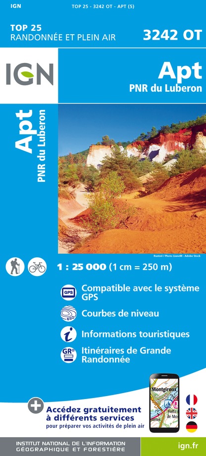
3242OT - APT PNR DU LUBERON
Editor : IGN
Collection : TOP 25 ET SÉRIE BLEUE
Scale : 1:25 000
13.90€
TOP75034 - LUBERON MONT VENTOUX
Editor : IGN
Collection : TOP 75
Scale : 1:75 000
9.80€
VEL03 - LE VAUCLUSE A VÉLO
Editor : IGN
Collection : DECOUVERTE A VELO
Scale : 1:100 000
9.10€
TOP100D13 - BOUCHES-DU-RHÔNE MARSEILLE AIX-EN-PROVENCE PARC NATIONAL DES CALANQUES PNR DES ALPILLES ET DE CAMARGUE
Editor : IGN
Collection : TOP 100
Scale : 1:100 000
8.40€
TOP100D04 - ALPES-DE-HAUTE-PROVENCE DIGNE MANOSQUE PNR DU VERDON LAC DE SERRE-PONÇON
Editor : IGN
Collection : TOP 100
Scale : 1:100 000
8.40€
TOP100D84 - VAUCLUSE AVIGNON CARPENTRAS PARCS NATURELS RÉGIONAUX DU LUBERON ET DU MONT-VENTOUX
Editor : IGN
Collection : TOP 100
Scale : 1:100 000
8.40€
D04-05 ALPES-DE-HAUTE-PROVENCE HAUTES-ALPES
Editor : IGN
Collection : CARTES DÉPARTEMENTALES IGN
Scale : 1:150 000
5.90€
D13-84 BOUCHES-DU-RHÔNE VAUCLUSE
Editor : IGN
Collection : CARTES DÉPARTEMENTALES IGN
Scale : 1:150 000
5.90€
D83 VAR
Editor : IGN
Collection : CARTES DÉPARTEMENTALES IGN
Scale : 1:150 000
5.90€
NR14 AUVERGNE-RHÔNE-ALPES RECTO/VERSO MASSIF CENTRAL
Editor : IGN
Collection : CARTES RÉGIONALES IGN
Scale : 1:250 000
6.80€
NR16 PROVENCE-ALPES-CÔTE D'AZUR
Editor : IGN
Collection : CARTES RÉGIONALES IGN
Scale : 1:250 000
6.80€
NR15 AUVERGNE-RHÔNE-ALPES RECTO/VERSO MASSIF ALPIN
Editor : IGN
Collection : CARTES RÉGIONALES IGN
Scale : 1:250 000
6.80€
EUROPE
Editor : IGN
Collection : DÉCOUVERTE DES PAYS DU MONDE IGN
Scale : 1:2 500 000
7.00€

What to visit in DOMAINE DES CHENES BLANCS

See more suggestions
Visit the historical sites of DOMAINE DES CHENES BLANCS.
See more suggestions

Where to eat in DOMAINE DES CHENES BLANCS

See more suggestions
Chefs in DOMAINE DES CHENES BLANCS will delight you.
See more suggestions

Where to sleep in DOMAINE DES CHENES BLANCS

See more suggestions
Discover popular accommodations in DOMAINE DES CHENES BLANCS.
See more suggestions
Hôtel Les Arcades - Le Lion d'Or
38 km

Hôtel Les Arcades - Le Lion d'Or

A former private mansion dating from 1661, this charming hotel is located under the famous 15th-century arcades in the center of the village. Cosy, air-conditioned Provencal rooms & apartments. Heated pool, Spa, Bike room, Seminar room, Private garden. Ideally nestled for exploring the splendors of the Baronnies in complete tranquility, our former mansion invites you to enjoy a remarkable experience. Its timeless charm, verdant walled garden, sunny terraces and balconies provide an idyllic setting for your stay. Rated "Fabulous" by some guidebooks, our establishment offers excellent value for money. Our spacious, air-conditioned rooms with flat-screen TVs guarantee absolute comfort. To get your day off to a good start, our breakfast offers a gourmet selection of organic, local and homemade products, providing an authentic and tasty experience. What's more, our relaxation area invites you to indulge in total relaxation. Featuring a sauna, Jacuzzi and massage facilities, this area offers you a wellness interlude after a day of exploration. Take advantage of these moments to recharge your batteries and unwind in a soothing, warm setting. We also offer a secure garage for your car or motorcycle (reservation required) and a free lock-up for your bicycles. Take advantage of our free wifi. Please note that pets are not allowed. Finally, we are proud to have been awarded the "Valeurs Parc" label, a sign of our commitment to preserving the environment. We look forward to welcoming you for an authentic and memorable experience in the heart of the Baronnies. Whether you're looking for a romantic getaway, a wellness retreat or a wilderness adventure, our attentive team is on hand to make your stay unforgettable. Book now and let yourself be seduced by the charm and comfort of our hotel. We look forward to welcoming you soon!

7 place du Marché 26170 Buis-les-Baronnies
Book from 0 €Book
Show
Caution!
We have no information on the difficulty of this circuit. You may encounter some surprises along the way. Before you go, please feel free to inquire more and take all necessary precautions. Have a good trip! 🌳🥾