Tours
Activities
Places of interest
Where to eat
Where to sleep

Explore Rustrel with Camping Le Colorado

Are you the owner?
Welcome to Camping Le Colorado, located in the heart of the stunning Rustrel region in Vaucluse, Provence-Alpes-Côte d'Azur. Nestled near the famous Provencal Colorado, this camping offers a gateway to unique natural and cultural wonders. Just steps from your pitch, explore the exceptional trails of the Provencal Colorado, an impressive geological formation with its multi-colored ochres reminiscen...See more

Walking around CAMPING LE COLORADO

See more suggestions
Stroll through the walking routes of CAMPING LE COLORADO.
See more suggestions
Colorado tour by mountain bike
1.8 km

Colorado tour by mountain bike

Technically affordable but full of reminders, it's quite physical. But what a treat! Exit Rustrel following the GR® and the GTV®. Cross the D22 and at the crossroads ''Cornet'', turn left. Go along the former car park of Colorado and reach the start of the DFCI track. 1 - Turn right, cross the ford on La Doua, then rise by the track. Pass two winding paths and at the crossroads ''Barriès'', turn left on a rocky path. Cross a sandy narrow gully and continue straight. Come out on the paved track and reach further onto a road. Turn right and climb to the pass. 2 - Leave the GR® behind and the GTV® to the left and continue straight. Glide and go straight to the crossroads"Pradenques'' and"Ubac de Pradenques'', then climb to the plateau. Follow to the right the 1st track (RP). At the 2nd crossing, turn right on the path. After a ledge, turn right and then immediately left to reach the edge of the plateau. Then, go along a big field and reach the"Croix de Christol''. 3 - Take a left and 50m further, turn right. Continue straight on the trail, and then down the slope to the road. Follow it to the right, cross the hamlet of Haute-Blace and continue for 1.5km. At the exit of left turn, turn right and go down to La Doua. At the bottom, turn right, cross the D22 with caution andturn left on the track at the entrance of Jean-Jean. At the next crossroads continue straight. Above, follow the small road to the small mountain pass of Trécassats (marking"The Ochres by bike"). 4 - Take on the right, the coloured trail parallel to the path (GTV® marking), then climb right to the top of La Bruyère (interpretation panels). At the crossroads ''Trou des Américains'', follow to the right the GR® and thus through all the ochre massif. Coming out on the road ''La Glaurivette'', follow the D214 to the right and 550m further turn left, cross the hamlet of Viaux, cross the D179 and climb a gravel path. 5 - Go down the road for 400m and take the first road to the left. Go up gently, turn right on the ledge and then embark on a beautiful rocky single track that falls between oaks and scrubs. Lower down, after a last turn, follow the opposite path along the foot of the massive and return quietly to Rustrel.

4 h
23 km
Medium
Show
The Provençal Colorado
1.8 km

The Provençal Colorado

A break in the vast ocher gathering, both intimate and panoramic. Facing the Restreou Hostel, take the Route de Saint-Christol (D30) to the right. 100m further, turn right and go down the Boulevard du Colorado (D30a). 430m further, take the Chemin de Saint-Joseph to the right and follow it. At the stop sign, cross the D22 (be careful!) and continue across. At the crossroads "Cornet", turn left. Then follow the old car park of Colorado. In a curve (refreshment area), immerse to the right on the DFCI track. Cross the Dôa (ford) and go up the long track of Barriès (GR® markings). 1- At the sign-post ''Barriès'' turn left onto the pretty trail (slab). Reach an area of ruts and continue straight (GR®). Then take the paved road "Chemin de l'Ubac". At the junction, go right onto Route de Gignac. 2- At the mountain pass, take the left track for 500m and reach the imprinted slabs. Turn around and go back to point 2. Back again on the pass, follow the road to the left. At the crossroads "Pradenques" and "Ubac de Pradenques" continue straight. On top of the hill, turn onto the right track. 1km away, take a right back into the woods. After a break, continue left onto the lower trail (PR). Go along a large field and reach the crossroads ''Croix de Christol '' (sign-post). 3- Pass the gate and hurtle down the trail (PR). The stones give way to ocher; take the time to make a landscape stop. Down, spin slightly to the left along the clearing, fording the Dôa, past the sewage treatment plant and reach the hamlet of Istrane. 4- Turn right and take small road. Skip two curves, go along a house and at the next intersection on the corner of a farm, turn left. Go up the small road. Cross the D22 (be careful!) and continue across. Pass the school parking lots and reach the center of the village of Rustrel.

4 h
16 km
Medium
Show
The Villars secrets
5.2 km

The Villars secrets

Far from the well-known areas, a summary of natural wonders and rural heritage, between ochres, cultures, oak groves and scrublands. Opposite the town hall, turn right towards Rustrel. When at the village hall, dive right onto a path that goes into the housing estate boundary (fence). Turn left onthe road, cross La Riaille and at the intersection ''Clastre'', continue straight. 500m further, take the left path (GR®) entering the classified massive and an ?environmentally sensitive area (ESA). Pass two corners and rise to the left at the top of the hill. 1 - At the crossroads"Trou des Américains" visit the pond 100m to the right and back to point 1. Continue on the right trail (GR®and travel through all the ochre massif. Coming out on the road ''La Glaurivette'', cross the D214. 2 - Take the opposite track (RP), then cross the D179. Advance on 80m on the path of Fumeirasse and turn left. At the bottom, turn right and go slowly straight tothe crossroads"Fumeirasse''. Continue the path completely to the left and reach a crossing (point 429). 3 - Go straight until the chapel and go back to point 3. There, ride up the steep path and continue on it. At the top of the second steep path, turn right. Reach to a track. Go up on the right on 650m. Do not miss to the left the road which descends slightly (local RP, green markings). 4 - In a right turn (cairn)Go across and go straight at the first intersection (cairn). Slowly descend on 700m and turn right on a path that winds through the scrubland (green markings). After two turns, cross the ravine, up to the junction with another path. 5 - Go down the road for 15m and take the first road to the left. Go straight and turn left to reach the D179 below. Cross the road, pass the Hameau des Marchands, go along the recreation centre and reach the D214. Continue straight through the protected pedestrian crossing. At the crossroads"Saint-Joseph'', climb the ramp to the right (no entry sign) and take the second right to return to the centre of Villars.

4 h
13 km
Medium
Show
Saignon, La Gardette path
6.4 km

Saignon, La Gardette path

A secular trace to dominate the horizon but also to search the myriad of hutches and dry stone huts. At the bottom of the car park go up the caladée ramp and join the Bourgades street. Turn right and join the road junction at the entrance of the village (Calvary). Turn left to pass the school then, at the height of the village hall, climb to the right three stone steps and follow the path undergrowth (local PR, markings green lines). Continue the path at the foot of the cliff and continue on a gentle slope in the woods. At the first obvious intersection, turn right, go up a rocky section and join the D48. Take the left on 150 m (caution!). 1- At the height of a large field, go left on the dirt road (local PR, green lines marking). Go up to the plateau of La Gardette. 2- At the Y, turn right and continue the path. Straight ahead get on the path (green lines). Cross a very heavily paved section and then switch to a slight descent on the side of the plateau. Further down, follow the path on the left (green lines). Climb a jump and reach a crossroads. 3- Turn right and then left (green lines). Get higher on the D48. Cross it and take the path that climbs to the left (green lines). Reach a wide path. 4- Turn right on the path (PR) and join the D48 (post "Chemin de la Française"). Take on the left the D48 on 560 m. At the end of a bend (caution!), Turn left on the small Fondons car park. 5- Go to the bottom of the car park on the stony path (PR). Cross a rocky section, continue straight, pass between two lavender fields and reach a crossroads of trails (post "Le Colombier", iron cross). 6- Turn right (GR® and GRP®), slip under the hedge of trees and brambles and reach a road. Turn 20 m to the right and continue the stony path that starts on the left edge of the road (GR® and GRP®). Take the tormented path down to the road and follow it 130 m on the left. 7- At the stop, turn left and follow the D48 towards Saignon. 280 m further down the first path (GR® and GRP®). At the bottom, take the D48 again for 30 m and take the path on the left (GR® and GRP®). Go straight Exit on the D48, go down 60 m on the left and then go down on the right the concrete road that leads to the entrance of the village of Saignon (GR® and GRP®).

3 h
7 km
Easy
Show
Underground water tanks in Travignon
7.6 km

Underground water tanks in Travignon

Starting at the hilltop village of Saint-Saturnin-lès-Apt, a great trip on the Sentier des Aiguiers, the top of Mount Cluyer and the ruins of Travignon. Back turned to the ''Information Point", next to the post office and pharmacy, go left then right onto the Rue Victor Hugo on 50m. Begin to the left on the Rue de la Combe and take a quick left under the puppet. Climb the cobblestone to the mill. Go up the path to the right on the edge of the plateau. Then take a right, cross the dam, pass through the castrum and turn left into the castle. Bypass the chapel on the left. 1 - At the crossroads, go straight across. Continue to the right and climb to the Chemin des Gavaniols. Continue straight. Leave several roads to your left and right leading to houses. Pass a sloping ledge and reach the Aiguiers Bessons. 2 - Rise to the right onto the path. At the 1st (new alternative route) then 2nd crossing, continue on the path in front. Leave a track going to the right and reach the rocky ledge. Climb the East ridge (markings barely visible), reach a small covered aiguier (Provençal underground water tank) and continue right to the Mount Cluyer dome. Pass the viewpoint and reach the summit plateau (milestone). 3 - Descend the trail due north, continue on the path under the pines and come out on La Liguière track. Follow the track for 150m and at the Y-like crossroad, continue left on the Chemin de la cassette (private pathway!). Bypass the farm to the right (gate) and reach the track below. Turn right (GR®) and after the aiguiers of Gayeoux, turn right. Go down 400m and leave a path to the left. 4 - Take a sharp left (milestone). Climb the small mountain pass of Travignon and switch to the aiguiers upstream the hamlet. Descend to the right on the rocky path, then turn left. Go through the ruins of Travignon, take a sharp right at the exit of the hamlet and immediately a left to go down the winding paths of the old mule track. 5 - Take a sharp left and immediately right (GR®). Hurtle down the trail which is very craggy down below. Continue at the valley bottom. Skip the narrow pass of the Rocher de la Cadière. At the crossroads "Puits du Geay", go straight. Pass the narrow gully of the Portes de Castor and go straight. 6 - look to the right for the 1st orchard along the track. Turn right, go up 100m along the field and climb the trail to the Bois du Defens. At the path, go across, descend and coming out of the scrubland, turn right. Go up the Rue de Fontaine de Guby to the right. Reach the Chemin de Romanet then the Cours de la Liberté to the left to go back to the village center.

6 h
20 km
Hard
Show
The Aiguiers (cistern from rock) of St-Saturnin-lès-Apt
8.6 km

The Aiguiers (cistern from rock) of St-Saturnin-lès-Apt

Short and clever combination of the "Sentier des Aiguiers'' which offers a beautiful glimpsecrafty and remarkable water supplies. Back facing the car park, go down across on the paved track. After the turn; go back up gently. At the 1st intersection, turn left and climbthe track. Leave behind several roads to the right then to the left leading to houses. Pass a sloping ledge and reach the Aiguiers Bessons. 1 - Rise to the right onto the path. At the 1st crossing, continue the winding paths across (new variant). At the path, still continue across. A little further, leave a track going to the right and continue on the rocky ledge. Reach a viewpoint and climb the edge to the east (marking hardly noticeable). Reach a small covered aiguier. Continue to the right, pass the orientation table and reach the Cluyer dome (mountain pass cycling milestone). 2 - Descend the trail due north, continue on the path under the pines and come out on La Liguière track. Follow right on 150m and take on the right the Lays track (ignore the sign'Sentier des Aiguiers'' to the left). Reach the Romanet track and go down to the right for 500m, then at the exit of a bend, turn left towards Travignon. After a ledge in the woods, turn left. 3  - Continue the path straight. Pass 2 turns and reach the Aiguiers upstream. Retrace your steps to point 3 by cutting through 2 turns by the stony path. Turn left and cross the ruins of Travignon. When leaving the hamlet, take a sharp right and immediately a left to go down the winding paths of the old mule track. When at the 2 large rocks, leave the GR® behind to the left and go down the path to the right. Go up slightly to come out on the Romanet track. Go down on the left for 1km / less than a mile. 4 - Do not miss the path that rises to the right (point 754m). 200m above, turn left and climb the path. Continue by following the marking carefully (private property!), then gradually rise to a track that leads to the Caulet farm. Go down to the left, go up slightly, then turn left (mountain pass cycling milestone).Go down the path to the south. Do not miss, at the exit of a corner, the trail rising to right and coming out on the corner of a fence. Turn left, walk along the fence and come out on the Romanes trail. Turn left to return to the starting point.

5 h
16 km
Medium
Show
The Aiguiers (cistern from rock) of St-Saturnin-lès-Apt
8.6 km

The Aiguiers (cistern from rock) of St-Saturnin-lès-Apt

Short and clever combination of the "Sentier des Aiguiers'' which offers a beautiful glimpsecrafty and remarkable water supplies. Back facing the car park, go down across on the paved track. After the turn; go back up gently. At the 1st intersection, turn left and climbthe track. Leave behind several roads to the right then to the left leading to houses. Pass a sloping ledge and reach the Aiguiers Bessons. 1 - Rise to the right onto the path. At the 1st crossing, continue the winding paths across (new variant). At the path, still continue across. A little further, leave a track going to the right and continue on the rocky ledge. Reach a viewpoint and climb the edge to the east (marking hardly noticeable). Reach a small covered aiguier. Continue to the right, pass the orientation table and reach the Cluyer dome (mountain pass cycling milestone). 2 - Descend the trail due north, continue on the path under the pines and come out on La Liguière track. Follow right on 150m and take on the right the Lays track (ignore the sign'Sentier des Aiguiers'' to the left). Reach the Romanet track and go down to the right for 500m, then at the exit of a bend, turn left towards Travignon. After a ledge in the woods, turn left. 3  - Continue the path straight. Pass 2 turns and reach the Aiguiers upstream. Retrace your steps to point 3 by cutting through 2 turns by the stony path. Turn left and cross the ruins of Travignon. When leaving the hamlet, take a sharp right and immediately a left to go down the winding paths of the old mule track. When at the 2 large rocks, leave the GR® behind to the left and go down the path to the right. Go up slightly to come out on the Romanet track. Go down on the left for 1km / less than a mile. 4 - Do not miss the path that rises to the right (point 754m). 200m above, turn left and climb the path. Continue by following the marking carefully (private property!), then gradually rise to a track that leads to the Caulet farm. Go down to the left, go up slightly, then turn left (mountain pass cycling milestone).Go down the path to the south. Do not miss, at the exit of a corner, the trail rising to right and coming out on the corner of a fence. Turn left, walk along the fence and come out on the Romanes trail. Turn left to return to the starting point.

5 h
15 km
Medium
Show
Le Mourre Nègre, northern side
8.9 km

Le Mourre Nègre, northern side

A classic, as sporty as bucolic! The height differences can be felt but the climb is unreal and the panoramas of the ridges are mindblowing Leave the car park and climb right on the paved road (PR). Pass a house and continue climbing on a rocky path. Pass the edge and at the 1st crossing (point 685), turn left (PR). Take the nice balcony path and pass the edges by a succession of uphills and downhills. Continue left in the third valley (PR) and do not go right to the valley of the Trois Eves. 1- At the crossroads "Marauvière", turn right, pass two hairpin bends and continue the ascent. Reaching a vague pass, continue straight and follow the road on the hillside. Exit the forest and lead to the track on the ridges. Turn left and go down 200m. 2- At the "Basse de Cabrière" climb the bump to the right (GR® marking barely visible). Switch, reach the DFCI track and go across to reach the foot of the top bump. 3- At the tank, climb the path that climbs on the north side of the summit and reach the Mourre Nègre. Go around the top (panorama) leaving the antennas on your right hand. Pass under the power line, and head northwest on the path through the summit field. Dive into the undergrowth and reach the DFCI track below. 4- At the track, do not dive in front into the Font Jean de Martin valley (steep and rocky), but turn left and take an immediate parallel path to the right. Rise slightly, pass the small sheepfold of the Jas de Brémond and a few meters below (sign-post), turn right. Start heading down following the edge, then dive to the left into the valley of Roumi (PR). Cut three times the forest track and follow the very craggy trail in certain places (cairns). Falling a fourth time on the track, follow it to the right. 5- At the exit of the first curve, turn right on the trail (PR). Go down, pass three curves and finish with a long cobblestone path section. Turn right to reach the car park.

4 h
9.1 km
Hard
Show
The Ochres by bike
8.9 km

The Ochres by bike

A colourful route! With exceptional landscapes, ochre sites, underground or open-air quarries and colourful villages. Across of the pharmacy, go right to reach below the small roundabout and turn left towards Lombards. Calmly climb to reach a crossing. At the stop sign, turn right and follow the route"The Ochres by bike". Reach the Mines of Bruoux. Then continue to the hamlet of Lombards. Exit through the right and get to the crossroads. 1 - Take a sharp right and at the corner of the campsite, turn left. Come out on the D227 and take a left for 2km. At the crossing with the D4, continue across on the D227 towards Roussillon. Climb two hairpin bends, take two lefts and enter the village streets. Go around a blockand reach to the left foot the ramp leading to the ochre trail. 2 – Go forward to La Burlière avenue (D105), pass a speed bump and at the next junction, go left. Reach a roundabout and continue left towards Apt. Reach another speed bump and at the Y junction, continue straight on the D104 towards Apt. Get to the Conservatoire of Ochres. 3 – Follow the D104, glide through the curves and at the straight line, look out for the small road to the left. Follow it and reach the D4. Cross with the utmost caution and take the small road across, leading to Lombards. Enter a residential area and reach the crossroads you didn't pass on your way going (point 1). 1 – Turn right and return to Gargas by the same route as the one used to go.

2 h
18 km
Easy
Show

What to do in CAMPING LE COLORADO

See more suggestions
Exciting adventures await you in CAMPING LE COLORADO, book now.
See more suggestions
La Maguette
16 km

La Maguette

Facing the Ventoux, Catherine and Pierre welcome you in the calm of their family lavender farm. The authentic and warm welcome will allow you to enjoy the place and discover the region. Whether you are cyclists, hikers, fans of nature, culture or outdoor activities, La Maguette will be the ideal setting for your holiday! To preserve the calm of the place and the relation with the guests, we propose you only 2 comfortable rooms on the same level (one of them is a family room). Decorated with care, they each have a bathroom with Italian shower, WC and 140 cm beds. Each room is equipped with fine linen and a hair dryer. Breakfast and table d'hôtes meals are served in the warm, communal living room; on sunny days, you can enjoy them outside facing the Mont Ventoux. The table d'hôtes is available on reservation and will allow you to taste a tasty cuisine made with local and garden products! Tourist information is available on site, and of course we can also advise you on what to see and do. Outside, the garden, the shaded terrace and its lounge are at your disposal as well as the petanque ground or the swings for your children. If you wish, we can show you the animals of the farm and the different crops. A shop selling the farm's products is open on site. Bikes and motorbikes can be parked in the shelter when you come! Shops at 7 km - Farm inn on the spot (500m) on reservation only at lunchtime. Baby facilities on request. Attached to our territory and eager to make you discover it, we will reveal you the richness of it. For hikers and cyclists, La Maguette is part of the "Compagnon de route" and "Accueil vélo" network. We speak english - Parliamo italiano Find more information and a reservation module on the website of the establishment.

2075, Route de Javon LA MAGUETTE 84390 Sault
Book from 0 €Book
Show

IGN cards

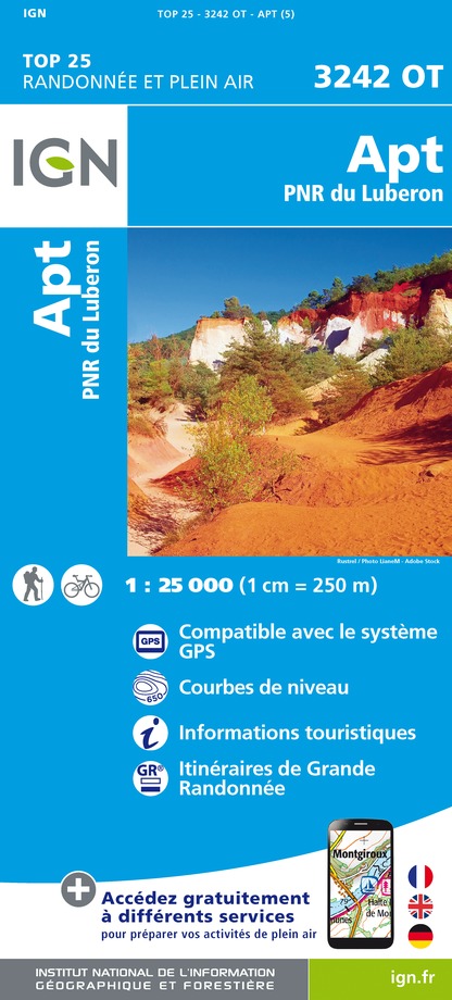
3242OT - APT PNR DU LUBERON
Editor : IGN
Collection : TOP 25 ET SÉRIE BLEUE
Scale : 1:25 000
13.90€
TOP75034 - LUBERON MONT VENTOUX
Editor : IGN
Collection : TOP 75
Scale : 1:75 000
9.80€
VEL03 - LE VAUCLUSE A VÉLO
Editor : IGN
Collection : DECOUVERTE A VELO
Scale : 1:100 000
9.10€
TOP100D13 - BOUCHES-DU-RHÔNE MARSEILLE AIX-EN-PROVENCE PARC NATIONAL DES CALANQUES PNR DES ALPILLES ET DE CAMARGUE
Editor : IGN
Collection : TOP 100
Scale : 1:100 000
8.40€
TOP100D04 - ALPES-DE-HAUTE-PROVENCE DIGNE MANOSQUE PNR DU VERDON LAC DE SERRE-PONÇON
Editor : IGN
Collection : TOP 100
Scale : 1:100 000
8.40€
TOP100D84 - VAUCLUSE AVIGNON CARPENTRAS PARCS NATURELS RÉGIONAUX DU LUBERON ET DU MONT-VENTOUX
Editor : IGN
Collection : TOP 100
Scale : 1:100 000
8.40€
D04-05 ALPES-DE-HAUTE-PROVENCE HAUTES-ALPES
Editor : IGN
Collection : CARTES DÉPARTEMENTALES IGN
Scale : 1:150 000
5.90€
D13-84 BOUCHES-DU-RHÔNE VAUCLUSE
Editor : IGN
Collection : CARTES DÉPARTEMENTALES IGN
Scale : 1:150 000
5.90€
D83 VAR
Editor : IGN
Collection : CARTES DÉPARTEMENTALES IGN
Scale : 1:150 000
5.90€
NR14 AUVERGNE-RHÔNE-ALPES RECTO/VERSO MASSIF CENTRAL
Editor : IGN
Collection : CARTES RÉGIONALES IGN
Scale : 1:250 000
6.80€
NR16 PROVENCE-ALPES-CÔTE D'AZUR
Editor : IGN
Collection : CARTES RÉGIONALES IGN
Scale : 1:250 000
6.80€
NR15 AUVERGNE-RHÔNE-ALPES RECTO/VERSO MASSIF ALPIN
Editor : IGN
Collection : CARTES RÉGIONALES IGN
Scale : 1:250 000
6.80€
EUROPE
Editor : IGN
Collection : DÉCOUVERTE DES PAYS DU MONDE IGN
Scale : 1:2 500 000
7.00€

What to visit in CAMPING LE COLORADO

See more suggestions
Relax in the parks of CAMPING LE COLORADO.
See more suggestions

Where to eat in CAMPING LE COLORADO

See more suggestions
Savor culinary specialties in CAMPING LE COLORADO.
See more suggestions

Where to sleep in CAMPING LE COLORADO

See more suggestions
Find an ideal lodging in CAMPING LE COLORADO.
See more suggestions
La Maguette
16 km

La Maguette

Facing the Ventoux, Catherine and Pierre welcome you in the calm of their family lavender farm. The authentic and warm welcome will allow you to enjoy the place and discover the region. Whether you are cyclists, hikers, fans of nature, culture or outdoor activities, La Maguette will be the ideal setting for your holiday! To preserve the calm of the place and the relation with the guests, we propose you only 2 comfortable rooms on the same level (one of them is a family room). Decorated with care, they each have a bathroom with Italian shower, WC and 140 cm beds. Each room is equipped with fine linen and a hair dryer. Breakfast and table d'hôtes meals are served in the warm, communal living room; on sunny days, you can enjoy them outside facing the Mont Ventoux. The table d'hôtes is available on reservation and will allow you to taste a tasty cuisine made with local and garden products! Tourist information is available on site, and of course we can also advise you on what to see and do. Outside, the garden, the shaded terrace and its lounge are at your disposal as well as the petanque ground or the swings for your children. If you wish, we can show you the animals of the farm and the different crops. A shop selling the farm's products is open on site. Bikes and motorbikes can be parked in the shelter when you come! Shops at 7 km - Farm inn on the spot (500m) on reservation only at lunchtime. Baby facilities on request. Attached to our territory and eager to make you discover it, we will reveal you the richness of it. For hikers and cyclists, La Maguette is part of the "Compagnon de route" and "Accueil vélo" network. We speak english - Parliamo italiano Find more information and a reservation module on the website of the establishment.

2075, Route de Javon LA MAGUETTE 84390 Sault
Book from 0 €Book
Show
Caution!
We have no information on the difficulty of this circuit. You may encounter some surprises along the way. Before you go, please feel free to inquire more and take all necessary precautions. Have a good trip! 🌳🥾