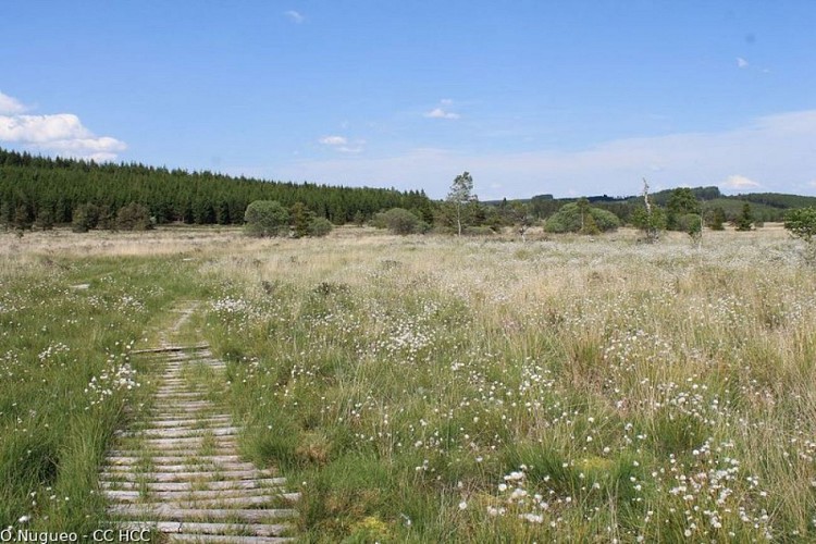
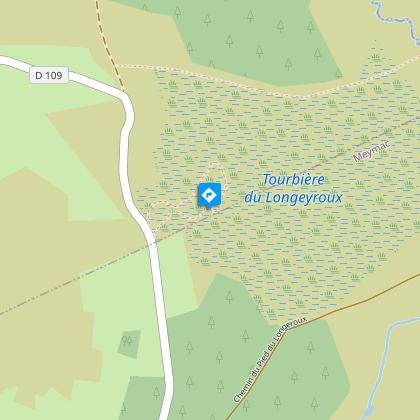
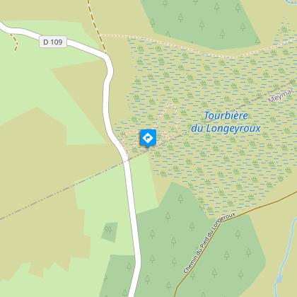
The cottongrass path
Description
Dive into the very heart of the bog to observe its formation, as well as its special flora and fauna.Markers: follow the carved granite stones representing the cottongrass (white flower) Leaving the reception area. Opposite the information panels, take the small path on the left located 10m further on.At the landscape reading table, follow the small path to descend into the bog.Take the small wooden bridge.Find and follow the planked wooden path.
Technical informations
895 m
|
max. 899 m
min. 877 m
| |||
Altimetric profile
Starting point
Steps
Panorama
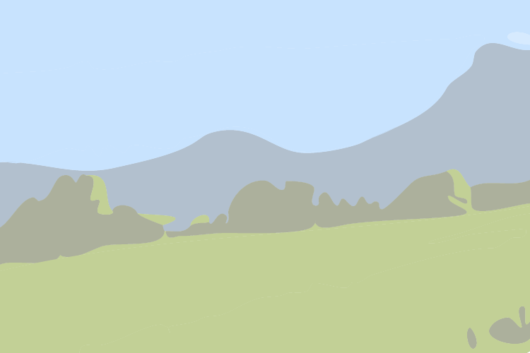
Vous surplombez ici les tourbières que vous pouvez observer en contrebas. Cet endroit vous offre également un panorama sur les puys qui entourent les tourbières. Par ciel dégagé, cela vous permet d’admirer un des paysages emblématiques du plateau de Millevaches.
Processus de formation de la tourbe
Une tourbe ne peut se former que dans des milieux qui sont constamment gorgés d’eau. Il leur faut donc un bilan hydrique positif avec des apports d’eau de multiples sources (pluie, neige, brouillard, ruissellement, etc...). Ce bilan doit être égal ou supérieur aux pertes (évapotranspiration, etc...). Il faut environ un siècle pour que se forme entre 1 et 2 centimètres de tourbe. Les tourbières du Longeyroux ont une profondeur de 2 mètres de tourbe.
Une flore adaptée
Le développement d’une faune et d’une flore classiques est compliqué dans les tourbières. De nombreuses espèces se sont alors adaptées aux contraintes de ce milieu. Par exemple, la linaigrette, emblème du sentier, pousse en formant des touffes de plus en plus épaisses qui lui permettent ainsi de s’extirper de l’eau. La drosera se nourrit, elle, de petits insectes qu’elle attire sur ses feuilles à l’aide de gouttelettes d’un suc qu’elle produit.
Le tourbage familial
Jusqu’au début du siècle dernier, les familles du plateau utilisaient la tourbe comme combustible pour chauffer leur maison, la région étant à l’époque peu boisée. Pour ce faire, elles creusaient des fossés dans une parcelle de tourbe afin d’en drainer l’eau. Puis, elles enlevaient des morceaux de tourbes sous forme de briquettes qu’elles laissaient sécher. A la mauvaise saison, elles mettaient ces briquettes dans le feu comme nous mettrions du bois aujourd’hui.
Pâturage et callune
Autrefois les landes des tourbières étaient utilisées pour faire pâturer les brebis ; avec la déprise agricole liée à l’exode rural, ces landes ont été abandonnées. Aujourd’hui, le Conservatoire des Espaces Naturels du Limousin a réintroduit des Brebis Limousines sur ces parcelles afin d’entretenir les callunes. La callune est une plante vivace qui mesure entre 20 et 50 cm de hauteur. Malgré sa ressemblance avec la bruyère, ces deux plantes sont très différentes.
Points of interest
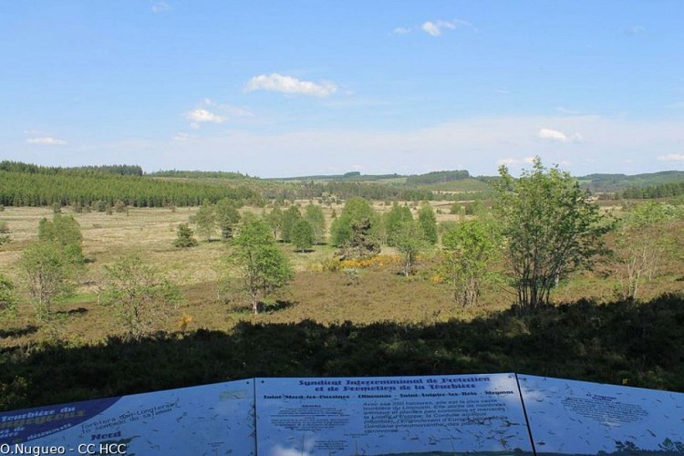
Panorama
Here you overlook the peat bogs spread out below. This place also offers you a panoramic view of the puys, or extinct volcano cones, that surround the peat bogs. On a clear day, you can admire one of the most iconic landscapes of the Millevaches plateau.
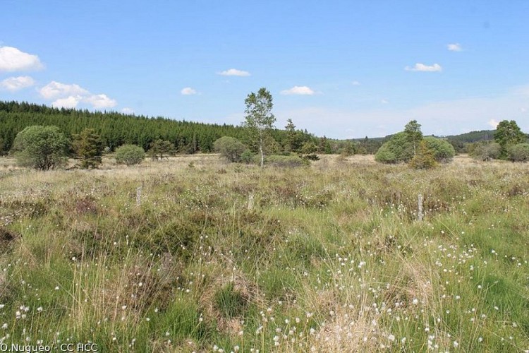
An adapted flora
The development of conventional fauna and flora was complicated in peatlands. Many species adapted themselves to the constraints of this environment. For example, cottongrass, the trail's symbol, grows in ever thicker tufts, which allow it to escape from the water. The drosera feeds on small insects that it attracts to its leaves with droplets of a juice it produces.
Family peat cutting
Until the beginning of the last century, families on the plateau used peat as fuel to heat their homes, as the region was not very heavily wooded at the time. To do this, they dug ditches in an area of peat to drain the water from it. Then they would remove pieces of peat in the form of briquettes and let them dry. In bad weather, they put these briquettes on the fire as we would use wood today.

Grazing and callune
In the past, the peat bogs were used to graze sheep; with the agricultural decline linked to the rural exodus, these areas have been abandoned. Today, the Conservatoire des Espaces Naturels du Limousin has reintroduced Limousin sheep on these plots in order to maintain the callunes. Callune is a perennial plant that measures between 20 and 50 cm in height. Despite its similarity to heather, these two plants are very different.
Additional information
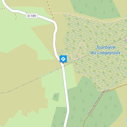
Advised parking
Reception area for Longeyroux, Saint-Merd-les-Oussines
Advice
Waterproof shoes recommended
Access
From Meymac take the D 36, and then the D 979 towards Bugeat. Head towards the village of Le Celle. At the cemetery, take the road on the right towards the car park for the Longeyroux reception area
Ambiance
The Longeyroux peat bog invites you to share its secrets. An interpretation trail has been built to immerse you in the heart of this very special site. With the help of the educational panels, you can learn how peat is formed as well as learning about its flora and fauna. Spend a few peaceful moments surrounded by an exceptional panoramic view of the bog and the extinct volcano cones nearby.
Arrival
Reception area for Longeyroux, Saint-Merd-les-Oussines
Departure
Reception area for Longeyroux, Saint-Merd-les-Oussines
