Following in the footsteps of Robert Louis Stevenson

The Cirkwi brief
Embark on a journey curated by the Tourism Office of Nemours, blending nature's allure with a rich civic tapestry. This path lets you tread through the forest of Fontainebleau, tracing the youthful travels of Robert Louis Stevenson. Immerse yourself in a realm where culture and heritage converge along red and white marked trails. Far more than a mere hike, it's an adventure through time, tailored to satisfy the curious soul eager to absorb the essence of a locale steeped in history yet brimming with natural beauty.
Brief Technique: Key Route Insights
This meticulously curated trek spans approximately 30.9 km, fluctuating between altitudes of 55 and 120 meters. Offering a challenge with a total elevation gain of 368 meters, it showcases the dedication of the Office of Tourism of Nemours in presenting an optimally balanced route. Emphasizing safety and accessibility, the red and white markers of GR 13 and GR 13b trails guide your path, ensuring a focused yet enriching outdoor experience.
Seasonal Advice for Safe Trekking
Embarking on this journey mandates mindfulness towards seasonal changes. Spring and autumn are ideal, offering mild weather and the forest's seasonal bloom or hues. Summer requires hydration and sun protection, while winter demands caution against slippery paths. Prioritize sturdy footwear year-round for the varied terrain, and always stay updated on local weather. Remember, preparation is key to a safe and enjoyable experience.
Historical Essence of Nemours
Nemours, a jewel in the Île-de-France, serves as a gateway to a bygone era, from prehistoric settlements to medieval grandeur. With its medieval castle, the city's architecture whispers tales of resilience, embodying the essence of France’s rich history. Nemours, once a pivotal city of the Gâtinais region, narrates stories of wars, peace treaties, and transitions, making it more than just a starting point of this journey but a destination imbued with historical significance.
Local Climate Guide: Best Time to Visit
Nemours, nestled in Île-de-France, experiences a temperate climate. Winters are chilly, with January being the coldest month. Summers are warm, making late spring to early autumn the prime times for hiking endeavors. Rainfall is evenly distributed throughout the year, thus adaptable gear is advisable. For optimal exploration, aim for May through September, when weather conditions complement the natural and cultural exploration of Nemours.
Technical Information
Altimetric profile
Starting point
Steps
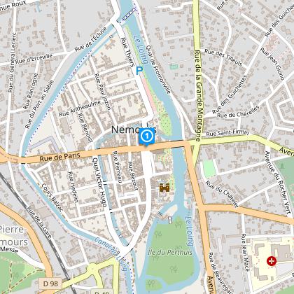
Point de départ
Ce circuit démarre devant l'église Saint Jean-Baptiste de Nemours
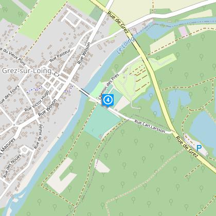
Traverser le pont puis poursuivre à gauche
A Nemours, traversez le pont puis poursuivez sur votre gauche sur le chemin de Halage de Fromonville.
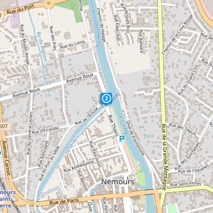
Passer sur la passerelle
Au niveau de l'écluse, vous trouverez un panneau d'interprétation sur le Moulin Rouge. Traversez ensuite la passerelle.
Traverser le pont puis prendre la première à gauche.
A l'entrée de Grez-sur-Loing, traversez le pont puis prenez sur votre gauche en direction du centre du bourg. Passez par la ruelle de la Tour de Ganne.
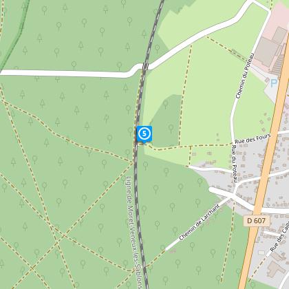
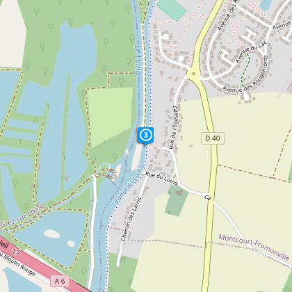
Passer sous la voie ferrée
Passez sous la voie ferrée puis prenez à gauche. Longez cette dernière sur quelques mètres puis prenez à droite. Vous arriverez à Villiers-sous-Grez où vous rejoindrez le GR13.
Traverser le hameau de Busseau
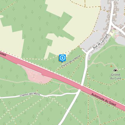
A la sortie de Villiers-sous-Grez, passez sous l'autoroute. Vous traverserez ensuite le hameau de Busseau puis vous arriverez à la Dame Jouanne.
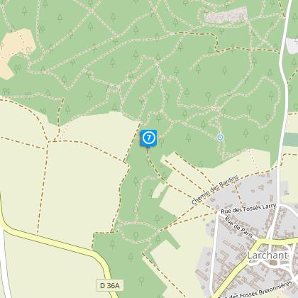
Passer par Larchant
Vous arrivez à Larchant, sur votre gauche, il y a un marais qui est classé réserve naturelle volontaire. Traversez le village où vous pourrez faire une halte au niveau de la basilique Saint Mathurin.
Poursuivre sur le GR13
A cet endroit, vous quittez le Parc du Gâtinais français. En revanche, vous restez au sein de la forêt domaniale de la Commanderie. Poursuivez sur le GR13 en direction de Nemours.
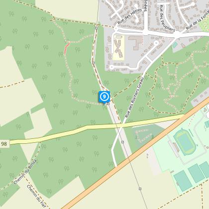
Traverser le parc des Rochers Gréau
A Saint Pierre-lès-Nemours, le GR13 traverse le parc des Rochers Gréau. À la sortie de ce dernier, vous entrez dans Nemours.
Points of interest

Nemours
This mediaeval town on the banks of the Loing is a charming little provincial town. This site bears witness to a long past from prehistoric times to the present day, including its rich medieval period...Today Nemours still has all the charm of an old town with its picturesque lanes and château on the banks of the Loing. There are signs of human occupation dating back to the Palaeolithic era as evidenced by the discovery of remains from that time. In medieval times, the first Lord of Nemours was Orson in 1120. His son-in-law, Gauthier de Villebéon (Gauthier I), gave permission for the château and Saint Jean-Baptiste church to be built. The town was burned down in 1358 during the Hundred Years War. As capital of the Gâtinais region, the town prospered throughout the ensuing centuries. On 7th July 1585, the Treaty of Nemours was ratified in the château, forbidding Protestant worship services and excluding Henri de Navarre from the line to the throne (the future Henri IV). In 1789, Pierre Samuel Dupont was Member of Parliament for Nemours. 10 years later, he left France for the United States where his son, Eleuthère Irénée, created the multinational firm Du Pont de Nemours. In 1800, the town lost its prefecture, which was moved to Fontainebleau. Still a rural town at the end of the Second World War, little by little it gained more economic importance in the region with its population growing at the same time. The château Built in the 12th century, the castle was the main part of the defence of the fortified town. To begin with, the castle’s original vocation was to provide a resting place for Lords returning from the Crusades. Altered in the 15th century by the Duke of Nemours who turned it into a residential building, and again in the 17th century, since when the château’s appearance has remained unchanged. Inside one of the turrets of the tower, there is a magnificent Chapel on two levels. Saint Jean-Baptiste church Saint Jean-Baptiste church was built in 1170 at the request of Gauthier I of Nemours. The church was destroyed in the town's fire in the 15th century, and rebuilt between 1445 and 1555. The choir dates from this reconstruction period. In 1850 and 1890, the interior of the church was developed with stained-glass windows and a master altar dedicated to Saint Jean-Baptiste. The Ile de France prehistory Museum Open to the public since 1981, the museum shows the prehistory of the Paris region in a building by the architect Roland Simounet. Opening up onto a wooded park and a rocky massif, the rooms are organised around for interior gardens that reconstitute the flora of the quartenary period in the Ile de France. This museum, which was recently listed as a "Historical Monument of the 20th Century", presents the Prehistory and the Protohistory of the Paris region, from the appearance of man to Gallo-Roman times. There are two possible visits. The first circuit, for educational visits, presents the daily life of Palaeolithic age hunters, farmers and breeders in the Neolithic period and then an introduction to bronze and iron metalworking. The circuit can then be completed with a second one dedicated to archaeological sites, stratigraphic geology and comparative typology of tools. A 20 minutes audio-visual presentation is made in interaction with the Pincevent archaeological ground moulding. Guided tours and workshops available for school groups daily except Wednesdays: learning to use tools, fire, throwing sticks. Themed workshops for single-class school groups: themes: habitat, food, fire, and tools. Special programmes scheduled on events days.

Church of Saint John the Baptist
The church Saint Jean-Baptiste is founded by Gautier 1st of Nemours in 1170 to receive a relic of the saint. It is composed of a 12th century tower-porch and a nave raised in the 17th century.It now houses the neo-Gothic high altar dedicated to Saint John the Baptist, a Piétà sculpture made in 1869 by Sanson (local artist of the 19th century), an organ dating from 1653 and the bell "Philippe" dedicated in 1672 to Philippe Duc d'Orléans, brother of Louis 14th, became Duke of Nemours. The church is classified as a historical monument since 1977.

Ancienne maison du Receveur du Canal du Loing
devenu le bureau des VNF (Voies Navigables de France)

Villiers-sous-Grez
Présentation de Villiers-sous-GrezAu centre d’une clairière, Villiers-sous-Grez s’est développé selon deux axes. Celui Est-Ouest, qui reliait la chapellenie de La Chapelle-la-Reine à celle de Grez-surLoing, toutes deux rattachées au domaine royal depuis 1068, correspond aujourd’hui aux rues Gabriel Bachet et René Lefebvre. L’autre, l’axe Sud-Nord, reliait la communauté laborieuse domiciliée le long du premier axe à son église. Celle-ci matérialisait le siège de l’Autorité. Cet axe suit la rue Creuse et la rue de l’Eglise. La première référence écrite du village, sous le nom d’Auvillare, date de 1080. La région est sous le règne des Capétiens ; le domaine de Fontainebleau est une de leurs principales chasses. Villiers, à l’extrémité de ce territoire, est bien placé pour une halte. Lorsque, pour le repos de leur âme, Robert le Pieux ou Henri 1er décident de créer ici un Prieuré qui facilitera le développement de l’agglomération, les « paysans défricheurs » ont déjà construit des chaumières et des petites dépendances. Les exploitations agricoles avaient, en moyenne, une surface de deux hectares. A cette époque, Auvillare comptait une centaine de feux. En 1303, Philippe le Bel, qui naquit et mourut à Fontainebleau, cède son droit de suzeraineté sur Villiers à son chambellan Hugues de Bouville. En 1367, ce chevalier visite sa seigneurie et passe à Villiers pour vérifier la solidité et les protections de l’église, afin de protéger les habitants en cas d’intrusion des bandes anglaises. Il y a déjà 30 ans que la « guerre de cent ans » a commencé. Plusieurs batailles ont lieu dans les environs immédiats : à Nemours, Larchant, Beaune-la-Rolande, ChâteauLandon, autant de places prises et reprises. Le 31 mars 1430, Jeanne d’Arc fait halte à La Chapelle-la-Reine. La fin de cette guerre, 27 ans plus tard, voit Villiers désolé et dépeuplé. La réorganisation administrative de la région va prendre du temps. La délimitation des seigneuries et la détermination des droits fiscaux par leurs nouveaux détenteurs est à l’occasion du démembrement le plus ancien qui nous soit parvenu. En 1552, Villiers compte 85 foyers logés dans 66 maisons, et Busseau, hameau de notre commune, 25 foyers pour 27 familles ; soit à peu près 440 habitants. En 1577, un édit interdisant aux parisiens d’acheter du vin à moins de 20 lieux de la Capitale, va favoriser la culture de la vigne qui sera, un temps, la richesse de Villiers et facteur de développement. Il faut attendre 1664 pour trouver trace d’un recensement. Barillon, grand maître de la forêt de Fontainebleau, dénombre 500 habitants de Villiers parmi les bénéficiaires des droits d’usage de la forêt. Donc une augmentation d’une soixantaine de personnes en 112 ans, au reflet de la moyenne de l’accroissement démographique de cette époque. Sous le règne de Louis XIV, sévissent famines et épidémies. Dans son « dénombrement du Royaume », l’auteur, Saugrain, libraire à Paris, indique 124 feux à Villiers en 1709. C’est donc une longue période de stagnation avant le début d’une croissance démographique jusqu’à la fin du XVIIIème siècle. La population est alors de 800 habitants. Nouvelle stagnation car, en 1836, on dénombre 804 villarons. Compte tenu de la petite surface cultivable de la commune, 450 hectares sur 1250, 800 villarons c’est beaucoup. Cela s’explique par la grande proportion de viticulteurs qui tirent des revenus suffisants de très petites parcelles. Les vignes occupent la moitié des terres cultivables. La concurrence des vins du Midi, qui arrivent à la Capitale grâce au « Chemin de fer », et l’arrivée de plusieurs maladies de la vigne, dont le phylloxéra, vont voir le déclin de cette culture dès la moitié du XIXème siècle. En compensation, les cultivateurs valorisent davantage leurs champs en remplaçant les jachères par des prairies de sainfoin et de luzerne. Mais le déclin démographique commence, les revenus agricoles diminuent et l’attrait de la Capitale augmente avec les moyens de transport. Le déclin continue. Il permet la concentration des exploitations. Elles étaient 190 en 1892, elles ne sont plus que 27 en 1957, soit en l’espace d’à peine deux générations. A ce jour, il reste deux agriculteurs sur Villiers. L’agriculture faisant travailler de moins en moins de monde, d’autres activités se développent. En 1926, la carrière de sable fait vivre 10 personnes ; on compte une dizaine de bûcherons, des agents forestiers, des charretiers spécialisés. On dénombre une vingtaine d’artisans et 16 commerçants. En 1946, la population tombe à 447 habitants. Elle ne bougera presque plus jusqu’en 1975 où la construction d’un nouveau quartier permet à Villiers de compter 706 habitants en 1982. Les nouveaux venus trouvent du travail à proximité. A Nemours et Bagneaux, les usines font de la verrerie industrielle grâce à la silice contenue dans le sable bellifontain. Le village voisin d’Ury accueille une centrale de flaconnage de parfums et celui de Recloses une imprimerie. Nous sommes aujourd’hui environ 770 villarons. Mais, pour trouver du travail, il faut aller plus loin, souvent jusqu’à Paris. Le cadre naturel de notre village, que vous allez bientôt découvrir dans votre promenade, explique pourquoi nous nous sommes enracinés ici. Il est aussi un atout important pour la ville et le développement d’un tourisme respectueux de l’environnement.

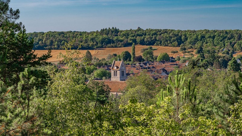
Larchant
Located in the south of the Seine-et-Marne near the forest of Fontainebleau and its most beautiful climbing sites, Larchant, a village of the Parc Naturel du Gâtinais Français, makes the delight of lovers of nature and heritage.

Chateau and Museum Nemours
A building that is particularly well conserved from the second half of the 12th century, the Nemours chateau has escaped several demolition projects.Originally the main part of the defences of the medieval city, it was transformed in the 15th century by the Duke of Armagnac then in the 17th century by the Duke of Orleans. Finally, and the beginning of the 20th century, a group of local artists led by Justin-Chrysostome Sanson (1833 – 1910) started the restoration of the old chateau. Reorganised from 1972, the collections include pieces of Gallo-Roman and Merovingian archaeology, sculptures and religious works and examples of popular arts and traditions. A particular place has been set aside for everywhere from the revolutionary period, nineteenth century paintings and sculptures and twentieth century stamps.
Data author
