Tours
Activities
Places of interest
Where to eat
Where to sleep

Discover Unique Experiences near LE MOULIN SARL in Fuveau

Are you the owner?
Nestled in the heart of the Bouches-du-Rhône within the Provence-Alpes-Côte d'Azur region, Fuveau offers a perfect blend of nature and culture for visitors. From LE MOULIN SARL, embark on a variety of exciting activities and local attractions. Start your adventure by hiking the iconic Sainte-Victoire Mountain, famous for its magnificent landscapes captured by Paul Cézanne. History enthusiasts can ...See more

Walking around LE MOULIN SARL

See more suggestions
Enjoy outdoor walks in LE MOULIN SARL.
See more suggestions


The Garlaban
17 km

The Garlaban

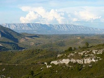
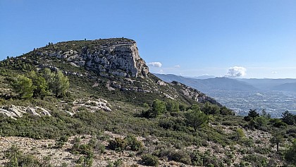
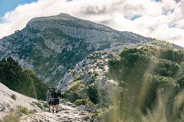
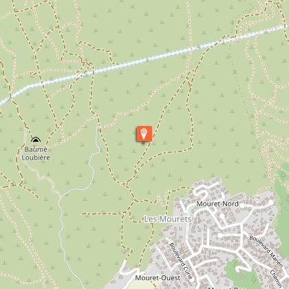
This hike leads to the summit of Garlaban, where you can discover the Douard engravings. The Garlaban, which rises to 714 metres, is easily distinguished when you're in the south-eastern part of the Bouches-du-Rhône département. Whether arriving from Toulon or from the sea, it dominates the landscape. Its shape is so distinctive that it served as a landmark for sailors navigating the Marseilles roadstead. Some even describe it as the crown that sits atop a hill so dear to Aubagne-born writer Marcel Pagnol. The Garlaban and its surroundings, whether in Marseille or Aubagne, were Marcel Pagnol's favorite playground as a child. He later made it a central element in his work. Let's recall the opening lines of his first novel, "La Gloire de mon père": "I was born in the town of Aubagne, under the goat-crowned Garlaban, at the time of the last goatherds. Garlaban is an enormous tower of blue rock, planted on the edge of the Plan de l'Aigle, the immense rocky plateau overlooking the green Huveaune valley. The tower is a little wider than it is tall: but as it rises out of the rock at an altitude of six hundred meters, it towers high into the Provencal sky, and sometimes a white July cloud comes to rest there for a moment. So it's not a mountain, but it's no longer a hill: it's Garlaban." The starting point for the hike is at the "Gastaude" bus stop, where there is also a parking lot. Join the Chemin du Ruissatel and follow the brown signposted path "Font de Mai, sentier Marcel Pagnol". Enter the Font de Mai park and pass in front of the large bastide. After the bastide, fork left to join the Font de Mai road, which you can follow along a path that runs between oak and pine trees. You'll pass an excellent gourmet restaurant, l'Auberge la Ferme. At the crossroads with Chemin du Ruissatel, continue straight ahead on Chemin de la Font de Mai, which winds its way up to Col d'Aubignane. From here, follow the yellow markings to the Garlaban. Shortly afterwards, there's a narrower path on your right. Follow it until you reach a sign suggesting a 100-metre detour to the Manon cave. Then return to the gently ascending corbelled path. Pass the Col Salis and continue on to the Pas Garrigue, a small steep slope, as we like them in Provence, to reach the Col du Garlaban. From here, it's just a short climb to the summit of Garlaban. The path zigzags through the garrigue. Yes, it's tough! But the panoramic view from the summit is your reward. It's sublime! An orientation table helps you decipher the landscape at your feet. You are the kings of Provence. Return to the Col and turn left onto the wide path leading down to the plain. On either side of the path, you'll discover engraved stones. The path overlooks the Draioulet valley, whose name comes from "petite draille", a reminder that it was once a transhumance route used by shepherds. A shortcut takes you straight downhill for 250 metres, avoiding 4 bends, before reaching an intersection where you must turn left to reach the park and the Font de Mai bastide more directly. After a 950-meter walk, you reach the edge of a hill. 4 circular cement shapes (remnants of an old high-voltage line support?) are the markers for turning left onto a path that zigzags downhill. Another landmark you'll pass: the ruins of a sheepfold. You then come to a wide DFCI track which you must take to the right, rounding a hill dominated by a rocky peak. Keep to the path along the rocky ridge. The Font de Mai estate can also be reached via an alternative route at the bottom of the valley, but the view is less unobstructed. Finish the hike by following the same section back to the parking lot or bus stop.

4 h
12 km
Medium
Parking de la Font de Mai route d'Eoures d44 13400 Aubagne
Show
Hiking through the countryside, east of Marseille
18 km

Hiking through the countryside, east of Marseille

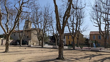
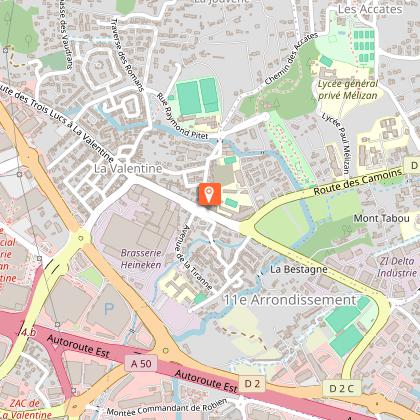
A walk to discover the outlying districts of the city center, nestled at the foot of the Garlaban massif and crossed by diversions of the Marseille canal. At the same time, you'll come across a trail in the footsteps of Marcel Pagnol. The starting point for this walk is in Eoures (0), at the "Eoures village" bus stop. To reach it from central Marseille, take RTM bus line 12 from the "Timone" metro station. Pass the church (1), the "aux tropiques" shop (2) and then fork left onto boulevard du Monument until the next intersection with rue Arnould, where you turn left. Go straight ahead, skirting a large park which conceals a beautiful, unseen country house, until you reach a traffic circle. Go down Rue de Ruissatel. You'd be forgiven for thinking that this was once the countryside, with a handful of beautiful mansions, bastides and, above all, a majority of farmland producing early vegetables and olive oil. Green spaces at the foot of the 445-meter-high Ruissatel hill. You've now reached the heart of the village of Les Camoins. On your right, a gate leads to a modern fountain (3). Go around the church of Sainte-Agathe and down the rue of the same name, then the rue Saint-Roch. If the church is open, you can still admire a wooden bust of this Saint-Roch. In the 19th century, this narrow street was home to a post office, where the omnibus to Marseille departed and arrived. For the younger generation, the omnibus is the ancestor of the bus. In those days, the vehicle was horse-drawn. Rue Saint-Roch leads to montée d'Eoures, which you follow to the right for a few meters, then left into traverse de la Penne. You'll continue to pass through suburban areas with beautiful detached houses. Take a look at number 63 (4). After a few steps, turn right onto the traverse de Saint-Menet. At number 21, you'll find a rare plot of undeveloped land, currently undeveloped. Will it resist? In the distance, the view is unobstructed over three mountains in the Calanques massif: Lantin, Saint-Cyr and Carpiagne. Once you've passed nr. 27 of the traverse, walk a little further to reach a secret passage in the wall, which we invite you to use. Marcel Pagnol and his parents' route to Bastide Neuve must have looked like this at times. We love it here at the Marseille tourist office (5). You have to cross the housing estate, part of the Parc des Sept Collines, which refers to the hills you could see in the past, when this was still farmland. Keep to the right down rue Hilaire Curtil until it opens onto a wider road, la traverse de la Buzine, which you have to walk down until you reach a nursery school. Walk along the school's fence to reach the entrance to the Parc des 7 Collines (6). Cross the park to reach the Château de la Buzine forecourt (7). Leave the site through the main gate and join the old panel opposite, which gives details of life in the bastide and the Château de la Buzine. Behind it, a small path runs along the road to the left, allowing you to take a short stroll through the greenery. In the distance, on the right, you'll see a very tall building with two towers and part of its roof topped by a lighthouse. This is the Lycée Paul Mélizan (8). At the end of the field, go back up to the road, the traverse de la Buzine, and go straight ahead. Then take the first right, the chemin de Saint-Menet aux Accates. This becomes a small footpath alongside a dry-stone wall, then joins the D4A departmental road, which you must cross to continue towards the historic heart of Les Accates. Until you reach the village church, the path is still called "chemin de Saint-Menet aux Accates". When you reach the Saint-Christophe square and crossroads, which are pleasantly shaded by several plane trees, walk along the restaurant building and up the Fenêtres Rouges crossroads (9) until you reach the small Jeanne d'Arc square, recognizable by a pretty house on the corner with blue shutters. Turn left, then right at the end to climb back up. You'll gain height as you follow a tarmac path winding through the vegetation to the Accates cemetery. There's a bench in the shade of several holm oaks, where you can take a break. To the left of the bench, take a path which, after offering a last bird's-eye view of the cemetery, joins a fenced property which you must walk along to the right. Walk under the pines along the fence and you'll soon reach a carriage road, the Canal au Val path. The first landmark to confirm that you're in the right place is a fig tree growing like a bush with several trunks in a field on your right. Shortly afterwards, you'll come to the Camoins diversion, a branch of the Marseille canal that supplies water to the land in the neighborhoods you pass through. The road then changes its name (although it's not clear whether there are any signs in situ) to Chemin de la Salette, marking the invisible dividing line between the Accates (left) and Valentine (right) districts. Follow this until you reach a junction with the Chemin des Accates, which you should take down to no. 61. At this point, you can leave the road to enter a natural area, a verdant park, and follow the path to the other end, marked by the ruins of an ancient bastide, La Denise (10). Cross the traffic circle to enter and cross the Denise departmental park (11). Leave the park on the D4A departmental road. Follow this road to the left (past the Fabrique bakery) to reach the RTM "Lycée Paul Mélizan" bus stop, where you can take lines 12, 12B or 12S to return to the town center and La Timone, the collective terminus for these 3 bus lines.

3 h
7.1 km
Easy
42 Boulevard Notre Dame à l'arrêt de bus "Eoures village" 13011 Marseille
Show
PLAN D’AUPS SAINTE-BAUME - Saint-Pilon Chapel
20 km

PLAN D’AUPS SAINTE-BAUME - Saint-Pilon Chapel

A must-see in Sainte-Baume! A genuine trove of natural, cultural and landscaped treasures. With your back to the Sainte-Baume Tourist & Discovery Area, cross the road to the corner of the “Parking de l'Hostellerie Est” (information sign), on your left. 1- Facing the Sainte-Baume mountains, take GR9® (red and white markings) going due south, via the trail leading to the forest. After the wooden bridge, take Allée Royale on your right.2- At the junction with the Compagnons du Devoir obelisk, start climbing Chemin du Canapé, to your left. At the intersection with Chemin de Giniez (pole), turn left in the direction of Grotte de Sainte Marie-Madeleine (Mary Magdalene's cave) and go past a first oratory. 3- At the “Oratoire” junction (pole), continue the climb on your right until you reach the stairs and then Mary Magdalene's cave. Taking the same route, descend to the Carrefour de l'Oratoire junction. Then start the climb on your right (GR®9). Go past the Chapelle des Parisiens chapel and continue to the Col du Saint-Pilon pass (952 m). 4- Take GR98® on your right and stay on the trail amidst the limestone pavements until you reach the Chapelle du Saint-Pilon chapel. Then take the same route back to the Carrefour de l'Oratoire junction (point 3). 3- Turn right and continue the descent via Chemin des Roys, following the yellow markings. Pass by the Source de Nans spring and stay on the main path. 5- At the Placette des Trois Chênes plot, with your back to the sign, take Allée Royale on the far left to the wooden bridge you took earlier and head back to the starting point. VARIANT: After visiting the sanctuary of Mary Magdalene's cave, go back down to the Carrefour de l'Oratoire junction (point 3) and continue the descent via Chemin des Roys until you reach the Placette des Trois Chênes plot (point 5) and directly return to the starting point.

3 h
6.3 km
Medium
Show

What to do in LE MOULIN SARL

See more suggestions
Plan your leisure time in LE MOULIN SARL by booking activities that suit your preferences.
See more suggestions
Trip to the Villages of Luberon with Regional Wine Tasting
14 km

Trip to the Villages of Luberon with Regional Wine Tasting

Explore the hill-top villages of Lubéron and savour regional wines during a tasting session at a Provencal vineyard.  EXPLORE THE HILL-TOP VILLAGES OF LUBÉRON AND SAVOUR REGIONAL WINES DURING A TASTING SESSION AT A PROVENCAL VINEYARD.  You will begin your trip with a drive by Mount Saint-Victoire, a great source of inspiration for the illustrious artist Cézanne.  You will then visit the vineyards of Saint Victoire Côtes de Provence located at the foot of the mountain, before taking part in wine tasting sessions at two of the region's wineries. After the tasting, you will return to Aix en Provence to have lunch wherever you choose.  In the afternoon you will head to the hill-top villages of Lubéron. Your first stop will be at Lourmarin village, where you'll have the time to stroll through the streets and admire the magnificent architecture of the Renaissance Castle.  Back on the road, you'll go to the village of Bonnieux before heading to Roussillon, considered as one of the most beautiful towns in France. Observe the yellow, orange and red-hued ochre deposits that give the village its name and its unique charm. Your tour will end with a visit to the medieval village of Gordes. Its buildings are constructed entirely from shale stone, lending the village an enchanting architectural style and a traditional atmosphere.  At the end of the day, you will driven back to Aix en Provence.

avenue Giuseppe Verdi 13100 Aix en Provence
Book from 155 EURBook
Show
Aix-en-Provence & Pays d’Aix City Pass: Tours, Activities, Museums & Transportation
14 km

Aix-en-Provence & Pays d’Aix City Pass: Tours, Activities, Museums & Transportation

Discover Aix en Provence and its surrounding areas thanks to the City Pass. Whether for one, two or three days, enjoy unlimited access to public transportation, visit popular tourist sites and benefit from several shopping discounts in the Pays d’Aix region! DISCOVER AIX EN PROVENCE AND ITS SURROUNDING AREAS THANKS TO THE CITY PASS. WHETHER FOR ONE, TWO OR THREE DAYS, ENJOY UNLIMITED ACCESS TO PUBLIC TRANSPORTATION, VISIT POPULAR TOURIST SITES AND BENEFIT FROM SEVERAL SHOPPING DISCOUNTS IN THE PAYS D’AIX REGION! The pass offers freee access to several sites a few steps away from the city centre such as: * The Musée Granet & Granet XXe museum * The Fondation Vasarely museum  * The Atélier de Cézanne workshop (book in advance) * The Pavillon Vendôme  * Tapestry Museum * Vieil Aix Museum * Califet Art Center Go on a tour of the old centre with your guide and travel from district to district on a small tourist train. You can also use your pass to discover the Pays d’Aix region. With unlimited access to the bus network, journey through the 36 towns and enjoy the beauty of the Provençal landscapes. Then, head to the essential sites in Provence, such as:  * The Jardins Val Joanis gardens (except weekends) * The Mémorial des Milles * The Silvacane Abbey * The Mediterranean Forest Eco-museum Upon returning to the city centre, use your free time to browse through the boutiques in Aix-en-Provence. Get several discounts and benefits in stores, restaurants and vineyards in the region.  Make the most of your trip and discover the beauty of Provence thanks to the City Pass! 

avenue Giuseppe Verdi 13100 Aix-en-Provence
Book from 25 EURBook
Show
Discover the Villages of Luberon and the Lavender Fields
14 km

Discover the Villages of Luberon and the Lavender Fields

Discover the Provencal backcountry by minibus. Spend the afternoon strolling through the beautiful villages of Lubéron and admiring the lavender fields. DISCOVER THE PROVENCAL BACKCOUNTRY BY MINIBUS. SPEND THE AFTERNOON STROLLING THROUGH THE BEAUTIFUL VILLAGES OF LUBÉRON, SOAKING UP THE COLORS AND SCENTS OF SOUTHERN FRANCE! Your minibus will set off from Aix en Provence for the village of Bonnieux. On the way, you’ll pass through the Combe de Lourmarin, a natural valley carved by a river flowing from the Luberon mountain range. When you stop in Bonnieux, you’ll get a splendid view of Cavalon valley, the Ventoux and Vaucluse mountains, as well as the small hilltop villages scattered throughout Luberon. The excursion then carries on towards Rousillon, crossing the Pont Julien on the way, a bridge built by the request of Julius Cesar. The minibus will make a stop-off here, giving you time to take photos of the impressive 2,000-year-old edifice. You’ll then visit the region’s vast fields of lavender. Known locally as 'blue gold', its flowers possess a delicate scent that is eternally associated with the landscapes of Provence. After the lavender fields, you’ll move on to explore Rousillon village Located on the site one of the world’s largest ocher deposits, Rousillon has a distinct charm. Its buildings are built from different shades of the rock; the yellow, orange and red tones of the façades striking a stark contrast to the deep blue sky. The resulting effect is reminiscent of a painter’s palette, and it’s hardly surprising that Rousillon is considered one of the most beautiful villages in France! At the end of your day, your driver will bring you back to Aix en Provence.

avenue Giuseppe Verdi 13100 Aix en Provence
Book from 70 EURBook
Show

Where to eat in LE MOULIN SARL

See more suggestions
Restaurants in LE MOULIN SARL will captivate you.
See more suggestions

Where to sleep in LE MOULIN SARL

See more suggestions
Book a quality accommodation in LE MOULIN SARL.
See more suggestions
Caution!
We have no information on the difficulty of this circuit. You may encounter some surprises along the way. Before you go, please feel free to inquire more and take all necessary precautions. Have a good trip! 🌳🥾