Tours
Activities
Places of interest
Where to eat
Where to sleep

Limoux, Aude, Languedoc-Roussillon

Are you in charge of the destination?
Located in the Aude department in the Languedoc-Roussillon region, the charming town of Limoux offers a treasure trove of discoveries. Known for its famous sparkling wine, Blanquette de Limoux, this town promises an unforgettable oenological experience. The historic heart of Limoux is a haven of tranquility with its picturesque streets, bustling central square, and stunning historic buildings. Don...See more

Walking around Limoux

See more suggestions
Enjoy pleasant walks in Limoux.
See more suggestions
Péiras e Vinhas - tronçon TransEquestre d'Artagnan
8.6 km

Péiras e Vinhas - tronçon TransEquestre d'Artagnan

From the Medieval Castle of Carcassonne to the St Hilaire’s Abbey. From Saint-Gimer church, take the ascent of the Porte d'Aude (GR36) and enter the Medieval City.The trail starts on the right and passes in front of the Saint-Nazaire basilica to exit through the Porte Narbonnaise. After the drawbridge, cross the square and turn right along the cemetery.Take the first street on the left towards Sainte-Croix, bordering a vineyard. Pass under the bridge and continue straight ahead until you reach the highway. Cross it and continue for 120 meters , turn left and follow the path in the middle of broom. Then, go down along the edge of a row of trees and at the end of it, turn left along the field and then go up in the undergrowth.When you reach the road, turn right for 100m over the bridge and take a path on the right as far as the Saint-Foulc priory.Just after the priory, cross the D42 road and follow the path up to the road. Cross it and take opposite a path going down along the campsite of the village of Cazilhac.Cross the river, go up following the signs to the vineyards. Turn right up to the cemetery.At the end of the cemetery, turn left onto the small tarred road which turns onto a track that runs along and under the high voltage line.Alternate between tracks and tarred roads and wander through the old village of Cavanac.At the exit, take a path going up gradually allowing you to appreciate the landscape at its fair value.Then at the crossroads of tracks, turn right and gradually discover the impressive panorama offered by the Pyrenean mountain range. A plunging view over the village of Leuc surprises, cross its alleys, then a bridge. At the passageway, take on the left the half-shaded path along the railway line.Pass through the small tunnel leading to a very pleasant track as it is protected from the sun by its vaulted vegetation.On the left stands the peaceful village of Verzeille . While following the Lauquet (river) on your right, pass by a stone well surmounted by an iron structure called noria: an old hydraulic irrigation system operated by horses.Cross the road leaving the Peyremale bridge behind you and join the path on your left.Follow the Lauquet river through its meanders, other vineyards and olive groves and finally you will see the Abbey of Saint-Hilaire.

4 h
23 km
Easy
Show
Péiras e Vinhas
8.6 km

Péiras e Vinhas

From the Medieval Castle of Carcassonne to the St Hilaire’s Abbey. From Saint-Gimer church, take the ascent of the Porte d'Aude (GR36) and enter the Medieval City.The trail starts on the right and passes in front of the Saint-Nazaire basilica to exit through the Porte Narbonnaise. After the drawbridge, cross the square and turn right along the cemetery.Take the first street on the left towards Sainte-Croix, bordering a vineyard. Pass under the bridge and continue straight ahead until you reach the highway. Cross it and continue for 120 meters , turn left and follow the path in the middle of broom. Then, go down along the edge of a row of trees and at the end of it, turn left along the field and then go up in the undergrowth.When you reach the road, turn right for 100m over the bridge and take a path on the right as far as the Saint-Foulc priory.Just after the priory, cross the D42 road and follow the path up to the road. Cross it and take opposite a path going down along the campsite of the village of Cazilhac.Cross the river, go up following the signs to the vineyards. Turn right up to the cemetery.At the end of the cemetery, turn left onto the small tarred road which turns onto a track that runs along and under the high voltage line.Alternate between tracks and tarred roads and wander through the old village of Cavanac.At the exit, take a path going up gradually allowing you to appreciate the landscape at its fair value.Then at the crossroads of tracks, turn right and gradually discover the impressive panorama offered by the Pyrenean mountain range. A plunging view over the village of Leuc surprises, cross its alleys, then a bridge. At the passageway, take on the left the half-shaded path along the railway line.Pass through the small tunnel leading to a very pleasant track as it is protected from the sun by its vaulted vegetation.On the left stands the peaceful village of Verzeille . While following the Lauquet (river) on your right, pass by a stone well surmounted by an iron structure called noria: an old hydraulic irrigation system operated by horses.Cross the road leaving the Peyremale bridge behind you and join the path on your left.Follow the Lauquet river through its meanders, other vineyards and olive groves and finally you will see the Abbey of Saint-Hilaire.

6 h
23 km
Easy
Show
Le Circaète (Circaetus – « Snake Eagle »)
9.3 km

Le Circaète (Circaetus – « Snake Eagle »)

This trail offers an exceptional and varied flora, several holm oaks and wild flowers to admire. A waterfall and two viewpoints can also be found in this picturesque landscape Signs: Yellow and the orange circaète eagle From the sign in the village, take the D43 downhill.               After a turn on the right, turn left for 50m/164ft towards La Salle. Then take the earth track going up. At the top, turn left onto the small tarred road. Leave the road leading to La Salle on the right and follow the path.            At the crossroads of tracks, continue to the right in the direction of the crest line along the vineyard. Viewpoint on the left on Carcassonne and on the other side on the place called "Arnauteuille" and the village of Montclar further to the right. The vineyard gives way further on to a thicket of holm oaks. In the undergrowth, there is fragon and along the path these cistus, blue carnations of Montpellier (small blue flowers, thin and tall stems), sweet peas (pink and white. Pass in front of the magnificent holm oak (Auzina in Occitan) where wild boars rub to get rid of parasites. The traces of mud left by the animals are permanent on the trunk. Further on, turn right and go down. Take the small marked path, more pleasant than the previous one. The “asphalt grass” (its name comes from the smell it gives off when you crumple it) colonizes the edge of the path (opposite). Turn right at the crossroads, the path goes uphill and ends with a small steep slope leading you to the arboretum. At the very bottom, cross the brook and don't miss this small detour of 30 meters which leads you to a waterfall, a cool and humid place, colonized by horsetail and also occupied by a variety of fern, "le capillaire" (Maidenhair spleenwort). Take the path again and go up to the road D43, cross and turn left for about 120m/400ft. Take the upward path which leads to the Pech de Gabarre. At the junction with the track, turn right and follow this ridge overlooking the campsite. A nice view on the left, over Limoux and its tile factory (the big roof). The path climbs on the left quite abruptly, then descends steeply with, in the hollow, a muddy part. Continue on the highest path in the undergrowth. Strong rise on a gullied path.                At the highest point of the route, don't miss this little detour to the left which offers a panoramic view on the Pyrenees. Go back to the forest crossroads and go down the gravel track (steep descent) which runs along the lower part of the cereal crops where the harrier often flies.                 At the river, turn right. A steep ascent to the village. A drinking water tap is available in the parking lot on the other side of the road. After taking a breath, you will be able to walk through the streets of the circular village called "circulade".

4 h
11 km
Easy
Show
The wildboar
9.3 km

The wildboar

Sporty excursion where you will alternate between some rough climbs and pleasant passages in the woods at the shade of the oaks. The trail offers a multitude of landscapes: views of the vineyards, scrubland, hills, Pyrenees... Also enjoy the presence or traces of certain raptors and wild boars. Signs: Yellow markings and Orange Wild Boars From the sign in the village, continue up the D43 and drive past the parking lot. After leaving the village, at the fork, turn right uphill. Further on, leave the “Touloury” property on your right. On the plateau, you can breathe and admire on your right the Rouffiac and Preixan vineyards, then behind, the white vineyards of the plain and the Corbières in the background.  At the road, turn right: you enter an area of crop-livestock (cattle). At the "Boulbonne" farm, turn left. The residential buildings are protected from the sun by large lime trees.  Follow the fence on the left, this is a short climb. On the field on the left, the harrier St-Martin can often be seen (this grey raptor with black wingtips, flies like a glider at 2m from the ground to surprise field mice and voles). You may also see the lark, high in the sky, beating its wings very quickly and singing continuously. Very pleasant passage in the oak woods where you will enjoy this area of shade and coolness in summer.  Holm oaks and white oaks accompanied on the edge of the path by fragon (tall, very straight stem, small dark leaves, red balls). Cross the track which leads to "Lavax" and go up opposite. This path runs along the road D43 in the undergrowth. In wet weather, presence of wild boar tracks. Arriving on the road D43, take the track opposite and go down towards "Le Dégo". On the side of the road, notice the geraniums (pink-purple) and cistus (white). This area is often overflown by the circaetes whose cry will not leave you indifferent. Leave "Dégo" on the right and continue on the left.  This track was traced for the Forest Fire Defence. It is pleasant and in some places you can admire the view of the Pyrenees in the background and in front, a hill which shelters a private animal park.   50m after the junction leading to the property "La Soulette", there is a fork. Turn left onto a path descending through a coppice of oaks and strawberry trees. Leave the ruin (barely visible because it is covered with ivy) on the left and go straight ahead. It can be seen by the presence of cypress trees. Always go down the path.  Turn left to reach the brook. On the bank of the brook are two varieties of ferns including the scolopendre (long flat leaves). The path goes along the brook and by raising your head, you will see in this big dead trunk the holes of the woodpecker, the bird that gives the impression of making fun of us when he sings. The path goes up and crosses a rather high scrubland from where, in spring, the strong smell of broom is released. At the junction with the access path that leads to Bédounet, turn right and walk along the edge of the field on the grassy path that runs under the property. Observe the restored dovecote on the building and in the descent a view of the village of Montclar. The agriculture of the heights now gives way to the vineyards of the Malepère. On the right-hand side, you can see "Malfouich", a former agricultural property. The cypress hedge is quite typical of the crop protection against the wind. Once on the road, turn left and in the hollow, is built a stone building on which rests a rusty metal mechanism. It was the water point that the wind turbine was going up, later replaced by an engine that is now abandoned. Finally, a steep climb up to the village and at the crossroads, turn right.

3 h
9.9 km
Easy
Show
The mills
10 km

The mills

Entre sous-bois, garrigue et vignes, arpentez cette jolie piste, avec en prime de beaux paysages. Markings : Yellow lines and orange windmill  Start in front of the cemetery. Go left, then first right. Steep climb (smallest front chainring and largest sprocket) on the small asphalt road. Next to the isolated holm oak on the roadside if you stop for a while, the sight will reward you for your efforts. On the right, the vineyards with behind, the plain of Carcassonne and in the background the Montagne Noire, foothills of the Massif Central. On the other side of the road: below, the D43 which enters the massif, with above on the left, "La Lagaste", an archaeological site located on the route of the ancient Roman road, which is in the process of being rehabilitated. This 2000 year old route linked Carcassonne to Spain via Rouffiac, Limoux, Bugarach and the St-Louis pass. Further to the right, on the summit, conifer plantations, exploited plots of oak trees (firewood). In the background the Madres Massif and the Ariege Pyrenees. On the roadside, the scent that reaches you is that of thyme. Variant*: the path goes over a ridge in the undergrowth and then crosses the garrigue. After the scrubland, overlooking the village of Montclar. In the forest on the left, the track that separates from the forest is part of the circuit « Circaète » (sports…) Take in the field on the right, the track that goes down where the ruts will ask you for a little more attention. Exceptional view on the vineyard. On the edge, pyramidal orchid, daisy, asphalt grass, broom. At the level of the first vines, fruit trees: cherry trees, fig trees, walnut trees, plum trees. The large trees below as well as the talus slopes are home to several varieties of birds: blackbirds, chickadees, nuthatches, red tails, red throats, jays, wrens, etc.. The brook that runs along the path benefits everyone: trees and birds.  Continue straight ahead. Steep climb (smallest front chainring and largest sprocket). Turn right at the village. Portion of road for 800m/0.5mi bordered by white mulberry trees, a variety of trees planted on the Mediterranean rim and also visible on Villeneuve and Montreal. At the cypress trees, turn right and go up into the vineyards. Go straight ahead between the broom massifs and descend. Just before the first vine, the abandoned field is invaded by St. John's wort (its name is given to it by the tiny holes that pierce its leaves).  Further down, almond trees line the path at the top of the slope. Turn left along the stream and follow it. On the river bank: walnut trees, lime trees, ash trees, willows, cherry trees.  Turn right. Pass in front of the lavoir decorated with flowers and cross the village. While the plane tree imposes itself in the southern villages, you will notice that the chestnut tree generously replaces it here. Arrival. ARBORETUM VARIANT: Go down to the left. In the shallows, the dampness of the ground will certainly keep the boar's footprints. Turned and scraped earth is also an indicator of their passage. At the ruin, take the path opposite. Very strong descent! If you are not used to this exercise, it is better to put your feet on the ground and walk the 100m/330ft bike by hand. Low point of the route: arboretum. Realised with the help of the school children, it will inform you about the names of the different existing species.  The waterfall (marked out) after the small bridge over the river, will give you a little freshness. Cross the bridge again and go up the path to the last pine trees that you go around to the right. This passage in undergrowth is certainly the most beautiful place of the circuit and offers an exceptional perspective. Turn left and go up the small steep path. You come out on the big path on which the circuit of the mill continues.

3 h
10 km
Easy
Show
The Justices
14 km

The Justices

On the way, take time to admire the castle, the panorama, the nature as well as the forests of Aleppo pines and Kermes oaks. Signs: Yellow Markings From the parking lot at the foot of the castle, take the D60 (avenue de Villefloure) in the direction of Mas de Cours. Take the third street on the left, called chemin Mingaud (trail in common with the "Pierres et Vignes - Peiras e Vinas" trail, a path linking the City of Carcassonne to the abbey of  Saint-Hilaire). At the fork, go right and follow the path to the plateau at the top of the village. The itinerary turns right, past the olive grove and turns left. You will soon reach a fork in the road (sign). Walk along the path to the right, up along a vineyard and then to the left. Reach another fork in the path. Turn left towards a very wooded area (viewpoint with an observation post). Pass to the north of the “Mont des Justices”. Then go down for about 500m to reach a crossroads in the pines. Possibility of a shortcut by turning right (small loop of 2.5km) to join the main route passing south of Les Justices. On the left, the large loop goes down to a road; follow it on the left for 30m, then go down into the undergrowth on the left by a path along the “Toron” stream. At the exit of the wood, carry on this same path to a crossroads. Turn left in the direction of Leuc, also taking the path "Pierre et Vignes- Peiras e Vinas"trail. Always follow the same track between woods and vineyards and back to the olive grove, admire the Panorama during the whole descent.

2 h
6.2 km
Very easy
Show
On the tracks of the thief
16 km

On the tracks of the thief

A breathtaking trail, take advantage of the many exceptional viewpoints over the woods and vineyards, then enjoy a panorama of the "Justices" massif and the foothills of the western Corbières and finish with a 360° horizon over all the massifs of the department! The name of the hike is in reference to the legend of Pierre Sourgnes, who spread terror in the villages in the 1800 Signs: Yellow markings with a triangle Departure in front of the town hall. Go into the rue des Sardes to the right of the War Memorial, along the "yellow rectangle surmounted by a triangle" signs. Turn onto rue Traversière, take the passage of the "Couvert du Roy" which will take you back in time. After a short passage on rue de la Mairie, turn right on rue Tortueuse, at the bottom of this street, turn towards rue du Passadou. The stroll carries on along a path that runs along the lower part of the village, after having passed the vegetable gardens, the first vines appear. At the crossroads of the D 304, turn left in the direction of the "Domaine du Bru". At the next crossroads, on the right, go down the gentle slope and pass the stream of "Préchanel". Go left on a semi-shaded path. Go along the small oak wood in the direction of the "pylône d'Eric" and enjoy the exceptional view of the woods and vineyards. Continue on the right on the Saint Martin path for about 650 metres, at the crossroads, go left and then cross the bridge over the stream "Quarantus". Go to the right, ford the stream "Le Toron", turn immediately to the left following the cement path. At the crossroads of tracks, in front of you, panorama on the massif "Des Justices" and the foothills of the western Corbières. Turn right (itinerary from the Chemin de La Cité to the Abbey of Saint Hilaire), after about 600 metres, go up the track on the left towards the crest line through a small wood. Surprise! 360° horizon on the Minervois, the Montagne Noire and its “Pic de Nore”, the Lauragais, the Malepère, the Haute-Vallée de l'Aude, a breathtaking view of the Pyrenees chain with its Monts d'Olmes, its Porteille d'Orlu, its Pérics, its Madre massif, its Canigou and finally the Corbières. Walk along the path the at the angle of a vineyard, turn right and cross the hedge. Go along the hedge on the left and you will come upon a track .Go up left , and at the hight of the water basin turn right and follow the track to the entrance of the village.

3 h
7.3 km
Very easy
Show

What to do in Limoux

See more suggestions
Explore Limoux through its many bookable activities.
See more suggestions
Via Ferrata in Mazamet
49 km

Via Ferrata in Mazamet

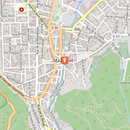
Looking for big thrills? Desire to surpass yourself? The via ferrata of Mazamet is for you! In the the Arnette gorges, in Mazame, via ferrata and giant zip line, under the footbridge. Acrobats and adventurers will enjoy this safe activity which completes, since 2022 the current tourist offer. This land is located in a protected natural site carried by an outstanding historic heritage (Cormouls-Houlès remarkabe gardens, St-Sauveur ruins, classified archeological site), and a rich and diverse wildlife. Nearby, after crossing the Mazamet's Hymalayan footbridge at 70 meters high over the Arnette river, you will find the medieval village of Hautpoul and its gardens, as well as, on the GR7, the House of Wood and Toy, its arboretum and its orchard. A nice wander along the 'Art Net' to picnic in th the shadows of chestnut trees. - Via Ferrata with ziplines : . Access: 20 mn . Drop : 90 m . Length: 880 ml . Difficulty: AD à D+ . Duration: 2 h 30 . Way back: 20 mn - Via Ferrata without zipline . Access: 30 mn . Drop: 110 m . Length: 370 ml . Difficulty: AD à D+ . Duration: 1 h 30 . Way back: 20 mn - Via Ferrata (upper part of Hautpoul) . Access: 20 mn . Drop: 60 m . Length: 130 ml . Difficulty: PD . Duration: 45 mn . Way back: 25 mn Minimum gear required: . Helmet . Harness . Closed shoes . Rest Karabiner & short lanyard . 2 wide aperture autoblock gate karabiners . Karabiner aerolink specifically for continuous safe line . Lanyard aeroline Ferrata . Double lanyard with shock absorber . Gloves General recommendations: Access to the Via Ferrata of Mazamet is prohibited: - to children measuring less than 1,35m and minors who are not accompanied by un experienced adult ; - outside opening hours and over night ; - in adverse weather conditions and especially when the route is slipppery and affected by snow, ice and stormy conditions. You agree to undertake this activity at your own risk. If you have little or no experience in this type of activity, please contact the services of a guide. Equipment rental: Mazamet Tourist Office Online booking: www.tourisme-castresmazamet.com/billetterie Rates: 18€/pers. Groups more than 5 persons: 16,50€/pers. Groups more than 10 persons : 15€/pers. Deposit: 400€ (on the day of the rental, chèque ou Crédit card) For beginners or persons needing a guide, you can contact: - Aude Escapades - Laurence Combes 06 03 50 00 85 - Axecime - Yannick Saulnier 06 08 42 27 13

95 rue de la Resse 81200 Mazamet
Book from 0 €Book
Show
Grand' Hortensia
81 km

Grand' Hortensia

Fully renovated and furnished holiday home for 14 people, just outside the village, 1 minute from the leisure centre. Situated at an altitude of 620 metres, in the Hautes Terres d'Oc, your holiday at Saint-Pierre de Trivisy in the Haut-Languedoc Regional Nature Park. You'll love the friendly locals, the leisure centre ideal for children (and adults too!), the first-class rivers for fishing, forest walks, hiking trails... In the village, you'll find all the shops you need for your holidays, a wellness and spa centre open all year round, a leisure centre with a water park, water slides, Aventure Parc (tree climbing) and lots of entertainment in summer... Fully renovated and furnished holiday home sleeping 14. For families or groups of friends, it is located at the entrance to the village, on the road to Lacaune, just a minute's walk from the leisure complex. Enclosed garden, terrace Ground floor: - large living room opening onto a single-storey terrace at the rear, equipped with a wood-burning stove, - fully-equipped kitchen (traditional oven, microwave, combined fridge-freezer, extractor hood, dishwasher... ) with comfortable dining area, - laundry room opening onto outside terrace with washing machine, ironing board and iron - wc 1st floor: - 3 bedrooms, each with double bed (140x190), - large bathroom with bath and shower, hairdryer - wc 2nd floor: - 2 bedrooms, each with double bed, - bedroom with 2 single beds (90x190) and 2 bunk beds (90x190), - 2 toilet cubicles with shower, - wc A small games house with a multi-games table (table football, billiards, table tennis and table hockey), board games and toys for the children. External electric car charging point. Le Grand Hortensia can be rented in a smaller format (ground floor and 1st floor only), a gîte for 6 people, Le Petit Hortensia (reference G1746 on Gîtes de France).

1200 avenue des Monts de Lacau 81330 Saint-Pierre-de-Trivisy
Book from 0 €Book
Show

Where to eat in Limoux

See more suggestions
Explore the best dining spots in Limoux.
See more suggestions

Where to sleep in Limoux

See more suggestions
Discover available accommodations around Limoux.
See more suggestions
Caution!
We have no information on the difficulty of this circuit. You may encounter some surprises along the way. Before you go, please feel free to inquire more and take all necessary precautions. Have a good trip! 🌳🥾