Tours
Activities
Places of interest
Where to eat
Where to sleep

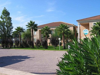
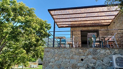
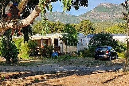
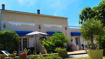
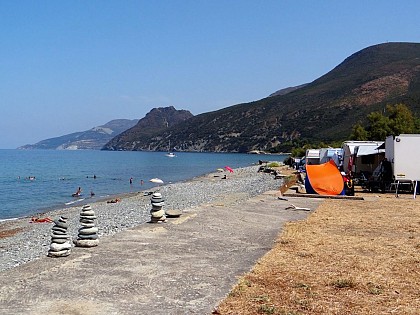
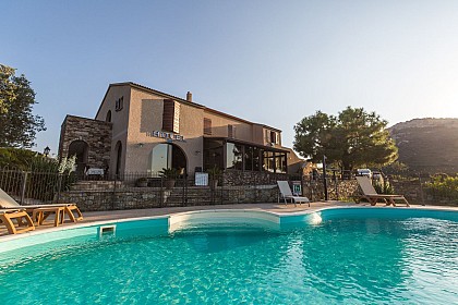
U SOLE MARINU: camping getaway in Patrimonio Haute-Corse

Are you the owner?
Nestled in the heart of Haute-Corse, Patrimonio is a must-see destination for tourism and adventure enthusiasts. Staying at U SOLE MARINU, you will be ideally positioned to explore the many wonders of this region rich in culture and natural beauty.

Patrimonio is renowned for its vineyards and prestigious wines. Along the famous wine route, you will discover wineries where you can taste local wine...
See more

Walking around U SOLE MARINU

See more suggestions
Discover the nature of U SOLE MARINU on foot.
See more suggestions
CHAPELLE SANT'ANDRIA DI FABRICA - BIGUGLIA
8.7 km

CHAPELLE SANT'ANDRIA DI FABRICA - BIGUGLIA

Set off to explore Biguglia along two trails: the Biguglia Village trail immerses you in the village’s atmosphere, whilst the Sant’Andria Chapel trail takes you to the Sant’Andria Chapel, along a route that is as artistic as it is natural. Hidden sculptures, painted trees, colourful figures… a local artist has scattered his imagination all along the path, much to the delight of young and old alike. A picnic area awaits you at the chapel. Please note, however, that the trail crosses several watercourses — best avoided in wet weather due to mud and flooding, but well worth enjoying in fine weather! Biguglia Village Trail: Start from the village car park: 42.627197, 9.421073 (Alt. 113m) Duration of the walk (excluding breaks): 40 mins Distance covered: 500m Elevation gain: 40m / Elevation loss: 40m Difficulty: Easy 1) The walk starts from the car park of the 16th-century Baroque Church of Saint-André. Meet on the church forecourt. From here, you can see the Étang de Biguglia, also known as the Étang de Chjurlinu. Retrace your steps back to the war memorial. 2) Head up to the crossroads 50 metres further up. 3) Turn right, then slightly left, and take the narrow lane (not the main road), then continue for 80 metres to reach Piazza dell’Avvene. 4) To the left of the piazza, if you’re facing the sea, stands a ruined tower. This is an ancient Genoese tower dating from the 16th century, which marked the fortified boundary of the village in the Middle Ages. Facing the fountain (with your back to the sea), take the stone steps, then head slightly to the right. After about twenty steps, turn left, then at the top of the steps turn left again to reach Piazza di u Chjalzu (Mulberry Tree Square). 5) From there, cross the square and continue towards the archway, but first look out for the cannonball above the door on your left. Begin to descend slightly to reach the washhouse 70 metres further down. 6) To reach the Sant’Andria Chapel trail, continue along the route. If you wish to turn back, leave the house on your left, then turn left again; after 100 metres you’ll come to the junction. 7) Cross the road to return to the car park. Sant’Andria Chapel Trail: Start from the village car park: 42.626335, 9.419397 (Alt. 154m) Duration of the walk (excluding breaks): 90 mins Distance covered: 3.5 km Elevation gain: 190 m / Elevation loss: 190 m Difficulty: Moderate 1) From the wash house, take the concrete steps. Continue for 380 metres through the woodland, taking care to read the signs along the botanical trail. 2) At the junction, you’ll come across one of the many sculptures carved directly into the trees that line the route. Continue along the ‘lower’ path and follow the trail marked in yellow and blue, the colours of Biguglia. 3) Take a break at the ‘pagliaghju’ (haystacks), located 1,100 metres from the wash house. Tackle the short but ‘challenging climb’ leading to the ruined chapel. 4) The Sant’Andria di Fabrica chapel is situated at an altitude of 343 metres, the highest point of the walk. By this point, you will have covered 1,900 metres since setting off. From the chapel, continue across the plateau for about 50 metres. 5) At the dry fountain, turn right. The descent takes you through the oak woodland, following a water pipe for 1,200 metres to reach point 2. 6) From the burnt chestnut tree and its sculpture, walk a few metres, turn left and return via the same route. The Topo Guide is available to download to guide you throughout your walk and ensure you have an enjoyable and safe hike.

2 h
4 km
Medium
BIGUGLIA 20620 Biguglia
Show
CHJASSU SAN MICHELE - LUCCIANA
17 km

CHJASSU SAN MICHELE - LUCCIANA

Discover Lucciana via two accessible trails steeped in history. The first takes you into the heart of the village, through peaceful alleyways and past restored heritage sites, such as the Funtanelle. The second, longer trail leads you to the magnificent San Michele Chapel, perched amongst the hills. Please note, however, that the route offers little shade: make sure you’re well-equipped, especially in summer, and adjust your pace to suit any children. Lucciana Village Trail: Starts from the village car park: 42.546300, 9.417990 (Alt. 220m) Walking time (excluding breaks): 30 mins Distance covered: 1 km Elevation gain: 40m / Elevation loss: 40m Difficulty: Easy Suggestion: Why not have a go at a ‘blue sign’ treasure hunt? 1) From the car park, find your first sign, ‘Piazza u Suru’, and turn right towards the bar, then right again towards the church. 2) From ‘Piazza San Michele’, look for ‘Riccata Suprana’ – keep the church on your right and head up to ‘Piazza di a funtana’ (water point). 3) A few metres further up, in ‘Piazza u Zi’, look out for the ‘1’ and go down the steps to reach the start of the San Michele footpath. We’ll turn left onto ‘Funtanella Suprana’. Pass ‘E Terraghjule Suprane’ on your right. When you reach ‘Piazza caserna’, turn right towards ‘Carrughju a Teppa’, then from ‘Piazza a Teppa’ go down the steps leading to ‘Piazza Zia Memetta’. Continue towards ‘Stretta a Ghjesa’, which you’ll leave on your left. When you reach ‘Carrughju Funtanella Sottane’ – which marks the end of the San Michele trail – turn left, then a few metres further on turn right onto ‘A Piazzetta’; continue downhill and you’ll arrive at ‘Piantò’ 4) From ‘Piazza Piantò’, with its superb stone arch, you look out over the Mormorana stream. Look out for the ‘76’ to reach ‘Piazza San Anghjulu’ (no. 5). 5) From ‘Piazza San Anghjulu’, head back up via ‘Ricciata Suttana’ then pass in front of ‘Piazza Casò’. Finally, turn right towards the car park. San Michele Chapel Trail: Start from the village car park: 42.546300, 9.417990 (Alt. 220m) Hike duration (excluding breaks): 60 mins Distance covered: 3 km Elevation gain: 130 m / Elevation loss: 130 m Difficulty: Moderate 1) From the car park, look out for your first signpost ‘Piazza u Suru’ and turn right towards the bar, then right again towards the church. From ‘Piazza San Michele’, look for ‘Ricciata Suprana’ and keep the church on your right as you climb up to ‘Piazza di a Funtana’ (water point). 2) A few metres further up, at ‘Piazza u Zi’, look out for the steps and go down them to reach the start of the San Michele path. Turn right towards ‘Funtanella Suprana’; this is where the path begins. A footbridge leading to the ‘Funtanelle’ has been built, providing access to this lively part of the village where the Luccianinchi (inhabitants of Lucciana) used to come to fetch water and wash their clothes. 3) Once you reach the river, continue your ascent through the forest. Make the most of this remarkable viewpoint to observe the natural surroundings and perhaps take a few photos before beginning your descent along a dirt track. 4) Take a break at the San Michele Chapel. Take in the natural surroundings and snap a few photos before beginning your descent along a dirt track. 5) 150 metres further on, you’ll reach a crossroads of paths; keep to your left, cross the stream once more before heading slightly uphill towards the village. 6) ‘Carrughju Funtanella Suttane’ – marks the end of the San Michele trail. Take a little more time to stroll through the village and its many ‘piazzette’ (small squares), which have retained their charm. And finally, you’ll arrive back at the car park… The Topo Guide is available to download to guide you throughout your walk and ensure you have a pleasant and safe hike.

1 h
4 km
Easy
Parking du village de Lucciana 20290 Lucciana
Show
BOUCLE SAN MAMILIANU - SCOLCA
18 km

BOUCLE SAN MAMILIANU - SCOLCA

Calling all hikers looking for a challenge! The Scolca trail is the most demanding route offered by the Marana-Golo Tourist Office, but also one of the wildest. It winds through the woods of Mala Notte, a dense forest of downy holm oaks, offering shady spots that are perfect for taking a break amidst nature. This circular walk allows you to discover both the charm of the village and the richness of its wooded surroundings. Scolca Trail: Start from San Mamilianu Church: 42.530542, 9.363545 (Alt. 590m) Duration of the walk (excluding breaks): 3 hours Distance covered: 5.5 km Elevation gain: 390 m / Elevation loss: 390 m Difficulty: Moderate Please note: It is best to park at the entrance to the village and walk to the church. 1) Right from the start, you’ll notice the campanile (separate bell tower) of the Church of San Mamilianu, built in the 17th century. Take the road opposite (passing a fountain on your left) leading up to the top of the village for 150 metres. 2) Sign marking the start of the ‘Giru di San Mamilianu’. Follow the path through a beautiful chestnut grove, then enter the dense Malanotte wood (the ‘cursed night’) to reach the crossroads by the fountain (now dry) 2.2 km on. This spot has a distinctive and eerie atmosphere. 3) At the crossroads, you will find two signposts: the one on the right leads to ‘Bocca a Foata’; the one on the left points towards ‘Chjassu di San Mamilianu’, which you should follow. Take care whilst walking through the forest. Note the presence of ‘aghje’ (wheat-threshing areas) and charcoal kilns (used for the traditional production of charcoal). 4) You’ll reach a small plateau, then come to the junction leading to the hamlet of Cammare. 5) 100 metres further on, to the right, there is a magnificent viewpoint (elevation 922 metres) overlooking the entire mountain range, the valley and its villages. Take a well-deserved break… 6) Retrace your steps back to point 4. Continue for about 30 metres. 7) Look out for the start of the descent on your left. Do not venture onto unmarked paths. During the descent, the path crosses a forest track several times; you’ll need to pay close attention once again to stay on the path. You’ll come across the ruins at a place called Pastricciola and its ‘lenze’ (terraced gardens). Continue downhill for 1.5 km to reach the path leading to the cross overlooking the village of Scolca. The view over the valley and the surrounding villages is breathtaking. 8) Leave the main path to head for the 754-metre point, 100 metres further on. 9) At ‘San Simone’, after yet another ‘stunning photo’, retrace your steps. 10) Continue down the somewhat tricky descent leading to Scolca Paese, 800 metres below. 11) The walk through the village is extremely picturesque. At the crossroads, turn left towards your starting point. The Topo Guide is available to download to guide you throughout your route and ensure you have an enjoyable and safe hike.

3 h
5.5 km
Medium
20290 Scolca
Show
SENTIER DE LA MADONNA - CAMPITELLO
21 km

SENTIER DE LA MADONNA - CAMPITELLO

Ideal for a family outing, the Campitello walk is short, shaded and perfectly maintained, with steps and handrails to ensure maximum comfort and safety. It takes you through the village’s surroundings, following the river, to the famous rock where the Virgin Mary is said to have appeared – a place of pilgrimage steeped in serenity. A little corner of nature and spirituality, accessible to all. Campitello Trail: Start from the municipal car park: 42.52735, 9.31619 (alt. 522m) Duration of the walk (excluding breaks): 1 hour Distance covered: 2.2 km Elevation gain: 110 m / Elevation loss: 110 m Difficulty: easy 1) From the car park, head up the road, then turn left towards the lower part of the village, heading for the hamlet of Panicale. 2) After 60 m, you’ll reach the war memorial (cannon). Look out for the path leading to the hamlet of Bagnolo. Continue downhill for 50 m to reach the parish church of San Petru. 3) The church of San Petru, whose origins date back to the 14th century, is situated behind the ‘Casa cumuna’ (town hall). After a short break on the church square, head towards the lower part of the village – a dead end for vehicles – and follow the signs for ‘Madonna’. 4) When you reach the San Roccu chapel (with its striking blood-red and gold doors), turn left and continue towards the lower part of the village. You will enter the oak grove and its magnificent terraced gardens: ‘e lenze’. Originally, these olive groves allowed the owners to harvest their olives and press their own oil. The mill, ‘u fragnu’, is situated 50 metres below. 5) You have now reached the site of the four rocks of the apparitions. Campitello shares something in common with Lourdes: it was the site of apparitions of the Virgin Mary. Between 1899 and 1912, Madeleine Parsi, known as Lélléna, and other villagers witnessed these apparitions. 6) After a refreshing break, you’ll need to head back up the same way to the car park, 1.1 km higher up. If you’ve still got some energy left, carry on towards the hamlet of Bagnolo along the path you spotted earlier (distance approx. 100 m one way / 50 m elevation gain) to discover the Chapel of the Immaculate Conception, which houses the painting of the same name by the artist Francesco Carli, dating from the 1760s–1770s. The guidebook is available to download to accompany you throughout your walk and ensure you have an enjoyable and safe hike.

1 h
2.2 km
Easy
20252 Campitello
Show
GIRU DI E PUNTE - OLMU
22 km

GIRU DI E PUNTE - OLMU

The Olmo trail invites you to enjoy a leisurely stroll around the village, taking in both the natural surroundings and local heritage. Along the way, a viewing point offers a breathtaking panorama – the perfect spot for a picnic break under the parasol provided there. Whether you’re a keen walker or simply looking for a peaceful spot to enjoy the view, Olmo welcomes you with its simple charm. This walk is suitable for families. Olmo Trail: Start from the village car park: 42.496490, 9.408563 (Alt. 545m) Duration of the walk (excluding breaks): 3 hours Distance covered: 5.3 km Elevation gain: 120 m / Elevation loss: 102 m Difficulty: Easy 1) Head left (with your back to the war memorial) for 70 metres, then take the concrete road on your right. 2) From the junction, head uphill to the hairpin bend. 3) From the gate, walk beneath the chestnut grove for 400m until you reach the dirt track. After 20m, do not take the right-hand fork leading to route 7: Stollu. 4) Once on the track, head to your right and climb for 950m. 5) Look out for the path on your right leading to Stollu 7. Directly in front of you is the path leading down to Viscuvatu (Vescovato). To reach the ‘viewpoint’, continue along the track for a further 200 metres. 6) You will arrive here at the picnic area – U Macinaggiu – with its lovely view; turn back to point 5. 5) Take the path signposted towards Olmu (Olmo) and walk for 750 metres. The path is to the left of the track you saw on the way there. At the highest point (cairn), take a look to your right; you’ll see the ruins of Fort Castellucciu below and the artificial lake. 7) From Stollu, continue along the path towards the pass; look out for ‘u Nespulu’ on your right, which means ‘the medlar tree’. 8) From Bocca Calanchella (a shortcut back to the village), continue slightly uphill; then, after a short descent, you’ll reach another junction leading to the Col de Carcheroni, situated on your left. Here, take the Strada Pascal PAOLI. 9) Head down the track suitable for vehicles on your right and, after 800 metres and a few hairpin bends, you’ll be on the RD10. Pass the cemetery on your right. 10) Once on the road, turn right; walk 400 metres with a view of the village and its church. 11) On your left is the church of Saint Julitte and Saint Quilicus. 12) Another 50 metres and you’ll arrive back at the car park where you started. The Topo Guide is available to download to guide you throughout your walk and ensure you have an enjoyable and safe hike.

3 h
5.3 km
Easy
20290 Olmo
Show
GIRETTU DI CARONEO - MONTE
25 km

GIRETTU DI CARONEO - MONTE

This lovely walk immerses you in the spirit of the village of Monte and its neighbouring hamlets, Divina and Carognu. As you follow the path, you’ll discover the ruined Church of the Immaculate Conception in Carognu, steeped in mystery, and the typical stone houses of Divina, true to the architecture of small Corsican villages. A walk combining heritage, nature and authenticity. Monte Trail: Start from the Caroneo fountain car park: 42.47880, 9.39103 (Alt. 622m) Duration of the walk (excluding breaks): 1 hour Distance covered: 2.5 km Elevation gain: 150 m / Elevation loss: 150 m Difficulty: Easy 1) From the car park, with your back to the Church of the Immaculate Conception, follow the road leading down to the bottom of the village – the road on the right. 2) After 160m, you’ll reach the village’s old church and its imposing campanile (bell tower), which you should leave on your left. This church, which predates the one in Caroneo, is also dedicated to the Immaculate Conception. Built in the 19th century, it collapsed in the 1930s when the ‘keys’ stabilising the vault gave way, just as a religious service was ending. The path continues down the ridge before plunging into the oak woodland to reach point 3 at 650m from the start. 3) Turn left to reach the road to Divina and its chapel dedicated to the two saints: Saints Cosmas and Damian – do take a look at the superb stained-glass windows! The Chapel of Saints Cosmas and Damian is thought to date from the 17th century and was rebuilt by the hamlet’s inhabitants in the second half of the 19th century. 4) Turn back. 5) You’ll arrive back at point 3. Continue left into the beech forest, climbing gently but steadily. You’ll reach the cemetery road 800 metres higher up. 6) Turn right to reach the starting car park (1); turn left at the church to reach the fountain 150 metres further on. 7) After a refreshing break, turn back. 8) Why not take the path on the left for about ten metres to explore the hamlet and its ‘loghje’ (vaulted passages)? The Topo Guide is available to download to guide you throughout your walk and ensure you have a pleasant and safe hike.

1 h
2.5 km
Easy
20290 Monte
Show
Caution!
We have no information on the difficulty of this circuit. You may encounter some surprises along the way. Before you go, please feel free to inquire more and take all necessary precautions. Have a good trip! 🌳🥾