Alert
Alerts
GIRETTU DI CARONEO - MONTE
Description
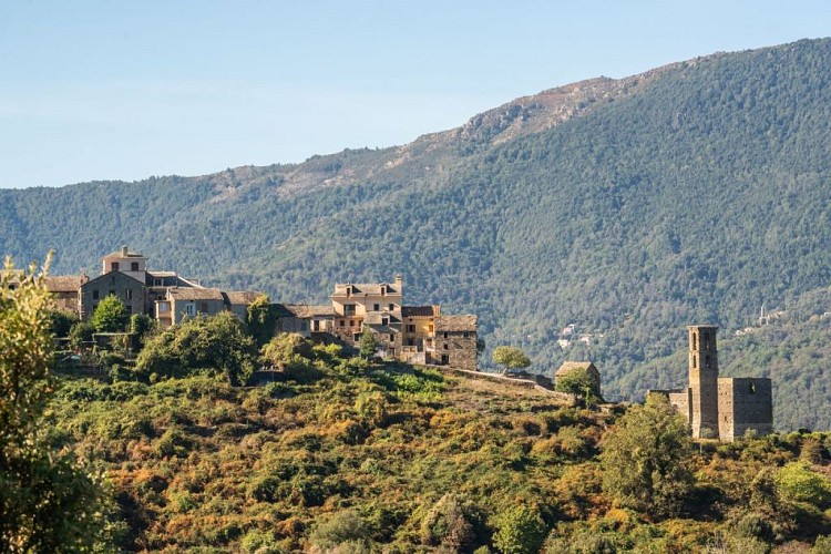
This beautiful walk immerses you in the soul of the village of Monte and its neighbouring hamlets, Divina and Carognu. As you follow the path, you'll discover the ruined church of the Immaculate Conception in Carognu, steeped in mystery, and the typical stone houses of Divina, faithful to the architecture of small Corsican villages. A walk that combines heritage, nature and authenticity.
Sentier de Monte :
Start from the Caroneo fountain car park: 42.47880, 9.39103 (Alt. 622m)
Length of walk (excluding breaks): 1 hour
Distance covered: 2.5 km
Difference in altitude: D+150m / D-150m
Difficulty: Easy
1) From the car park, with your back to the Church of the Immaculate Conception, follow the road to the bottom of the village - the road on the right.
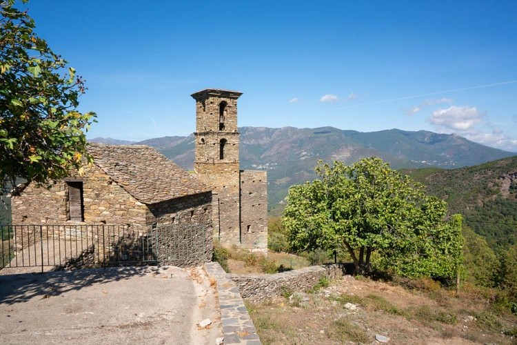
2) 160m further on, you will come to the old village church with its imposing bell tower, which you should leave on your left. This church, which predates that of Caroneo, is also dedicated to the Immaculate Conception. Built in the 19th century, it collapsed in the 1930s after a religious service when the "Keys" stabilising the vault broke.
The path continues to descend along the ridge before plunging into the oak forest to reach the 3, 650m
from the start.
3) Turn left to reach the road to Divina and its chapel of the two saints: Saint Côme et Damien - Note the superb stained glass windows!
The chapel of Saint Côme and Damien dates back to the 17th century and was rebuilt by the hamlet's inhabitants in the second half of the 19th century.
4) Turn around.
5) You will come to number 3 again. Continue to the left through the beech forest and climb slowly but surely. You will reach the cemetery road 800m further up.
6) Turn right to reach car park 1; turn left at the church to go to the fountain 150m further on.
7) After a thirst-quenching break, turn back.
8) And why not take the left-hand road for about ten metres to see the inside of the hamlet and its "loghje" (vaults).
The Topo Guide is available to download to accompany you along your route and ensure you have a safe and enjoyable hike.
Technical Information
Altimetric profile
Starting point
Data author
