Tours
Activities
Places of interest
Where to eat
Where to sleep

Discover Mas-cabardes, Aude, Languedoc-Roussillon

Are you in charge of the destination?
Nestled in the heart of Aude, the charming town of Mas-cabardes beckons you to explore its delightful surrounding attractions. As you wander through its quaint streets, marvel at the architectural structures typical of the region, telling a rich and fascinating history. Around Mas-cabardes, nature offers a plethora of opportunities for outdoor enthusiasts. Hiking trails meander through the lush hi...See more

Walking around Mas-cabardes

See more suggestions
Hiking trails in the Mas-cabardes area.
See more suggestions
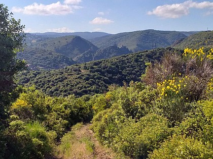
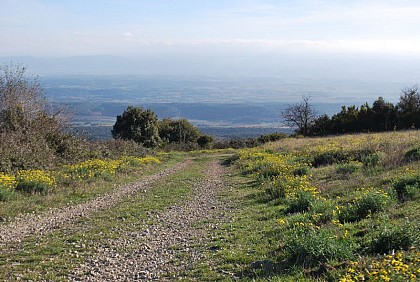
The Bosc Grand path
4.8 km

The Bosc Grand path

Loop to the north of the village, you will pass close to the cave, take the opportunity to visit it (pay for entry)! WARNING: in summer, protect yourself from the sun and keep hydrated because of the long distance, the sunshine and the elevation gain. Start in the centre of the village, Place de la Fontaine. Head north on Rue du Four, then continue along a slightly sloping path towards the "Grave" stream. Further on, turn left at the junction with the "Ménentière" stream and go up towards Fournes-Cabardès. In the village, turn right on rue de la bergerie (D401) leaving the wash house on your left. Walk for about 450m and then take a path on the right. Go down towards the Courrebies valley and go up to Sériès. Take the D401 and cross the hamlet then the ford. At the level of the "Courtal Long" sheepfold, in the left-hand bend, take the path on the right towards the pass (alt 644m) on the crest of Mount Simel. Take a break to admire the landscape. Resume the progression: go down the stony path for 1km then at the level of a grove of trees, turn right through the scrubland. At the bottom of the track, turn right and 150m further on, turn right again and go up. Arriving at a flat area, at a small crossroads: look out for the signs. Turn left and follow a small path in the middle of fairly short vegetation. Go down to the level of the Limousis cave, cross the shady car park and then take the road opposite which leads back to Limousis.  

4 h
9.8 km
Easy
Show
La Grotte des Maquisards - The resistants cave
6.2 km

La Grotte des Maquisards - The resistants cave

Near to the GR 36 and the giant chasm of Cabrespine, a nice walk on the Mediterranean slope of the Montagne Noire and its limestone landscapes. Yellow mark with a circleDeparture from the parking lot on the left before the village’s entrance.Leave the parking lot and go towards the village. Once at the first house, turn right onto rue du 8 Aout 1944.About 100 meters later, outside of the village,  take the path on the right towards the Maquis stele.Behind it, on the left, the path carries on through vegetation with some difficult passages on the rocks : be careful when the weather is humid.Once you have crossed "Laure’s gulch", you will need to go up a little in order to cross another gulch a bit further : "Matte  Arnaude’s" one.Then go up through a more dense vegetation that will shield you from the sun.There is a path through a small wall in the shadow of some oak trees.Once at the pass, go slightly on the right on a relatively flat path for 1 km : please remember to close all three gates.Soon after, you will encounter a cross-path : turn right to go slightly up.Soon, you will come across a fork.Turn right and admire a beautiful point of view,  then go down for 500 meters until the Coroluna cave.Carry on going down until Escoles ravine, then go back up.At the cross-path, turn left. You will walk in front of another bigger cave that was used as a shelter by the resistance.There is a commemorative plaque above the entrance.While passing by, it would be nice to have a thought towardsthem  : "they died for FRANCE and FREEDOM".Follow the itinerary towards the stream (it can be dry sometimes).Walk back up for 90 m bringing you back to the Maquis stele .Go back to Trassanel village in order to go back to the parking lot.

3 h
6.1 km
Easy
Show
The eagle rock
7.2 km

The eagle rock

Above the giant chasm of Cabrespine: between shale and limestone where terraces become truffle patches. Yellow markingsCross the road opposite the entrance to the Espace Maguelon and take a tarred road that climbs up to the left. If you look down on the sides, you will soon notice a succession of small signs indicating the names of the plants that have taken root on the path. This botanical trail will lead you to the pass.When you reach the first houses, return to the path on the right, which climbs hairpin turn under holm oaks. Here you take an old path that leads to the cirque of Escoles, that was a century ago, land of the best vineyards and once the land of the lords of Cabrespine. In this first part of the path, the Cabardès schist outcrops, which will soon give way to limestone up to the summit.Suddenly, at the crossing of a path coming from the left, we find a concrete section on 25m/80ft. You are close to the entrance of the "Gouffre Géant" cavern (that you can visit, approximately 45mn, ask about visiting hours (tel: +33 (0)4 68 26 14 22). The path goes around and behind the buildings. Here the route crosses a Natura 2000 listed area which especially protects bats.A few hundred metres above the path runs along a magnificent wall of dry stones. Then we discover on the left in this wild environment some recently cleaned plots of land; they are truffle patches. Shortly after , you reach the pass where you are invited to take a few steps to your left, facing south to get a magnificent view of the Escoles site.  The rocky cirque configuration in the heights is followed downwards by a succession of terraces well exposed and protected from the wind. Leaving the route of the "Las Escolas" loop on the left, take the path to cross the bottom of the valley and pass near a ruined sheepfold to, after a bend to the left, progress for about fifty metres on the side.You will soon find a path on the left that goes down. It leads to the cave of the maquisards, a high place of the WW2 resistance in the Montagne Noire. You can make this detour on the outward or return journey (40 minutes return) to grasp the living environment of these Resistance fighters, most of whom were executed, and to feel the breath of freedom that we owe them.By taking the path back where you left it, you reach a small pass. Leave the path leading to Trassanel on your left and take the one on your right which goes north first over grassy crests, then over pebbles and rocks, following the route which winds between the cairns (artificial heaps of stones) up to geodetic point 700.Then head east on the ridge up to the Roc de l'Aigle. At the arrival, give yourself a time to recover in front of the Pyrenees and enjoy the panoramic view without moderation! 

3 h
6.4 km
Easy
Show
Dawn’s footsteps (Les pas de l’Aube)
7.5 km

Dawn’s footsteps (Les pas de l’Aube)

Along this itinerary, discover a whole mosaic of beautiful landscapes that man has shaped over time. Olive trees, scrubland, rockroses, junipers and holm oaks. Further on, in the steepest parts, on the cool banks of streams, there is still the chestnut tree, an important source of income for the inhabitants in the past. Old sheepfolds recall that there was also a considerable pastoral activity. Signs: Yellow markings Departure  Place de l'Eglise. Cross the bridge over the Clamoux. Turn right and then immediately left on the "Chemin de Brescou". The path climbs between two walls and then crosses terraces with some fruit trees. Pass next to a “capitella” drystone hut. After the scrubland, go past holm oaks and pass by the old sheepfold of "Costo Granie". Climb up to the crest of the Cocaillère pass. Go down slightly and turn left along the fence. Take the track on the left towards the point of view of the "Traouc de l'Oulo" in the loop of the track, beware by strong wind, this place is very exposed. After 100m turn left and continue on the track. After a few meanders in the heather, turn right to go down to the stream "Belle Bruyère". Continue through the forest. Pass the brook of “Burgasse”, then a sheepfold, the brooks of “Laouzière” and “Fouzéry” to reach the road to “Serremijeanne” hamlet.Cross and go down by the small path between the meadows and the stream. Cross it and go up between two low walls by following the ruins of the farm of “Maïssantoul” underneath. Further on, cross the brook again and by the path, join the road and follow it for 500m. To take on the right the road which goes down towards the brook of “Belle Bruyère”. Pass the footbridge, go up the road from where we see the "Cabanial" and join the road in a loop. Turn right immediately on the downhill path that cuts the loops of the road. Join the road before the hamlet of “Laval” and carry on back towards Cabrespine.

4 h
9.7 km
Easy
Show
The "Capitelles” - Le Cagarot
8.4 km

The "Capitelles” - Le Cagarot

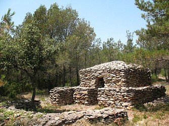
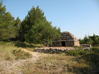
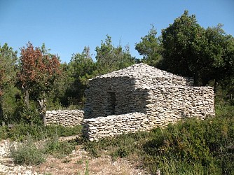
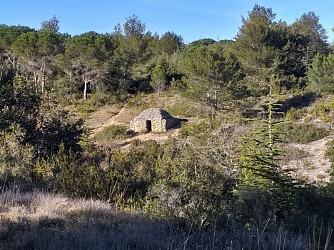
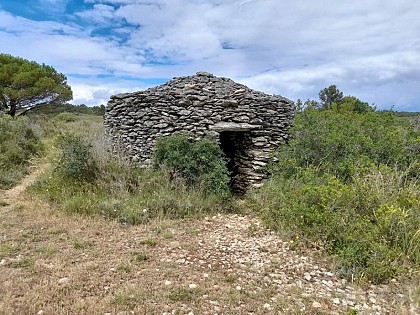
In Conques-sur-Orbiel, about thirty volunteers meet for half a day each week to restore these "capitelles" - dry-stone cabins -, which once served as shelters for winegrowers in winter times.  Forty-five “capitelles” mark four trails in a magnificent setting.  Trail Markings: Pink  The starting point of the Cagarot Trail is not located at the trailhead sign, as with the other three trails. To reach it, you must first follow the “Les Murailles d’Aribaud” trail (blue markings) for about 600 meters in the direction of the route. From the “L’Embarado” picnic area in the woods, the “Le Cagarot” loop (pink trail markers) begins.  Set off again in front of the "capitelle", then turn left shortly afterward. Before reaching a trail junction, turn right to cross a small wall. Pass in front of the "dansaïro" (a nickname given to the person who works the plot) and then near a rabbit warren or shelter: the Garenne de Gauby.  When you reach a trail, turn right, and after 50 meters, turn left onto a long straight stretch. Enjoy the shade provided by the pine and holm oak trees along the route.  At the trail junction, turn right, where you’ll follow a major "draille" (transhumance trail) with reconstructed stone walls.  After about 200 meters, turn left onto a gravel path; as you wind through the vegetation, you’ll discover several "capitelles". At the end, turn left, and as you face the view, take a moment to appreciate the magnificent vista of the limestone cirque and listen for the peaceful trickling of the “Rieu Sec.” Continue to the left and follow the trail, turning left again.  At the trail junction, turn right, and 100 meters further on, turn left to return to the picnic area in the woods. Continue to the right, following the “blue” trail markers, to return with a view of the Pyrenees mountain range: take a moment to admire this view.  Tips: The restoration of the "capitelles" is the result of the work of volunteers from the Foyer Laïque de Conques sur Orbiel. Please respect what has been restored by not moving the stones on these structures, which remain fragile. 

1 h
2.7 km
Very easy
Show
The “Capitelles” - The Scrubland Steam
8.7 km

The “Capitelles” - The Scrubland Steam

In Conques-sur-Orbiel, about thirty volunteers meet for half a day each week to restore these "capitelles" - dry-stone cabins -, which once served as shelters for winegrowers during winter times.  Forty-five "capitelles" mark four trails in a magnificent setting.  Green Markings  From the starting sign, turn right twenty meters ahead and keep turning right; the green sign for the “Le ruisseau de la Garrigue” trail invites you to venture into the very dense vegetation.  Soon, the first "capitelle", named “La Mignarda,” comes into view.  It features a distinctive four-sided dome. From there, green arrows mounted on posts will guide you along the entire loop.  At the following "capitelles", notice the protruding stones built into the outer wall—known locally as “assietadous”—which serve as seats.  Further along, one “capitelle” is distinguished by its dome, covered with earth to protect it from erosion.  Every year in the spring, when the irises bloom, it becomes a sight to behold, taking on shades of blue and yellow. When you reach a trail, head straight ahead. Continue walking through very sparse scrubland toward a small valley.  When you reach a trail, turn left onto it and climb up to the trail junction, then pay close attention to the trail markers.  Turn right and continue along a trail through the sparse garrigue, facing the Pyrenees.  Back on a trail, turn left toward the last "capitelle" on the loop, “La Semparella.”  It features a mule shelter whose roof was covered with tiles until the 1940s, when it was last used.  Ideal family hike !

1 h
1.8 km
Very easy
Show
The “Capitelles” - The Cocalière Plain
8.7 km

The “Capitelles” - The Cocalière Plain

In this scrubland area, Andorran farmers and herds have given way to fragrant plant species.  Here, one can find the priceless remnants of that past.  A landscape that changes from one valley to the next, dotted with little stone gems: capitelles, assietadous… names bringing Mediterranean sun to your ears!  Trail Markings: Orange  Start to the left of the large sign. Follow the trail markers on the wooden posts; the path descends slightly.  The first "capitelle" you come to is quite an impressive structure. Be curious and feel free to wander around it.  At the trail junction, take the path straight ahead, slightly offset to the left. After 200 meters, turn left toward a "capitelle" and continue deeper into the fragrant garrigue. Discover the “Siamoises,” a pair of adjoining "capitelles" unique to the region.  Shortly after, cross the trail again and continue straight ahead for 50 meters, then turn right onto a long straight stretch.  Leave the trail to the left; further on, at a right-hand curve, on the outside of the curve, a surprising, perfectly round "capitelle" comes into view. When you emerge onto a trail, head right until you reach a star-shaped intersection.  At the intersection, turn right again, and then right once more at the next intersection. After about 150 meters, leave the path on the left and take a narrow trail.  Further on, when you rejoin the trail, turn right, then shortly after, at the trail junction, turn left.  You’re already on your way back! 

3 h
4 km
Very easy
Show
Aribaud’s Walls - Les capitelles
8.7 km

Aribaud’s Walls - Les capitelles

In Conques-sur-Orbiel about thirty volunteers meet for half a day a week to restore these capitelles (dry stone hutS) which served as shelters for the winegrowers during the bad weather. Signs: Blue markings Departure to the right of the big sign going up the track for about 200m. Take on the right a path (small trail) following the blue arrows. Gradually go into the "Occitan garriga" scrubland to discover different “capitelles”. Arrival on a track, on the right for 50m then on the left where four visual supports will inform you about the Essences of the area, the Garrigue, the Alaric mountain and the Pyrenees. Resume the progression behind you by following the markings, you will pass in front of the capitelle des Jumelles. Then two capitelles further on, you will leave on your right the departure of the Cagarot (path N°4, 2km, with beautiful panoramas) and by taking on the left you will arrive at "l'embarrade", this place was restored and fitted out in picnic area by a local association of protection of the capitelles. The path continues on the right up to a track, turn left, slightly uphill for about 250m. On your right, you can see another construction, "l'assietadou" dry stone shelter for sitting. Then the signposts will take you to the left, the progression will take place in a rather dense garrigue, very pleasant and you will end up on a new track. Turn right for 50m and then turn left (do not go over the power line). You will fall back on the track of the departure, take on the left in light descent for the return. You are facing south towards the Pyrenees: admire the panorama... Return to the parking lot.

1 h
2.2 km
Very easy
Show
Dry stone and scrubland
9.1 km

Dry stone and scrubland

This route takes you on a journey of discovery of landscapes shaped by men. On limestone plateaus covered with scrubland that had to be cleared to make them suitable for cultivation, stones were used to build low walls, enclosures or dry stone huts named "capitelles".These constructions, originally built for agriculture (cereals and then vines) were used as temporary shelters by shepherds in case of bad weather. There are very few specific pastoral buildings: there are enclosures either to keep the sheep or to enclose the crops and protect them. Signs : Yellow, follow the track with the sign “pierres seches”The path climbs up to the plateau via Avenue des Capitelles, running alongside,  at times , an old draille (a passageway for herds) on the left.At the top of the housing estate, take the path to the large enclosure wall on the left (interpretation panel).On your right, the path goes through the scrubland.Follow the yellow markings, reinforced by white signs. Numerous dry stone constructions and typical vegetation (boxwood, thyme, broom, etc.).The plateau offers beautiful views over the Carcassonne plain and the Pyrenees.After arriving on a track, turn right for about 500m then left towards the trees.Carry on through the open countryside and down a winding path.Once on the track, fork right for 400m.One last time to the right in the undergrowth, take a small shady path, which is very pleasant in the summer, going back up to the arrival point.

2 h
5 km
Very easy
Show

What to do in Mas-cabardes

See more suggestions
Exciting adventures await you in Mas-cabardes, book now.
See more suggestions
Via Ferrata in Mazamet
12 km

Via Ferrata in Mazamet

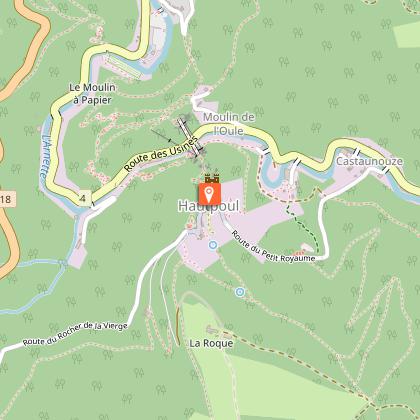
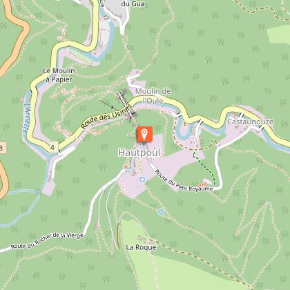
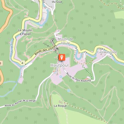
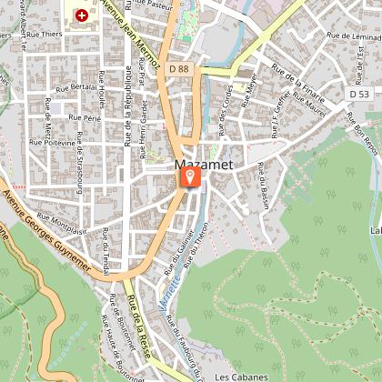
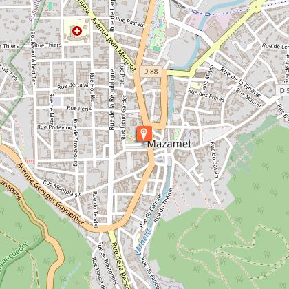
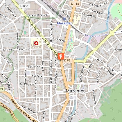
Looking for big thrills? Desire to surpass yourself? The via ferrata of Mazamet is for you! In the the Arnette gorges, in Mazame, via ferrata and giant zip line, under the footbridge. Acrobats and adventurers will enjoy this safe activity which completes, since 2022 the current tourist offer. This land is located in a protected natural site carried by an outstanding historic heritage (Cormouls-Houlès remarkabe gardens, St-Sauveur ruins, classified archeological site), and a rich and diverse wildlife. Nearby, after crossing the Mazamet's Hymalayan footbridge at 70 meters high over the Arnette river, you will find the medieval village of Hautpoul and its gardens, as well as, on the GR7, the House of Wood and Toy, its arboretum and its orchard. A nice wander along the 'Art Net' to picnic in th the shadows of chestnut trees. - Via Ferrata with ziplines : . Access: 20 mn . Drop : 90 m . Length: 880 ml . Difficulty: AD à D+ . Duration: 2 h 30 . Way back: 20 mn - Via Ferrata without zipline . Access: 30 mn . Drop: 110 m . Length: 370 ml . Difficulty: AD à D+ . Duration: 1 h 30 . Way back: 20 mn - Via Ferrata (upper part of Hautpoul) . Access: 20 mn . Drop: 60 m . Length: 130 ml . Difficulty: PD . Duration: 45 mn . Way back: 25 mn Minimum gear required: . Helmet . Harness . Closed shoes . Rest Karabiner & short lanyard . 2 wide aperture autoblock gate karabiners . Karabiner aerolink specifically for continuous safe line . Lanyard aeroline Ferrata . Double lanyard with shock absorber . Gloves General recommendations: Access to the Via Ferrata of Mazamet is prohibited: - to children measuring less than 1,35m and minors who are not accompanied by un experienced adult ; - outside opening hours and over night ; - in adverse weather conditions and especially when the route is slipppery and affected by snow, ice and stormy conditions. You agree to undertake this activity at your own risk. If you have little or no experience in this type of activity, please contact the services of a guide. Equipment rental: Mazamet Tourist Office Online booking: www.tourisme-castresmazamet.com/billetterie Rates: 18€/pers. Groups more than 5 persons: 16,50€/pers. Groups more than 10 persons : 15€/pers. Deposit: 400€ (on the day of the rental, chèque ou Crédit card) For beginners or persons needing a guide, you can contact: - Aude Escapades - Laurence Combes 06 03 50 00 85 - Axecime - Yannick Saulnier 06 08 42 27 13

95 rue de la Resse 81200 Mazamet
Book from 0 €Book
Show
Le Mouscaillou
18 km

Le Mouscaillou

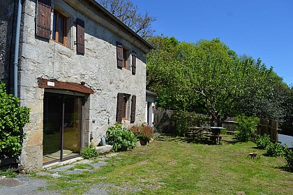
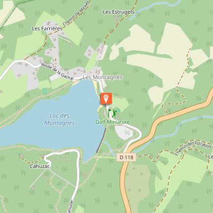
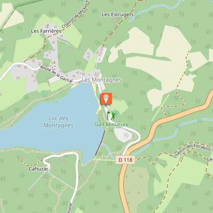
Towering majestically over you, the Montagne Noire Our large Guest House, authentic, spacious, very comfortable, surrounded of 5ha of prairies and oak woods invite to well-being. Need for tranquillity, contemplation: a panorama of exception, a large swimming pool with salt, beautiful beach wood vegetation, with on-site botanical trail. Here in the Parc Naturel Regional du Haut-Languedoc is planned to make you discover a rich and preserved nature. The Panda label is attested. For more physical activity: discovery of the mountain, the waterfall of the Mouscaillou, walk or bike the trails. Possibility to put in place of hiking tours with picnic. Maps and guidebooks available. Opportunity also to try our all-terrain scooters: initiation on-site warranties sensations. More than cultural: rich local heritage: Albi, Castres, Cordes, Carcassonne, Sorèze, Lautrec. After l aperitif offered on the moment of sharing and conviviality terrace, you can enjoy in our The large ground floor room opened by its three windowpanes on the shaded terrace and its remarkable panorama, fully reserved you. Wood, stone, green plants create a soft and warm atmosphere. You will take your meals and enjoy relaxing lounge chairs, his television, his library enriched with many works nature and tourism and its corner bar with fridge. Also on the ground floor, you have two toilets and a washing machine. L floor the rooms, with their wooden floors, colors in the milk of lime, custom decorations, beautiful openings of the mountains or the plain of Castres, offer you comfort and privacy. Three rooms with private wc and shower room; a fourth is added if necessary to one of them to form the family that will accommodate up to five people. You certainly understand that we need to take the time to have fun, which is why we you propo

112 chemin du Mouscaillou La B 81290 Escoussens
Book from 0 €Book
Show
The Great Paths
18 km

The Great Paths

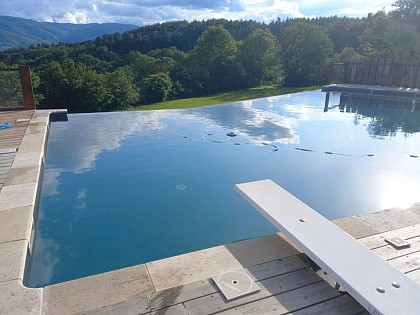
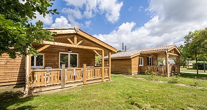
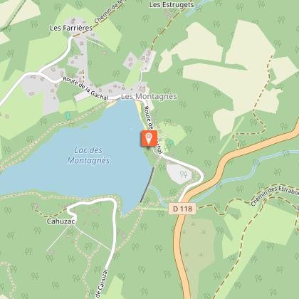
Towering majestically above you: the Montagne Noire. Here in the Haut-Languedoc Regional Nature Park, everything is designed to help you discover a rich and unspoiled natural environment. The Panda label attests to this. This authentic, spacious, and very comfortable home, surrounded by five hectares of meadows and oak forests, invites you to relax and unwind. Looking for peace and quiet, or a chance to reflect? Enjoy an exceptional panoramic view, a large saltwater pool (shared), a beautiful wooden deck surrounded by greenery, and an on-site botanical trail. For more physical activities: explore the mountains and the Mouscaillou waterfall on foot or by bike along marked trails. Maps and guidebooks are available. Be sure to try our all-terrain scooters as well—get an on-site introduction; thrills guaranteed. For cultural experiences: rich local heritage, Albi, Castres, Mazamet, Cordes, Sorèze, the springs, lakes, and waterways of the Canal du Midi, and Carcassonne. ** THE COTTAGE ** You enter on the ground floor into a large open room with floor-to-ceiling windows opening onto the terrace, which offers a pleasant mix of sun and shade, the lawn, and its remarkable panoramic view. Wood, stone, and houseplants create a soft and warm atmosphere. You can relax in the living room’s armchairs, watch TV, browse the library—which is well-stocked with books on nature and tourism—or enjoy the bar area with a fridge; there’s also a separate living room. You’ll also find another living room and a very large, professionally equipped kitchen: a large refrigerator with a separate freezer compartment, a professional-grade gas stove, a gas oven and an electric oven, a microwave, a sink, and a dishwasher. Upstairs, the four bedrooms—with their hardwood floors, lime-washed walls, personalized decor, and beautiful views of the mountains or the Castres plain—offer comfort and privacy thanks to enhanced insulation. There are three bathrooms and three separate toilets. Your stay is all-inclusive: sheets, towels, and linens are provided; beds are made upon your arrival; and end-of-stay cleaning is included.

112 chemin du Mouscaillou La B 81290 Escoussens
Book from 884 EURBook
Show

What to visit in Mas-cabardes

See more suggestions
Discover the local markets of Mas-cabardes.
See more suggestions
Where to eat in Mas-cabardes

See more suggestions
Explore the culinary traditions of Mas-cabardes.
See more suggestions
Where to sleep in Mas-cabardes

See more suggestions
Explore hostels and hotels in Mas-cabardes.
See more suggestions
La Villa de Mazamet
14 km

La Villa de Mazamet

In a quiet area 5 minutes walk from the city center, with views of the Montagne Noire, magnificent mansion with 5 air-conditioned rooms of the highest standard and many services for a well-being stay in the heart of the South West . Come stay at La Villa de Mazamet, one of the best luxury guest rooms in the heart of the south-west and winner of the Trip Advisor Traveler's Choice for 9 years in a row. The Villa is a magnificent mansion located in a quiet area 5 minutes walk from the city center, with views of the Black Mountain. Your hosts Geoffrey and Janice will do everything to make your stay unforgettable, with a cheerful welcome, advice on how to enjoy the region and good homemade dishes. Our 5 bedrooms are 26m² (52m² for the Suite) and have an en-suite bathroom. Each has its original parquet and marble fireplace, and have been redecorated with excellent quality furniture, paintings and fabrics. In addition, we provide, free of charge, tea and coffee machines, Gilchrist & Soames toiletries, slippers, bathrobe and safe. The centerpiece remains the bed: sweet dreams with the Hypnos king-size mattress. Divine ! A spa and a massage room in the basement, two lounges and a dining room on the ground floor, a library on the first floor, an outdoor pool, terraces and a gazebo in the garden, each space of La Villa is thought to bring you comfort and well-being. If you can leave your room, La Villa is an ideal base for exploring our magnificent region, UNESCO-listed sites of Albi and Carcassonne, passing by mountain lakes, vineyards or superb cycling tours in the countryside. There is something for every taste !

4 rue Pasteur 81200 Mazamet
Show
Caution!
We have no information on the difficulty of this circuit. You may encounter some surprises along the way. Before you go, please feel free to inquire more and take all necessary precautions. Have a good trip! 🌳🥾