Tours
Activities
Places of interest
Where to eat
Where to sleep
Narbonne is a charming town in the south of France, nestled between the mountains and the Mediterranean Sea. Once a Roman capital, Narbonne is rich with fascinating history. The city is traversed by the Canal de la Robine, a UNESCO World Heritage site, offering beautiful walks along its banks. Discover the majestic Saint-Just-et-Saint-Pasteur Cathedral, an unfinished Gothic masterpiece that amazes...See more

")


")
What to do in Narbonne
See more suggestionsMake your stay in Narbonne special by booking activities.
See more suggestions


IGN cards
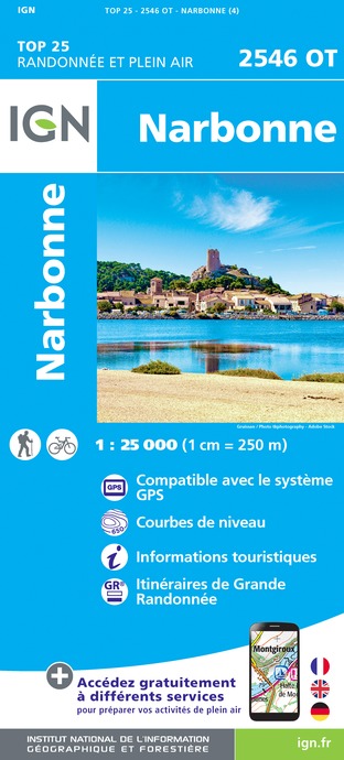
2546OT - NARBONNE
Editor : IGN
Collection : TOP 25 ET SÉRIE BLEUE
Scale : 1:25 000
13.90€

TOP100D11 - AUDE CARCASSONNE NARBONNE LIMOUX QUILLAN CANAL DU MIDI
Editor : IGN
Collection : TOP 100
Scale : 1:100 000
8.40€
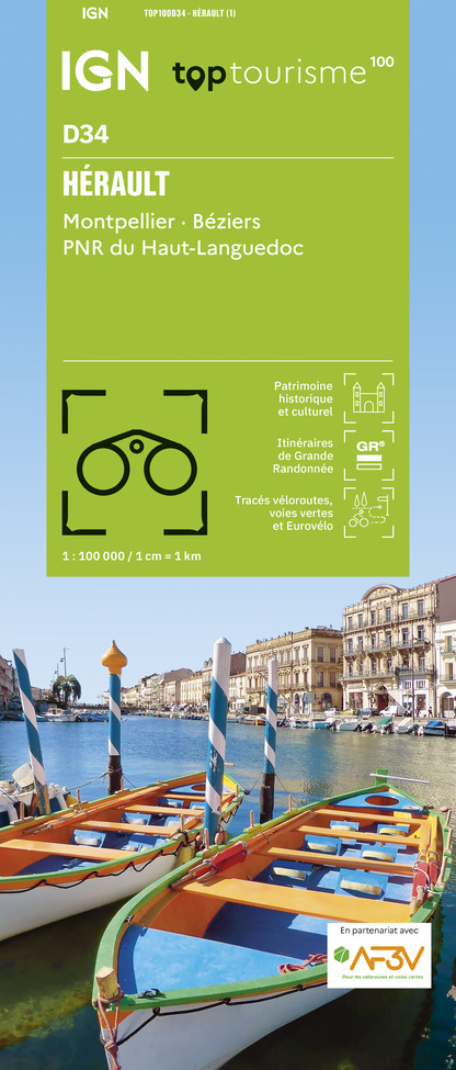
TOP100D34 - HÉRAULT MONTPELLIER BÉZIERS PNR DU HAUT-LANGUEDOC
Editor : IGN
Collection : TOP 100
Scale : 1:100 000
8.40€

TOP100D66 - PYRÉNÉES-ORIENTALES PERPIGNAN PRADES CÉRET CÔTE VERMEILLE PNR DES PYRÉNÉES CATALANES
Editor : IGN
Collection : TOP 100
Scale : 1:100 000
8.40€

89031 - LE CANAL DU MIDI
Editor : IGN
Collection : DECOUVERTE DES CHEMINS
Scale : 1:100 000
9.10€

D30-34 GARD HÉRAULT
Editor : IGN
Collection : CARTES DÉPARTEMENTALES IGN
Scale : 1:150 000
5.90€

D09-66 ARIÈGE PYRÉNÉES-ORIENTALES
Editor : IGN
Collection : CARTES DÉPARTEMENTALES IGN
Scale : 1:150 000
5.90€

D11-81 AUDE TARN
Editor : IGN
Collection : CARTES DÉPARTEMENTALES IGN
Scale : 1:150 000
5.90€

EUROPE
Editor : IGN
Collection : DÉCOUVERTE DES PAYS DU MONDE IGN
Scale : 1:2 500 000
7.00€
What to visit in Narbonne
See more suggestionsSavor the local cuisine of Narbonne.
See more suggestions


Where to eat in Narbonne
See more suggestionsA wide selection of restaurants awaits you in Narbonne.
See more suggestions


Where to sleep in Narbonne
See more suggestionsDiscover available accommodations around Narbonne.
See more suggestions


")
