Tours
Activities
Places of interest
Where to eat
Where to sleep
Discover Villegly, Aude, Languedoc-Roussillon, and its charms
Are you in charge of the destination?Nestled in the sun-drenched region of Languedoc-Roussillon, Villegly in Aude is a hidden gem offering a multitude of activities and sites to explore. Whether you are a nature lover, history enthusiast, or culture seeker, this charming rural town will become one of your favorite stops.
Explore the surrounding vineyards and taste the famous wines of the Languedoc. A visit to local wineries like C...See more
Explore the surrounding vineyards and taste the famous wines of the Languedoc. A visit to local wineries like C...See more


What to do in Villegly
See more suggestionsMake your stay in Villegly special by booking activities.
See more suggestions


IGN cards
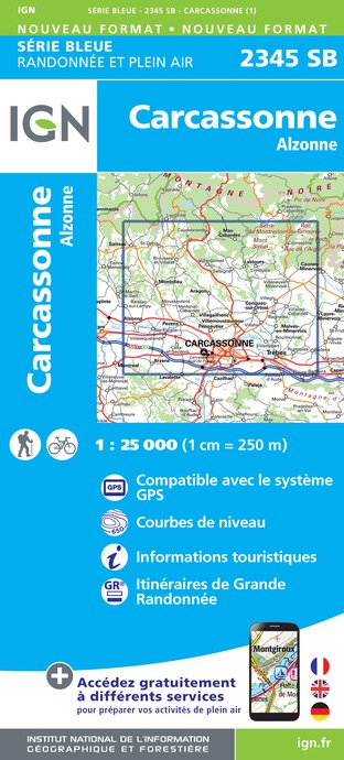
2345SB - CARCASSONNE ALZONNE
Editor : IGN
Collection : TOP 25 ET SÉRIE BLEUE
Scale : 1:25 000
13.90€

TOP100D11 - AUDE CARCASSONNE NARBONNE LIMOUX QUILLAN CANAL DU MIDI
Editor : IGN
Collection : TOP 100
Scale : 1:100 000
8.40€

89031 - LE CANAL DU MIDI
Editor : IGN
Collection : DECOUVERTE DES CHEMINS
Scale : 1:100 000
9.10€

D11-81 AUDE TARN
Editor : IGN
Collection : CARTES DÉPARTEMENTALES IGN
Scale : 1:150 000
5.90€

D09-66 ARIÈGE PYRÉNÉES-ORIENTALES
Editor : IGN
Collection : CARTES DÉPARTEMENTALES IGN
Scale : 1:150 000
5.90€

EUROPE
Editor : IGN
Collection : DÉCOUVERTE DES PAYS DU MONDE IGN
Scale : 1:2 500 000
7.00€
What to visit in Villegly
See more suggestionsStroll through the historic districts of Villegly.
See more suggestions


Where to sleep in Villegly
See more suggestionsExplore hostels and hotels in Villegly.
See more suggestions


")


