Tours
Activities
Places of interest
Where to eat
Where to sleep
Discover Chateaudouble: a gem in Drôme, Rhône-Alpes
Are you in charge of the destination?Nestled in the heart of Drôme, in the Rhône-Alpes region, Chateaudouble is a destination brimming with treasures to uncover. Start by exploring the historic ruins of the double castle, which overlooks the village and offers a breathtaking view of the Drôme Valley. Nature lovers will be delighted by the numerous hiking trails offering stunning mountainous and forested landscapes.
For heritage ent...See more
For heritage ent...See more
Walking around Chateaudouble
See more suggestionsTake a walk around Chateaudouble.
See more suggestions")


What to do in Chateaudouble
See more suggestionsExperience unique moments with the bookable activities in Chateaudouble.
See more suggestions


")

IGN cards
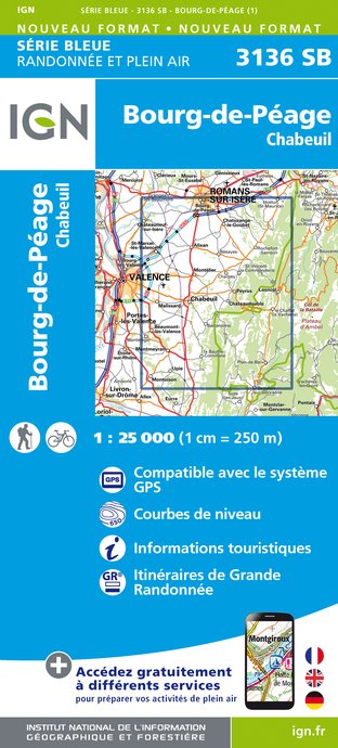
3136SB - BOURG-DE-PÉAGE CHABEUIL
Editor : IGN
Collection : TOP 25 ET SÉRIE BLEUE
Scale : 1:25 000
13.90€

VEL01 - LA DRÔME A VELO
Editor : IGN
Collection : DECOUVERTE A VELO
Scale : 1:105 000
9.10€

TOP100D26 - DRÔME VALENCE MONTÉLIMAR DIE PNR DES BARONNIES PROVENÇALES PNR DU VERCORS
Editor : IGN
Collection : TOP 100
Scale : 1:100 000
8.40€

202 JURA ALPES DU NORD
Editor : IGN
Collection : TOP 200
Scale : 1:200 000
6.80€

D38 ISÈRE
Editor : IGN
Collection : CARTES DÉPARTEMENTALES IGN
Scale : 1:150 000
5.90€

D07-26 ARDÈCHE DRÔME
Editor : IGN
Collection : CARTES DÉPARTEMENTALES IGN
Scale : 1:150 000
5.90€

NR16 PROVENCE-ALPES-CÔTE D'AZUR
Editor : IGN
Collection : CARTES RÉGIONALES IGN
Scale : 1:250 000
6.80€

NR15 AUVERGNE-RHÔNE-ALPES RECTO/VERSO MASSIF ALPIN
Editor : IGN
Collection : CARTES RÉGIONALES IGN
Scale : 1:250 000
6.80€

NR14 AUVERGNE-RHÔNE-ALPES RECTO/VERSO MASSIF CENTRAL
Editor : IGN
Collection : CARTES RÉGIONALES IGN
Scale : 1:250 000
6.80€

EUROPE
Editor : IGN
Collection : DÉCOUVERTE DES PAYS DU MONDE IGN
Scale : 1:2 500 000
7.00€
What to visit in Chateaudouble
See more suggestionsVisit the museums and galleries of Chateaudouble.
See more suggestions


Where to eat in Chateaudouble
See more suggestionsExperience Chateaudouble's gastronomy.
See more suggestions


Where to sleep in Chateaudouble
See more suggestionsFind a comfortable stay in Chateaudouble.
See more suggestions


