Tours
Activities
Places of interest
Where to eat
Where to sleep
Discover Valdrome while staying at AUBERGE L'OUSTAOU
Are you the owner?Welcome to Valdrome, a charming village in the heart of the Drôme, Rhône-Alpes. From AUBERGE L'OUSTAOU, embark on an exploration of local wonders. Nature enthusiasts will be delighted by the hiking trails that wind through the surrounding mountains. Valdrome is a true haven for outdoor lovers. The marked trails will guide you through stunning landscapes, where you can observe diverse flora and fau...See more
Walking around AUBERGE L'OUSTAOU
See more suggestionsExplore the walking circuits of AUBERGE L'OUSTAOU.
See more suggestions


What to do in AUBERGE L'OUSTAOU
See more suggestionsEnjoy unforgettable moments in AUBERGE L'OUSTAOU by booking activities for everyone.
See more suggestions


IGN cards
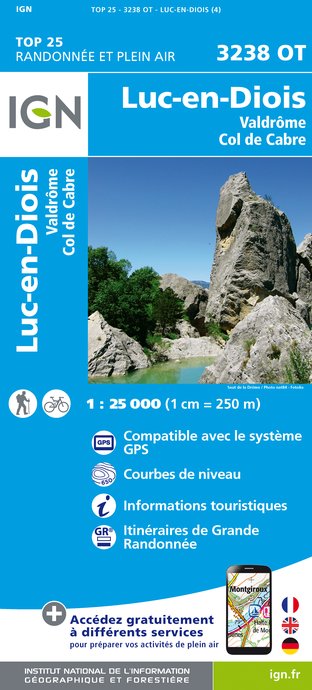
3238OT - LUC-EN-DIOIS VALDRÔME COL DE CABRE
Editor : IGN
Collection : TOP 25 ET SÉRIE BLEUE
Scale : 1:25 000
13.90€

TOP75009 - DIOIS DEVOLUY HAUTE VALLEE DE LA DROME
Editor : IGN
Collection : TOP 75
Scale : 1:75 000
9.80€

VEL01 - LA DRÔME A VELO
Editor : IGN
Collection : DECOUVERTE A VELO
Scale : 1:105 000
9.10€

TOP100D26 - DRÔME VALENCE MONTÉLIMAR DIE PNR DES BARONNIES PROVENÇALES PNR DU VERCORS
Editor : IGN
Collection : TOP 100
Scale : 1:100 000
8.40€

TOP100D84 - VAUCLUSE AVIGNON CARPENTRAS PARCS NATURELS RÉGIONAUX DU LUBERON ET DU MONT-VENTOUX
Editor : IGN
Collection : TOP 100
Scale : 1:100 000
8.40€

D13-84 BOUCHES-DU-RHÔNE VAUCLUSE
Editor : IGN
Collection : CARTES DÉPARTEMENTALES IGN
Scale : 1:150 000
5.90€

D07-26 ARDÈCHE DRÔME
Editor : IGN
Collection : CARTES DÉPARTEMENTALES IGN
Scale : 1:150 000
5.90€

D04-05 ALPES-DE-HAUTE-PROVENCE HAUTES-ALPES
Editor : IGN
Collection : CARTES DÉPARTEMENTALES IGN
Scale : 1:150 000
5.90€

NR16 PROVENCE-ALPES-CÔTE D'AZUR
Editor : IGN
Collection : CARTES RÉGIONALES IGN
Scale : 1:250 000
6.80€

NR15 AUVERGNE-RHÔNE-ALPES RECTO/VERSO MASSIF ALPIN
Editor : IGN
Collection : CARTES RÉGIONALES IGN
Scale : 1:250 000
6.80€

NR14 AUVERGNE-RHÔNE-ALPES RECTO/VERSO MASSIF CENTRAL
Editor : IGN
Collection : CARTES RÉGIONALES IGN
Scale : 1:250 000
6.80€

EUROPE
Editor : IGN
Collection : DÉCOUVERTE DES PAYS DU MONDE IGN
Scale : 1:2 500 000
7.00€
What to visit in AUBERGE L'OUSTAOU
See more suggestionsWalk along the picturesque streets of AUBERGE L'OUSTAOU.
See more suggestions


Where to eat in AUBERGE L'OUSTAOU
See more suggestionsFood enthusiasts will love AUBERGE L'OUSTAOU's restaurants.
See more suggestions


Where to sleep in AUBERGE L'OUSTAOU
See more suggestionsDiscover popular accommodations in AUBERGE L'OUSTAOU.
See more suggestions


