Tours
Activities
Places of interest
Where to eat
Where to sleep

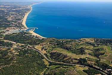
Explore Argeles-sur-mer at Le Pearl Camping

Are you the owner?
Welcome to Argeles-sur-mer, a gem of the Languedoc-Roussillon nestled at the foothills of the Pyrénées-Orientales. LE PEARL is your gateway to exploring this region rich in activities and breathtaking landscapes. Begin your adventure with a stroll along the beautiful beaches where golden sands meet the turquoise waters of the Mediterranean. For a nature immersion, take the hiking trails of the Alb...See more

Walking around LE PEARL

See more suggestions
Explore the walking circuits of LE PEARL.
See more suggestions
"Vélo route" – Argelès-sur-Mer / Le Boulou
2.6 km

"Vélo route" – Argelès-sur-Mer / Le Boulou

The mediterranean by bike  (section Argelès-sur-Mer/ Le Boulou) Follow the cycle track along the D81 on the left, towards Argelès. Go over the blue bridge of the Riberette and follow the Le Littoral campsite. At the Luna Park roundabout, continue straight, on the Route du Littoral. At the next roundabout, turn left towards Boulevard de la Méditerranée, while staying on the cycle path. At the end of the boulevard, continue straight on a gravel passage, between two buildings and continue until the promenade by the sea. Continue to the left on this promenade which runs along the beach, on the left. At 500 m, you will be on the green promenade. //! \ The area is shared with pedestrians and it is very busy in the summer season //! \ After the fairground parking lot (right), turn right onto Avenue des Pins. At the roundabout of the tourist office of Argelès-sur-Mer turn left Avenue des Platanes. Then, at the rond-point de l'Arrivée, take the first exit, on the right, and follow the big Avenue Charles de Gaulle to the petrol station where you have to turn right, Route de la Mer. At the roundabout of the sports complex turn right, Avenue Molière. At the next roundabout, take the third exit, rue des Trabucaires. Now the cycle path runs along the street on the right. At the roundabout cross the road towards the sidewalk opposite to follow the track and take the second exit, rue du 14 Juillet. Keep going straight. You cross a ford. Immediately after, turn right. The cycle track runs along a one-way street on the left and the Massane on the right. Go under the bridge and continue under the pines. The track becomes at this level a dirt road. //! \ Section shared with pedestrians. //! \ Cross the ford on your right to join the rue des Merles, climb the hill (note the beautiful oratory at the top of the hill) and continue again, until the end of the rue des Colibris. Go around the Pôle Emploi building, then turn right at impasse des Sarcelles, and again right to join Avenue de Montgat. At the stop sign, opposite the pharmacy, turn left to reach the roundabout and go around it on the right. Leave two exits and continue on the cycle path, chemin des Brunesses. The path runs along the railway on the left then passes under a bridge. Then you arrive at the Saint-André roundabout. Stay on the cycle path which continues on your right, below the road until the end of the route. At the Saint Genis roundabout, turn right so as not to arrive on the d618. Continue through the vineyards and fields. Attention, do not take the ramps to join the departmental.  At the end of this road, join the D900 and the end of the route

3 h
26 km
Easy
Show
"Vélo route" – Argelès-sur-Mer / Le Boulou
2.6 km

"Vélo route" – Argelès-sur-Mer / Le Boulou

The mediterranean by bike  (section Argelès-sur-Mer/ Le Boulou) Follow the cycle track along the D81 on the left, towards Argelès. Go over the blue bridge of the Riberette and follow the Le Littoral campsite. At the Luna Park roundabout, continue straight, on the Route du Littoral. At the next roundabout, turn left towards Boulevard de la Méditerranée, while staying on the cycle path. At the end of the boulevard, continue straight on a gravel passage, between two buildings and continue until the promenade by the sea. Continue to the left on this promenade which runs along the beach, on the left. At 500 m, you will be on the green promenade. //! \ The area is shared with pedestrians and it is very busy in the summer season //! \ After the fairground parking lot (right), turn right onto Avenue des Pins. At the roundabout of the tourist office of Argelès-sur-Mer turn left Avenue des Platanes. Then, at the rond-point de l'Arrivée, take the first exit, on the right, and follow the big Avenue Charles de Gaulle to the petrol station where you have to turn right, Route de la Mer. At the roundabout of the sports complex turn right, Avenue Molière. At the next roundabout, take the third exit, rue des Trabucaires. Now the cycle path runs along the street on the right. At the roundabout cross the road towards the sidewalk opposite to follow the track and take the second exit, rue du 14 Juillet. Keep going straight. You cross a ford. Immediately after, turn right. The cycle track runs along a one-way street on the left and the Massane on the right. Go under the bridge and continue under the pines. The track becomes at this level a dirt road. //! \ Section shared with pedestrians. //! \ Cross the ford on your right to join the rue des Merles, climb the hill (note the beautiful oratory at the top of the hill) and continue again, until the end of the rue des Colibris. Go around the Pôle Emploi building, then turn right at impasse des Sarcelles, and again right to join Avenue de Montgat. At the stop sign, opposite the pharmacy, turn left to reach the roundabout and go around it on the right. Leave two exits and continue on the cycle path, chemin des Brunesses. The path runs along the railway on the left then passes under a bridge. Then you arrive at the Saint-André roundabout. Stay on the cycle path which continues on your right, below the road until the end of the route. At the Saint Genis roundabout, turn right so as not to arrive on the d618. Continue through the vineyards and fields. Attention, do not take the ramps to join the departmental.  At the end of this road, join the D900 and the end of the route

3 h
26 km
Easy
Show
(E12 Coastal Trail) Argelès - Cerbère
2.8 km

(E12 Coastal Trail) Argelès - Cerbère

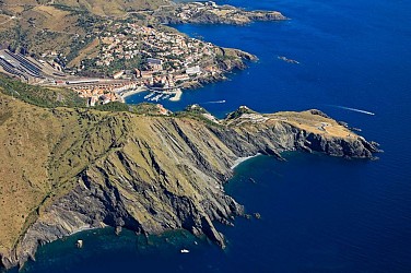
The coastal trail: discovering the heritage./! Diversions before the Camping des Criques de Porteils due to bad weather. /! From Peyrefite to the entrance of Cerbère, the coastal path is not accessible.Between the center of Cerbère and the border, the path is accessible. Here is the translation of your text into English:The coastal trail offers a beautiful hike along the Côte Vermeille, between Argelès-sur-Mer and Cerbère. Stretching for 32 kilometers, it will take you through beaches, coves, villages, and stunning landscapes.The different stages of the coastal trail allow everyone to enjoy the coast with varying levels of difficulty (easy, medium, and hard), different durations (from 20 minutes to 2h35), and multiple lengths (between 1 and 7 km).Traversing the communes of Argelès-sur-Mer, Collioure, Port-Vendres, Banyuls-sur-Mer, and Cerbère in chronological order, the trail offers a variety of landscapes.The sandy coastline is mostly found at the beginning of the trail, in Argelès-sur-Mer. From the tourist office to Racou, you will encounter several touristy beaches. After Racou, the landscape changes. The sandy coastline becomes rocky, and the beaches transform into coves, often more secluded and less frequented.Passing by the Château de Collioure, the Port of Port-Vendres, and the Cap Béar lighthouse, the trail lets you explore the historical heritage of the area.Between Port-Vendres and Banyuls-sur-Mer, the Anse de Paulilles, one of the most beautiful beaches in the region, invites you to swim in its crystal-clear waters. The trail continues in Banyuls-sur-Mer, an artistic hub where many artists have drawn inspiration.The many capes (Cap l’Abeille, Cap Rédéris, Cap Peyrefite, and Cap Canadell) lead you through the Cerbère-Banyuls Marine Nature Reserve. Finally, just a stone's throw from the Spanish border, Cerbère and its solar lighthouse mark the end of the trail.The coastal trail promises a hike with sea views, discovering the historical, natural, and artistic heritage of our region.

13 h
38 km
Easy
Show
(E12 Coastal Trail) Argelès - Cerbère
2.8 km

(E12 Coastal Trail) Argelès - Cerbère

The coastal trail: discovering the heritage./! Diversions before the Camping des Criques de Porteils due to bad weather. /! From Peyrefite to the entrance of Cerbère, the coastal path is not accessible.Between the center of Cerbère and the border, the path is accessible. Here is the translation of your text into English:The coastal trail offers a beautiful hike along the Côte Vermeille, between Argelès-sur-Mer and Cerbère. Stretching for 32 kilometers, it will take you through beaches, coves, villages, and stunning landscapes.The different stages of the coastal trail allow everyone to enjoy the coast with varying levels of difficulty (easy, medium, and hard), different durations (from 20 minutes to 2h35), and multiple lengths (between 1 and 7 km).Traversing the communes of Argelès-sur-Mer, Collioure, Port-Vendres, Banyuls-sur-Mer, and Cerbère in chronological order, the trail offers a variety of landscapes.The sandy coastline is mostly found at the beginning of the trail, in Argelès-sur-Mer. From the tourist office to Racou, you will encounter several touristy beaches. After Racou, the landscape changes. The sandy coastline becomes rocky, and the beaches transform into coves, often more secluded and less frequented.Passing by the Château de Collioure, the Port of Port-Vendres, and the Cap Béar lighthouse, the trail lets you explore the historical heritage of the area.Between Port-Vendres and Banyuls-sur-Mer, the Anse de Paulilles, one of the most beautiful beaches in the region, invites you to swim in its crystal-clear waters. The trail continues in Banyuls-sur-Mer, an artistic hub where many artists have drawn inspiration.The many capes (Cap l’Abeille, Cap Rédéris, Cap Peyrefite, and Cap Canadell) lead you through the Cerbère-Banyuls Marine Nature Reserve. Finally, just a stone's throw from the Spanish border, Cerbère and its solar lighthouse mark the end of the trail.The coastal trail promises a hike with sea views, discovering the historical, natural, and artistic heritage of our region.

13 h
38 km
Easy
Show
(E 12-Sentier Littoral/guide OTI) Mas Larrieu Nature Reserve - The Racou
3.1 km

(E 12-Sentier Littoral/guide OTI) Mas Larrieu Nature Reserve - The Racou

An ideal walk to do with the family. From the Luna Park parking lot, you have two options.First option: Head north, cross the Equinoxe campsite, ford the stream, and you will find access to the Mas Larrieu nature reserve. The Argelès-sur-Mer tourist office offers guided walks. Additionally, information panels on the dune discovery trail are accessible year-round, explaining the management, history, flora, and fauna of this protected coastal site. To join the coastal path, simply follow the shore southward. Cross the mouth of the Riberette River and continue towards Argelès beach. Second option: Head to your right towards Argelès-sur-Mer. Leave the road to walk along the leisure park and the Riberette on your left, which flows into the sea a bit further on. A first ford allows you to cross a ditch. Follow the path briefly winding through the undergrowth, where a second reed-lined ford awaits you. Once out of the shade, take the road to the right, then head to the beach on your left, passing along the Marende parking lot. Now, continue to the right with your feet in the sand. Be mindful of the vegetation growing here and there, as it helps to maintain the beach! In the depression known as "Tamariguer," take the walk under the pine trees. Dotted with signs describing notable sites, it will naturally lead you to the port. Cross the Massane River via the bridge, and take the left along the quays, welcoming fishermen and boaters. Leave the quays via the stairs leading to the parking lot before the port's technical area. Follow the bike path towards "Le Racou." This path will lead you to a trail that skirts the Racou wetland on the left. You can stop at the beach to observe this wetland area, along with its developing flora and fauna. This part of the trail ends at the Racou parking lot.

2 h
7.2 km
Very easy
Show
"Loop of Albères" Nature has come knocking
3.3 km

"Loop of Albères" Nature has come knocking

Bike ride to discover the natural heritage around the villages of Albères. Starting point: Town Hall car park Leaving the Town Hall car park, turn right onto Rue Miloussa, then at the end of the street turn left onto Rue de Taxo. Continue towards Taxo. Go under the bridge and stay on the cycle route (on the right). Leave the cycle route that heads towards Argelès-sur-Mer and continue straight ahead towards the Discovery Farm. Cross the level crossing. Turn left, then immediately right towards the Discovery Farm. Cross the ford. Pass the Discovery Farm and the “4 Étangs de Robinson”. About 300 m further on, turn left onto Chemin de Sainte-Colombe to reach Palau-del-Vidre. Reach Traverse d’Argelès and turn left under the bridge. Continue straight on. At the entrance to Palau-del-Vidre, turn right towards Elne. At the stop sign, turn right towards Perpignan. At the next roundabout, take the 2nd exit and continue straight ahead. At the end of the dirt track, turn right to reach the lake. Leave the lake by the same route back to the roundabout. Take the 1st exit to reach the village centre. Take the opportunity to visit the glassmakers’ workshops. Continue along Avenue Joliot Curie. At the Post Office, turn right onto Chemin d’Ortaffa, then follow signs for Ortaffa. Cross the Tanyari bridge and immediately turn left onto Traverse de Saint-Genis. Continue straight ahead. At the stone farmhouse (Mas Puig), turn left towards Castell de Blés. At the farmhouse (private road), turn left and cross the river (ford). Continue on the cycle route on the left towards Saint-André / Argelès-sur-Mer. After passing the Palau-del-Vidre carpool area, cross the road and continue on the cycle route for about 700 m. At the next junction, at the give-way sign, leave the cycle route by turning right and go under the bridge to reach Saint-André. Continue straight on Rue Miloussa. Turn right onto Allée de la Liberté to return to the Town Hall car park.

2 h
16 km
Very easy
Show
A Fun Family Adventure in the Albères
3.6 km

A Fun Family Adventure in the Albères

This loop, starting from Argelès, takes you to the villages nestled at the foot of the Albera range. A playful discovery awaits, thanks to the Isalia game created by the Intercommunal Tourist Office. The discovery farm in Saint-André and the Valley of Turtles in Sorède will delight both young and old alike. Starting point:Head left onto Avenue des Platanes, then turn right at the Arrival roundabout onto Avenue Charles de Gaulle. Take the right onto Route de la Mer, near the gas station. Turn right onto Avenue Molière, continue straight until the roundabout, where you’ll take the third exit onto Rue des Trabucayres. At the next roundabout, take the second exit onto Rue du 14 Juillet, then take the first right, which runs along the river "La Massana." Turn left at the ford to reach Rue des Merles, then continue onto Rue des Colibris. Bypass the bank through Impasse des Sarcelles and turn left onto the bike path, which leads to the roundabout. Cross the roundabout and continue on the small road straight ahead. Follow the railway tracks, then turn left at the small bridge, passing an aeromodelling club. Keep going and at the large roundabout, stay right on the Pirenexus, following the D618. Turn right and follow a pleasant small paved road. Enjoy a nice visit to the discovery farm. Then return to the Pirenexus. Turn right, then left under the bridge onto the Chemin du Mas Nou. Continue along Route de Taxo to reach Saint-André. In Saint-André : Turn right onto Rue de Taxo, then right again onto Rue du Miloussa. Take the first left to reach the heart of the village. Visit the Tourist Information Office where you can get the "Isalia" game. Good luck in Saint-André! Next, head towards Sorède : Take Rue des Albères. At the roundabout, take the second exit right and go up Rue Joan Cayrol, continuing along Chemin de Saint-André. You will soon be on a section of EuroVelo 8, passing through olive groves and vineyards. At this point, turn right and cross the ford. Turn left onto Route de Palau (D11). At the second roundabout, head towards Rue de l'Église. After the square, go straight onto Rue Saint-Jacques, then Rue du Moulin Cassanyes. Follow Avenue de la Vallée Heureuse and go all the way to the Valley of Turtles. Valley of Turtles.Meet several species of turtles and other unexpected animals. Once the visit is complete, retrace your steps back. Head left towards Laroque Turn right onto Rue Louis et Michel Soler. Take a detour through the Tourist Office. Don’t hesitate to explore the typical streets of the village. Return to the Tourist Office and head towards Saint-Genis-des-Fontaines by turning left. Cross the bridge and go straight. Take Rue de Tanya. Turn onto Cami de la Creu and go straight towards the center of Saint-Genis-des-Fontaines. Turn onto Place Jean Rolland and carefully descend Rue Clemenceau. At the Tourist Office, the "Isalia" game will be offered for a detective challenge in the cloister (same location). Once completed, head left onto Rue Clemenceau, then continue straight to the Pirenexus. Return to Argelès via the Pirenexus Turn left, following the same route as you did initially.

3 h
182566 km
Easy
Show

What to do in LE PEARL

See more suggestions
Activities for all tastes await you in LE PEARL, book them today.
See more suggestions
Via Ferrata in Mazamet
113 km

Via Ferrata in Mazamet

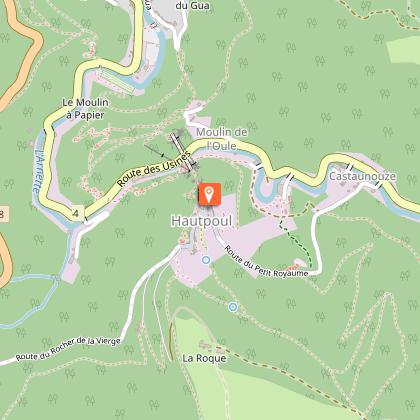
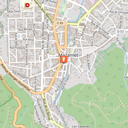
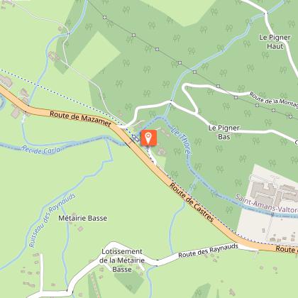
Looking for big thrills? Desire to surpass yourself? The via ferrata of Mazamet is for you! In the the Arnette gorges, in Mazame, via ferrata and giant zip line, under the footbridge. Acrobats and adventurers will enjoy this safe activity which completes, since 2022 the current tourist offer. This land is located in a protected natural site carried by an outstanding historic heritage (Cormouls-Houlès remarkabe gardens, St-Sauveur ruins, classified archeological site), and a rich and diverse wildlife. Nearby, after crossing the Mazamet's Hymalayan footbridge at 70 meters high over the Arnette river, you will find the medieval village of Hautpoul and its gardens, as well as, on the GR7, the House of Wood and Toy, its arboretum and its orchard. A nice wander along the 'Art Net' to picnic in th the shadows of chestnut trees. - Via Ferrata with ziplines : . Access: 20 mn . Drop : 90 m . Length: 880 ml . Difficulty: AD à D+ . Duration: 2 h 30 . Way back: 20 mn - Via Ferrata without zipline . Access: 30 mn . Drop: 110 m . Length: 370 ml . Difficulty: AD à D+ . Duration: 1 h 30 . Way back: 20 mn - Via Ferrata (upper part of Hautpoul) . Access: 20 mn . Drop: 60 m . Length: 130 ml . Difficulty: PD . Duration: 45 mn . Way back: 25 mn Minimum gear required: . Helmet . Harness . Closed shoes . Rest Karabiner & short lanyard . 2 wide aperture autoblock gate karabiners . Karabiner aerolink specifically for continuous safe line . Lanyard aeroline Ferrata . Double lanyard with shock absorber . Gloves General recommendations: Access to the Via Ferrata of Mazamet is prohibited: - to children measuring less than 1,35m and minors who are not accompanied by un experienced adult ; - outside opening hours and over night ; - in adverse weather conditions and especially when the route is slipppery and affected by snow, ice and stormy conditions. You agree to undertake this activity at your own risk. If you have little or no experience in this type of activity, please contact the services of a guide. Equipment rental: Mazamet Tourist Office Online booking: www.tourisme-castresmazamet.com/billetterie Rates: 18€/pers. Groups more than 5 persons: 16,50€/pers. Groups more than 10 persons : 15€/pers. Deposit: 400€ (on the day of the rental, chèque ou Crédit card) For beginners or persons needing a guide, you can contact: - Aude Escapades - Laurence Combes 06 03 50 00 85 - Axecime - Yannick Saulnier 06 08 42 27 13

95 rue de la Resse 81200 Mazamet
Book from 0 €Book
Show

What to visit in LE PEARL

See more suggestions
Experience the annual festivals of LE PEARL.
See more suggestions
Where to eat in LE PEARL

See more suggestions
The flavors of LE PEARL await you.
See more suggestions

Where to sleep in LE PEARL

See more suggestions
Find a comfortable stay in LE PEARL.
See more suggestions
Caution!
We have no information on the difficulty of this circuit. You may encounter some surprises along the way. Before you go, please feel free to inquire more and take all necessary precautions. Have a good trip! 🌳🥾