Tours
Activities
Places of interest
Where to eat
Where to sleep
Discover Argeles-sur-mer from Camping Le Clos du Thym
Are you the owner?Welcome to Argeles-sur-mer, where the sea and mountains meet to offer our visitors an unforgettable experience. During your stay at Camping Le Clos du Thym, you can explore the beautiful Mediterranean beaches, perfect for swimming, sunbathing, or water activities such as kayaking and diving. Nearby, the charming medieval village of Collioure is worth a visit with its picturesque alleys and culinar...See more
Walking around CAMPING LE CLOS DU THYM
See more suggestionsDiscover the walking paths of CAMPING LE CLOS DU THYM.
See more suggestions")


 Argelès - Cerbère")
 Argelès - Cerbère")
")


![[Connection] Argelès-sur-Mer Tourist Office / Château de Valmy](https://fichier0.cirkwi.com/image/photo/circuit/380x250/474783/fr/0.jpg?1765498365 "[Connection] Argelès-sur-Mer Tourist Office / Château de Valmy")
What to do in CAMPING LE CLOS DU THYM
See more suggestionsOrganize your days in CAMPING LE CLOS DU THYM with bookable activities for the whole family.
See more suggestions


IGN cards
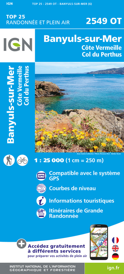
2549OT - BANYULS-SUR-MER CÔTE VERMEILLE - COL DU PERTHUS
Editor : IGN
Collection : TOP 25 ET SÉRIE BLEUE
Scale : 1:25 000
13.90€

TOP100D66 - PYRÉNÉES-ORIENTALES PERPIGNAN PRADES CÉRET CÔTE VERMEILLE PNR DES PYRÉNÉES CATALANES
Editor : IGN
Collection : TOP 100
Scale : 1:100 000
8.40€

89030 - TRAVERSEE DES PYRENEES GR10®
Editor : IGN
Collection : DECOUVERTE DES CHEMINS
Scale : 1:100 000
9.10€

D09-66 ARIÈGE PYRÉNÉES-ORIENTALES
Editor : IGN
Collection : CARTES DÉPARTEMENTALES IGN
Scale : 1:150 000
5.90€

EUROPE
Editor : IGN
Collection : DÉCOUVERTE DES PAYS DU MONDE IGN
Scale : 1:2 500 000
7.00€
What to visit in CAMPING LE CLOS DU THYM
See more suggestionsTake a boat tour around CAMPING LE CLOS DU THYM.
See more suggestions


Where to eat in CAMPING LE CLOS DU THYM
See more suggestionsRestaurants in CAMPING LE CLOS DU THYM offer a variety of cuisines.
See more suggestions


Where to sleep in CAMPING LE CLOS DU THYM
See more suggestionsDiscover the best lodging options in CAMPING LE CLOS DU THYM.
See more suggestions


")