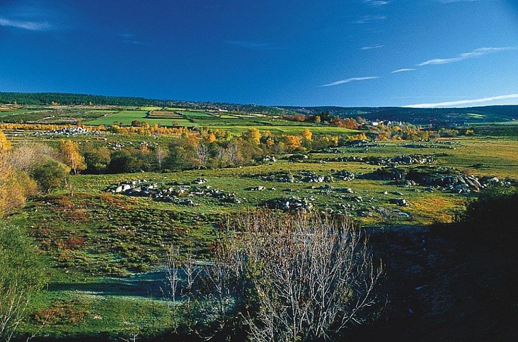
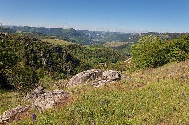
This circuit criss-crosses the Bramont valley, passing through wetlands and sweet-chestnut groves, and villages whose houses were built from limestone and schist.
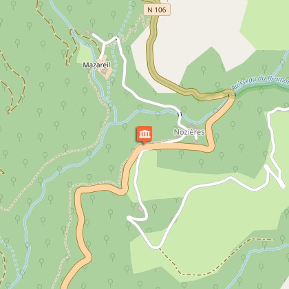
Mountain-bike route # 6. Exit left from the car park and take the D 907 bis for 500 m, then take on your right a path alongside the river Tarn towards Le Cantonnet. Cross the D 907 bis and take the path on the valley floor to Pradines mill. Go uphill to Lonjagnes. N.B.: Do not enter the hamlet, but fork right beforehand towards Le Marazeil. As you exit Le Marazeil, go downhill on the road to Nozières. Cross the N 106 and take the road opposite towards Les Combettes. Go through the hamlet and continue on the track for about 1.7 km, then turn left onto a very small path to get back to Le Marazeil and Nozières. Cross under the N 106 and go downhill to Pradines mill/Le Cantonnet. Cross the N 106 and take a track along the Tarn to return to Ispagnac.
20 km
|
585 m
| |||
This is one of the eight watermills that used to operate in the Ispagnac valley. Two were on the Tarn, the others on its tributaries. These mills produced wheat flour and chestnut flour as well as oil.
There are actually two Bramonts! The one that you are cycling along, and another Bramont, which flows north of the Cham des Bondons. As you go through Les Combettes, you are at the foot of this limestone plateau, whose highest point is at about 1,200 m. But under the plateau flows another river: the underground Bramont, discovered in 1967. It takes some of the water of the Bramont du Lot (north) and empties it into the Bramont du Tarn (south)! The old-timers knew this and understood that by blocking, unblocking or diverting the waters draining out of the northern river, they could vary the rate of flow of the resurgence.
This nocturnal animal has large black eyes. On its back, its smooth black skin has a pattern of yellow (sometimes orange or red) points or lines. The pattern is different for each individual and makes it possible to identify them. The thick shiny skin has many glands, which secrete a fine layer of mucus containing a neurotoxin that acts when it comes into contact with mucous membranes. These secretions primarily serve to suppress the growth of bacterial and fungal infections on the animal's moist skin (bactericidal and fungicidal properties).
Transcription du texte gravé sur une façade des Combettes. QUIDQUID AGAS, PRUDENTI AGAS, RESPICE FINEM NON TAM PROFOND FIT VIR QUIN HUNC PALAN SITOn peut traduire « Quoi que tu fasses, fais-le prudemment, regarde la fin. L'homme ne fait rien de si secret qui ne soit un jour révélé »
Marker 7The village of Les Combettes is built in a natural depression, as its name indicates (combette = little valley). The exhibition on display in the communal oven building emphasises how late Mont Lozère was first settled. By the Upper Neolithic (around 3500 BC), the region of the Grands Causses was widely settled, following a population increase. The first agro-pastoral communities formed, creating farms and villages and clearing land to grow cereals and breed livestock, whilst still hunting and gathering. These groups are behind local megalithism. The age of metals put an end to the practice of erecting menhirs, but dolmens were in use for a while longer.
Marker 8Did the menhir-builders move in the same landscape that we see today? Current archaeological knowledge does not allow us to reproduce with great accuracy what the landscape of Mont Lozère’s slopes would have looked like in the late Neolithic. Yet the birth of agriculture and livestock rearing in the Neolithic without doubt opened a new chapter in the relationship between humans and nature. For the first time in their history, populations designed the landscape by dotting it with monuments, but more importantly by developing agricultural and pastoral activities. Today – 5,000 years later – human interventions are carried out based on Natura 2000 measures, which focus notably on keeping open spaces intact and maintaining agro-pastoral activities.
“We were Catholics here, and there were many stories about fées (fairies). Opposite the Rock, there are piles of rocks, from a bridge built by the fairies. One day when it was -15°C here, people were coming back from Ispagnac and, at the foot of the Rock, they saw a shivering baby, a little fairy dying of cold. They took her up to their house and put her next to the fireplace. When the little fairy started to revive, they heard the mother calling her through the chimney, Fédou, Fédou, so the little fairy flew out through the chimney.”
"Called vergnes locally, they plunge their roots into the river because they love wet environments. This tree has a deep root system that enables it to cope with a brusque rise of the river. Its wood, reddish when cut, has long been considered evil. Once cut, it rots rapidly, but can last centuries if it is immersed in water. In the Middle Ages, it was used to make bridges. Venice is built on piles of alder and South European flowering ash. Soft and water-resistant, the wood was also used to make clogs.” (P. Grime)
Ispagnac
Ispagnac
On the N 106 from Florac towards the Col de Montmirat, then on the D 907 bis towards Ispagnac / Quézac
Car park opposite the pharmacy
No cycling off-track. You are strongly advised to wear a helmet. Do not forget your repair kit and a small set of tools. Shut all gates and barriers after yourself. Slow down in farms and hamlets.
The national park is an unrestricted natural area but subjected to regulations which must be known by all visitors.