To see around
See more
Open
Close
Show
Show
Show
Show
Show
Show
Show
Show
Show
Show
Show

Oups... It would appear that Cirkwi does not have permission to use your location.

Description
Map
Points of interest
Ratings and reviews
See around

UNESCO Global Geopark Famenne-Ardenne : Geotrail of Rochefort

UNESCO Global Geopark Famenne-Ardenne : Geotrail of Rochefort
Credit : Geopark Famenne-Ardenne

Description

"Tracing the courseof the Lomme"
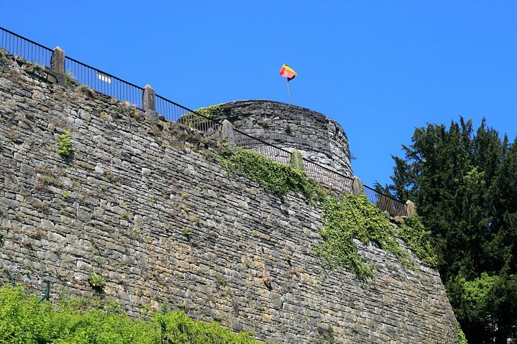
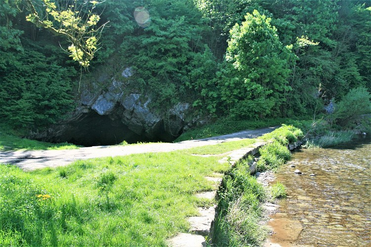
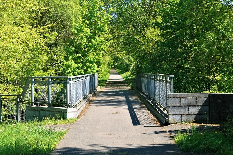
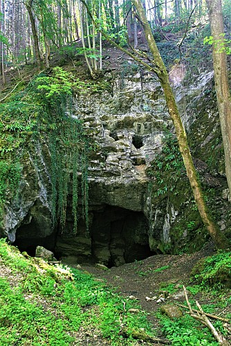
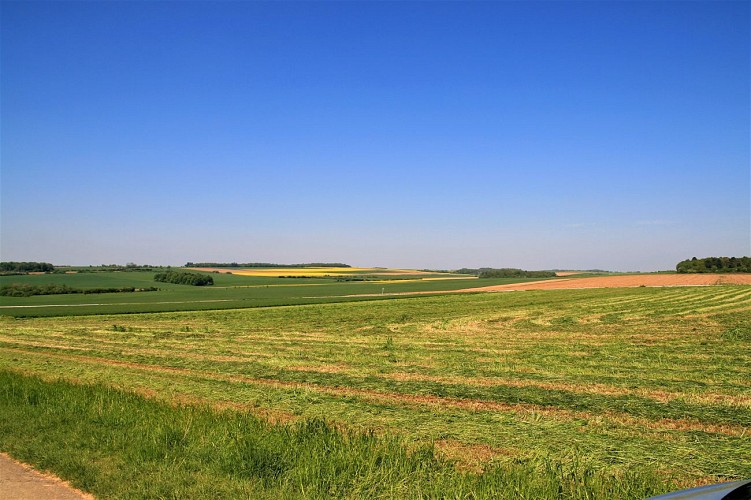
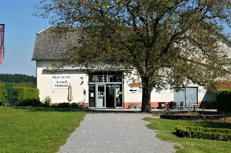
This geotrail starts from the centre of Rochefort and leads to Jemelle via the RAVeL 150 cycle path, along the valley of the Lomme. The valley here follows the limestone strip and is shaped by major karst phenomena. The return to Rochefort is along the left bank of the Lomme, climbing up to the edge of the Gerny plateau and including a suggested detour to visit the Gallo-Roman villa in Malagne.

Technical informations

This circuit was updated on: 21/02/2022
12 km
3 h 15 mn
1 h 20 mn
40 mn
max. 280 m
min. 172 m
415 m

Accessibility

Styles : BaladeDiscoveryUnusualFestiveTerroir
Public : FamilyBackpackerOccasional hikersExperienced hikersSeniorsScientistsTeenagersCyclistsSchool
Themes : CouplesCulturalPatrimonyCraftsNature walkWaterfrontMajor sites

Altimetric profile

Starting point

10 Place Roi Albert Premier , 5580 Rochefort
Lat : 50.15896Lng : 5.22349

Points of interest

image du object

Castel of the counts of Rochefort

The Château Comtal de Rochefort, or chateau of the Counts of Rochefort, built in the Middle Ages by the Montaigus, the first lords of Rochefort, was to become one of the greatest fortified castles of the Calestienne, and gave its name to the town itself (rocha fortis). The siting of the castle is remarkable in terms of geomorphology. Standing atop a limestone promontory within a loop of the Lomme, close to its peak it levels out into a large and fairly flat area at an altitude of 230 metres. This area represents the upper terrace of the Lomme, a dominant and much prized position of major strategic importance. It looks out over the Famenne depression to the northwest, the dry valley of Rue Jacquet(1) to the south and east and the Thier des Falizes sink-holes to the west. To the north, the promontory is bounded by a cliff created by differential erosion where limestone meets shales. The castle was besieged on numerous occasions. Later it became a ceremonial palace, then was nationalised, and finally ended its days as an unofficial “quarry”, its stones plundered by local residents for their own building needs. A prime historical and archaeological site, it is now open to visitors. More information can be found on the castle’s website, www.chateaurochefort.be, under “News”.

88 Rue Jacquet 5580 Rochefort
- UNESCO Global Geopark Famenne-Ardenne -
Consulter
image du object

The Cave of Lorette

You are now standing on the plateau of Notre Dame de Lorette, a mainly horizontal area that is simply an extension of the area on which the chateau stands, across the Rue de Jaquet valley. Seen from above, the plateau features a number of deep hollows. When not man-made in origin (shell holes, excavation), such hollows are often caused by the underlying limestone dissolving and the land sinking to form these depressions, known as sink-holes or dolines. They are also surface clues to the probable existence of underground caves. What you see before you here are the morphological forms typical of a karst landscape. The Cave of Lorette or Rochefort Cave is run on a rather unusual pattern, as a tourist attraction but also as a place of scientific research that then communicates its results to the public. This makes it one of the major geosites within the Geopark. The Cave of Lorette extends over six kilometres of galleries beneath the plateau, some of which are open to visitors, while others are used as an underground laboratory. The location of this laboratory was chosen following the discovery of an active fault within the cave that is altering the shape of certain galleries or very gradually crushing blocks of stone and concretions. The laboratory focuses its studies on geophysics (studying faults, seismology and gravimetry) and hydrogeology (studying how water percolates through rock). Although an underground river once ran through the cave, most of the galleries are now dry. Small underground rivers and lakes can still be found in some places, however, proof that the Cave of Lorette is connected to a much larger system, much of which is still to be discovered: the Lomme-Wamme underground system. These two rivers flow down from the Ardenne but when they reach the limestone, they follow the limestone strip rather than cutting perpendicularly across it, as the Lesse does at the Caves of Han. As they follow the course of the strip, the Lomme and the Wamme both gradually disappear underground, giving rise to a highly complex underground flow, mostly heading in the same direction as surface flows. The waters emerge once again at the Eprave resurgence. At the Nou Maulin Cave, this flow cuts across the surface meander encircling the town of Rochefort.

1 Avenue de Lorette 5580 Rochefort
- UNESCO Global Geopark Famenne-Ardenne -
Consulter
image du object

The point of view of N.D. de Lorette

The N.D. de Lorette lookout point offers a magnificent panorama over the Lomme valley, from which you can just make out the industrial buildings of the Lhoist quarries in the distance. The main focus here, however, is the course of the Lomme itself. Clearly, here it is following the limestone strip very closely, with both sides of the valley similar in appearance and fairly steep. Between the two slopes lies a vast horizontal area, the alluvial plain of the Lomme, through which the river snakes. Note that the course of the Lomme has been altered on numerous occasions by the hand of man, particularly during the building of the railway. The alluvial plain is made up of pebbles and fine sediments. At high water, the valley will flood, performing its natural function of accommodating the floodwaters. It will be no surprise that this area is designated a floodplain by the Wallonia Public Service (SPW).

1 Avenue de Lorette 5580 Rochefort
- UNESCO Global Geopark Famenne-Ardenne -
Consulter
image du object

Nou Maulin hole

You are now standing outside the entrance to the Trou Maulin, which gives access to a complex network of galleries extending over more than 1,600 metres. You can enter the first 20 metres of the entrance gallery with just a hand-torch (any further would require the presence of a qualified guide). The left wall of the entrance features a series of asymmetric spoon-shaped hollows. These structures or “chisel marks” are the sign of a turbulent current and indicate the direction of flow. It is also apparent that the gallery actually descends beneath below the level of the surface river. Speleologists have found the level of the water table some fifteen metres beneath the bed of the Lomme. Opposite the entrance, a dyke separates the river from the cave, otherwise the Lomme would disappear completely into the cave. The construction of the dyke, and the paving of the bed of the river, were carried out by the local authorities in the last century. The aim was to keep the course of the river above ground as it flowed through the village, for sanitation purposes and as a source of power for its mills.

19 Route de Marche 5580 Rochefort
- UNESCO Global Geopark Famenne-Ardenne -
Consulter
image du object

Line 150 or Lesse line

RAVeL line 150 or the Lesse line is a now disused railway line built in 1880 to link the town of Rochefort to Jemelle, a station of some importance on the Brussels-Luxembourg line. The Compagnie de l’État Belge gradually extended the line, in stages, towards Dinant, completing the project in 1898. During the Second World War, the local Resistance blew up the bridges over the Lesse at Vignée and Villers-sur-Lesse. Rail operator SNCB brought the line back into service in 1950. In 1978, the last cabotage freight train drew into Jemelle station. By 1985, the last of the tracks had been ripped up, to be replaced by the RAVeL cycling and walking path we know today. A railway line, of course, needs to be as straight and horizontal as possible, which means building tunnels, bridges, cuttings and embankments. As the geotrail follows this part of RAVeL line 150 to its terminus at Jemelle station, one section runs through a cutting through the rock almost 10 metres in depth. It is one of the finest cross-sections in the whole Geopark for studying Mid-Devonian geology (Givetian and Eifelian stages, i.e. from 393 to 383 million years ago).

25 Route de Marche 5580 Rochefort
- UNESCO Global Geopark Famenne-Ardenne -
Consulter
image du object

The Pre-au-Tonneau Cave

The entrance to the Pré-au-Tonneau Cave on the left bank of the Lomme is marked by an impressively large entrance, leading to a perpendicular gallery running east to west. It was created by the collapse of the rock wall separating the valley from the gallery that runs parallel to it. This was one of the main sink-holes on the Lomme, before the construction of a railway embankment in 1880 created a separation between the two. When the flow of water in the Lomme is powerful enough, the sinkholes upstream of the cave become active and feed into the gallery to the left of the entrance. The river continues its course to the right of the entrance before disappearing some 50 metres further on into a siphon.

Rue Paul Nizan 5580 Rochefort
- UNESCO Global Geopark Famenne-Ardenne -
Consulter
image du object

Former SNCB station

Arriving in Jemelle is something of a shock: in a few dozen metres, the terrain changes from nature and rocks to an entirely man-made setting: railway tracks, workshops (abandoned) and the SNCB station. The backdrop consists of (disused) quarry walls and the industrial plant of the quicklime works still operated by the Lhoist group. Keen photographers will find plenty of opportunities here, in the disused part of the station, for fascinating shots of old railway installations, unique in the Calestienne.

Rue Paul Nizan 5580 Rochefort
- UNESCO Global Geopark Famenne-Ardenne -
Consulter
image du object

Rail and Stone Center

The railway, along with limestone quarrying, both played a part in Jemelle’s rise to prosperity towards the turn of the 19th century. Midway between Brussels and Luxembourg, Jemelle became a nerve centre for rail equipment servicing and maintenance, and attracted large numbers of workers during the first half of the 20th century. This prosperity also had its downside, however. During the Second World War, on 10 May 1940, Jemelle was also the first railway station to be bombed. It was to honour the memory of the region’s railways that the non-profit organisation “Fous du Rail” succeeded in 2000 in transforming the former civic centre into Centre for Rail and Stone (Centre du Rail et de la Pierre), a museum extending over three floors, containing an outstanding collection of tools and objects from the heyday of rail.

- UNESCO Global Geopark Famenne-Ardenne -
Consulter
image du object

Former Career of On

From here, you will see a cliff rising on the other side of the Wamme. This marks an historic spot for the village, the former On limestone quarry, which began operating in the 19th century, to serve the construction of the Brussels-Luxembourg railway line (1850). A number of different owners operated the quarry prior to its acquisition by L. Lhoist in 1924, who expanded and modernised the plant. Since his day, the quarry is no longer used to produce limestone, but houses the lime kilns vital to the production of quicklime from limestone. Every years, 400,000 tonnes of quicklime are shipped out by truck or freight train, mainly to clients in the steel industry or for use in environmental protection. The On-Jemelle site employs 105 people directly. The kilns are supplied with Frasnian limestone from the Boverie quarry on the other flank of the Calestienne to the north.

27 Rue de la Wamme 5580 Rochefort
- UNESCO Global Geopark Famenne-Ardenne -
Consulter
image du object

The Gerny Anticline

You will find yourself at the highest point of a flattened area. From Rue de Ninove onwards, you will have passed by a number of disused quarries (not always easy to spot, as they are fenced off). Were you to continue northwards, you would come to the Boverie quarry, mentioned above. Geologically speaking, you would still be treading Calestienne limestone all the way from the On quarry to the Boverie. Along most of its length, the Calestienne is a strip less than a mile wide. Here, however, it is at its widest at 4 km, as a result of a geological anticline: this is the Gerny plateau, or Gerny anticline, which stretches eastwards from Rochefort as far as Hargimont. This slightly rolling limestone plateau was covered by windborne silt loam deposits ideal for crop-growing.

Avenue de Ninove 5580 Rochefort
- UNESCO Global Geopark Famenne-Ardenne -
Consulter
image du object

Malagne, Rochefort Archaeopark

Malagne is an outstanding example of a Gallo-Roman rural estate that stands on the edge of the Calestienne, on a hill overlooking the Lomme valley to the south and an outpost of the Famenne depression to the northwest. The limestone plateau of Gerny stretches to the northeast. This strategic position offered its early inhabitants a south-facing aspect on the boundary between the limestones and schists of the Devonian Period (385 million years ago). In common with the rest of the Gerny plateau, the loamy/stony soil, rich in limestone or schist, was ideal for growing crops. As with so many ancient sites, Malagne owes its location not to chance but to a combination of advantageous geological and topographic features. The Malagne villa in Jemelle is the Geopark’s only sizeable landed estate, and was built in the middle of the 1st century AD; the ancient site is now a centre for learning, tourism and experimental archaeology (lime kiln).

- UNESCO Global Geopark Famenne-Ardenne -
Consulter
image du object

The little tourist train

Now retrace your steps and walk back down Rue du Coirbois. Back at the crossroads, turn right onto Rue de la Martinette. After 450 metres, take Rue Louis Banneux on the left. After 250 metres, take a sharp right turn and walk alongside the Lomme for 450 metres. When you come to the stone bridge, turn left across it and then follow Rue de Behogne for 480 metres. Pass the church and, a little further on, you will find your final stopping point on your left, opposite the cultural centre. You have now arrived at the last geosite on this trail: the little tourist train (www.rochefort. be/loisirs/tourisme/attractions/ TrainTouristique). A one-hour ride will (re)introduce you to Rochefort’s herRochefort 20 Famenne-Ardenne unesco global Geopark itage, both natural (the panoramic view from the Rond du Roi, the Lorette sink-hole) and historical (the Chateau of the Counts, the Lorette chapel, Malagne), with the help of an audio commentary in two languages.

5 Rue de Behogne 5580 Rochefort
- UNESCO Global Geopark Famenne-Ardenne -
Consulter
image du object

La Gourmandise

La Gourmandise is a partner of the Geopark Famenne-Ardenne. Our partners are labelled "Geopark Famenne-Ardenne", a territory itself recognised by UNESCO. What is it you do? “La Gourmandise is a restaurant and brasserie right in the centre of Rochefort, opposite the Tourist Office, and a great place to treat your taste buds to delicious regional cuisineusing fresh local produce. As well as the restaurant, we also have the “Artisans Shop” offering visitors a wide range of local products, ranging from farm-fresh meat to cheese, home-made jams and Wallonian wines. Our varied menu has something to suit every taste. We’re open daily from 10 am onwards.” What prompted you to seek "Famenne-Ardenne UNESCO Global Geopark Partner" status? “We are very proud of our region and all our dishes pay tribute to the skills and knowhow of our local producers and artisans. Becoming a Famenne-Ardenne UNESCO Global Geopark partner seems to us to be a natural part of the eco-responsibility and sustainability approach we are adopting for our business.” What is your approach to sustainable development and environment friendly practices? “Naturally, we sort all our kitchen waste but we also pay great attention to using and promoting quality local products. We act as ambassadors for our artisans and producers and always feature them by name on our various menus.” Véronique DELVAUX - manager Contact details: Rue de Behogne, 24 5580 Rochefort 084 22 21 81 info@la-gourmandise.be www.la-gourmandise.be

5 Rue de Behogne 5580 Rochefort
- UNESCO Global Geopark Famenne-Ardenne -
Consulter

Ratings and reviews

To see around
See more
Open
Close
Show
Show
Show
Show
Show
Show
Show
Show
Show
Show
Show