警报
警报
Hiking Trail: La Tête de Lassy (1653 m) from Véran
描述
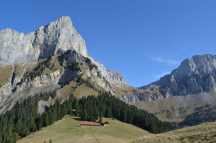
A small and pleasant peak above the Véran pasture, easily accessible from the refuge to all walkers.
For those who love heights, there is a higher path via Le Lançoir, from the Cascade d'Arpenaz (waterfalls).
From the Véran mountain pasture, the trail passes by the mountain hut before gently climbing toward the Tête de Lassy. It winds along the edge of the forest and then into its heart, on a steady and pleasant ascent.
After about thirty minutes, the trail reaches this small peak perched at an elevation of 1,653 meters. Upon arrival, the view opens up, offering a magnificent panorama of the Sallanches Valley and the Aravis Range. A great way to gain some elevation without undertaking a long climb!
The return trip follows the same route.
For hikers looking for a more challenging alternative, a more exposed route via Le Lançoir also leads to the Véran mountain pasture from the area around the Arpenaz waterfall.
Walking times are approximate and do not include rest breaks.
Hike safely!
This description provides a general guide but is not a substitute for a 1:25,000 hiking map or other guidebooks available at your local tourist office! In Sallanches, our Office of Guides & Tour Leaders also offers a wide range of guided outings led by mountain professionals who provide comprehensive expertise on the alpine environment and nature—be sure to check it out!
No matter which hike you choose, check the weather forecast before setting out.
Be sure to pack cereal bars, plenty of water, sunglasses, sunscreen, a small first-aid kit, and clothing appropriate for your outing based on the season and the forecast in your backpack.
技术信息
高程剖面
日期和时间
- 从 15/04/2026 到 31/10/2026
- 从 15/04/2027 到 31/10/2027
补充信息
Price(s)
Free access.
Updated by
Office de Tourisme de Sallanches - 15/10/2026
sallanchesmontblanc.com/
Report a problem
Contact
Phone : 04 50 58 04 25
Email : tourisme@sallanches.com
Website : https://sallanchesmontblanc.com/
Facebook : https://www.facebook.com/SallanchesMontBlanc
Guidebook with maps/step-by-step
Departure: mountain pastures of Véran
1.follow the path which passes in front of the Véran refuge then continue following the signs for the Tête de Lassy
2. the path winds along the forest,
3. it takes about 30 minutes to reach the top of this small summit at 1653 m above sea level where the view emerges on arrival to surprise you with a breathtaking panorama of the Aravis mountains and the valley.
4.return by the same path
动物
是
