警报
警报
练习类型
徒步
中等
6h35mn
Presentation
地图
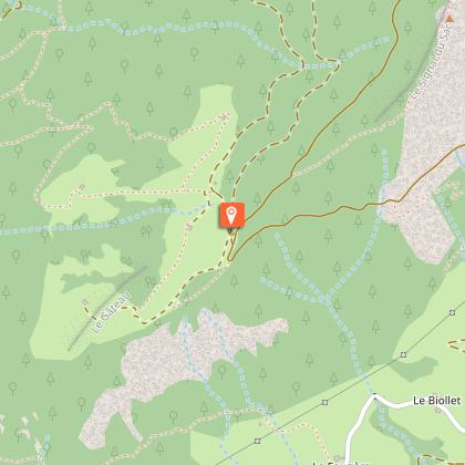
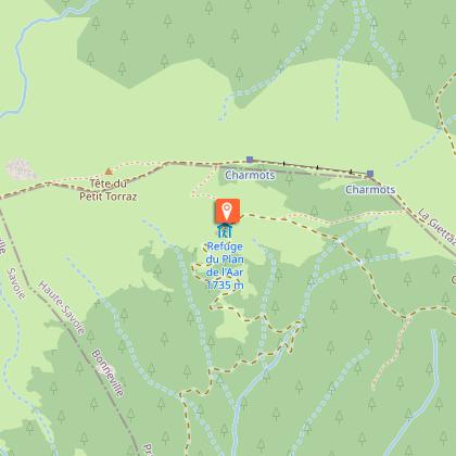
兴趣点
评级和评论
周围的看点
Tête du Torraz

技术信息
徒步
难度
中等
持续时间
6h35mn
距离
20 km
练习类型
徒步
中等
6h35mn
显示更多信息
高程剖面
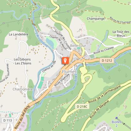
起点
73590
Flumet
Lat : 45.817843Lng : 6.51391
兴趣点


日期和时间
- 从 01/06/2026 到 30/09/2026
补充信息
Updated by
Office de Tourisme du Val d'Arly - 09/09/2025
www.valdarly-montblanc.com
Report a problem
Open period
从 6月1日 到 9月30日.
Contact
Phone : 04 79 31 61 08
Email : sentiers@valdarly-montblanc.com
Website : http://www.valdarly-montblanc.com
Type of land
不适合推车
动物
是
数据作者

评级和评论
周围的看点