Alert
Alerts
Type of practice
Walking
Medium
6h35mn
Presentation
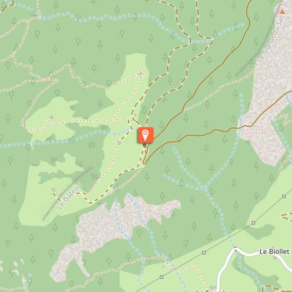
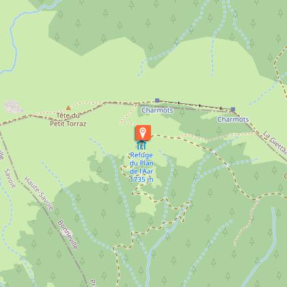
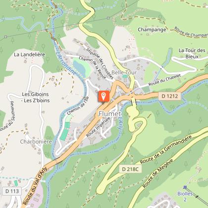
Map
Points of interest
Ratings and reviews
See around
Tête du Torraz

Technical Information
Walking
Difficulty
Medium
Duration
6h35mn
Dist.
20 km
Type of practice
Walking
Medium
6h35mn
Show more
Altimetric profile
Starting point
73590
Flumet
Lat : 45.817843Lng : 6.51391
Points of interest


Date and time
- From 01/06/2026 to 30/09/2026
Additional information
Updated by
Office de Tourisme du Val d'Arly - 09/09/2025
www.valdarly-montblanc.com
Report a problem
Open period
С 01/06 до 30/09.
Contact
Phone : 04 79 31 61 08
Email : sentiers@valdarly-montblanc.com
Website : http://www.valdarly-montblanc.com
Type of land
Неприспособленный к коляскам
Animals
Yes
Data author

Ratings and reviews
To see around