THE CÍES ISLANDS
Description
The island chain called Cíes (Vigo) is located in the beginning of the sea inlet of Vigo. It has 3091 hectares, 433 land and 2658 maritime. It consists of three principal islands: San Martiño to the South, Faro to the Centre (lighthouse) and Monteagudo to the North, and some minor islands as Boeiro, Viños, Ruzo or Carabelos. Faro and Monteagudo are easy to reach by boat or ship from Vigo, Baiona or Cangas. The south island can only be visited by private boat.
It has remarkable rugged lands with a maximum height of 197 meters on the hill of Cíes and a huge contrast between the western (with cliffs and caves) and easter slopes (with dunes and sandy areas); Rodas, Figueiras y Nuestra señora.
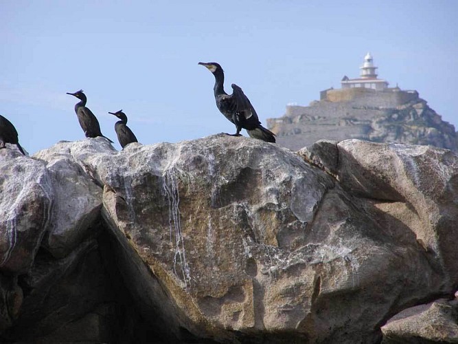
When we sail towards the islands we can see marine mammals such as common and bottlenose dolphins and migratory birds such as gannets, shearwaters and common terns.
It has a visitors´centre, information point, camping site, public toilets, first aid post, lifeguards, restaurants, rest areas and information panels.
There are four round trip itineraries, Monte Faro, Faro da Porta, Alto do Príncipe and Montegudo as well as guided routes accompanied by the interpreter-guides of the park.
Remarkable elements and places are the lake, the dunes of Muxieiro and Rodas, Faro do Peito, Porta and Monte Faro. There are huts to watch the birds (colonies of yellow legged gulls and European shags) and also viewpoints at Alto do Príncipe, A Campá and Monte Faro.
Informations techniques
Profil altimétrique
Auteur de la donnée
