Waarschuwing

Waarschuwingen

Om te zien rondom
Zie meer
Open
Sluiten
Toon
Toon
Toon
Toon
Toon
Toon
Toon
Toon
Toon
Toon
Toon

Oups... Het lijkt erop dat Cirkwi geen toestemming heeft om uw locatie te gebruiken.

Presentatie
Beschrijving
Kaart
Punten van interesse
Beoordelingen en recensies
Zie rondom

Grande Traversée du Jura te voet: van Culoz naar La Borne au Lion

1 waarschuwing op dit circuit

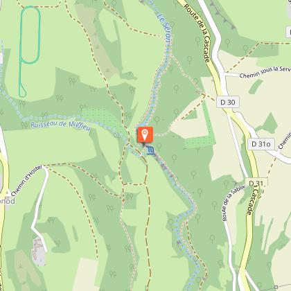
LES PERTES DE LA VALSERINE, ENS DE L'AIN:

Alerte visiteurs

Pour des raisons de sécurité, la circulation des piétons et cyclistes est interdite sur la portion comprise entre l'accès situé parking des Berges de la Valserine rue Louis Dumont (centre-ville) et le barrage de Métral et ce jusqu'à nouvel ordre.

Grande Traversée du Jura te voet: van La Borne au Lion naar Culoz_Champfromier
Grande Traversée du Jura te voet: van Culoz naar La Borne au Lion
Grande Traversée du Jura te voet: van La Borne au Lion naar Culoz_Champfromier
Grande Traversée du Jura te voet: van Culoz naar La Borne au Lion

Beschrijving

Deze Grande Randonnée (GR®) loopt door het Juragebergte van Mandeure, vlakbij Montbéliard in de Doubs in het noorden, door de Jura naar Culoz in de Ain in het zuiden.

De GTJ doorkruist het hele regionale natuurpark van de Haut-Jura, met een uitstapje naar het naburige Zwitserland. De GTJ te voet werd in 2004 geopend en volgt de Grande Randonnée GR® 5 en GR® 9 en de GR® de Pays.
Met de Grande Traversée du Jura te voet kunnen liefhebbers van natuur en ruimte intense momenten beleven in een zachte bergomgeving. Golvend over de bergkammen, over de kliffen, uit een bos komend om een meer te omzeilen, dit is een rustige route zonder bijzondere moeilijkheden, die de mooiste paden van het Juragebergte biedt.
De route is toegankelijk voor zoveel mogelijk mensen en biedt in totaal 400 km aan paden en een veelheid aan verschillende landschappen en sferen.
Om aan de behoeften van alle wandelaars te voldoen, kan de route worden aangepast aan elke smaak: van een 2- of 3-daagse wandeling die zeer geschikt is voor gezinnen, tot wandelingen voor wandelaars die hun batterijen willen opladen, tot meer fysiek veeleisende wandelingen, en waarom niet ... de volledige route, te voltooien in 15 of 20 dagen.

De route loopt door het hart van het regionale natuurpark van de Haut-Jura en een deel ervan door het nationale natuurreservaat van de Haute Chaîne du Jura: een beschermd, ongerept gebied dat met respect moet worden verkend.

Goed om te weten - Beschermd gebied
Een deel van de route loopt door het Nationaal Natuurreservaat van de Haute Chaîne du Jura, waarvoor speciale regels gelden:

Honden zijn niet toegestaan, zelfs niet aangelijnd.

Kamperen in tenten is verboden.

Respecteer deze regels om de rijkdom van deze uitzonderlijke omgeving te behouden.

Technische informatie

Wandel
Moeilijkheid
Moeilijk
Afstand
96 km
Meer informatie tonen

Hoogteprofiel

Startpunt

01410   Champfromier
Lat : 46.265401Lng : 5.869274

Punten van interesse

image du object

Grand Colombier Mountain range

Located to the south of the Jura Massif and Bugey’s highest point (1531 m), with over 100 km of marked hiking trails (GR9, LWG, GR) and panoramic views on the Alps (Belledonne and Mont Blanc), Bugey, Rhone, lake Bourget and Lake Annecy and Leman. There is the opportunity to discover various sites and landscapes: forests, grasslands, grangeons (temporary accommodation for winemakers) the Chartreuse Arvières ruins, ridge roads and panoramic views on the Alps.The summit of the Grand Colombier offers exceptional views of the Belledonne and Mont-Blanc massifs, the Bugey region, the Rhône, Lac du Bourget, Lac d'Annecy and Lac du Léman. The "giant of Bugey" offers a variety of sites and landscapes to admire: forests, meadows, barns, the ruins of the Chartreuse d'Arvières and panoramic views of the Alps. Two orientation tables: - "le Fenestrez" (Altitude: 1,150 m): from Culoz, follow the RD120, then at the Sapette crossroads, the D120b on the left. - La Croix" (altitude 1,525 m): from Culoz, follow the RD120 towards Col du Grand Colombier. Parking lot nearby. This massif has all the characteristics of the Jurassic era: firstly, alternating mountains and valleys: the mountain is surrounded to the west by the Valromey depression and to the east by the Lavours and Chautagne marshes. It reappears as a "mollard" at Lavours and Vions. The limestone rock, carved out by heavy rains, has given rise to picturesque sites such as the Thurignin gorges in Valromey, the Cerveyrieu waterfall near Artemare, the Groin canyon, etc... You can drive through the massif on the D120 from Culoz (where the climb is particularly spectacular), Anglefort, Virieu-le-Petit or Lochieu. There is a parking lot near the Iron Cross overlooking the massif.

Culoz 01350 Culoz-Béon
- Office de Tourisme Bugey Sud Grand Colombier -
Consulter
image du object

Lèbe Observatory

Located in Valromey sur Séran in the Bugey Sud, the Observatoire de la Lèbe is entirely dedicated to the discovery of astronomy for all.How about taking the time to observe the stars? A unique place in the Ain, the Observatoire de la Lèbe in Valromey sur Séran in the Bugey Sud offers you the opportunity to familiarise yourself with the galaxies, stars and planets through fun and exciting astronomical activities. All year round, upon reservation, the Observatoire de la Lèbe offers you : Planetarium sessions: Come aboard the planetarium for a virtual trip with striking realism. Guided by our scientific mediator, discover constellations, planets, nebulae, galaxies and other unsuspected wonders of the deep sky. The session consists of a film followed by a presentation of the sky by the presenter. A dive into the heart of the starry sky comfortably installed in a in a recliner. Duration: 1 hour. Sessions from Monday to Saturday (summer and school holidays). Other dates possible on reservation. Planetarium films: >Blind with starry eyes >Lucia, the secret of shooting stars >Voyager, the endless journey >From the earth to the universe >The sun, our living star Find the screenings on the agenda of our website. To schedule a session outside the dates already programmed, please contact us. More information by phone or on our website. Sun observations: observe the surface of the sun live in a 120 mm telescope equipped with a professional solar filter. Observation evenings for all: >Observation evenings: discover the sky with the naked eye and telescopes... >Family evenings" experience the magic of shooting stars and constellations in the planetarium and continue with an observation with instruments. >Celestial legends" evenings: learn to recognise the constellations and be lulled by their mythological tales. >Evscope" evenings The digital telescope that has revolutionised sky observation in recent years. Information, reservation by phone and on the internet: www.observatoiredelalebe.fr/soirees-dobservation/ Free access: Rediscover the path of the stars and its booklet sold at the Observatory and at the OT Bugey Sud Grand Colombier and spend a great moment in family in total autonomy. and have a great time with your family in total autonomy. Available every day of the year. Our course The bestiary of the sky focuses on the constellations and the animal figures associated with them. The Observatory also offers courses for adults and children. It is open all year round for groups (schools, leisure activities, associations, works councils, families...). Programmes Specific programmes on request.

669 Chemin des Etoiles Le Puy des Barres Sutrieu 01260 Valromey-sur-Séran
- Office de Tourisme Bugey Sud Grand Colombier -
Consulter
image du object

Nature reserve of Lavours marsh.

The Lavours Marsh is one of the last remaining giant marshlands in continental Western Europe. Located near Ceyzérieu in the shadow of the Grand Colombier the marsh covers an area of 500 hectares and is traversed by a wooden footbridge 1.2km long.The Lavours Marsh was declared a Nature Reserve in 1984 to protect the rich and diverse flora and fauna that exists there. Visitors can view this remarkable marshland from a 1.2km long wooden pathway on stilts that allows access right to the very heart of the marsh. All along this pathway there are signs in both French and English that give explanations about the various plants and animals that exist in the marsh. The pathway is accessible to wheelchair users and all the signs are available in Braille for the visually impaired. The only entrance to the Lavours Marsh is located in the hamlet of Aignoz, here you will find plenty of free parking and the Maison du Marais, an interpretative centre that explains the history and life of the marsh. Each year at the Maison du Marais between April and October a program of various events is scheduled that allows the public discover more about the marsh’s flora and fauna and heritage. To access to the swamp, a mandatory parking is at visitors disposal free of charge, at the entry of Aignoz hamlet. It is important de respect the natural reserve regulation: dogs and gathering forbidden. The stilt walk is accessible to people with reduced mobility with the help of an accompanying person.

Hameau d'Aignoz 01350 Ceyzérieu
- Office de Tourisme Bugey Sud Grand Colombier -
Consulter

Aanvullende informatie

Updated by

Aintourisme - 24/11/2025
www.ain-tourisme.com
Report a problem

Type of land

Rots
kiezelstenen
Grond
Harde coating (teer, cement, vloer)

Contact

Phone : 03 84 51 51 51

Website : https://www.gtj.asso.fr/

Environments

Panoramisch uitzicht
In een natuurreservaat

Topo/stap voor stap

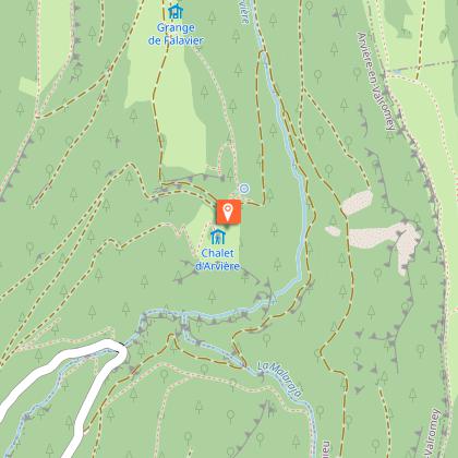
▶ Dag 1: Culoz -> Chalet d'Arvière, ongeveer 6u30
Afstand: 19,8 km
Hoogteverschil: 1333m D+ / 386m D-
Vanaf Culoz volgt u de Gr (rood en wit) richting Pont de la Magnine, uitkijkpunt Fenestré, Granges neuves, Grange à Masse, Col du Colombier, Croix du Colombier, Col de Charbemène, Sapin Daubré, vervolgens Chalet d'Arvières.

▶ Dag 2: Chalet d'Arvières -> Les Bergonnes.
Afstand: 15,4 km
Hoogteverschil: 349 D+ / 334 D-
Routebeschrijving: Vanaf Chalet d'Arvières de GR vervolgen richting Grande d'en Bas, Grange d'en Haut, Col de Richemond, Crêt Dauphin, Planvanel, Croix des Terments, een gele PR nemen naar Les Bergonnes.

▶ Dag 3: Les Bergonnes -> Lancrans, ongeveer 6u15
Afstand: 22, 3 Km
Hoogteverschil : 342 D +/ 1061 D-
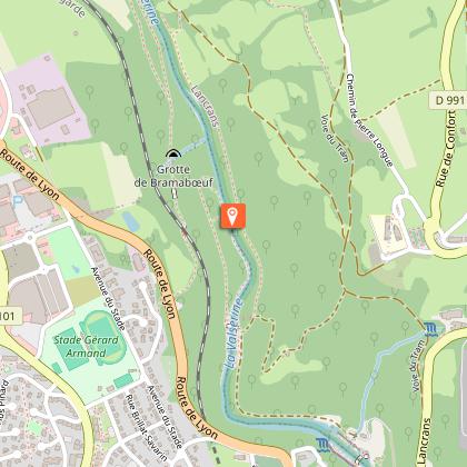
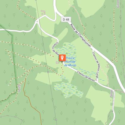
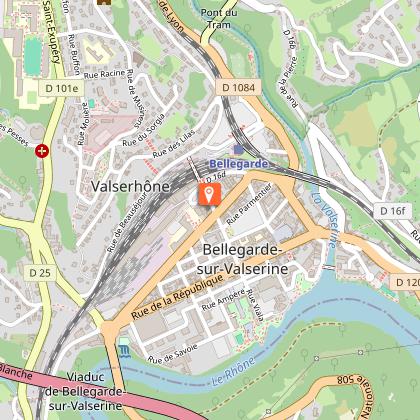
Routebeschrijving: Vanaf Les Bergonnes, neem de gele PR richting Croix des Terments, neem de GR, volg dan Crêt du Nu, Tumet, Charnay, Pra Devant, Catray, naar beneden naar Ochiaz, Mussel, Rue de Lafayette, Gare de Bellegarde, les Pertes de la Valserine, dan terug omhoog naar Lancrans.

▶ Dag 4: Lancrans -> Refuge du Gralet 6u30
Afstand: 17,8 km
Hoogteverschil: 1355 D+/ 399D-
Routebeschrijving: Neem vanaf Lancrans de GR richting Métral, Sorgia d'en Haut, Crêt de la Goutte, chalet du Sac, la Corne, la Pelaz, la Poutouille en vervolgens le Gralet.

▶Dag 5: Refuge du Gralet -> Refuge de la Loge 4u30
Afstand: 11,1 km
Hoogteverschil: 434m D+ / 438m D-
Routebeschrijving: Vanaf de Refuge du Gralet neemt u de GR richting Le Reculet, volg de kam om deze te bereiken, volg de Crêt de la Neige, daal vervolgens af richting La Loge via Sous le Crêt, Les Brulats, Combe des Voyettes en Refuge de la Loge.

▶ Dag 6: Refuge de la Loge -> La Borne au Lion, ca. 4u30
Afstand: 11,4 km
Hoogteverschil: 649 D+/ 505 D-
Routebeschrijving: Vanaf de Refuge de la Loge afdalen richting Le Ratou op de GR, Lélex volgen, Route du Frenet, le Niaizet, les Closette, Col du Crêt au Merles, vervolgens La Borne au Lion.

Dieren

Nee

Beoordelingen en recensies

Om te zien rondom
Zie meer
Open
Sluiten
Toon
Toon
Toon
Toon
Toon
Toon
Toon
Toon
Toon
Toon
Toon
Voorzichtigheid!
We hebben geen informatie over de moeilijkheidsgraad van dit circuit. U kunt onderweg enkele verrassingen tegenkomen. Voordat u vertrekt, aarzel niet om meer informatie in te winnen en alle nodige voorzorgsmaatregelen te nemen. Goede reis! 🌳🥾