Waarschuwing

Waarschuwingen

Om te zien rondom
Zie meer
Open
Sluiten
Toon
Toon
Toon
Toon
Toon
Toon
Toon
Toon
Toon
Toon
Toon

Oups... Het lijkt erop dat Cirkwi geen toestemming heeft om uw locatie te gebruiken.

Presentatie
Kaart
Punten van interesse
Beoordelingen en recensies
Zie rondom

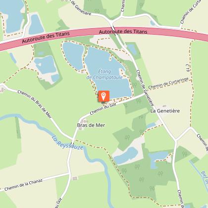
Randonnée - Plan d'eau de Champataule & Bois de But

Technische informatie

Wandel
Moeilijkheid
Gemiddeld
Duur
4h30mn
Afstand
15 km
Meer informatie tonen

Hoogteprofiel

Startpunt

Plan d'eau de Champataule Sud , 01440   Viriat
Lat : 46.260517Lng : 5.200612

Punten van interesse

image du object

Etang de But, ENS de l'Ain

The "Etang de But" site has been designated a sensitive natural area (ENS). It belongs to a chain of ponds in the southern Bresse plain, marking the transition to the Dombist plateau.This artificial pond is remarkable for the species of flora and fauna it contains. Set in a forest setting and sometimes covered with a carpet of white water lilies, it offers a variety of landscapes through the seasons. Key issues for the site Fauna: presence of the Leucorrhine dragonfly, yellow-bellied toad, great crested newt, Little Bittern, Black-crowned Night-Heron. Flora: Royal fern, water scorpion, Bohemian sedge, etc. The woodlands near the pond have a role to play in the pond's ecological functioning, in addition to their landscape value. Good management of these woodlands is essential. The main threats are the risk of the pond filling up, and invasion by invasive species. To discover the site... An information panel is located at the thou (drainage system), to the west of the pond. The site is generally accessible to pedestrians. The Etang de But was awarded the ENS or espace naturel sensible label by the Département de l'Ain in 2015. True natural and landscaped jewels of the Ain department, these ENS-labeled sites are on the one hand preserved through local management and on the other made accessible to as many people as possible when the fragility of the site allows.

But 01370 Saint-Étienne-du-Bois
- Bourg-en-Bresse destinations - Office de tourisme -
Consulter

Aanvullende informatie

Environments

Platteland
Oever van meer of plas
Rivieroever
In het bos
Meer of plas op -5 km
Rivier op -5 km
Waterkant
Vijver binnen 5 km

Updated by

Bourg-en-Bresse Destinations - Office de tourisme - 24/11/2025
www.bourgenbressedestinations.fr
Report a problem

Open period

Het hele jaar iedere dag.

Type of land

Grond
Harde coating (teer, cement, vloer)

Gegevensauteur

Beoordelingen en recensies

Om te zien rondom
Zie meer
Open
Sluiten
Toon
Toon
Toon
Toon
Toon
Toon
Toon
Toon
Toon
Toon
Toon
Voorzichtigheid!
We hebben geen informatie over de moeilijkheidsgraad van dit circuit. U kunt onderweg enkele verrassingen tegenkomen. Voordat u vertrekt, aarzel niet om meer informatie in te winnen en alle nodige voorzorgsmaatregelen te nemen. Goede reis! 🌳🥾