Om te zien rondom
Zie meer
Open
Sluiten
Toon
Toon
Toon
Toon
Toon
Toon
Toon
Toon
Toon
Toon
Toon

Oups... Het lijkt erop dat Cirkwi geen toestemming heeft om uw locatie te gebruiken.

Beschrijving
Kaart
Stappen
Beoordelingen en recensies
Zie rondom

VTTAE N°3 - Le tour de Lanne en Barétous

Vue vers le col de Seregu
Vue vers la Madeleine
Vue sur Lanne en Barétous et la Pierre Saint-Martin
Vers le col de Seregu
Vers le col de Bas
Route Escary à Aramits
Les Bergers du Haut-Béarn
Eglise et Château de Porthos à Lanne en Barétous
Descente du col de Bas
Chemin de crête

Beschrijving

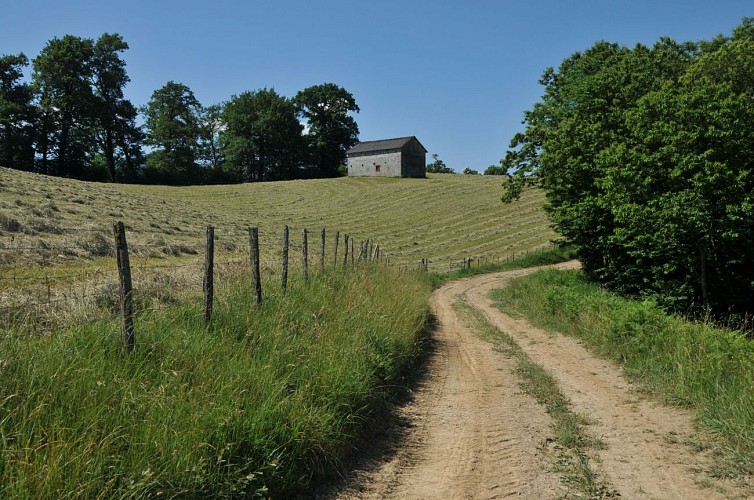
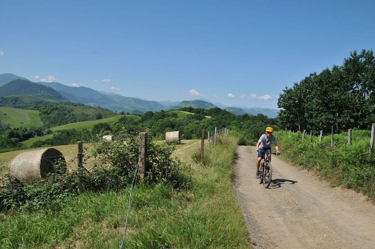
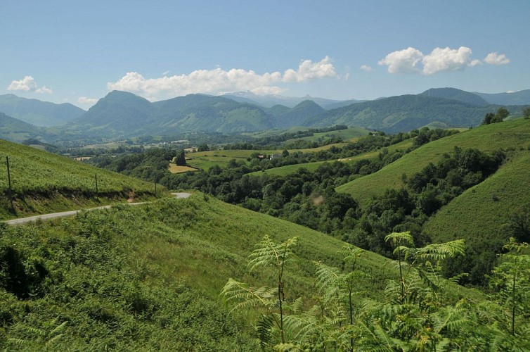
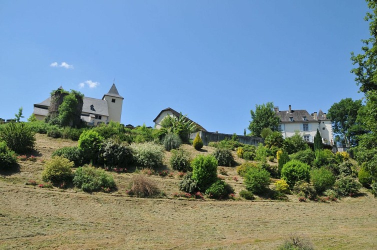
De Tour de Lanne stelt voor de panoramische heuvels van Barétous te doorkruisen, tussen bewerkte weiden en bossen, tussen boerderijen en gehuchten. Het circuit zit dus vol weidse landschappen, en moet zeker worden onderbroken door lange contemplatieve pauzes, van de Madeleine tot de pic d'Anie. Maar de hoogten worden gewonnen door de kracht van de kuit, en de elektrische assistentie zal zeer gerechtvaardigd zijn om enkele zware ravijnen te overwinnen, het zal nodig zijn om te spelen op de amplitude van de versnelling en de motor op te voeren om de uitdagingen aan te gaan die het bergkampad biedt. Maakt niet uit, niets is onmogelijk in het land van de musketier, de herinnering aan de dappere Porthos zweeft over het landschap en zal u hart onder de riem steken. En bij de finish wacht een proeverij van goede boerenkaas!

Technische informatie

Elektrische fiets
Moeilijkheid
Gemiddeld
Afstand
11 km
Meer informatie tonen

Hoogteprofiel

Startpunt

Parking de la piscine , 64570 LANNE-EN-BARETOUS
Lat : 43.113257Lng : -0.761716

Stappen

image du object
1

From Lanne-en-Barétous to Sérégu mountain pass

In front of the pool, go right towards the center of Lanne and then at the bakery follow the path towards Barcus on the left. Go straight on at the next junction to descend to the Hondate Bridge. 300 m after the bridge, choose the left lane twice in a row to start up the Chemin Plasence. 200 m higher, near the farm, leave the asphalt to go up the opposite path. You can use the battery without restrictions, as the climb is long and marked by several slopes. Go through a first pass and then, in a wide bend to the right, roll over the back of the hill (successive mounds).

- Communauté de Communes du Haut-Béarn -
Consulter
image du object
2

From Sérégu mountain pass to Bas pass

Cross the Col de Sérégu (various paths) to continue on the ridge path. Cross a new scenic mound and descend onto D459. Cross carefully and continue in front of Chemin Brouca (tarred). Just before the end of the asphalt, follow the path that passes the farm on the left and then pass behind it with the support of the assistance to overcome the obstacle. At the last house (blue shutters), you will still have to go up to the left; this time a little push will be inevitable. At the top, follow the obvious ridge path to the left.

- Communauté de Communes du Haut-Béarn -
Consulter
image du object
3

From Col de Bas to Rachou bridge

At the five-branch crossing of the Col de Bas, choose the path to the right to begin the descent. Panoramic and paved though, be sure to moderate your pace as several hairpin turns follow one another and can be difficult on a (quite heavy) electric bike. Head straight down the valley to the Rachou Bridge.

- Communauté de Communes du Haut-Béarn -
Consulter
image du object
4

From Rachou bridge to Lanne-en-Barétous

Just before the Rachou bridge (Vert stream), turn right onto a secondary road (optional, possibility of reaching Aramits opposite). At the Y-intersection of the Escary houses, continue on the path to the left, in the middle of the fenced meadows. Then follow the Aren farm and drive directly on the asphalt. At the Sau bridge, turn left towards the Lanne bell tower and then, 350 m further, turn right to pass under the castle of Porthos. A final push of the battery will take you to a crossroads (stop) where you turn left to return to the starting point.

- Communauté de Communes du Haut-Béarn -
Consulter

Aanvullende informatie

Typologie de l'itinéraire

Ronde

Durée moyenne de l'expérience

1 tot 2 uur

Equipements

Waterbron
Waterbron
Eetplek (kruidenier, restaurant)

Thèmes

Natuur

Gegevensauteur

12 place Jaca 64400 Oloron-Sainte-Marie Cedex France

Beoordelingen en recensies

Om te zien rondom
Zie meer
Open
Sluiten
Toon
Toon
Toon
Toon
Toon
Toon
Toon
Toon
Toon
Toon
Toon
Voorzichtigheid!
We hebben geen informatie over de moeilijkheidsgraad van dit circuit. U kunt onderweg enkele verrassingen tegenkomen. Voordat u vertrekt, aarzel niet om meer informatie in te winnen en alle nodige voorzorgsmaatregelen te nemen. Goede reis! 🌳🥾