Waarschuwing

Waarschuwingen

Om te zien rondom
Zie meer
Open
Sluiten
Toon
Toon
Toon
Toon
Toon
Toon
Toon
Toon
Toon
Toon
Toon

Oups... Het lijkt erop dat Cirkwi geen toestemming heeft om uw locatie te gebruiken.

Presentatie
Beschrijving
Kaart
Punten van interesse
Beoordelingen en recensies
Zie rondom

Loza wandelpad

Loza wandelpad
Loza wandelpad
Loza wandelpad
Loza wandelpad

Beschrijving

Dit is een wandeling vol contrasten, die je behendig meeneemt van bos naar alpenweiden en bergweiden. Een ideale blootstelling voor wandelingen buiten het seizoen die veel zon nodig hebben.

Klaar om de 1000 meter barrière te doorbreken? Heb je ooit de kegels van de grove den horen knappen in het zonlicht? De lange, aanhoudende klim door het geurige dennenbos biedt je deze mogelijkheid tijdens een pauze op de Mont op 1770 meter hoogte. Je kunt zelfs een glimp opvangen van de sneeuwheide, een zeldzame en beschermde plant die helemaal in het roze is gehuld. Hij is zo vroegrijp dat hij al bloeit tijdens de laatste sneeuwbuien. De open plek die zich voor je opent, maakt plaats voor de laatste uitdagende klim. Je betreedt met trots het nationale park van de Vanoise. De helling wordt zachter als je het Croix de la Loza bereikt. Neem plaats op deze uitkijkpost. De toppen van de Bramanais en de Mont Cenis komen in zicht, soms gehuld in de wolken van de Lombarde. Kantel voorzichtig naar de Combe de Bonne nuit. Op een hoogte van 3695 meter dwingen de Dent Parrachée en zijn scherpe bergkammen respect af. Stel je de spectaculaire lawines voor die in de winter soms op Sollières neerdalen! Neem tijdens de afdaling een koele pauze en trek je laarzen aan.

Technische informatie

Wandel
Moeilijkheid
Moeilijk
Duur
4h
Afstand
12 km
Meer informatie tonen

Hoogteprofiel

Startpunt

Route de l'Eglise Sollières-Sardières , 73500   Val-Cenis
Lat : 45.264204Lng : 6.805526

Punten van interesse

image du object

Vanoise National Park

The Vanoise National Park is located in the eastern part of the Savoie department, in the Vanoise mountain range, which connects the two high valleys of Maurienne and Tarentaise, near the Italian border.The park encompasses high mountains, rising to over 3,000 meters, on which numerous glaciers remain, but which are also cut by valleys opening onto wide, easily accessible mountain passes. Sheltered from oceanic rains by the Pre-Alps and the Belledonne Range, the massif enjoys a relatively dry and sunny climate. BY THE NUMBERS - 53,300 hectares, or 533 km², of the park’s core area - 25 municipalities, 17 of which are within the park’s core area - 224 protected species in the park’s core area (all protection statuses) - 400 km of marked trails - 40 mountain huts in the park’s core area - 5 nature reserves adjacent to the National Park - Elevations in the core area: highest 3,855 m (La Grande Casse) and lowest 1,280 m - 14 km of shared border with the Gran Paradiso National Park in Italy (Parco nazionale Gran Paradiso) A PROTECTED AREA The Vanoise National Park was created to protect the Alpine ibex. Protection has since been extended to other animal and plant species. The core area of the Park covers 53,300 hectares under special protection governed by specific regulations established by a decree of the Council of State. With 33 natural habitats—31 of which are of Community interest—more than 2,860 plant species (300 of which are protected at the national level), nearly 1,000 species of fungi, and 325 vertebrate species—representing 65% of the vertebrates found in metropolitan France, 92% of which are protected—the territory of the Vanoise National Park is a vast reservoir of biodiversity. The variety of its rocks (limestone, gypsum, sandstone, quartzite, schist, mica schist, gneiss…), combined with a highly complex geological structure, the wide range of elevations, and its position at a climatic crossroads, all contribute to the massif’s remarkable geological, floristic, and faunal richness. Thanks to their 14-km shared border, the Italian Gran Paradiso National Park and the Vanoise National Park form one of the largest protected areas in Western Europe, covering 1,250 km². NATIONAL NATURE RESERVES The Park has also managed four national nature reserves on behalf of the government since their creation. The Grande Sassière, Plan de Tuéda, Tignes-Champagny, and Bailletaz reserves cover a combined area of just over 5,100 ha, contiguous within the heart of the Park. The National Forest Service, for its part, manages the Hauts de Villaroger National Nature Reserve. A LIVING TERRITORY Shaped by human presence spanning thousands of years, the Vanoise is a living territory that benefits from the preservation of its heritage combined with sustainable and respectful development. Agriculture and tourism are major activities that contribute to the region’s prosperity and value but also have an impact on its natural heritage. Throughout history, humans have developed high-altitude agropastoralism—a traditional practice of livestock raising and cheese production that contributes significantly to the diversity of the landscapes and the character of the National Park. The presence of wolves, predation, and protective measures (herding dogs) have altered pastoral practices. The Park is committed to supporting all users of the area. Together with farmers, it therefore defines economically and environmentally sound land-use systems within the Park’s core area. Tourism is the major economic driver of the high valleys surrounding the Park’s core area. In addition to the winter sports resorts—which today form the largest ski area in Europe, with significant implications for the Park’s core—there is tourism focused on exploring and appreciating unspoiled nature and landscapes, whose reputation extends far beyond the country’s borders. Through its collaboration with local stakeholders, the National Park contributes to the economic and social vitality of the upper Tarentaise and Maurienne valleys. The growth of recreational activities and climate change also prompt us to reevaluate certain development models in light of the sensitivity of ecosystems and species: adapting visitor capacity, promoting sustainable transportation, and reducing impacts on flora and fauna are areas that require further exploration. A PARK ACCESSIBLE TO ALL The Vanoise National Park is committed to supporting people with disabilities: mountain huts and trails in the Vanoise that are accessible to all, adapted educational resources and activities, and projects led by the National Park to ensure access to nature for everyone.

- Apidae -
Consulter

Datum en tijd

  • Vanaf 01/06/2027 tot 15/10/2027

Aanvullende informatie

Open period

Van 01/06 tot en met 15/10 iedere dag.

Onder voorbehoud van goede sneeuwcondities en goede weersomstandigheden.

Distinctions

Genoteerd PDIPR

Updated by

Communauté de communes Haute Maurienne Vanoise - 18/11/2026
www.cchautemaurienne.com
Report a problem

Environments

In het bos
Uitzicht op bergen
In de bergen
Vlakbij een halte van openbaar vervoer
Bushalte op minder dan 500 m
Vijver binnen 5 km
In een natuurreservaat

Type of land

kiezelstenen
Grond
steenslag
Niet geschikt voor kinderwagens

Location complements

Vertrek vanuit het dorp langs de RD83.
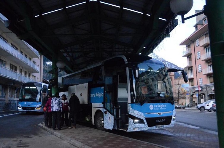
Met de bus: lijn S52 - halte Mairie, lijn S53 - halte Les Favières.
Om er met de auto te komen: parkeer vlakbij de kerk van Val Cenis Sollières/het kantoor van de burgemeester.

Topo guides and map references

Topo guides references :
Kaart en boekje "Haute Maurienne Vanoise. 120 wandelingen en trektochten - 36 routes. Voor alle niveaus" (voor 12 € te koop in de toeristenbureaus)

Map references :
Kaart IGN 3634OT - Val Cenis Kaart IGN 3534OT - Les Trois Vallées

Reception complements

De duur van de tocht wordt berekend aan de hand van referentietempo's: 300 m/u stijgen, 500 m/u dalen en 4 km/u op het vlakke.

Omdat er op elk moment gevaren kunnen voorkomen op de routes, zijn de GPX-tracks die worden gegeven niet contractueel. Ze worden alleen ter informatie gegeven. Rijders gebruiken ze op eigen verantwoordelijkheid, afhankelijk van hun niveau van beheersing van de technologische hulpmiddelen en hun kennis van het terrein.

Topo/stap voor stap

Om je op de grond te begeleiden, kun je het "stap-voor-stap" richtingsdiagram in pdf raadplegen.

Dieren

Nee. Huisdieren zijn niet toegestaan op deze wandeling in het Vanoise National Park.

Gegevensauteur

Beoordelingen en recensies

Om te zien rondom
Zie meer
Open
Sluiten
Toon
Toon
Toon
Toon
Toon
Toon
Toon
Toon
Toon
Toon
Toon
Voorzichtigheid!
We hebben geen informatie over de moeilijkheidsgraad van dit circuit. U kunt onderweg enkele verrassingen tegenkomen. Voordat u vertrekt, aarzel niet om meer informatie in te winnen en alle nodige voorzorgsmaatregelen te nemen. Goede reis! 🌳🥾