Waarschuwing
Waarschuwingen
Grote rit rondom het kanton La Grave Villar-d'Arène


IGN kaarten


Beschrijving
Tijdens deze mooie rondrit (type XC) doorkruist u alle gehuchtjes van het kanton La Grave. Vanaf de uit te rots gesneden wegen op de zuidhelling van La Grave, heeft u een prachtig uitzicht op de Meije en zijn gletsjers.
Parcours uit de gids "VTT en Oisans" (Oisans Tourisme)
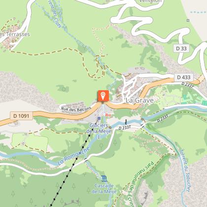
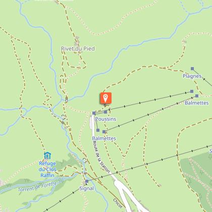
Vertrek/aankomst (lus) : La Grave 1450 m
Duur : 3 uur 30 minuten
Afstand : 30 km
Hoogste punt : 2069 m
Laagste punt : 1438 m
Positief hoogteverschil : 1109 m
Negatief hoogteverschil : -1109 m
Technisch niveau : 3/4
Uithoudingsniveau : 3/4
Kaart : IGN Top 25 Valloire 3435 ET en Meije Pelvoux 3436 ET.
PARCOURS
Vertrek in La Grave, le Chazelet of Villar d'Arène met de bewegwijzering FFC (n°8 - Le grand tour du canton).
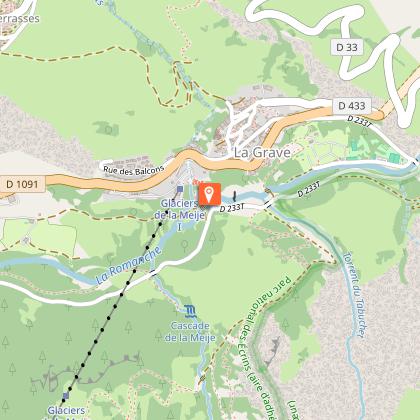
Vanaf het gidsenbureau van La Grave, afdalen tot de parking onderaan de kabellift en de weg nemen die afdaalt tot de Romanche (in de winter komen de skiers te voet terug langs deze weg). De brug oversteken en links de weg naar het Arboretum nemen en vervolgens naar Villar d'Arène via de weg van Les Vernois.
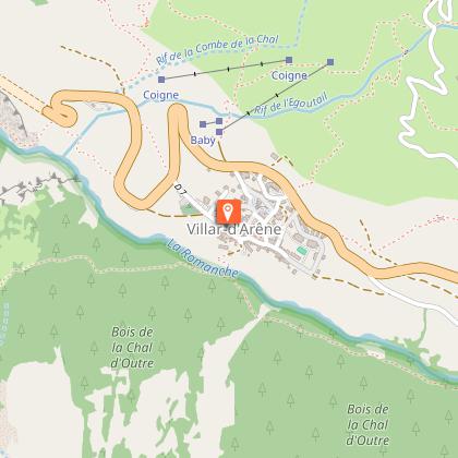
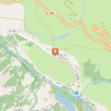
We komen aan in Villar d'Arène. Op de kerkplaats, kijken we rechts uit naar een omhooglopende straat (éénrichtingsstraat), die enkele 100m verder een pad wordt. We komen uit op het kleine weggetje die naar de Pied du Col gaat.
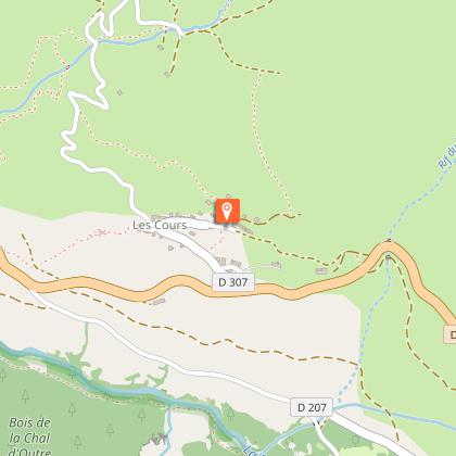
In het gehuchtje aangekomen, kunnen we een ommetje maken naar de Pas de l'Âne en het einde van de groeve. Terug aangekomen in Pied du Col, nemen we de omhooglopende weg richting Les Cours.
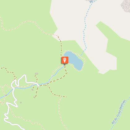
In Les Cours, rechts de weg nemen die richting het meer van Pontet klimt (1 km weg, 2,5 km baan, en vervolgens stijle weg tot het meer).
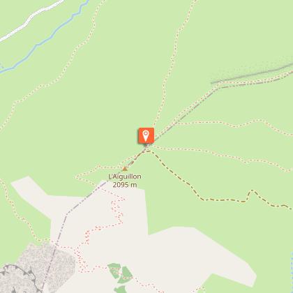
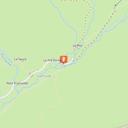
Rij links langs het meer om terug een steil stuk te klimmen via een prachtige single track tot l'Aiguillon (2060 m). Hier begint een mooie afdaling tot Entraigue / Valfroide.
De brug oversteken, vervolgens de piste volgen en tenslotte de baan tot in Valfroide, les Hières en Ventelon.
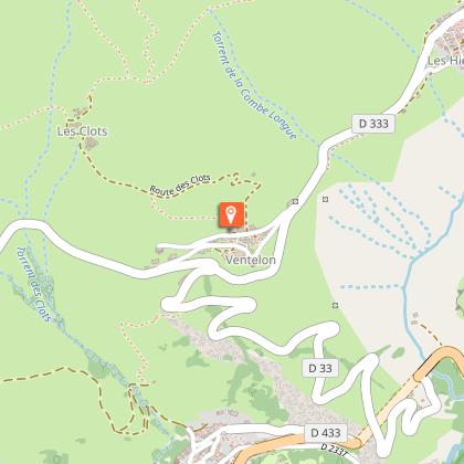
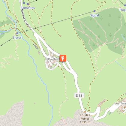
In Ventelon aangekomen, naar rechts klimmen richting het gehucht van Les Clots. Indien u het parcours wenst in te korten, blijft u rechtdoor de baan volgen tot in Les Terrasses.
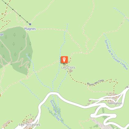
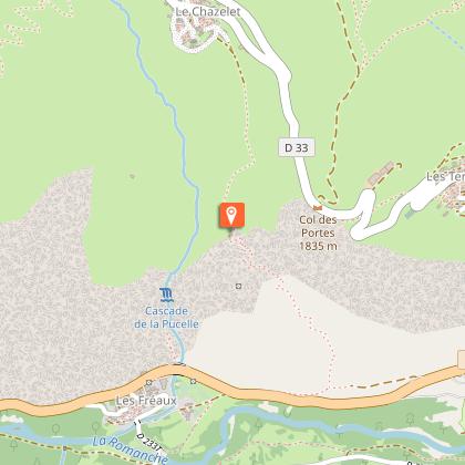
In het gehucht van Les Clots, naar rechts draaien op een prachtige single die een leisteengroeve doorkruist (opgepast, blootgestelde passage). Verder fietsen tot de skipistes van het dorp van Le Chazelet om vervolgens zachtjesaan terug af te dalen tot de snack in het dorp van Le Chazelet.
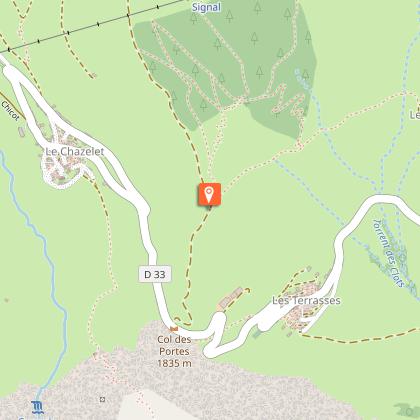
Gedurende 50 m terug klimmen tot aan het begin van de sleeplift en terug het dorp bereiken via de piste die rechts begint.
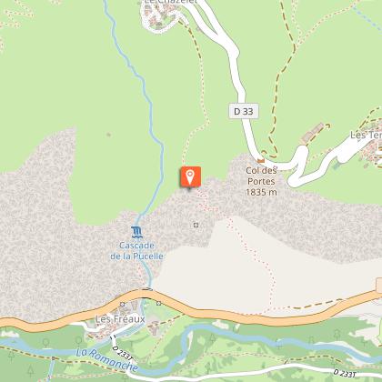
Le Chazelet doorkruisen en terug afdalen naar La Grave via Les Terrasses door de GR 54 te volgen.
Technische informatie
Hoogteprofiel
Startpunt
Stappen
Punten van interesse


Aanvullende informatie
Environments
In de bergen
Updated by
Office de tourisme des Hautes Vallées - La Grave - La Clarée - L'Izoard - 15/10/2025
www.hautesvallees.com/la-grave/
Report a problem
Open period
Van 01/06 tot en met 31/10.
Contact
Phone : 04 76 79 90 05
Email : info@oisans.com
Website : https://www.bike-oisans.com
Location complements
Parcours in lusvorm, vertrek mogelijk vanuit La Grave, Villar d'Arène of Le Chazelet.
Gegevensauteur
