Waarschuwing
Waarschuwingen
Col d'Ornon, Col de Parquetout
Beschrijving
Dit relatief gemakkelijk fietsparcours die de vallei van de Lignarre doorkruist, is populair bij de wielrenners in het begin van het seizoen. De moedigsten zullen van deze opwarming genieten om verder te fietsen richting Valbonnais via de col de Parquetout, 1 van de moeilijkste van Isère.
Deze route is te vinden op de kaart „Vélo en Oisans“ (Oisans Tourisme)
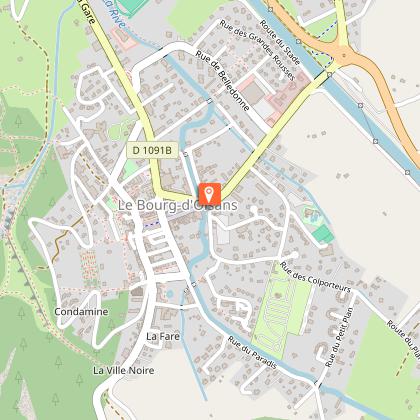
Vertrek / Aankomst: Bourg d’Oisans 720 m
Duur: 1 uur 20
Afstand (heen en terug): 28 km
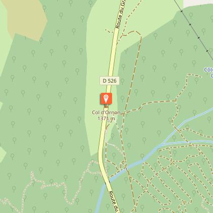
Maximale hoogte: 1380 m
Minimale hoogte: 716 m
Hoogteverschil: 764 m
Maximale helling: 10 %
Kaart: Michelin-kaart van de departementen Isère en Savoie, nr. 333
ROUTE
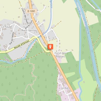
Neem vanuit Bourg d’Oisans de D1091 richting Grenoble. Sla na 2 kilometer linksaf richting Valbonnais – La Mure – Ornon via de D526. De Col d’Ornon ligt op 14 kilometer. De laatste kilometers voor de Col d’Ornon zijn iets steiler dan de rest van de route, maar zijn nooit echt slopend.
Op de pas kun je een tussenstop maken bij de vakantiehuisjes en restaurants van het skigebied van de Col d’Ornon.
HET „EXTRAATJE”: Col de Parquetout
Als je dapper genoeg bent om door te rijden naar de Col de Parquetout, verandert de sfeer radicaal! Hoewel deze klim kort is, geeft hij je geen moment rust. Het is een van de zwaarste cols van de Isère!
Max. helling 16 %, gemiddelde helling 10 %, min. helling 9 %... dat zegt genoeg.
Vanaf de Col d’Ornon daal je af richting La Mure. Je rijdt door Chantelouve en Entraigues. Bij kilometer 16 verlaat je de D526 door net voor de brug naar Valbonnais – goed herkenbaar aan zijn houten constructie – linksaf te slaan. Je hebt nog 7 km te gaan op de D212f voor je de col bereikt.
---
Afstand (heen en terug): 48 km
Duur: 3 uur en 30 minuten
Hoogteverschil: 747 m
Technische informatie
Hoogteprofiel
Startpunt
Stappen
Datum en tijd
- Vanaf 01/05/2026 tot 15/11/2026
- Vanaf 01/05/2027 tot 15/11/2027
Aanvullende informatie
Environments
Uitzicht op bergen
In de bergen
Updated by
Oisans Tourisme - 25/06/2026
www.bike-oisans.com
Report a problem
Contact
Phone : 04 76 80 71 60
Email : info-allemond@oisans.com
Website :
https://www.bike-oisans.com
https://www.oisans.com/stations-et-villages/allemond/
Topo guides and map references
Topo guides references :
Deze route is te vinden op de kaart „Vélo en Oisans“ (Oisans Tourisme)
Map references :
Michelin kaart van het departement Isère, Savoie n° 333
Gegevensauteur
