Waarschuwing

Waarschuwingen

Om te zien rondom
Zie meer
Open
Sluiten
Toon
Toon
Toon
Toon
Toon
Toon
Toon
Toon
Toon
Toon
Toon

Oups... Het lijkt erop dat Cirkwi geen toestemming heeft om uw locatie te gebruiken.

Presentatie
Beschrijving
Kaart
Punten van interesse
Beoordelingen en recensies
Zie rondom

Dennenlus

Beschrijving

Aan de voet van de Mont du Chat biedt St Paul 4 wandellussen, waaronder één met een zacht profiel. De Pins lus neemt je mee door het platteland van St Paul met zijn landelijke en bergachtige landschappen.

In het hart van een levendig, open agrarisch landschap ontdek je mooie gehuchten, een gevarieerde plattelandssfeer en, op hoger gelegen terreinen, een glimp van het bos. Voor de meer ervaren wandelaar is het mogelijk om naar wens 2 of 3 lussen te 'combineren'.

Wandel bonus :
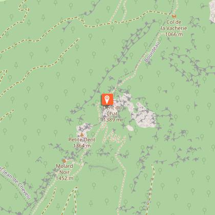
- Het uitkijkpunt van de Mont du Chat (1500m)
- Het recreatiecentrum van Chevelu
- Het Maison de la Dent du Chat in Yenne

Opgelet: kruisingen en stukken departementale weg. Wees voorzichtig!

Technische informatie

Wandel
Moeilijkheid
Eenvoudig
Duur
2h
Afstand
6.6 km
Meer informatie tonen

Hoogteprofiel

Startpunt

31 promenade du chef lieu , 73170   Saint-Paul-sur-Yenne
Lat : 45.677485Lng : 5.785221

Punten van interesse

image du object

Dent du Chat

The Dent du Chat is one of the peaks of the Mont du Chat, situated in the south of the Jura mountain range and reaching an altitude of 1390 m. It stretches along the western border of the Lac du Bourget, in the Savoie.Recognized as a remarkable regional site, the Dent du Chat is accessible to experienced hikers as well as cyclists via the Mont du Chat, a major stage of the 2017 Tour de France. From May to October, closer car access with parking is possible from Saint-Paul-sur-Yenne via the D42 departmental road near the Relais du Mont du Chat. The climb is also possible from the commune of Le Bourget-du-Lac. During the same period, refreshments are available on site at the bar-restaurant Les Aigles. A panoramic orientation table at Mollard Noir offers exceptional views over Lake Bourget. The site is also a stop in the treasure hunt game organized by the Yenne Tourist Office. To reach the Dent du Chat on foot, several routes are available: From the Relais du Mont du Chat parking: 1 hour one way (2 hours round trip), +110 m elevation gain. Access to the Mollard Noir orientation table in 40 minutes. The final section is exposed and difficult. From the Col du Chat parking (a different site from the Relais du Mont du Chat, located above the Chat Tunnel on the D914A road): 2h30 one way (5 hours round trip), +752 m elevation gain. Difficult hike with exposed sections. From the Saint-Jean-de-Chevelu leisure base parking: 6-hour loop, mostly through forest, +1250 m elevation gain. Very difficult. Access is not recommended for children or animals due to exposed and technical sections. The Dent du Chat is also associated with a local legend. Come and discover and listen to it at the Maison de la Dent du Chat in Yenne.

Route du relais du Mont du Chat puis chemin pédestre balisé 73170 Saint-Paul-sur-Yenne
- Office de Tourisme de Yenne -
Consulter

Aanvullende informatie

Contact

Phone : 04 79 36 71 54

Email : info@yenne-tourisme.fr

Website : http://www.dentduchat.fr

Open period

Het hele jaar iedere dag.

Environments

Uitzicht op rivier of beek
Vlakbij een G.R.
Uitzicht op bergen
In het bos
Uitzicht over meer
Platteland
Uitzicht op de wijngaard
Dorp op -2 km

Type of land

steenslag
Niet geschikt voor kinderwagens

Location complements

Ga vanaf de Départementale 921C naar het stadscentrum in de buurt van de Mairie en de polyvalente zaal van Saint-Paul-sur-Yenne.
Er is gratis parkeergelegenheid.

Updated by

Office de Tourisme de Yenne - 23/02/2026
www.dentduchat.fr
Report a problem

Reception complements

De lussen starten vanaf de parkeerplaats bij het gemeentehuis van St Paul sur Yenne.

Topo/stap voor stap

Start - Parkeerplaats bij het gemeentehuis van Saint-Paul-sur-Yenne 435 m.
1 / Ga richting St-Paul école.
2/ Neem het pad richting Pierre des Borrels via het gehucht Vaisselets en neem de kleine weg van Borrels.
3/Neem de weg naar "Le Petit Creux".
4/ Volg het pad 400 m in noordelijke richting en volg de hoofdweg 200 m voordat je links afslaat op een breed pad om Prariond te bereiken.
5/ Ga verder om Le Châtelard en vervolgens Les Janins te bereiken door afwisselend weiden en kreupelhout.
6/ Keer terug naar het dorp via een breed pad.

Dieren

Ja

Beoordelingen en recensies

Om te zien rondom
Zie meer
Open
Sluiten
Toon
Toon
Toon
Toon
Toon
Toon
Toon
Toon
Toon
Toon
Toon
Voorzichtigheid!
We hebben geen informatie over de moeilijkheidsgraad van dit circuit. U kunt onderweg enkele verrassingen tegenkomen. Voordat u vertrekt, aarzel niet om meer informatie in te winnen en alle nodige voorzorgsmaatregelen te nemen. Goede reis! 🌳🥾