Allarme

Allarmi

Da vedere nei dintorni
Vedi di più
Apri
Chiudi
Mostra
Mostra
Mostra
Mostra
Mostra
Mostra
Mostra
Mostra
Mostra
Mostra
Mostra

Oups... Sembra che Cirkwi non abbia il permesso di utilizzare la tua posizione.

Presentazione
Mappa
Punti di interesse
Valutazioni e recensioni
Vedi nei dintorni

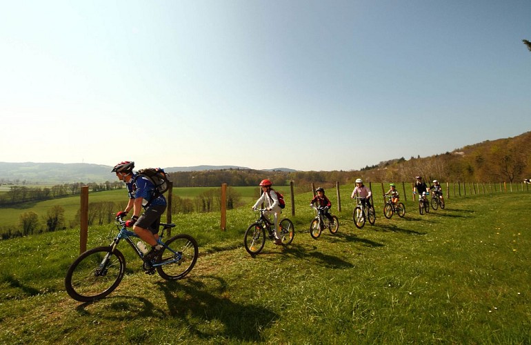
Circuit VTTAE n°4 (rouge) - Meillonnas-Treffort-Cuisiat

Informazioni tecniche

In mountain bike
Difficoltà
Medio
Durata
2h30mn
Dist.
32 km
Mostra di più

Profilo altimetrico

Punto di partenza

Cuisiat La Grange du Pin , 01370   Val-Revermont
Lat : 46.305858Lng : 5.355505

Punti di interesse

image du object

Espace Revermont mountain bike base

Espace Revermont mountain-biking base, accredited by the Fédération Française Vélo. Rendezvous in the heart of the Revermont mountains. 26 circuits, 6 marked trails from 4 to 32 km. - 650 km of marked trailsWith its hilly terrain, wild landscapes and invigorating nature, the Revermont is a great destination for mountain bikers and handlebar enthusiasts. Revermont, a land of mountains. Its sunny slopes stand in stark contrast to the misty mornings of the Bresse bocage. It's a privileged vantage point, with views across the Mâconnais to the Lyonnais mountains, the Jura and the Alps. Prepare your outings according to your desires... descents, false flats and climbs follow one another at a good pace. Cross wild, damp valleys where the moss on the trees is omnipresent. everywhere. The scenery is astonishing. Play with the Revermont mountains and ride across the plateaus on pretty single tracks that alternate between forests, meadows, dry grasslands, hillsides and ridges. Ride along the banks of the Suran or through the narrow streets of picturesque villages. At 660 m, Mont Myon is probably the most sought-after symbol. Listed as a remarkable natural site, it remains a target for many hikers. The Ain Gorge, with its cliffs, wildlife, lookouts and wilderness, is another emblematic Revermont site. Further south, the Revermont vineyards (AOP Bugey Cerdon), dominated by the Cuiron rocks and the Croix de la Dent, with their picturesque villages and vast forests. 5 departure points: Base de loisirs de la Grange du Pin à Cuisiat (Val Revermont), Stade à Simandre sur Suran, mairie de Ceyzériat, mairie de Cize and base de loisirs de l'Ile Chambod. 4 levels / 650 km marked / VTT FFCT label

330 chemin de la La Grange du Pin 01370 Val-Revermont
- Bourg-en-Bresse destinations - Office de tourisme -
Consulter
image du object

Château de Treffort

A former estate of the Counts of Savoy and architect Tony Ferret, Château de Treffort in the Ain department overlooks Bresse from the Revermont mountains.Come and discover Treffort castle, its history, the monument, meet Amédée V and Tony Ferret, its two emblematic occupants, and enjoy a magnificent setting on the heights of the village. The château museum comprises ten rooms, divided into two zones: the château entrance with the Tour Tony Ferret (8 rooms) and the Tour du Papegai (2 rooms). Visitors discover the history of the château, from its construction in the Middle Ages to its renovation by Tony Ferret in the 20th century. The tour explores several centuries of history, including seigniorial life and the family of Amédée V, the château's first Savoyard owner. Activities: - An outdoor games area for children aged 5 and over. - Screening of a story with subtitles. - Reproductions of weapons of war from different eras. - Historical lectures inside the château. - A booklet of games has been designed for children. It will be handed out free of charge at the entrance. Guided by the characters Huguette, Louis and the dog Damelot, they can discover the history of the château and its occupants through observation games and riddles. Services : - The gîte: a character house that can accommodate up to 10 people. It is located just a few meters from the château, in the village of Treffort. It offers a breathtaking view of the Bresse from the bedrooms and garden. The gîte is open all year round, by reservation only with the château. - The boutique: The boutique offers a variety of local products (honey, chocolate, oil, etc.), a selection of books, handicrafts (jewelry, stationery, etc.) and wooden toys. The store is open during museum opening hours and for special events. - The Château's pizzas are available to eat in or take away on Friday evenings all year round.

2 Place des Tilleuls 01370 Val-Revermont
- Bourg-en-Bresse destinations - Office de tourisme -
Consulter
image du object

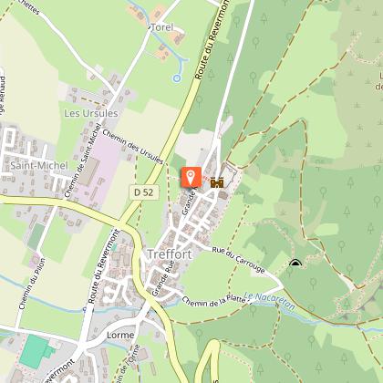
Treffort, medieval hilltop village

Treffort is the junction between the Bresse plain and the Revermont. A village of character, it has preserved its medieval layout and winegrowers' houses, and its streets are dotted with a number of interesting fountains.Treffort's history is recorded as far back as 974 (Trefortium), with the construction of the first fortified house, but there's no doubt that the site was inhabited long before that, particularly in the Gallo-Roman period. Clinging to the first ranges of the Jura, Treffort is a perched village that has retained its medieval layout. Lordship of the Counts of Burgundy, the town also belonged to the Lord of Coligny, to whom we owe the construction of the castle, and to the Lord of La Tour du Pin, who granted a charter of franchise to the inhabitants but had to cede Treffort to the Count of Savoy in 1289. The latter endowed the town with ramparts, pierced by at least six gates and defended by over thirty towers, the remains of which can still be seen today. In 1601, Treffort became part of the kingdom of France under the Treaty of Lyon. Vines also shaped the town for over a thousand years, until the arrival of Phylloxera and the First World War. Today, Comté replaces the Cavets' "p'tit vin" (nickname for the inhabitants of Revermont). Treffort was once a border town with Franche-Comté, which lies just beyond the mountain. Several times under siege, the town regained its serenity when the Comté was annexed to France in 1678. The remains of the castle (now privately owned) can still be seen from this defensive period, and you can stroll along the covered walkway that runs alongside the ancient ramparts on the valley side. Built by the Savoyards, they were pierced by at least six gates and topped by over thirty towers, and were as high as the church itself. The fortified house of the early Middle Ages was transformed in the 13th century under the impetus of the Sires de Coligny. It became a defensive castle, reinforced by eight towers, one of which served as an entrance to the south. It occupied a quadrilateral measuring 60 m x 43 m, protected to the south by a moat and drawbridge, and to the north by a trench dug into the rock, now used as a road. It was ravaged in the 16th century and transformed into a stone quarry (numerous reuses can be seen throughout the village). It was bought and partly rebuilt by Tony Ferret (1851-1923), architect of the Ain department. Rue Pelot: toponym from the Franco-Provencal ""pêl"" (hair), in connection with the skin-working industry or ""pelo"" (gruel) and the presence of grain threshing floors. The tanners found water here from the Nacaretan, an essential stream for their work away from the town, to avoid the unpleasant smell of the hides. The courtyards of the houses (on the right-hand side of the street) at the foot of the old ramparts were once used as threshing floors. Fontaine des trois jets (Three-spout fountain): this extraordinary development meant that residents no longer had to fetch water from outside the village. Legend has it that in good harvest years, wine flowed freely from this fountain. Carrouge fountain (1850): on the site of a former house (remains of a chimney, wall niches...). Carrouge, from the Latin "quadrivium", means crossroads of four roads. Rue Ferrachat: from Latin ""ferrarius"" (blacksmith) or ""ferratus"" (iron-clad). A Roman cistern lies beneath the street. Sink spouts protruding from the facades. Bridge house: this facade features mullioned windows, a basket-handle door lintel and, above all, a staircase known as a "bridge". It provided access to the house, which was elevated above the street because of the wine cellar, which was semi-buried in the rock. The other bridges were demolished in the 19th century to facilitate traffic. The hollow pillar (reused) was filled with water and used by the wheelwright to cool the metal strapping on the cartwheels and tighten them. Rue du Fiscal: led directly to the former châtellenie, where taxes were collected. Les halles: Dating from the 14th century, these were originally made of wooden pillars and wattle-and-daub walls, and hosted the market every Thursday morning. Afternoons were reserved for public audiences held by the châtelain. Destroyed by fire, they were rebuilt in the 14th century. Notre Dame de l'Assomption church (14th century) is located at the top of the village, near the castle. Its steeple was built with the help of the monks of Nantua, while the nave was left to the villagers and hastily covered. This explains the discrepancy between the nave and the bell tower. The façade was richly decorated in the 15th and 16th centuries. The Virgin and Child is sheltered by a Gothic-style canopy. On either side of the entrance portal, three coats of arms celebrate the return of Bresse and Revermont to the House of Savoy, through the marriage of Duke Emmanuel-Philibert of Savoy to François I's daughter, Marguerite de France. The cross over the gable is pierced by an oculus, and its center features fleur-de-lys branches. Inside, the Louis XIV-style stalls are remarkable. The carved medallions depict the life of Saint-Bruno, founder of the Carthusian order, from the time he took the habit to his death.

Le village 01370 Val-Revermont
- Bourg-en-Bresse destinations - Office de tourisme -
Consulter
image du object

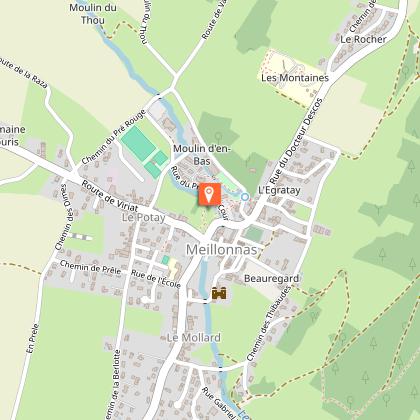
Village of Meillonnas

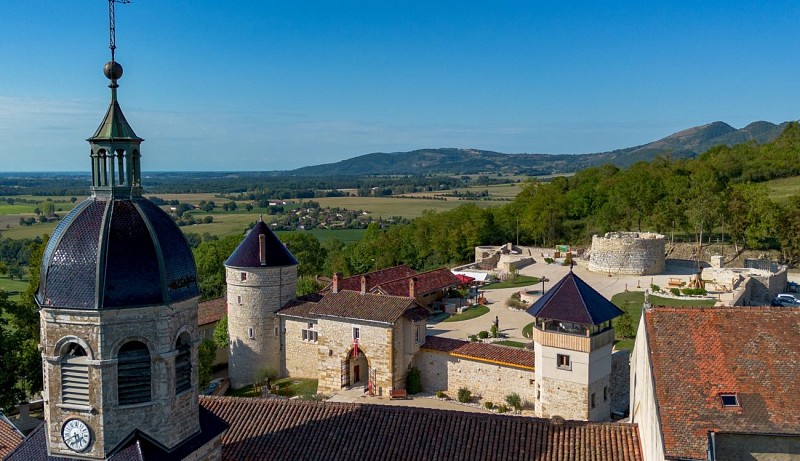
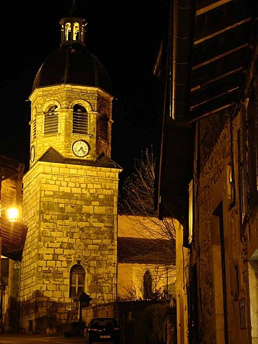
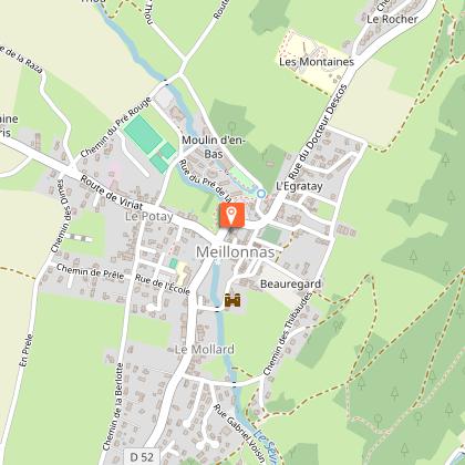
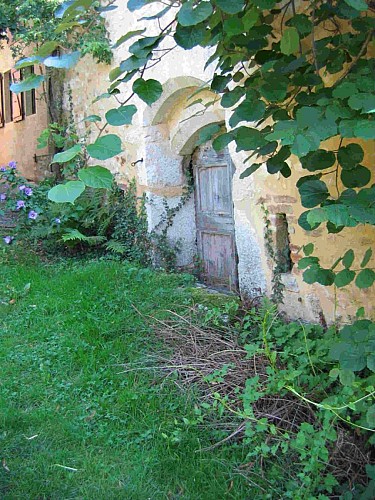
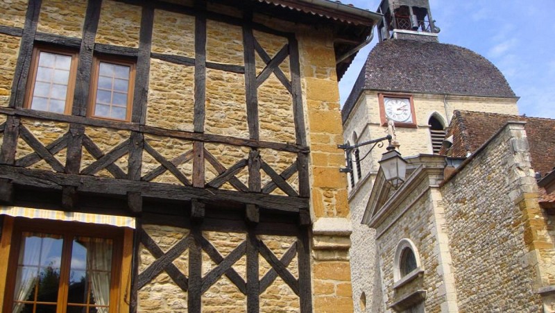
At the foot of the hills, along an ancient road that ran alongside the Revermont, the ancient fortified town of Meillonnas still has part of its castle and enclosure. It owes its fame to the earthenware it produced in the 18th and 19th centuries.The château was probably built around 1350 by the son of Humbert de Corgenon, bailiff of Bresse. From the 15th to the 18th century, it belonged to the La Chambre-Seyssel, a Savoyard family who sold it in 1740 to Nicolas de Marron, uncle of the founder of the earthenware factories. Since Gallic times, Meillonnas has been associated with the manufacture of ceramics ("In villa Mellionaco"... Mellona = Gallo-Roman estate), as the clays in the area are of excellent quality. At the end of the 16th c., a glazed earthenware called "green service" was distributed throughout the region and beyond Lyon. From common, utilitarian pottery made in tupinières (tupin = pot), the focus shifted to the "fabrique en fayance" founded in 1760 by the Marron family, in their château. The proximity of the local waterway, the Sevron, contributed to this activity. The Marrons owned the château until 1839, when earthenware production ceased. The finest pieces can now be seen at the Musée du Revermont in Cuisiat and the Musée de Brou in Bourg-en-Bresse. Note that the street signs are made of earthenware! The Saint-Oyen church was largely rebuilt in the 17th and 19th centuries, but the Notre-Dame chapel bears witness to its medieval past. It was founded by the knight Jean de Corgenon in 1382, as attested by the inscription engraved on the keystone. He commissioned frescoes to decorate the church, which can still be seen today and constitute the most complete ensemble in the département (classified MH). The Italian-inspired artist remains anonymous, but the influence of Giotto can easily be seen. On the outside, the bell tower is topped by an imperial-style dome. Meillonnas boasts a number of fine old houses, some of them half-timbered, such as the former presbytery opposite the church. There is even a "rue des colombages". There are also three fortified houses "hors les murs" (outside the walls) on the chemin de Beauregard, dating from the 16th century, when the second enclosure was built (the first dates from the 15th). Also worth a visit near the château is the Balland park, crossed by the Sevron river and featuring a small waterfall: a truly romantic haven of peace. And here and there, works of art adorn the green spaces: the work of artist friends of Roger Vailland, whose house can be seen in the street that bears his name since 1989 (grave in the communal cemetery). A small roadside building, which can be likened to a gazebo, originally stood at the corner of the Viriat and Treffort roads. But it was moved because it was in the way of traffic. It is linked to the house visible at the far end of the park, a 19th-century colonial Reunion-style house. On this island, the Creole name "Guétali" is given to this type of construction, meaning "look at him". It's a small corner pavilion used to watch what's going on in the street without being seen!

- Bourg-en-Bresse destinations - Office de tourisme -
Consulter

Informazioni aggiuntive

Updated by

Bourg-en-Bresse Destinations - Office de tourisme - 09/06/2026
www.bourgenbressedestinations.fr
Report a problem

Environments

In prossimità di un itinerario GR
Vista montagna
In un bosco
Spiaggia a 300 m
Campagna
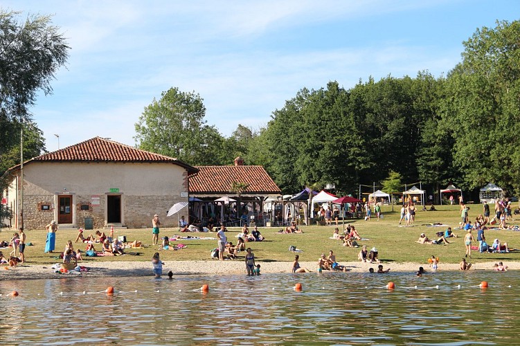
Lago o bacino d'acqua a -5 km
Villaggio a -2 km

Distinctions

Elencato nel PDIPR
Etichetta MTB - FFCT

Open period

Tutto l'anno ogni giorno.

Type of land

ciottoli
Terra

Animali

No

Valutazioni e recensioni

Da vedere nei dintorni
Vedi di più
Apri
Chiudi
Mostra
Mostra
Mostra
Mostra
Mostra
Mostra
Mostra
Mostra
Mostra
Mostra
Mostra
Attenzione!
Non abbiamo informazioni sulla difficoltà di questo percorso. Potresti incontrare alcune sorprese lungo il cammino. Prima di partire, non esitare a informarti ulteriormente e a prendere tutte le precauzioni necessarie. Buon viaggio! 🌳🥾