Allarme

Allarmi

Da vedere nei dintorni
Vedi di più
Apri
Chiudi
Mostra
Mostra
Mostra
Mostra
Mostra
Mostra
Mostra
Mostra
Mostra
Mostra
Mostra

Oups... Sembra che Cirkwi non abbia il permesso di utilizzare la tua posizione.

Presentazione
Mappa
Punti di interesse
Valutazioni e recensioni
Vedi nei dintorni

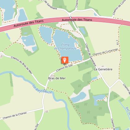
Randonnée - Plan d'eau de Champataule & Bois de But

Informazioni tecniche

A piedi
Difficoltà
Medio
Durata
4h30mn
Dist.
15 km
Mostra di più

Profilo altimetrico

Punto di partenza

Plan d'eau de Champataule Sud , 01440   Viriat
Lat : 46.260517Lng : 5.200612

Punti di interesse

image du object

Etang de But, ENS de l'Ain

The "Etang de But" site has been designated a sensitive natural area (ENS). It belongs to a chain of ponds in the southern Bresse plain, marking the transition to the Dombist plateau.This artificial pond is remarkable for the species of flora and fauna it contains. Set in a forest setting and sometimes covered with a carpet of white water lilies, it offers a variety of landscapes through the seasons. Key issues for the site Fauna: presence of the Leucorrhine dragonfly, yellow-bellied toad, great crested newt, Little Bittern, Black-crowned Night-Heron. Flora: Royal fern, water scorpion, Bohemian sedge, etc. The woodlands near the pond have a role to play in the pond's ecological functioning, in addition to their landscape value. Good management of these woodlands is essential. The main threats are the risk of the pond filling up, and invasion by invasive species. To discover the site... An information panel is located at the thou (drainage system), to the west of the pond. The site is generally accessible to pedestrians. The Etang de But was awarded the ENS or espace naturel sensible label by the Département de l'Ain in 2015. True natural and landscaped jewels of the Ain department, these ENS-labeled sites are on the one hand preserved through local management and on the other made accessible to as many people as possible when the fragility of the site allows.

But 01370 Saint-Étienne-du-Bois
- Bourg-en-Bresse destinations - Office de tourisme -
Consulter

Informazioni aggiuntive

Environments

Campagna
In prossimità di un lago o di un bacino d'acqua
In prossimità di un fiume
In un bosco
Lago o bacino d'acqua a -5 km
Fiume a -5 km
Vicino del acqua
Stagno entro 5 km

Updated by

Bourg-en-Bresse Destinations - Office de tourisme - 24/11/2025
www.bourgenbressedestinations.fr
Report a problem

Open period

Tutto l'anno ogni giorno.

Type of land

Terra
Rivestimento duro (catrame, cemento, pavimentazione)

Valutazioni e recensioni

Da vedere nei dintorni
Vedi di più
Apri
Chiudi
Mostra
Mostra
Mostra
Mostra
Mostra
Mostra
Mostra
Mostra
Mostra
Mostra
Mostra
Attenzione!
Non abbiamo informazioni sulla difficoltà di questo percorso. Potresti incontrare alcune sorprese lungo il cammino. Prima di partire, non esitare a informarti ulteriormente e a prendere tutte le precauzioni necessarie. Buon viaggio! 🌳🥾