Allarme

Allarmi

Da vedere nei dintorni
Vedi di più
Apri
Chiudi
Mostra
Mostra
Mostra
Mostra
Mostra
Mostra
Mostra
Mostra
Mostra
Mostra
Mostra

Oups... Sembra che Cirkwi non abbia il permesso di utilizzare la tua posizione.

Presentazione
Descrizione
Mappa
Punti di interesse
Valutazioni e recensioni
Vedi nei dintorni

Sentiero escursionistico della Loza

Sentiero escursionistico della Loza

Descrizione

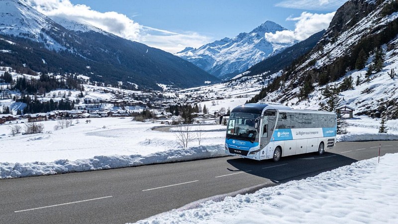
Si tratta di un'escursione di contrasti, che vi porterà abilmente dai boschi ai pascoli e ai prati di alta montagna. Un'esposizione ideale per passeggiate fuori stagione che richiedono molto sole.

Pronti a superare la barriera dei 1000 metri? Avete mai sentito le pigne del pino silvestre schioccare alla luce del sole? La lunga e sostenuta salita attraverso la profumata pineta vi offre questa opportunità durante una pausa al Mont, a 1770 metri di altitudine. Potreste anche scorgere l'erica delle nevi, una pianta rara e protetta, tutta vestita di rosa. È così precoce che riesce a fiorire sotto le ultime nevi. La radura che si apre davanti a voi lascia il posto all'ultima impegnativa salita. Si entra con orgoglio nel Parco Nazionale della Vanoise. Il pendio diventa più dolce quando si raggiunge la Croix de la Loza. Accomodatevi in questo punto di osservazione. Si vedono le cime del Bramanais e del Mont Cenis, a volte avvolte dalle nubi della Lombarde. Con cautela, si può entrare nella Combe de Bonne nuit. A 3695 metri di altitudine, la Dent Parrachée e le sue creste affilate meritano rispetto. Immaginate le spettacolari valanghe che a volte scendono su Sollières in inverno! Durante la discesa, assicuratevi di fare una pausa fresca e di allacciare gli scarponi di conseguenza.

Informazioni tecniche

A piedi
Difficoltà
Difficile
Durata
4h
Dist.
12 km
Mostra di più

Profilo altimetrico

Punto di partenza

Route de l'Eglise Sollières-Sardières , 73500   Val-Cenis
Lat : 45.264204Lng : 6.805526

Punti di interesse

image du object

Vanoise National Park

The Vanoise National Park is located in the eastern part of the Savoie department, in the Vanoise mountain range, which connects the two high valleys of Maurienne and Tarentaise, near the Italian border.The park encompasses high mountains, rising to over 3,000 meters, on which numerous glaciers remain, but which are also cut by valleys opening onto wide, easily accessible mountain passes. Sheltered from oceanic rains by the Pre-Alps and the Belledonne Range, the massif enjoys a relatively dry and sunny climate. BY THE NUMBERS - 53,300 hectares, or 533 km², of the park’s core area - 25 municipalities, 17 of which are within the park’s core area - 224 protected species in the park’s core area (all protection statuses) - 400 km of marked trails - 40 mountain huts in the park’s core area - 5 nature reserves adjacent to the National Park - Elevations in the core area: highest 3,855 m (La Grande Casse) and lowest 1,280 m - 14 km of shared border with the Gran Paradiso National Park in Italy (Parco nazionale Gran Paradiso) A PROTECTED AREA The Vanoise National Park was created to protect the Alpine ibex. Protection has since been extended to other animal and plant species. The core area of the Park covers 53,300 hectares under special protection governed by specific regulations established by a decree of the Council of State. With 33 natural habitats—31 of which are of Community interest—more than 2,860 plant species (300 of which are protected at the national level), nearly 1,000 species of fungi, and 325 vertebrate species—representing 65% of the vertebrates found in metropolitan France, 92% of which are protected—the territory of the Vanoise National Park is a vast reservoir of biodiversity. The variety of its rocks (limestone, gypsum, sandstone, quartzite, schist, mica schist, gneiss…), combined with a highly complex geological structure, the wide range of elevations, and its position at a climatic crossroads, all contribute to the massif’s remarkable geological, floristic, and faunal richness. Thanks to their 14-km shared border, the Italian Gran Paradiso National Park and the Vanoise National Park form one of the largest protected areas in Western Europe, covering 1,250 km². NATIONAL NATURE RESERVES The Park has also managed four national nature reserves on behalf of the government since their creation. The Grande Sassière, Plan de Tuéda, Tignes-Champagny, and Bailletaz reserves cover a combined area of just over 5,100 ha, contiguous within the heart of the Park. The National Forest Service, for its part, manages the Hauts de Villaroger National Nature Reserve. A LIVING TERRITORY Shaped by human presence spanning thousands of years, the Vanoise is a living territory that benefits from the preservation of its heritage combined with sustainable and respectful development. Agriculture and tourism are major activities that contribute to the region’s prosperity and value but also have an impact on its natural heritage. Throughout history, humans have developed high-altitude agropastoralism—a traditional practice of livestock raising and cheese production that contributes significantly to the diversity of the landscapes and the character of the National Park. The presence of wolves, predation, and protective measures (herding dogs) have altered pastoral practices. The Park is committed to supporting all users of the area. Together with farmers, it therefore defines economically and environmentally sound land-use systems within the Park’s core area. Tourism is the major economic driver of the high valleys surrounding the Park’s core area. In addition to the winter sports resorts—which today form the largest ski area in Europe, with significant implications for the Park’s core—there is tourism focused on exploring and appreciating unspoiled nature and landscapes, whose reputation extends far beyond the country’s borders. Through its collaboration with local stakeholders, the National Park contributes to the economic and social vitality of the upper Tarentaise and Maurienne valleys. The growth of recreational activities and climate change also prompt us to reevaluate certain development models in light of the sensitivity of ecosystems and species: adapting visitor capacity, promoting sustainable transportation, and reducing impacts on flora and fauna are areas that require further exploration. A PARK ACCESSIBLE TO ALL The Vanoise National Park is committed to supporting people with disabilities: mountain huts and trails in the Vanoise that are accessible to all, adapted educational resources and activities, and projects led by the National Park to ensure access to nature for everyone.

- Apidae -
Consulter

Data e ora

  • Dal 01/06/2027 al 15/10/2027

Informazioni aggiuntive

Open period

Dal 01/06 al 15/10 ogni giorno.

Con riserva di condizioni di neve et meteorologiche favorevoli.

Distinctions

Elencato nel PDIPR

Updated by

Communauté de communes Haute Maurienne Vanoise - 18/11/2026
www.cchautemaurienne.com
Report a problem

Environments

In un bosco
Vista montagna
Montagna
In prossimità di una fermata di un mezzo di trasporto pubblico
Fermata autobus a meno di 500 m
Stagno entro 5 km
In una riserva naturale

Type of land

ciottoli
Terra
trucioli
Non adatto ai passeggini

Location complements

Partenza dal villaggio lungo la RD83.
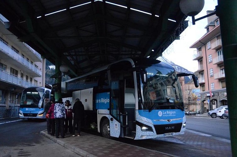
Per arrivare in autobus: linea S52 - fermata Mairie, linea S53 - fermata Les Favières.
Per arrivare in auto: parcheggiare vicino alla chiesa/ufficio del sindaco di Val Cenis Sollières.

Topo guides and map references

Topo guides references :
Mappa e libretto "Haute Maurienne Vanoise. 120 passeggiate ed escursioni - 36 itinerari. Per tutti i livelli" (in vendita a 12 € negli uffici del turismo).

Map references :
Mappa IGN 3634OT - Val Cenis Mappa IGN 3534OT - Les Trois Vallées

Reception complements

La durata del tour è calcolata in base ai tempi di riferimento: 300 m/h in salita, 500 m/h in discesa e 4 km/h in pianura.

Poiché i pericoli possono verificarsi in qualsiasi momento sui percorsi, le tracce GPX fornite non sono contrattuali. Sono fornite a titolo puramente informativo. I ciclisti le utilizzano sotto la propria responsabilità in base al loro livello di padronanza degli strumenti tecnologici e alla loro comprensione del terreno.

Topografia/passo passo

Per guidarvi sul terreno, consultate il diagramma direzionale "passo dopo passo" fornito in pdf.

Animali

No. Gli animali domestici non sono ammessi in questa passeggiata nel Parco Nazionale della Vanoise.

Autore dei dati

Valutazioni e recensioni

Da vedere nei dintorni
Vedi di più
Apri
Chiudi
Mostra
Mostra
Mostra
Mostra
Mostra
Mostra
Mostra
Mostra
Mostra
Mostra
Mostra
Attenzione!
Non abbiamo informazioni sulla difficoltà di questo percorso. Potresti incontrare alcune sorprese lungo il cammino. Prima di partire, non esitare a informarti ulteriormente e a prendere tutte le precauzioni necessarie. Buon viaggio! 🌳🥾