Allarme
Allarmi
Tipo di pratica
A piedi
Molto facile
1h
Presentazione
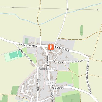
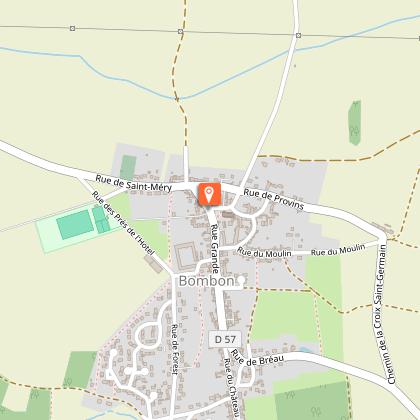
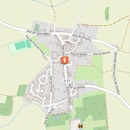
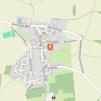
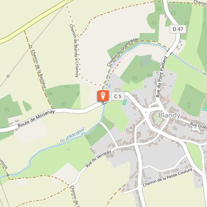
Mappa
Tappe
Punti di interesse
Sintesi di Cirkwi
Valutazioni e recensioni
Vedi nei dintorni
Passeggiata a Bombon


Credito : CCBRC
Il breve di Cirkwi
Scopri il fascino storico di Bombon a piedi
Imbarcati in un viaggio affascinante attraverso i paesaggi pittoreschi e la ricca storia di Bombon. Questo pittoresco villaggio, situato nel cuore della Val d'Ancœur, offre un mix unico di tradizioni rurali e significato storico. Proposto dalla Communauté de Communes Brie des Rivières et Châteaux, questo tour a piedi invita i viaggiatori a immergersi in un comune dove una volta fiorivano i vigneti e ora regna la competenza agricola. Vivi la tranquillità delle antiche strade, meravigliati di fronte a una chiesa del XII secolo e lasciati affascinare dal maestoso castello che ha resistito alla prova del tempo. Senti l'essenza della Francia rurale e le sue vibrazioni storiche ad ogni passo.
Dettagli del percorso: numeri e pendenza
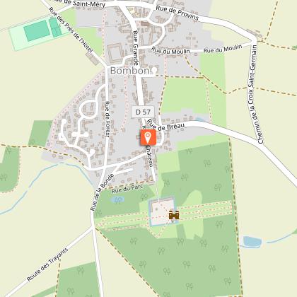
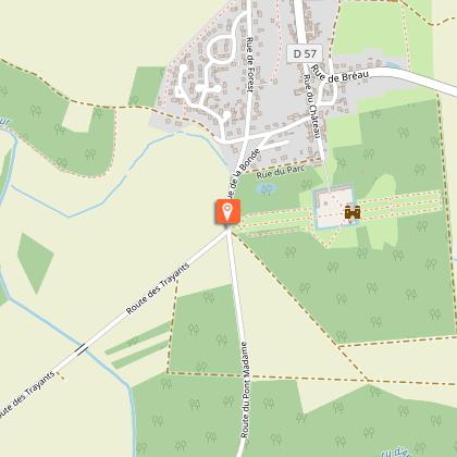
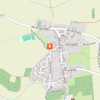
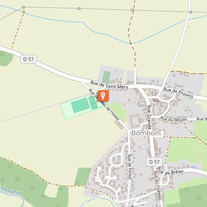
Coprendo una distanza di 2,9 km con un dislivello che varia tra i 93 e i 114 metri sul livello del mare, questa camminata è perfetta per gli appassionati di tutti i livelli. L'ascesa totale e la discesa variano leggermente, marcate a 36-38 metri, presentando un pendio dolce. L'itinerario, curato dalla Communauté de Communes Brie des Rivières et Châteaux, non è segnato, aggiungendo un elemento di avventura, ma è diretto, tornando al punto di partenza presso la Chiesa di Saint-Germain. Analizzando tecnicamente, questo percorso è una scelta eccellente per una breve esplorazione tranquilla dei gioielli storici di Bombon.
Suggerimenti stagionali e raccomandazioni di sicurezza
Indipendentemente dalla stagione, la bellezza di Bombon è sempre verde. Tuttavia, la primavera offre un ambiente lussureggiante e vibrante, rendendola un momento ideale per gli appassionati di fotografia. L'estate porta tutto il grandioso della campagna, anche se mantenere un'adeguata idratazione è fondamentale. L'autunno ti circonda con una tavolozza di colori, ideale per passeggiate rilassanti, mentre l'inverno, spesso mite, richiede comunque abbigliamento appropriato per le giornate più fredde. Assicurati sempre di indossare scarpe comode e portare acqua, specialmente durante i mesi più caldi. Familiarizzati con il percorso in anticipo per migliorare la tua esperienza e rispetta le proprietà private, in particolare intorno al castello.
Una passeggiata attraverso la storia di Bombon
Bombon, una gemma della regione della Brie, non è solo un villaggio; è un museo vivente che mostra tradizioni rurali in un contesto di eventi storici significativi. La presenza del quartier generale dei generali alleati durante la Prima Guerra Mondiale e la brillante strategia del Maresciallo Foch che ha portato alla vittoria degli Alleati, hanno conferito a Bombon il titolo di "Culla della Vittoria". Questo villaggio, con la sua antica chiesa e l'emblema storico del castello, testimonia la resilienza e l'evoluzione della Francia rurale. Le sfumature architettoniche e storiche di Bombon offrono un affascinante sguardo al passato, arricchendo l'esperienza di camminata ad ogni passo.
Condizioni meteorologiche regionali e migliori momenti per visitare
Bombon ha un clima temperato, caratterizzato da inverni miti ed estati calde. Le precipitazioni sono relativamente distribuite uniformemente durante l'anno, rendendo Bombon una meta tutto l'anno. Tuttavia, il periodo migliore per visitare è tra la fine della primavera e l'inizio dell'autunno, quando il tempo è più favorevole per le camminate. Durante questi mesi, le temperature sono comode e il paesaggio naturale è al suo massimo, offrendo un'esperienza di camminata incomparabile attraverso i paesaggi storici e naturali di Bombon.
Imbarcati in un viaggio affascinante attraverso i paesaggi pittoreschi e la ricca storia di Bombon. Questo pittoresco villaggio, situato nel cuore della Val d'Ancœur, offre un mix unico di tradizioni rurali e significato storico. Proposto dalla Communauté de Communes Brie des Rivières et Châteaux, questo tour a piedi invita i viaggiatori a immergersi in un comune dove una volta fiorivano i vigneti e ora regna la competenza agricola. Vivi la tranquillità delle antiche strade, meravigliati di fronte a una chiesa del XII secolo e lasciati affascinare dal maestoso castello che ha resistito alla prova del tempo. Senti l'essenza della Francia rurale e le sue vibrazioni storiche ad ogni passo.
Dettagli del percorso: numeri e pendenza
Coprendo una distanza di 2,9 km con un dislivello che varia tra i 93 e i 114 metri sul livello del mare, questa camminata è perfetta per gli appassionati di tutti i livelli. L'ascesa totale e la discesa variano leggermente, marcate a 36-38 metri, presentando un pendio dolce. L'itinerario, curato dalla Communauté de Communes Brie des Rivières et Châteaux, non è segnato, aggiungendo un elemento di avventura, ma è diretto, tornando al punto di partenza presso la Chiesa di Saint-Germain. Analizzando tecnicamente, questo percorso è una scelta eccellente per una breve esplorazione tranquilla dei gioielli storici di Bombon.
Suggerimenti stagionali e raccomandazioni di sicurezza
Indipendentemente dalla stagione, la bellezza di Bombon è sempre verde. Tuttavia, la primavera offre un ambiente lussureggiante e vibrante, rendendola un momento ideale per gli appassionati di fotografia. L'estate porta tutto il grandioso della campagna, anche se mantenere un'adeguata idratazione è fondamentale. L'autunno ti circonda con una tavolozza di colori, ideale per passeggiate rilassanti, mentre l'inverno, spesso mite, richiede comunque abbigliamento appropriato per le giornate più fredde. Assicurati sempre di indossare scarpe comode e portare acqua, specialmente durante i mesi più caldi. Familiarizzati con il percorso in anticipo per migliorare la tua esperienza e rispetta le proprietà private, in particolare intorno al castello.
Una passeggiata attraverso la storia di Bombon
Bombon, una gemma della regione della Brie, non è solo un villaggio; è un museo vivente che mostra tradizioni rurali in un contesto di eventi storici significativi. La presenza del quartier generale dei generali alleati durante la Prima Guerra Mondiale e la brillante strategia del Maresciallo Foch che ha portato alla vittoria degli Alleati, hanno conferito a Bombon il titolo di "Culla della Vittoria". Questo villaggio, con la sua antica chiesa e l'emblema storico del castello, testimonia la resilienza e l'evoluzione della Francia rurale. Le sfumature architettoniche e storiche di Bombon offrono un affascinante sguardo al passato, arricchendo l'esperienza di camminata ad ogni passo.
Condizioni meteorologiche regionali e migliori momenti per visitare
Bombon ha un clima temperato, caratterizzato da inverni miti ed estati calde. Le precipitazioni sono relativamente distribuite uniformemente durante l'anno, rendendo Bombon una meta tutto l'anno. Tuttavia, il periodo migliore per visitare è tra la fine della primavera e l'inizio dell'autunno, quando il tempo è più favorevole per le camminate. Durante questi mesi, le temperature sono comode e il paesaggio naturale è al suo massimo, offrendo un'esperienza di camminata incomparabile attraverso i paesaggi storici e naturali di Bombon.
Generato automaticamente.
Informazioni tecniche
A piedi
Difficoltà
Molto facile
Durata
1h
Dist.
3 km
Tipo di pratica
A piedi
Molto facile
1h
Mostra di più
Profilo altimetrico
Punto di partenza
9
Place de l'église
,
77720
Bombon
Lat : 48.574463Lng : 2.858589
Punti di interesse


Autore dei dati

1 rue des Petits Champs 77820 Le Châtelet-en-Brie France
Valutazioni e recensioni
Da vedere nei dintorni