Alerta

Alertas

Para ver alrededor
Ver más
Abrir
Cerrar
Mostrar
Mostrar
Mostrar
Mostrar
Mostrar
Mostrar
Mostrar
Mostrar
Mostrar
Mostrar
Mostrar

Oups... Parece que Cirkwi no tiene permiso para usar tu ubicación.

Presentación
Mapa
Puntos de interés
Calificaciones y reseñas
Ver alrededor

Le chemin des pêcheurs - balade

1 alerta en este circuito

Alerte visiteurs

Itinéraire potentiellement soumis à de forts dégâts dus à des évènements météorologiques majeurs et dont la viabilité peut être incertaine, renseignez-vous avant de vous engager sur ce parcours.

Informaciónes técnicas

A pie
Dificultad
Muy fácil
Duración
2h
Dist.
3.8 km
Mostrar más

Perfil altimétrico

Punto de partida

38750   Huez
Lat : 45.080617Lng : 6.058348
Puntos de interés

image du object

At the Col de Sarenne (1999 m)

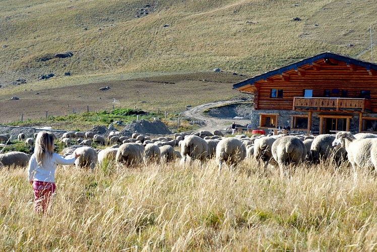
Located at the end of a winding road, the Col de Sarenne links the Sarenne and Ferrand valleys. It offers an unspoilt natural setting, ideal for a picnic or a stopover at the sheepfold, and marks the start of the hike to the Croix de Cassini.Getting to the Col de Sarenne is an adventure in itself. The narrow asphalt track winds up the side of a cliff, offering breathtaking views of the Ferrand valley and the Écrins massif along the way. Accessible only in summer, when the snow has left the mountain, it immediately sets the mood with its impressive climb. The Col de Sarenne is an ideal spot for a break in the heart of nature, a picnic facing the mountains or a stopover at the col's sheepfold, where you can discover and taste local cheeses. It's also the starting point for the hike to the Croix de Cassini. This aerial and technical hike leads to the summit of the Croix de Cassini, at 2,361 m altitude. From the summit, a 360° panorama opens up over the surrounding mountains and, on a clear day, Mont Blanc can be seen on the horizon. The experience is accessible to those with a little mountaineering experience, and offers a breathtaking panorama. In summer, the Col de Sarenne is also very popular with cyclists for its wild and demanding character, and is on the route of the 2026 Tour de France. In winter, it gives its name to the "Sarenne" ski run, the longest black run in Europe, linking the Pic Blanc at 3,330 m to the Sarenne gorges over a distance of almost 18 km. Around the pass, wetlands and high-altitude marshes contribute to the ecological richness of the site. Fed by melting snow, these fragile environments play an essential role in local biodiversity, and bear witness to the natural balance preserved in the heart of the mountain pastures. An authentic, lively site, where nature remains largely unspoiled: marmots and chamois roam the alpine pastures, while orange lilies and gentians color the meadows, and a few crystals dot the ground.

Col de Sarenne 38142 Clavans-en-Haut-Oisans
- Oisans Tourisme -
Consulter

Información adicional

Environments

En montaña

Updated by

Alpe d'Huez Tourisme - 30/07/2026
www.alpedhuez.com
Report a problem

Open period

Del 01/05 al 30/11/2026.

Contact

Phone : 04 76 11 44 44

Email : info@alpedhuez.com

Website : https://www.alpedhuez.com

Animales

No

Calificaciones y reseñas

Para ver alrededor
Ver más
Abrir
Cerrar
Mostrar
Mostrar
Mostrar
Mostrar
Mostrar
Mostrar
Mostrar
Mostrar
Mostrar
Mostrar
Mostrar
¡Precaución!
No tenemos información sobre la dificultad de este circuito. Es posible que encuentre algunas sorpresas en el camino. Antes de salir, no dude en informarse más y tomar todas las precauciones necesarias. ¡Buen viaje! 🌳🥾