Alerta
Alertas
Voie Verte La Traverse

Informaciónes técnicas
Perfil altimétrico
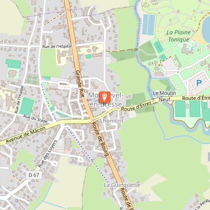
Punto de partida
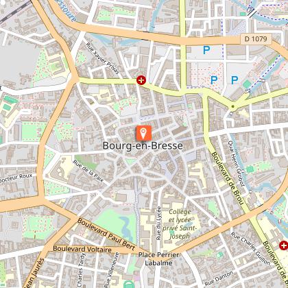
Puntos de interés


Información adicional
Updated by
Bourg-en-Bresse Destinations - Office de tourisme - 09/06/2026
www.bourgenbressedestinations.fr
Report a problem
Environments
En ciudad
Itinerario ciclista a menos de 1 km
Cerca de una autopista
Playa a 300 m
Carril bici/ruta a menos de 500 metros
Orilla del agua
A 10-20 minutos en bicicleta de una estación SNCF
En el campo
A las afueras de la ciudad
En el casco histórico
Centro del pueblo
Centro de la ciudad
Río a -5 km
Lago o estanque a -5 Km
A 20 - 30 minutos a pie de una estación SNCF
Cerca de una parada de transporte colectivo
Pueblo a -2 km
Ruta de senderismo señalizada a menos de 500 m
Distinctions
Etiqueta VTT-FFCT
Open period
Todo el año todos los dias.
Contact
Phone : 04 74 22 49 40
Email : accueil@bourgenbressedestinations.fr
Website : https://www.bourgenbressedestinations.fr
Facebook : https://www.facebook.com/BourgenBresseTourisme
Type of land
Recubrimiento duro (alquitrán, cemento, pisos)
Animales
Sí
Autor de los datos
