Alerta

Alertas

Para ver alrededor
Ver más
Abrir
Cerrar
Mostrar
Mostrar
Mostrar
Mostrar
Mostrar
Mostrar
Mostrar
Mostrar
Mostrar
Mostrar
Mostrar

Oups... Parece que Cirkwi no tiene permiso para usar tu ubicación.

Presentación
Descripción
Mapa
Puntos de interés
Calificaciones y reseñas
Ver alrededor

Le lac de Paladru

1 alerta en este circuito
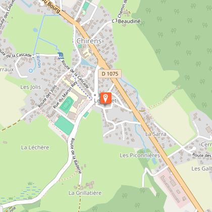
LE LAC DE PALADRU:

Alerte visiteurs

Le lac de Paladru est sujet à de fortes affluences durant la période estivale avec un pic de fréquentation les week-ends de beaux temps et jours fériés.
Préférez plutôt la semaine pour venir en toute tranquillité ! N'hésitez pas à passer voir les conseillères en séjour à l'office de tourisme pour des suggestions alternatives à proximité.

Descripción

Un comienzo suave a lo largo del Isère, que le llevará suavemente sobre el Col de la Placette para dominar las colinas de Valdaine y las aguas azules del Lac de Paladru.

Saliendo de Grenoble por el Quai de France, tome la carretera de la orilla derecha del Isère hasta el puente de Veurey. Después del puente, tome la pasarela Roise a la derecha hacia Voreppe.

En el pueblo, gire a la izquierda por la D520 y afronte el Col de la Placette (la subida es agradable gracias al corredor diseñado para cicloturistas). Desde el puerto, descienda hasta Pont Demay y gire a la izquierda hacia St-Etienne-de-Crossey, después, en el pueblo, tome la D49 en dirección opuesta hacia St-Nicolas-de-Macherin y Chirens por un pequeño tramo de la D1075.

En Chirens, gire a la izquierda hacia Clermont et Colletière y tome la D50d hacia Paladru y siga el lago hacia Charavines. Justo antes de Charavines, gire a la derecha por la D50e hacia Oyeu, luego a la izquierda por la D520e hacia Colombe y Rives, y de nuevo a la izquierda hacia Renage.

En el pueblo, gire a la derecha en el semáforo por la D1092 y, poco después, a la izquierda por la D45 en dirección a St-Quentin-sur-Isère.

Antes del puente sobre el Isère, gire a la izquierda por el carril bici que bordea el río y vuelva a Grenoble por el camino inverso.

(Distancia aprox. 45 km)

Informaciónes técnicas

En bicicleta de carretera
Dificultad
Difícil
Duración
7h
Dist.
105 km
Mostrar más

Perfil altimétrico

Punto de partida

38000   Grenoble
Lat : 45.193561Lng : 5.722547

Puntos de interés

1 alerta
image du object

Lake Paladru

5km long, 1km wide and 392 ha in surface area, it is the 5th largest natural glacial lake in France. Did you know that, in addition to giving the lake its beautiful turquoise color, the lake chalk that covers its bottom is good for the skin?Shaped during the Ice Age, its banks were home to one of the Isère's 1st human communities in 2700 BC (the Neolithic village of Les Baigneurs). Later, knights from the An Mil period settled on the Colletière site. The remains unearthed during numerous archaeological digs are now on display in the new Musée archéologique du lac de Paladru ( MALP ) in Paladru. The site is also remarkable for its 7 protected natural areas, including the Grands Roseaux to the north of the lake, an ideal nesting ground for birds (mallards, swans, coots and great crested grebes) and spawning grounds for fish (carp, tench, etc.); these reed beds remain inaccessible. To discover the flora and fauna, take the greenway to join the marsh path, which has 4 discovery stations. At a depth of 36 m, its temperature rises to 25° in summer. It is fed by two tributaries, the ruisseau de Courbon and the ruisseau du Pin. At its southern end, the overflow is evacuated via an outfall that forms the La Fure spring. Water is released via surface sluice gates, combined with a weir when the lake's "zero" level is exceeded, and via a deep-water draw-off device (siphon at -30 m), which discharges into the Fure 5 m downstream of the sluice gates. The lake is accessible via 4 municipal beaches: 3 are fee-paying (plages du Pin, Paladru and Montferrat) and 1 is free (plage de Chararvines). SWIMMING is permitted ONLY on these supervised beaches. Animals are not allowed on the beaches. 2 recreation areas, Le Bois d'Amour in Charavines and La Verronière in Montferrat, are freely accessible for picnics by the lake. Please note: barbecues are prohibited in all Tour du Lac areas. The "Blue" lake is not only unique in its color, it's also a private lake that promotes tranquility and family activities. It is also open to fishing and boating. For more information on boating, fishing, swimming and other water sports, visit www.lacpaladru.com/reglement or ask one of our Tourist Office advisors... Whether you're a keen hiker, mountain biker or cyclist, you'll be able to tour the lake and discover all its facets. There's something for everyone, depending on the route you take! And if you'd like to see all the marked trails, the hiking map is available for €5, while the mountain bike map is available free of charge from our reception desks.

- Office de Tourisme du Pays Voironnais -
Consulter

Información adicional

Updated by

Isère Attractivité - 18/02/2026
www.alpes-isere.com
Report a problem

Environments

Al Borde de lago o estanque
Orilla del agua
En el campo

Consejos

Por el camino, podrá refrescarse en el Lac de Paladru.

Open period

Todo el año todos los dias.

A reserva de buen tiempo.

Contact

Phone : 04 76 42 41 41

Email : info@grenoble-tourisme.com

Website : https://www.grenoble-tourisme.com/fr/

Topo guides and map references

Map references :
Mapa IGN Top 100 nº 51 - Mapa Michelin Local nº 333

Calificaciones y reseñas

Para ver alrededor
Ver más
Abrir
Cerrar
Mostrar
Mostrar
Mostrar
Mostrar
Mostrar
Mostrar
Mostrar
Mostrar
Mostrar
Mostrar
Mostrar
¡Precaución!
No tenemos información sobre la dificultad de este circuito. Es posible que encuentre algunas sorpresas en el camino. Antes de salir, no dude en informarse más y tomar todas las precauciones necesarias. ¡Buen viaje! 🌳🥾