Para ver alrededor
Ver más
Abrir
Cerrar
Mostrar
Mostrar
Mostrar
Mostrar
Mostrar
Mostrar
Mostrar
Mostrar
Mostrar
Mostrar
Mostrar

Oups... Parece que Cirkwi no tiene permiso para usar tu ubicación.

Descripción
Mapa
Puntos de interés
Calificaciones y reseñas
Ver alrededor

Ruta de descubrimiento: el valle del Giffre y el Cirque du Fer à Cheval

Ruta de descubrimiento: el valle del Giffre y el Cirque du Fer à Cheval

Descripción

Un típico valle alpino con una mezcla de bosques, pastos, cultivos, pueblos soleados y aldeas. Descubra las estaciones de los pueblos turísticos. Paisajes pastorales dominados por las montañas, con el río Giffre recorriendo el fondo del valle.

Salir de Annemasse por carretera en dirección a Taninges. En el Pont de Fillinges (Il km), diríjase a Viuz-en-Sallaz y a su museo campesino. Continúe hacia Saint-Jeoire (20 km) y después hacia Mieussy (27 km).


Un pequeño desvío sólo posible en verano: tomar la carretera de Sommand (carretera sinuosa) que domina el valle y ofrece una magnífica vista de la cordillera del Mont Blanc. Llegada a Sommand (35 km): pastos alpinos en verano y estación de esquí en invierno (circo de montaña - paseos). Continúe por el Col de la Ramaz - 1557 m de altitud (cerrado en invierno) para llegar a Praz-de-Lys (41 km): estación turística dominada por la Pointe de Marcelly, con una hermosa vista de la cadena del Mont-Blanc.
A continuación, descienda hasta Pont des Gets (46 km) para volver a la ruta principal.

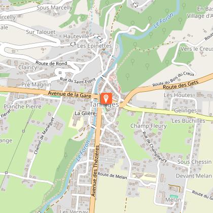
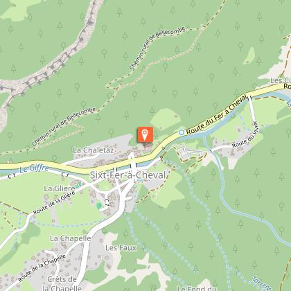
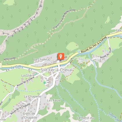
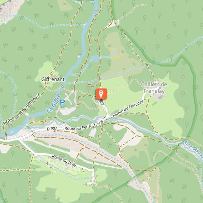
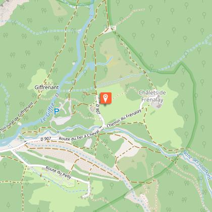
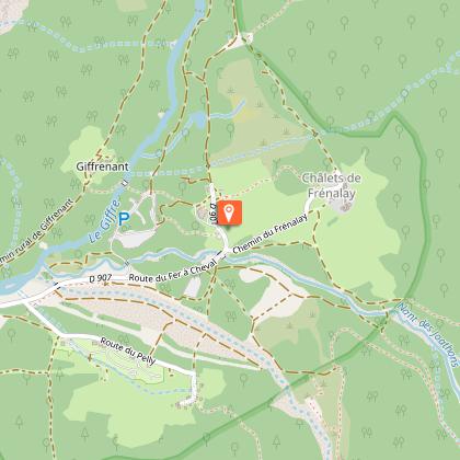
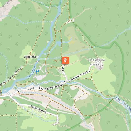
Taninges (54 km): Ciudad muy antigua en la encrucijada de dos valles (Carillon de Taninges - Chartreuse de Mélan - Iglesia y claustro). Continúe hasta Samöens (65 km): Estación turística muy agradable y bien desarrollada, con un atractivo centro urbano en el que destaca un tilo bicentenario, una típica grenette y una antigua iglesia con un pórtico tallado. A continuación, Sixt-Fer-à-Cheval (72 km): Pueblo saboyano situado en el fondo del valle, a orillas del Giffre. Antigua abadía del siglo XI. Cascada de Rouget. Y por último, la ruta termina en el Circo del Fer à Cheval: un impresionante circo de montaña dominado por el Pic de Tenneverge (2987 m). En el fondo del valle se pueden realizar bonitos paseos y es un lugar turístico notable con numerosas cascadas.

Regreso a Annemasse por la misma ruta directa.
(Sixt - Samoëns - Taninges - Le Pont de Fillinges - Annemasse).
Aproximadamente 145 km.

Informaciones técnicas

Este circuito fue actualizado el: 19/04/2024
145 km
max. 1612 m
min. 435 m

Perfil altimétrico

Punto de partida

Place de la Gare , 74100 Annemasse
Lat : 46.199595Lng : 6.237506

Puntos de interés

image du object

Ecomusée Paysalp

A museum that recounts life in the mountains in the last century. Carpenters, blacksmiths, farmers... tell you about their daily lives in an immersive exhibition. As a family, with friends, as a couple or even on your own, we look forward to welcoming you.There are so many unusual objects in this museum! But who did they belong to, and what could they have been used for? It's up to you to find out with our game booklets for young and old. You'll even be able to solve a certificate exercise in the classroom, bringing back memories for some. Are you a gamer? Then our Absurd Game is for you: a timed exploration of the Museum filled with enigmas. Can you conjure up the curse that threatens you? Groups all year round on reservation: www.paysalp.fr

628 av. de Savoie 74250 Viuz-en-Sallaz
- Môle et Brasses tourisme -
Consulter
image du object

Chartreuse de Mélan

Avenue Melan Mélan 74440 Taninges
- Conseil Départemental Haute-Savoie / Tourisme -
Consulter
image du object

Peal of bells at Taninges and harmonium museum

The peal of bells at Taninges, in the church belltower, is the largest in the area: it has 40 bells and every year attracts expert bellringers for concert performances. It also houses a collection of harmoniums.

Rue de la Poste - Église 74440 Taninges
- Praz de Lys Sommand Tourisme -
Consulter
image du object

St Jean-Baptiste Church of Taninges

A monumental church by its size but also by its history !Built between 1824 and 1834 by the architect Prosper Dunant, the St Jean-Baptiste church is from the last architectural style of the States of Savoy : neo-classic Sardinian. Before, it was the biggest of the diocese of Annecy : 58 m length, 27 m wide and 18 m height. The facade of the building looks austere with few ornaments, but inside there is a profusion of decoration : paintings on the vault and pillars, stalls, carved wood and multicolored stained glasses. The visitor will visit a religious building and will discover how the jacquemarde population was decorating its churches there during the XIXth century.

- Praz de Lys Sommand Tourisme -
Consulter
image du object

Samoëns Tourist Office

The safest way to a successful holiday in Samoëns. Located near the centre of the village, beside a vast free car park, the artificial winter ice rink, the Tourist Office is open to visitors all year round.Within the framework of its quality reception approach, the Tourist Office participates in the success of your stay, by offering you, via its reception and information area, free services which will improve and simplify your holidays in Samoëns and by committing itself to provide you with the following services - To provide you with the information you need to make your stay in our village resort a success. - To assist you in your search for accommodation and to direct you to the service provider(s) likely to be able to help you. Our reception service offers you the following services: - Registration for free events offered by the tourist office - Sale of posters and goodies with the Samoëns logo - Photocopying - Provision of documentation on the resort's surroundings. - Sale of hiking maps and snowshoeing routes. - Sale of fishing permits

66 place de l'Office de tourisme 74340 Samoëns
- OT Samoëns -
Consulter
image du object

The Cascade du Rouget

Also known as "The Queen of the Alps", is Sixt's best-known waterfall. The torrent surges dramatically in two huge steps, falling for over 80 metres.It's located 6 kilometres beyond the hamlet of Salvagny, and you can get there easily by car except in winter. In the winter months the road is closed to cars but you can park near the road block and then walk or snowshoe to the waterfall. It takes an hour and a half there and back and is at a height of 1000 metres - a height gain of about 100 metres from the car park.

Salvagny 74740 Sixt-Fer-à-Cheval
- Haut-Giffre Tourisme -
Consulter
image du object

A walk to the Cascade du Rouget

Discover the Rouget waterfall and have your efforts rewarded with this magnificent spectacle! The hike takes you to the foot of the waterfall.

Salvagny 74740 Sixt-Fer-à-Cheval
- Haut-Giffre Tourisme -
Consulter
image du object

Sixt-Fer-à-Cheval church

A 13th-century church comprising an abbatial part and a parochial part. You can wander freely in the gardens.

Chef-Lieu 74740 Sixt-Fer-à-Cheval
- Haut-Giffre Tourisme -
Consulter
image du object

Abbaye de Sixt Fer A Cheval

Place du Tilleul 74740 Sixt-Fer-à-Cheval
- Haut-Giffre Tourisme -
Consulter
image du object

Picnic area at the Cirque du Fer à Cheval

A picnic area has been installed at the Cirque du Fer-à-ChevalPlease follow these rules of good practice: - Do not leave any wrappers behind - a rubbish bin is provided - Show respect and good manners to ensure others enjoy the facilities

Cirque du Fer à Cheval 74740 Sixt-Fer-à-Cheval
- Haut-Giffre Tourisme -
Consulter
image du object

Bureau des Guides de Sixt-Fer-à-Cheval

These qualified guides have a passion for what they do and can propose a whole range of mountaineering activities."Modern Tradition". This is the spirit that guides the Guides of Sixt Fer-à-Cheval. It is part of the tradition of the third oldest Guides de France company, founded in 1865 in Sixt. Here for you whatever your project, in these mountains or others around the world.

Maison de la Montagne 74740 Sixt-Fer-à-Cheval
- Haut-Giffre Tourisme -
Consulter
image du object

Fer-à-Cheval Chalet Restaurant

Enjoy the traditional food with a breathtaking view of the Fer-à-Cheval circle. Located near the car park, easily access this restaurant which offers typical Savoyard dishes.The Cirque du Fer-à-Cheval Chalet Restaurant welcomes you to a magical place. You will be left speechless by the magnificent views... You can come here for lunch or just for an afternoon snack after a hiking expedition. Evening meals and banquets are available but only with prior bookings.

6113 route du Fer à Cheval Cirque du Fer à Cheval 74740 Sixt-Fer-à-Cheval
- Haut-Giffre Tourisme -
Consulter
image du object

Fer-à-Cheval Cirque

The Fer à Cheval is the largest mountain cirque in the Alps. Ringed by towering cliffs, the cirque is breathtakingly beautiful throughout the year but it is most spectacular in the spring, when melting snow swells its waterfalls to majestic proportions.Lying at the eastern end of the Giffre Valley, the cirque forms an immense amphitheatre almost 5 km across and bounded by 500- to 700-m high limestone cliffs. In June, dozens of waterfalls cascade down these huge walls. The Fer à Cheval attracts large numbers of visitors and is twinned with the Gavarnie Cirque in the Pyrenees.

Cirque du Fer-à-Cheval 74740 Sixt-Fer-à-Cheval
- Haut-Giffre Tourisme -
Consulter
image du object

The 30 waterfalls of the Cirque du Fer à Cheval

A unique area with impressive rock faces, cliffs 2000 metres high, and hiking trails past numerous waterfalls.Some waterfalls at Fond de la Combe and Nants des Peres at Fer a Cheval are fed by glaciers. If you begin at the bar/restaurant at Plan des Lacs and look towards the Pic de Tenneverge, you'll see two notable waterfalls below the Corne du Chamois: la Meridienne , and to the right of that, la Pierrette. This is also called la Fontaine de l'Or and is one of the highest. Further to the right, on the cliffs of Le Fer a Cheval, are other waterfalls, for example the Joaton, Pissevache, the Lyre (one of the most beautiful), and the Genette. Even further to the right are le Saint-Jacques, la Citerne, le Folly, and la Massue waterfalls. Going in to the Fond de la Combe valley, to the left of the Corne du Chamois, there are many other waterfalls such as le Rejon, la Cage, la Scie, le Violon, and la Gouille. Leaving Fer a Cheval and following the Giffre downstream youi'll find the village of Le Brairet between Le Molliet and Les Curtets. Above this is Le Dard waterfall.

- Haut-Giffre Tourisme -
Consulter
image du object

Piste de luge

- Haut-Giffre Tourisme -
Consulter
image du object

Sixt-Fer-à-Cheval / Passy Nature Reserve

Sixt-Fer-à-Cheval/Passy Nature Reserve, the biggest nature reserve in Haute-Savoie, covers a vast region and boasts two impressive glacier cirques (Fer à Cheval and Les Fonts), both bursting with spectacular waterfalls.Sixt-Fer-à-Cheval/Passy Nature Reserve, the biggest nature reserve in Haute-Savoie, is an exclusively limestone universe featuring a wide variety of forms sculpted by erosion: fissures, grooves, etc. It covers 9,000 hectares across different mountain levels: sub-alpine, alpine and nival, from the banks of the Giffre at 900 metres up to the top of Buet culminating at over 3,000 metres. This range of elevations and the diversity of terrains (wet zones, mixed forests, cliffs, grassy areas, etc., offer contrasting habitats that are richly populated with a wide variety of wildlife species. From the forests to the highest peaks, approximately 800 plant species have been recorded in the nature reserve, including 28 different orchids! Sixt forest is dominated by beech and spruce, but only the most compatible plants can be found in the mountain pastures. Because the habitat changes with the altitude, there is a huge diversity of animal species: deer, wild boar, marmot, mountain hare, etc.. Wild animals thrive in the tranquillity of the nature reserve: ibex, bearded vulture, rock ptarmigan and royal eagle. To view real-time car park attendance, please click here: affluences.com/parking-de-sixt-fer-a-cheval

Maison de la Réserve Naturelle 74740 Sixt-Fer-à-Cheval
- Haut-Giffre Tourisme -
Consulter

Información adicional

Environments

En montaña
En el campo
Vista a la montaña

Updated by

Office de Tourisme des Monts de Genève - 18/04/2024
www.montsdegeneve.com
Report a problem

Open period

Todo el año.
Cuidado con las condiciones de acceso en invierno (nieve).

Contact

Phone : 04 50 95 07 10

Email : ot@montsdegeneve.com

Facebook : www.facebook.com/montsdegeneve/

Autor de los datos

Image Monts de Genève
propuesto por Monts de Genève
Place de la Gare 74100 Annemasse France

Calificaciones y reseñas

Para ver alrededor
Ver más
Abrir
Cerrar
Mostrar
Mostrar
Mostrar
Mostrar
Mostrar
Mostrar
Mostrar
Mostrar
Mostrar
Mostrar
Mostrar