Tours
Activities
Places of interest
Where to eat
Where to sleep

Explore Mas-blanc-des-alpilles, Bouches-du-Rhône

Are you in charge of the destination?
Nestled in the heart of the Alpilles, Mas-blanc-des-alpilles is a charming Provencal village offering a myriad of activities and attractions for visitors. Stroll through its picturesque streets lined with olive trees and enjoy the fresh air of Provence-Alpes-Côte d'Azur. Nearby, discover the fascinating Alpilles Regional Natural Park, perfect for hiking or biking through breathtaking landscapes an...See more

Walking around Mas-blanc-des-alpilles

See more suggestions
Explore the parks and paths of Mas-blanc-des-alpilles.
See more suggestions
SAINT ETIENNE DU GRES - Cycling tour in Alpilles, in 3 days
2.5 km

SAINT ETIENNE DU GRES - Cycling tour in Alpilles, in 3 days

Between cliffs, vineyards and olive trees, indulge in the identity of the Alpilles! Back to the car park, follow on the right the D32, direction Fontvieille. At the intersection with the D33, take it on the left. After 500 m, fork right on the Joncs draille At the end, find the D33 and join Fontvieille on the right. 1- At the roundabout, take left, and then at the crossroads continue straight. After 2.5 km, turn left on the road, direction "Aqueduct Romain". . Follow it for 6 km to the village center of Paradou. 2- At the crossing, continue on the avenue Jean Bessat. Take the D17 on the right, then on the left the D78b direction Les Baux. At the end, follow to the right the D78f. 1 km further, turn right on the D27 and reach the town center of Maussane. 3 - at the intersection with the D17, turn to the left. After 800 m, take to the left the D5, direction of Eygalières. At the next intersection, follow the direction "Le Petit Roman" on the right. Continue on this road until the intersection with the D17. 4- Turn left on Alphonse Daudet road, before the D17, and continue to the roundabout. Take it on the left to follow the D24. After 1.5 km, turn right onto the D24a and follow it to Aureille. 5- Take the D25a on the left. After 4 km, go right on the D25 and continue for 7.5 km. At the junction with the D569, turn right. At the roundabout, continue straight for 150 m. 6- Turn left towards Sénas and continue for 7 km. Take the roundabout direction Sénas. After 300 meters, turn left on the path of "Donne", just before the level crossing. Continue to Orgon. 7- Go through Orgon via rue de la Fontaine and Edmond Coste Street. Continue by the Paradis uphill and the avenue Jean Moulin. At the intersection with the D24b, turn left and continue for 7 km to Eygalières. 8- Cross the village and continue on the D24b for 2 km. Turn left on the D24, towards Mouriès. At the foot of Calans, turn right on the GR marked path. Pass by the bridge called Romain, the triangular junction stays on the right and follow this path for 3 km. 9- Continue straight on the Aurelia road to the city entrance sign. Continue to Van Gogh Avenue. Cross it and follow Joseph d'Arbaud Avenue. Continue on the "Chemin Gaulois". Turn left after the canal, then take the old road on the left to Arles until the intersection with the D27. Cross it and continue straight on to St-Etienne du Grès.

72 h
93 km
Easy
Show
SAINT REMY DE PROVENCE - Cycling from the Alpilles to Val d'Enfer
5.2 km

SAINT REMY DE PROVENCE - Cycling from the Alpilles to Val d'Enfer

Go through the ages with the exceptional historical heritage of the Alpilles! From the Inter communal Tourist Office of Saint-Rémy-de-Provence, take the D5 towards the Glanum site to the junction with Joseph d'Arbaud Avenue. 1 - Turn right on the avenue. Continue straight on "Chemin Gaulois" to the irrigation canal. Turn left after the canal, then take the old road on the left to Arles until the intersection with the D27. 2 - Take the D27 left towards Les Baux-de-Provence. Climb the road for 4 km, then go down the Val d'Enfer to Baux-de-Provence. 3 - Continue on the D27 towards Maussane-les-Alpilles to the junction with the D78f. Turn left and continue until the intersection with the D17 in the heart of Maussane-les-Alpilles. 4- Cross the D17 and continue on the way to the pine forest. At the crossroads of the D78c, take it on the right. Continue to the center of Paradou and the intersection with the Belle Croix road. 5 - Turn left on Belle Croix road and continue for about 5 km until you reach the D33. 6 - Turn right towards Fontvieille, until you reach the junction with the D17a. Cross this crossroads and continue towards Saint-Etienne du Grès 7 - (Caution!) At the intersection with the D33a, turn left and continue using the coloured shoulder to the Saint Gabriel chapel. 8 - Just after the chapel, turn right on the D32, always towards Saint-Etienne du Grès. Cross the village, past the town hall. 9 - Before the exit of the village, take on the right the little path of Notre-Dame-du-Château. 10 - After a small bridge, take on the left the path of Calanquet. Continue for 700 m then at the crossroads with the D31, turn right and continue to the center of Saint-Rémy-de-Provence. At the church, turn right to join the departure car park.

4 h
41 km
Medium
Show
LES BAUX DE PROVENCE - The Baumayrane ridges
5.5 km

LES BAUX DE PROVENCE - The Baumayrane ridges

Leave the foot of Baux-de-Provence, and win the roof of the Alpilles by the peaceful trail of the Lombards! Back to the Carrières de Lumières car park, take the road on the left, and go directly left on a road marked PR. Continue down this road until the D27 Turn right and follow this road to the entrance of the Baumanière hotel. 1- Cross the road to reach a Department sign and take the path marked PR. At the fork, follow the path marked PR on the right. At the next intersection, turn right and then left just before a Canadian crossing. 500 m further, join another intersection and its Canadian crossing.2- bifurcate to the left on a tarmac path marked PR. Pass the Sainte-Berthe Mas and continue until the D27. Cross it, then after 150 m take path on the right marked PR. Follow it for 800 m until you reach a crossroads. Cross it and continue straight. At the next intersection keep left and join a hairpin bend. 3- At the bend, take a path marked PR on the left, preceded by a hard-wired barrier. Climb this track in laces for 3 km. At the intersection marked with a cairn, turn left on the track marked GR®, following the sign of the Department "Les Baux-de-Provence 3.7 km". At the next intersection, stay on the GR®6 and follow it for 1.7 km to a cistern. 4- 100 m further, go down on the left the marked path PR, indicated by the sign of the Department "Les Baux-de-Provence by the Val d'Enfer 2 km". At the next junction, continue straight until you reach the D27 road. Follow it to the left to find the starting point.

4 h
12 km
Medium
Show
LES BAUX DE PROVENCE - Le Val d'Enfer
5.8 km

LES BAUX DE PROVENCE - Le Val d'Enfer

Discover the landscapes evoking the Hell of Dante by browsing the Val d'Enfer ! With your back to the Tourist Office, turn right and cross the esplanade. At the end, go down the stairs and follow the road on the left. At the intersection, follow the road to the right in direction of Maillane. Go past the Quarries of Lights, ignore the road that goes down to the left, and just after the sign of end of agglomeration take on the right the way marked PR. Continue straight on this road for 500 m. 1- At the crossing, turn right on the blue marked path, then ignore the path on your left. At the next intersection, climb the path to the left and continue for 1 km. Ignore the path on your left and join immediately after a crossroads near a buried cistern. 2- Take the marked GR® trail on the left and follow it to a DFCI barrier. Climb the very wide path on the right leading to a panorama. Go down the path on the left. Follow the road on the right for 200 m to reach the pierced rock. Return of the descended path by foot. 3- Turn right on the path, follow it for 500 m, and find the intersection of point1. Go down the path already practiced in the other direction and join the end of agglomeration sign. Follow the road towards the Carrières de Lumières and take the marked road PR on the right. Follow it on 200 m. 4- At the level of the stone, engraved ""Le Val d'Enfer - les Portelets", take on the right the way with the feet of the rocks on a few meters, then to return on your steps. Continue on the marked road PR, until the small parking of the old school of Les Baux On the left of the school, go up the concrete road to join the D27. 5- (Caution, traffic) Cross the road and climb the stairs on the right to a parking lot. Once on the parking lot, climb the paved street, pass a fortified gate and cross the town center of Les Baux to reach the starting point.

3 h
6.2 km
Easy
Show
SAINT REMY DE PROVENCE - The Alpilles ridge
6 km

SAINT REMY DE PROVENCE - The Alpilles ridge

Take full view, during this sensational circuit that will take you to discover the Alpilles in all their facets! The burial works of the High Voltage line of the Caume, Saint-Rémy-de-Provence will take place between 18/09/2017 and 22/12/2017, down from the telecommunication relay to the Plaines car park. Diversion routes will be set up except for the portion between Vallon de Valrugues and the plateau, on the route of Gr6, which will be completely closed for a few weeks. Consult the map of the works on the Park's website for more details. From the Antiques car park, along the D5 towards Saint-Rémy-de-Provence, and turn right to join the Cloister of Saint Paul Mausole, at the end of the path lined with plane trees. 1- Facing the Cloister, follow the road on the right to bypass it. At the Relais Information Service panel of the Alpilles Regional Nature Park, take Chemin des Carrières on the right. Follow the marked path PR (in yellow), which crosses valley and forest. 2- At the crossroads with the small paved road, follow it to the left. Continue on the road to the telecommunication tower of the Caume plateau. At the tower, turn left towards GR®6. After the sign of "Biotope", follow the ridge line to the right by a series of rocky steps. 3- After 2 km, turn to the right following the GR®6 and join the foot of the peaks. Continue between rocky passages and undergrowth to the Vallongue pass and its rocky gorge. Go down to the left to a road near the airfield (some passages require the hands). 4- Take the path on the left. From this point the circuit will be double marked PR (yellow) and GR® (red / white) until arrival. Continue for 3 km, remaining attentive to the marking, until a junction of marked paths and a property lined with walls. 5- Turn left and walk 500 m. Take a track on the right and then a small asphalt road. At the hairpin bend, turn left onto the path lined with properties. 6- At the fork stay on the right, further pass a barrier then continue to a stone cottage. After the shed, turn left. Cut the path where the GR®6 passes, go up between two wooden barriers and continue to the right on the path that joins the starting point.

6 h
16 km
Hard
Show

What to do in Mas-blanc-des-alpilles

See more suggestions
The best experiences in Mas-blanc-des-alpilles are just a click away, book now.
See more suggestions
The Alyscamps necropolis and Saint Honnorat church
16 km

The Alyscamps necropolis and Saint Honnorat church

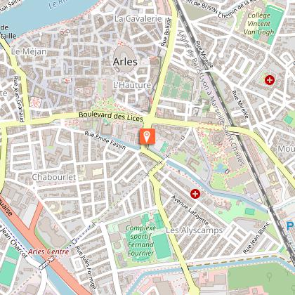
Les Alyscamps, a Christian necropolis listed as a UNESCO World Heritage Site, offers a walk lined with remarkable sarcophagi. At the heart of the site, the church of Saint-Honorat marks the starting point of the Chemin d'Arles to Compostelle. This emblematic site, immortalized by Vincent Van Gogh in his works, is a veritable treasure trove of Provence. With every step you take between the majestic rows of slender cypress trees, you'll feel the evocative power of this place steeped in history. Les Alyscamps is much more than just a Roman cemetery. History lovers will find an alley of sarcophagi and chapels. Pilgrims will find the starting point of the Chemin d'Arles (a UNESCO World Heritage site) to Santiago de Compostela. And everyone will find a haven of tranquillity, where time seems to stand still. At the very heart of the Alyscamps site is the church of Saint-Honorat, a jewel of medieval architecture that plays a key role for pilgrims. Dating back to the 12th century, this spiritual site marks the starting point of the Chemin d'Arles, one of France's main routes to Santiago de Compostela. With its carved portal and serene atmosphere, the church invites contemplation and is the perfect introduction to this historic and spiritual route. With Luma Arles and Frank Gehry's modern Tower in the background, Les Alyscamps is a testament to the link between past and present, a place where history, art and nature blend harmoniously. To visit this site is to immerse yourself in a unique experience, where the soul of the place is revealed to those who take the time to explore it. To make the most of your visit, we recommend purchasing a pass (available from our online ticketing service), which will enable you to visit the city's various museums and monuments more economically. Guided tours and cultural events take place during every school vacation. Please note that although most of the site is accessible to people with reduced mobility, some areas may be difficult to access.

Avenue Des Alyscamps 13200 Arles
Book from 0 €Book
Show
Discover the blooming lavender fields and Provençal markets
18 km

Discover the blooming lavender fields and Provençal markets

Discover the lavender fields by minibus in one day! Enjoy the exceptional panoramic views and discover the region's most beautiful villages! **THIS SERVICE IS ONLY AVAILABLE JUNE TO AUGUST** Start your minibus tour with a stunning view of the region and its lovely lavender fields in full bloom! Discover and stroll through traditional open-air markets. You will be amazed at the incredible palette of colours created and the captivating scents of lavender! Cross through the lavender fields with your driver/guide and reach the typical village of Sault or Roussillon (depending on the bloom of the lavender fields). Make the most of your free time to discover the traditional shops and unique savoir-faire of the region! You can also choose one of its delicious restaurants for lunch. Gordes, listed as "France's most beautiful village" will welcome you and offer you breathtaking views of Provence! Then finish your circuit by visiting the Lavender Museum in Coustellet where you will discover all the production secrets of lavender circuits! You will make a stop at Sénanque Cistercian Abbey (from 15 June to 15 July) located at the foot of a lavender field! You will marvel at this idyllic view! At the end of the day, you will return to Avignon accompanied by your driver. This tour will immerse you in the heart of Provence where you will soak up the flavours and the typical atmosphere of the region!

Cours Jean Jaurès 84000 Avignon
Book from 115 EURBook
Show

What to visit in Mas-blanc-des-alpilles

See more suggestions
Discover the local markets of Mas-blanc-des-alpilles.
See more suggestions

Where to eat in Mas-blanc-des-alpilles

See more suggestions
Restaurants in Mas-blanc-des-alpilles will captivate you.
See more suggestions

Where to sleep in Mas-blanc-des-alpilles

See more suggestions
Explore hostels and hotels in Mas-blanc-des-alpilles.
See more suggestions
Caution!
We have no information on the difficulty of this circuit. You may encounter some surprises along the way. Before you go, please feel free to inquire more and take all necessary precautions. Have a good trip! 🌳🥾