Tours
Activities
Places of interest
Where to eat
Where to sleep

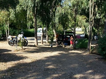
Explore Ajaccio near Camping Les Mimosas

Are you the owner?
Adventure and exploration await around Camping Les Mimosas in Ajaccio, Corse-du-Sud, Corse. Start your journey with a visit to Maison Bonaparte, the birthplace of Napoleon Bonaparte, where history and culture intertwine. Don't miss a visit to the Cathedral of Our Lady of the Assumption, an architectural gem.

Nature lovers can enjoy the crystal-clear waters and stunning landscapes of Porticcio B...
See more

Walking around CAMPING LES MIMOSAS

See more suggestions
Explore the hiking trails around CAMPING LES MIMOSAS.
See more suggestions
GT20 /  ETAPE 11 : ZICAVU - ZONZA
33 km

GT20 / ETAPE 11 : ZICAVU - ZONZA

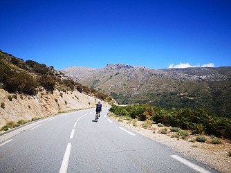
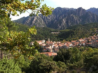
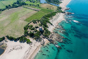
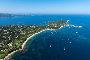
In the heart of the wide open spaces of the south of the island, stage 11 of the GT20 links **Zicavu** to **Zonza**, at the foot of the majestic Aiguilles de Bavella. Over 44 km and with a climb of around 800 metres, this crossing combines high altitude panoramas, pastoral plateaux and emblematic mountain passes. You're in the heart of the Corsican Regional Nature Park, an unspoilt area where the Taravo and Alta Rocca valleys are revealed in all their glory. From the very first kilometres, the road winds through meadows and forests, in an authentic mountain atmosphere. You'll want to stop off at the Cuscione plateau, a vast high-altitude setting renowned for its remarkable biodiversity. On foot, this site offers a timeless interlude between pozzines, streams and infinite horizons. The main difficulty of the stage is the ascent to **a Bocca di Vacca (Vaccia pass)**, culminating at 1,193 metres. Approximately 14 km long at an average gradient of 3%, the climb is steady, gradual and punctuated by typical encounters: pigs and cows roaming free are a reminder that you are crossing pastoral territory - caution is recommended. At the junction between the Taravo valley and the Alta Rocca, the pass comes into view after a long flat stretch, offering a breathtaking view of the south of the island. The gentle, sometimes winding descent stretches for 13 km to Aullène (Auddè), before the final undulations to Zonza. The final kilometres alternate between gentle climbs and flat stretches, with the spectacular silhouettes of the Aiguilles de Bavella in the background. A grandiose finish for an immersive stage, where nature, altitude and traditions shape the profound identity of Corsica.

3 h
44 km
Medium
20132 Zicavo
Show
GT20 / ETAPE 7 : PORTU - VERGHJU
36 km

GT20 / ETAPE 7 : PORTU - VERGHJU

Halfway through the GT20, it's time for one of the island's legendary climbs. From **Portu (Porto)** to **Col de Verghju (Vergio)**, Corsica's highest road pass, this 7ᵉ stage unfurls 34km of continuous climbing for 1,486 metres of positive vertical drop. A veritable vertical journey, from the sea to the wide open spaces of the mountains. From the very first kilometres, the sea fades into the rear-view mirror. The road climbs up the cliff face, offering the prospect of the next twist in the road at every bend, before plunging into the spectacular Spelunca Gorge. The scenery changes dramatically: sheer cliffs, rocky chaos and a river below make for a striking start. After an initial 10km ascent, a short flat area allows you to catch your breath before the climb to **Evisa**, a village clinging to the mountain. The crossing, sometimes at 8%, is a reminder that you are gradually gaining in altitude. The route then enters the majestic Aïtone forest, home to slender laricio pines and crystal-clear natural pools. The shade is welcome and the atmosphere cooler, almost alpine. The last ten kilometres are steeper, at around 6%, until you reach the Niolu region via the summit of the Col de Vergio. At an altitude of 1,477 metres, the panorama opens up onto a mineral and pastoral world, emblematic of the Corsican interior. An immersive, progressive stage, where every pedal stroke brings you closer to the beating heart of the island's mountains.

4 h
33 km
Hard
20150 Porto
Show
SENTIER DU PATRIMOINE SERRA DI SCOPAMENE
37 km

SENTIER DU PATRIMOINE SERRA DI SCOPAMENE

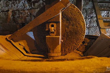
This easy, well-marked trail passes through landscapes typical of Corsican rural life and highlights elements of the past that bear witness to the local agro-pastoral culture. The trail begins in the heart of the village, with a typical cobbled descent (calade) towards the Vangonu district, where the chestnut groves once flourished, a vital resource for the inhabitants of this mountain region. Along the way, you'll discover - the "U Siccatoghju" chestnut dryer, a small traditional building used in the past to dry chestnuts after harvesting, an essential stage before processing them into flour or eating them - U Fragnu" water mill, fed by an aqueduct and set beside a stream. This mill is a fine example of traditional Corsican hydraulic architecture and a reminder of the importance of water for domestic and agricultural use - old vegetable gardens, bordered by dry stone walls, which bear witness to the self-sufficiency of the villagers in the past - fountains and wash-houses, essential community places in the daily lives of the villagers, where people came to draw water and wash their clothes. Along the way, the path winds its way between dry-stone walls typical of Corsican rural architecture, leading you to a neighbourhood dominated by beautiful light-coloured granite houses with their sober, massive architecture. Why is this walk interesting? This trail is more than just a walk: it's designed as an interpretation trail of the local heritage. It's an ideal walk for everyone: families, heritage enthusiasts, curious walkers or visitors wanting to understand how Corsican communities lived in harmony with their environment.

50 min
1.3 km
Easy
VILLAGE 20127 Serra-di-Scopamène
Show
GT20 / ETAPE 9 : CORTI - GHISONI
41 km

GT20 / ETAPE 9 : CORTI - GHISONI

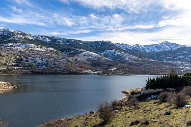
Set course for one of the most demanding and contrasting stages of the GT20. Between Corti (Corte) and Ghisoni, this 57km route has a total climb of almost 1,400 metres. An intense crossing of the mountainous heart of the island, between suspended villages and spectacular gorges. From Corti, the ancient historic capital dominated by its citadel, the route heads towards Venacu (Venaco) before branching off eastwards. The road soon becomes more winding and climbs up the twists and turns leading to Bocca a Croce. The ascent of the Col de Croce - 12 km and around 500 metres of ascent - puts the legs to the test. The effort is sustained, but rewarded by sweeping panoramic views over the hills of central Corsica. The villages of Noceta, Ruspigliani and Vezzani punctuate the route with their typical silhouettes, clinging to the mountainside. At the summit, there's a long, smooth and exhilarating descent of almost 17km. After crossing the Col de Cardo, the road joins the D69 towards Ghisoni. The scenery changes again, as you pass the Sampolu dam, the gateway to an impressive natural site. You arrive via the spectacular Défilé de l'Inzecca, famous for its sheer rock faces and narrow road with tight bends. The atmosphere here is mineral, almost wild, before reaching Ghisoni, a mountain village nestling in the heart of an unspoilt environment. A complete and challenging stage, alternating between demanding passes, fast descents and landscapes of great diversity - the very essence of inland Corsica.

4 h
58 km
Hard
20250 Corte
Show
GT20 /  ETAPE 12 :ZONZA - BUNIFAZIU
42 km

GT20 / ETAPE 12 :ZONZA - BUNIFAZIU

It's the end of the road for the GT20, with a spectacular final stage from **Zonza** to **Bunifaziu (Bonifacio)**. Over 71km and almost 1,000 metres of ascent, this final section crosses the luminous landscape of the Far South before a spectacular finish facing the sea. The first few kilometres offer a long descent to **Levie**, a village known for its rich prehistoric past and its departmental archaeology museum. Nearby, the remarkable Cucuruzzu bears witness to the island's ancient occupation and is well worth a cultural stop. The road then climbs towards the Col de Bacinu. The steady climb up the north face gradually opens up views of the south of the island, before a panoramic descent reveals the Gulf of Porto-Vecchio in the distance. The route then crosses Sotta and Chera, alternating short but steady climbs with rolling sections. The landscape softens, the light becomes more Mediterranean and the scents of the maquis herald the approach of the coast. Then comes the deliverance: the final descent to Bunifaziu. Clinging to its white limestone cliffs, overlooking the turquoise waters of the Bouches de Bonifacio, the town offers an unforgettable backdrop to conclude this great island crossing. The last few kilometres on the T10 require vigilance, but the emotion quickly takes over. Welcome to Bunifaziu, a town steeped in art and history, and the culmination of a sporting and sensory adventure across the whole of Corsica.

5 h
71 km
Hard
Show
Caution!
We have no information on the difficulty of this circuit. You may encounter some surprises along the way. Before you go, please feel free to inquire more and take all necessary precautions. Have a good trip! 🌳🥾