Tours
Activities
Places of interest
Where to eat
Where to sleep
explore Pennautier, Aude, Languedoc-Roussillon
Are you in charge of the destination?Nature enthusiasts will delight in the numerous hiking trails encircling Pennautier. The UNESCO World Heritage-listed Canal du Midi is just a short distance away, offering tranquil walks along its plane tree-lined banks.
History buffs will find plenty of historical sites, such as the medieval fortress of Carcassonne, just a few kilometers away. The local heritage is also showcased in small museums and guided tours that delve into the region's fascinating history.
Finally, the countryside is brimming with vineyards and wine estates, inviting you to discover local grape varieties through tours and tastings. Don't forget to end your day with a typical Languedoc-Roussillon meal paired with a fine glass of wine for an authentic experience.">Situated in the heart of the Aude in Languedoc-Roussillon, Pennautier is a charming village offering visitors countless discoveries. Begin your exploration with the magnificent Château de Pennautier, a stunning 17th-century building, often referred to as the "little Versailles of Languedoc." Continue your journey by strolling through the picturesque streets of the village, admiring the local archi...See more
Walking around Pennautier
See more suggestionsHiking trails in the Pennautier area.
See more suggestions


What to do in Pennautier
See more suggestionsMake your stay in Pennautier special by booking activities.
See more suggestions


IGN cards
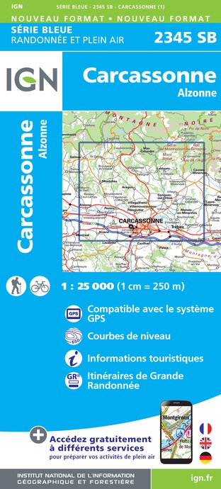
2345SB - CARCASSONNE ALZONNE
Editor : IGN
Collection : TOP 25 ET SÉRIE BLEUE
Scale : 1:25 000
13.90€

TOP100D11 - AUDE CARCASSONNE NARBONNE LIMOUX QUILLAN CANAL DU MIDI
Editor : IGN
Collection : TOP 100
Scale : 1:100 000
8.40€

TOP100D09 - ARIÈGE FOIX SAINT-GIRONS PNR DES PYRÉNÉES ARIÉGEOISES
Editor : IGN
Collection : TOP 100
Scale : 1:100 000
8.40€

89031 - LE CANAL DU MIDI
Editor : IGN
Collection : DECOUVERTE DES CHEMINS
Scale : 1:100 000
9.10€

D09-66 ARIÈGE PYRÉNÉES-ORIENTALES
Editor : IGN
Collection : CARTES DÉPARTEMENTALES IGN
Scale : 1:150 000
5.90€

D11-81 AUDE TARN
Editor : IGN
Collection : CARTES DÉPARTEMENTALES IGN
Scale : 1:150 000
5.90€

EUROPE
Editor : IGN
Collection : DÉCOUVERTE DES PAYS DU MONDE IGN
Scale : 1:2 500 000
7.00€
What to visit in Pennautier
See more suggestionsTake a boat tour around Pennautier.
See more suggestions


Where to eat in Pennautier
See more suggestionsRestaurants in Pennautier offer a variety of cuisines.
See more suggestions


Where to sleep in Pennautier
See more suggestionsExplore lodging possibilities in Pennautier.
See more suggestions


")


