Tours
Activities
Places of interest
Where to eat
Where to sleep
Discover Ombleze, Drôme, Rhône-Alpes and its wonders
Are you in charge of the destination?Nestled in the heart of the Drôme, Ombleze, Rhône-Alpes, is a natural gem that will captivate nature lovers and adventurers looking for a change of scenery. Begin your journey by exploring the majestic Omblèze gorges, a green haven where picturesque waterfalls and shaded trails flourish. Hiking enthusiasts will not want to miss the trails that zigzag through stunning landscapes, such as the Trois ...See more


")


")


What to do in Ombleze
See more suggestionsPlan a perfect day in Ombleze with our bookable activities.
See more suggestions


IGN cards
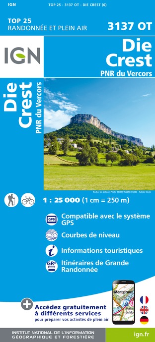
3137OT - DIE CREST PNR DU VERCORS
Editor : IGN
Collection : TOP 25 ET SÉRIE BLEUE
Scale : 1:25 000
13.90€

3136ET - COMBE LAVAL
Editor : IGN
Collection : TOP 25 ET SÉRIE BLEUE
Scale : 1:25 000
13.90€

TOP75001 - MASSIF DU VERCORS
Editor : IGN
Collection : TOP 75
Scale : 1:75 000
9.80€

VEL01 - LA DRÔME A VELO
Editor : IGN
Collection : DECOUVERTE A VELO
Scale : 1:105 000
9.10€

TOP100D26 - DRÔME VALENCE MONTÉLIMAR DIE PNR DES BARONNIES PROVENÇALES PNR DU VERCORS
Editor : IGN
Collection : TOP 100
Scale : 1:100 000
8.40€

202 JURA ALPES DU NORD
Editor : IGN
Collection : TOP 200
Scale : 1:200 000
6.80€

D38 ISÈRE
Editor : IGN
Collection : CARTES DÉPARTEMENTALES IGN
Scale : 1:150 000
5.90€

D04-05 ALPES-DE-HAUTE-PROVENCE HAUTES-ALPES
Editor : IGN
Collection : CARTES DÉPARTEMENTALES IGN
Scale : 1:150 000
5.90€

D07-26 ARDÈCHE DRÔME
Editor : IGN
Collection : CARTES DÉPARTEMENTALES IGN
Scale : 1:150 000
5.90€

NR14 AUVERGNE-RHÔNE-ALPES RECTO/VERSO MASSIF CENTRAL
Editor : IGN
Collection : CARTES RÉGIONALES IGN
Scale : 1:250 000
6.80€

NR16 PROVENCE-ALPES-CÔTE D'AZUR
Editor : IGN
Collection : CARTES RÉGIONALES IGN
Scale : 1:250 000
6.80€

NR15 AUVERGNE-RHÔNE-ALPES RECTO/VERSO MASSIF ALPIN
Editor : IGN
Collection : CARTES RÉGIONALES IGN
Scale : 1:250 000
6.80€

EUROPE
Editor : IGN
Collection : DÉCOUVERTE DES PAYS DU MONDE IGN
Scale : 1:2 500 000
7.00€
What to visit in Ombleze
See more suggestionsAdmire the unique architecture of Ombleze.
See more suggestions


Where to sleep in Ombleze
See more suggestionsDiscover the best lodging options in Ombleze.
See more suggestions


