Tours
Activities
Places of interest
Where to eat
Where to sleep

Experience the Best of Tarascon at CAMPING SAINT GABRIEL

Are you the owner?
Immerse yourself in the natural and cultural treasures around Tarascon, Bouches-du-Rhône, Provence-Alpes-Côte d'Azur. Just steps away from CAMPING SAINT GABRIEL, explore the historic Tarascon Castle, one of the best-preserved medieval castles in France, offering stunning views over the Rhône River. Wander through the picturesque hiking trails of the Alpilles, renowned for their breathtaking landsc...See more

Walking around CAMPING SAINT GABRIEL

See more suggestions
Discover the nature of CAMPING SAINT GABRIEL on foot.
See more suggestions
The chapels path
907 m

The chapels path

Walk this nature trail, which will reward your efforts with great discoveries! From the starting point, pass the barrier and follow the path on the left marked PR. At the crossroads, continue following the sign "Chapelle St-Gabriel 0.8 km".1- At the sight of Castrum, turn left to the Saint Gabriel chapel. Go back to point # 1 and turn left. At the fork, climb the right path marked PR. Continue for 1.2 km. 2- At the junction, continue to the left following the sign "St-Etienne du Grès 5.3 km". Follow this marked path GR® on 1,6 km, by passing by 2 tanks 3- At the crossroads, go down the path still tagged GR®. Pass a barrier and join a crossing with a cistern and houses nearby. 4- Continue straight on the marked path PR, following the sign "Fontvieille 5.1 km". Pass the chapel St-Peire, then, at the crossroads, take the path on the right. Continue for 1 km.5- Go on the right path marked PR, following the sign "Chapelle St-Gabriel 8.4 km". Climb the path to the left. 100 m further, leave the bend on your right and continue passing under the fig tree Follow this marked path for 1 km. 6- At the crossroads, turn left and continue for 500 m. At the cistern with a trough, continue straight on the unmarked path. Make 600 m with a left turn, then a right. 7- Find the marked path PR, follow it on the right, then 50 m further turn left. At the next crossroads, take the path marked PR on the right. Get off, then go up the small valley.8- At the crossing, continue on the same road, always signposted PR. Follow it for 800 m until the "T" crossing. Take the right path for 800 m as well. Back to point n°2, turn left, following the sign "Chapel St Gabriel 2 km" Follow this marked path GR® on 1 km, then join the first junction. Turn left and return to the starting point.

5 h
14 km
Medium
Show
SAINT ETIENNE DU GRES - Cycling tour in Alpilles, in 3 days
3.6 km

SAINT ETIENNE DU GRES - Cycling tour in Alpilles, in 3 days

Between cliffs, vineyards and olive trees, indulge in the identity of the Alpilles! Back to the car park, follow on the right the D32, direction Fontvieille. At the intersection with the D33, take it on the left. After 500 m, fork right on the Joncs draille At the end, find the D33 and join Fontvieille on the right. 1- At the roundabout, take left, and then at the crossroads continue straight. After 2.5 km, turn left on the road, direction "Aqueduct Romain". . Follow it for 6 km to the village center of Paradou. 2- At the crossing, continue on the avenue Jean Bessat. Take the D17 on the right, then on the left the D78b direction Les Baux. At the end, follow to the right the D78f. 1 km further, turn right on the D27 and reach the town center of Maussane. 3 - at the intersection with the D17, turn to the left. After 800 m, take to the left the D5, direction of Eygalières. At the next intersection, follow the direction "Le Petit Roman" on the right. Continue on this road until the intersection with the D17. 4- Turn left on Alphonse Daudet road, before the D17, and continue to the roundabout. Take it on the left to follow the D24. After 1.5 km, turn right onto the D24a and follow it to Aureille. 5- Take the D25a on the left. After 4 km, go right on the D25 and continue for 7.5 km. At the junction with the D569, turn right. At the roundabout, continue straight for 150 m. 6- Turn left towards Sénas and continue for 7 km. Take the roundabout direction Sénas. After 300 meters, turn left on the path of "Donne", just before the level crossing. Continue to Orgon. 7- Go through Orgon via rue de la Fontaine and Edmond Coste Street. Continue by the Paradis uphill and the avenue Jean Moulin. At the intersection with the D24b, turn left and continue for 7 km to Eygalières. 8- Cross the village and continue on the D24b for 2 km. Turn left on the D24, towards Mouriès. At the foot of Calans, turn right on the GR marked path. Pass by the bridge called Romain, the triangular junction stays on the right and follow this path for 3 km. 9- Continue straight on the Aurelia road to the city entrance sign. Continue to Van Gogh Avenue. Cross it and follow Joseph d'Arbaud Avenue. Continue on the "Chemin Gaulois". Turn left after the canal, then take the old road on the left to Arles until the intersection with the D27. Cross it and continue straight on to St-Etienne du Grès.

72 h
93 km
Easy
Show
SAINT ETIENNE DU GRES - Cycling tour in Alpilles, in 3 days
3.6 km

SAINT ETIENNE DU GRES - Cycling tour in Alpilles, in 3 days

Between cliffs, vineyards and olive trees, indulge in the identity of the Alpilles! Back to the car park, follow on the right the D32, direction Fontvieille. At the intersection with the D33, take it on the left. After 500 m, fork right on the Joncs draille At the end, find the D33 and join Fontvieille on the right. 1- At the roundabout, take left, and then at the crossroads continue straight. After 2.5 km, turn left on the road, direction "Aqueduct Romain". . Follow it for 6 km to the village center of Paradou. 2- At the crossing, continue on the avenue Jean Bessat. Take the D17 on the right, then on the left the D78b direction Les Baux. At the end, follow to the right the D78f. 1 km further, turn right on the D27 and reach the town center of Maussane. 3 - at the intersection with the D17, turn to the left. After 800 m, take to the left the D5, direction of Eygalières. At the next intersection, follow the direction "Le Petit Roman" on the right. Continue on this road until the intersection with the D17. 4- Turn left on Alphonse Daudet road, before the D17, and continue to the roundabout. Take it on the left to follow the D24. After 1.5 km, turn right onto the D24a and follow it to Aureille. 5- Take the D25a on the left. After 4 km, go right on the D25 and continue for 7.5 km. At the junction with the D569, turn right. At the roundabout, continue straight for 150 m. 6- Turn left towards Sénas and continue for 7 km. Take the roundabout direction Sénas. After 300 meters, turn left on the path of "Donne", just before the level crossing. Continue to Orgon. 7- Go through Orgon via rue de la Fontaine and Edmond Coste Street. Continue by the Paradis uphill and the avenue Jean Moulin. At the intersection with the D24b, turn left and continue for 7 km to Eygalières. 8- Cross the village and continue on the D24b for 2 km. Turn left on the D24, towards Mouriès. At the foot of Calans, turn right on the GR marked path. Pass by the bridge called Romain, the triangular junction stays on the right and follow this path for 3 km. 9- Continue straight on the Aurelia road to the city entrance sign. Continue to Van Gogh Avenue. Cross it and follow Joseph d'Arbaud Avenue. Continue on the "Chemin Gaulois". Turn left after the canal, then take the old road on the left to Arles until the intersection with the D27. Cross it and continue straight on to St-Etienne du Grès.

72 h
93 km
Easy
Show
Les Crottes d'Aubert
4.9 km

Les Crottes d'Aubert

From the Daudet mill to the Barbegal aqueduct, travel back in time around the Crottes d'Aubert From the parking, follow the path that runs along the road from the south and join the Daudet mill on the left. 1- At the mill, go down to the left then take a yellow and blue marked path on the right (follow this double yellow and blue markings to point no. 3). At the crow's feet, stay on your left. Pass the barrier before a picnic area, then a second barrier on the left. 2- 200 m further, at the sign, follow to the right the direction "Les Baux-de-Provence". Pass a barrier and continue on the roadside path to another barrier. Then take the path on the left, then 350 m further the second path on the right (signposting on the ground!). 3- On this yellow and blue marked path, join a barrier from where you can see the road. Take the path on the right and join this road passing an irrigation canal. Follow the road on the right for 300 m (Caution, traffic!) To the Roman aqueduct and the mill at the end of the path that runs along the latter. 4- return by the same itinerary up to the channel. A few meters higher, climb to the right by the blue marked path (follow this blue marking until the end of the hike) and continue to a barrier. 5- After this one, take the path on the left towards the north. Go to a buried cistern. At this junction, take the path that goes north-east. Arrive at a junction where you can see a rock wall.6- turning left toward the old quarries of Fontvieille. Stay on this path lined with a fence (Caution, quarry holes!) To the entrance of the quarries and the first houses of Fontvieille. Take the road on the left. 7- Turn right just after the fenced garden and before the water retention pond. Follow this path through woods to a small road, following the communal signs. Take it on the right and join the Montauban castle from behind. Exit through the front door and cross the village to reach the parking lot of the pine alley.

3 h
10 km
Medium
Show
Bike ride in the Provencal countryside
5.1 km

Bike ride in the Provencal countryside

A loop that will make you travel across fields and cross many channels! From the parking, go past the castle on the left. At the roundabout take the first exit, Itam Boulevard At the Porte Condamine roundabout, follow the 1st exit, boulevard Gambetta. Continue 100 m then turn left on the D80 towards Maillane. Continue on this road until you cross the D570n. 1- Cross the D570n and follow the D80a towards Maillane for 3 km. After the main entrance of the Breuil estate, turn left on the paved road of Mas de Terras. Continue for 1 km and turn left on the tarmac road of Mas de la Musique. Continue until the D80 then switch to the right. 2- At the roundabout marking the entrance to Graveson, take the 1st exit, Chateaurenard road. Turn immediately left on Lavandin Street towards the center. Continue to the Sundial hotel and turn left on Chemin du Moulin. 200 m further, past the Tourist Office and the Auguste Chabaud Museum. 3- Pass the National Course, take the Jeanne d'Arc street after the Virgin statue and turn right on the Provence street. Then turn right on the General de Gaulle avenue then left on Lieutenant Atger Avenue. At the roundabout continue on the D5 until the entrance to Maillane. 4- Cross Maillane via the Jousse d'Arbaud alley, General de Gaulle avenue and Poet's Avenue. Continue on the D27, for 4 km, to the business area of ??Massane. At the crossroads with the D99 (Caution, traffic!), Turn left then continue for 400 m and turn right on the D27 towards Les Baux-de-Provence. 5- Drive 1.5 km and turn right on the old road to Arles after crossing the crossing with the Mas-Blanc road. Continue to Saint-Etienne du Grès, cross the village and continue on the D32. At the crossroads with the D33, take the left to join the Saint-Gabriel chapel 100 m further. 6- At the Saint-Gabriel chapel, retrace your steps to the last crossroads and continue towards Tarascon. (Caution, traffic!) At the roundabout take the 3rd exit, D570N, then turn right on the Lansac road. At the intersection with the D35, turn right and drive to Tarascon and continue for 3.5 km. 7- Turn left on the D970, then at the next crossroad, turn left going under the level crossing. At the roundabout, take the 2nd exit, D99 towards Beaucaire. At the next roundabout, take the first exit and turn immediately left on the République Avenue to reach your starting point.

4 h
39 km
Easy
Show
The Via Rhôna Beaucaire - Aramon - Avignon
6.2 km

The Via Rhôna Beaucaire - Aramon - Avignon

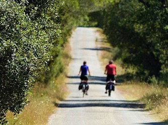
If you want to cycle from the shores of Lake Geneva to the beaches of the Mediterranean along the Rhône River, here's the ViaRhôna! On this section, you'll set off from Avignon or Beaucaire, passing through Aramon. The route takes you gently from Beaucaire (Ville d'Art et d'Histoire) via the Pont du Gard greenway. You'll then zigzag through vineyards and orchards to reach Aramon, a town strongly marked by the presence of water. The prosperity of its port in the 17th century led to the construction of numerous mansions by Forton, Jossaud, Posquières, Laudun, Saint-Jean and Choisity. You then travel along the banks of the Rhône to the city of the Popes, Avignon. Departure from the Beaucaire Arena. Take the Chemin de Marguilliers to the roundabout just outside Beaucaire to get back on the voie verte. Voie verte from Beaucaire to Montfrin (after Comps) Turn right off the greenway onto route de Jonquières. Cross the bridge, then turn right, Drive alongside the TGV line, then turn right to cross the TGV line ( Caution ) Cross the river "Le Briançon" then turn left Turn right at the 2nd intersection and continue to Aramon. In the village, go to the Halte Fluviale (on the right), where you'll join the Voie verte (on the left) from the TGV bridges along the river. At the end, turn left onto the road that diverges from the river, passing the TGV bridges at Les Angles. At the Les Angles TGV bridge, turn right onto rue du Chêne Vert At the end of the street, turn right and cross the Pont Daladier You're now in the center of Avignon.

3 h
38 km
Very easy
30390 Aramon
Show
LES BAUX DE PROVENCE - The Baumayrane ridges
8.8 km

LES BAUX DE PROVENCE - The Baumayrane ridges

Leave the foot of Baux-de-Provence, and win the roof of the Alpilles by the peaceful trail of the Lombards! Back to the Carrières de Lumières car park, take the road on the left, and go directly left on a road marked PR. Continue down this road until the D27 Turn right and follow this road to the entrance of the Baumanière hotel. 1- Cross the road to reach a Department sign and take the path marked PR. At the fork, follow the path marked PR on the right. At the next intersection, turn right and then left just before a Canadian crossing. 500 m further, join another intersection and its Canadian crossing.2- bifurcate to the left on a tarmac path marked PR. Pass the Sainte-Berthe Mas and continue until the D27. Cross it, then after 150 m take path on the right marked PR. Follow it for 800 m until you reach a crossroads. Cross it and continue straight. At the next intersection keep left and join a hairpin bend. 3- At the bend, take a path marked PR on the left, preceded by a hard-wired barrier. Climb this track in laces for 3 km. At the intersection marked with a cairn, turn left on the track marked GR®, following the sign of the Department "Les Baux-de-Provence 3.7 km". At the next intersection, stay on the GR®6 and follow it for 1.7 km to a cistern. 4- 100 m further, go down on the left the marked path PR, indicated by the sign of the Department "Les Baux-de-Provence by the Val d'Enfer 2 km". At the next junction, continue straight until you reach the D27 road. Follow it to the left to find the starting point.

4 h
12 km
Medium
Show

What to do in CAMPING SAINT GABRIEL

See more suggestions
Experience unique moments with the bookable activities in CAMPING SAINT GABRIEL.
See more suggestions
Babykart Beaucaire
9.1 km

Babykart Beaucaire

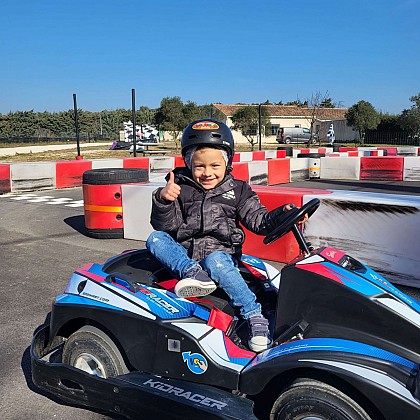
Unique in the region: karting circuit for children aged 3 and over! Let your child discover the thrill of driving an electric kart adapted for the youngest on a safe circuit. Fun, educational and family-friendly. It's possible to drive a go-kart at the age of 3! At the wheel of the Kid Racer electric kart from Sodi Kart, safe, easy to handle and fun, your child can learn to drive alone or accompanied by an adult on a safe track. A unique experience. Also on site: Karting track for children over 7 years old and adults, snack bar, bouncy castle, barbecues, refrigerators, shaded terraces... Becoming a racing driver or following in mum or dad's footsteps even though I don't yet know how to ride a bike without training wheels is now possible at Espace Loisirs Karting with the new children's kart designed by Sodikart: the SODI KidRacer! At the wheel of real 100% electric, non-polluting karts, budding young drivers aged 3 to 6 can also race with their friends or learn the basics of driving rules to be just like the grown-ups. Designed and developed by Sodikart engineers, the KidRacer had to be safe, manoeuvrable and fun for young drivers. With a short wheelbase and tight turning radius, the KidRacer is highly manoeuvrable and easy to drive: perfect for a fun and enjoyable first driving experience. Safety is paramount for Sodikart, which is why the KidRacer is equipped with ‘PROLINE®’ plastic protection fixed to ‘OMEGA’ components that act as shock absorbers, ensuring that our young drivers can drive in complete safety. What's more, the KidRacer is designed to accommodate one child and one adult, allowing parents to accompany their children and help them drive. In terms of motorisation, the KidRacer is equipped with an electric motor designed and configured to offer linear acceleration that is pleasant and reassuring for younger children. Its automatic brake (by releasing pressure on the accelerator) allows younger children to easily understand how to stop the kart (however, a safety button is accessible to the accompanying parent in case of emergency). How about a Babykart race with friends? On your marks, get set, fire away! Activity for children aged 3 to 6.

Chemin des Melettes Chez Espace Loisirs Karting 30300 Beaucaire
Book from 5 EURBook
Show
Saint Roman Abbey
9.8 km

Saint Roman Abbey

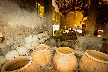
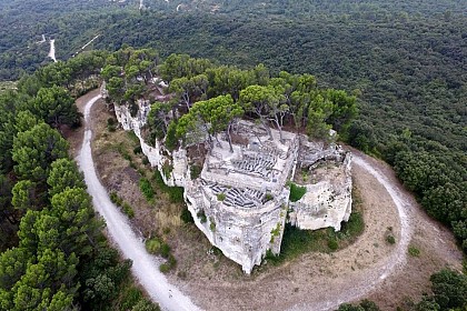
Come and discover the troglodytic Abbey of Saint-Roman on a hilltop overlooking the Rhône River. A veritable rock necropolis, it is home to hundreds of tombs carved into the rock. These vestiges of monastic life are unique in Western Europe. Saint-Roman Abbey is a Monument Historique, housing the remains of a monastery founded before the 10th century. Chapel and cells, cisterns and cellars, these vestiges of troglodytic monastic life are unique in Western Europe. A veritable rock necropolis houses hundreds of burials dug into the rock. From the guarded parking lot, a path takes you through the Mediterranean garrigue to the top of the limestone hill. A magnificent panorama opens up over the Rhone River to the Alpilles, with a unique view of the river and Provence. At lunchtime and in the evening, last admission 1/2 h before closing time. In very bad weather, the abbey may be closed. Allow 10 to 15 minutes for the climb. No toilets inside the Abbey. Not recommended for people with reduced mobility. Admission to the Abbey also includes free admission to the Mas des Tourelles in Beaucaire, and reduced admission to the Beaucaire Archaeological Museum. Free admission for residents of Beaucaire, Bellegarde, Jonquières Saint-Vincent, Fourques and Vallabrègues, with proof of residency (Communauté de Communes Beaucaire Terre d'Argence). Directions to the abbey are signposted on leaving Beaucaire, at the 1st traffic circle on the route de Nîmes. Saint-Roman Abbey is a protected heritage site located within a particularly fire-sensitive forested area. In the event of a red wildfire alert issued by the Prefecture for the Gard Rhodanien area, access to Saint-Roman Abbey and the Aiguille Massif is strictly prohibited. The Abbey will remain closed to the public for the duration of the alert. www.risque-prevention-incendie.fr/gard/

Chemin de Saint-Roman D999 30300 Beaucaire
Book from 5 EURBook
Show

What to visit in CAMPING SAINT GABRIEL

See more suggestions
Visit the iconic landmarks of CAMPING SAINT GABRIEL.
See more suggestions
Where to eat in CAMPING SAINT GABRIEL

See more suggestions
The cuisine of CAMPING SAINT GABRIEL is a must-try.
See more suggestions

Where to sleep in CAMPING SAINT GABRIEL

See more suggestions
Find a comfortable stay in CAMPING SAINT GABRIEL.
See more suggestions
Caution!
We have no information on the difficulty of this circuit. You may encounter some surprises along the way. Before you go, please feel free to inquire more and take all necessary precautions. Have a good trip! 🌳🥾