Tours
Activities
Places of interest
Where to eat
Where to sleep

Discover Tuchan at Le Relais d'Aguilar: Adventure and Nature

Are you the owner?
Located in the heart of the Corbières, Le Relais d'Aguilar in Tuchan, Aude, Languedoc-Roussillon, offers you the chance to immerse yourself in a region rich in history and breathtaking landscapes. A plethora of activities and discoveries await you.

Begin your adventure by visiting the Château d'Aguilar, a gem of Cathar history, overlooking the surroundings of Tuchan. Discover its majestic ruins a...
See more

Walking around LE RELAIS D'AGUILAR

See more suggestions
Explore the walking circuits of LE RELAIS D'AGUILAR.
See more suggestions
The Sculptural Trail (Le Sentier Sculpturel)
25 km

The Sculptural Trail (Le Sentier Sculpturel)

Astonishing and enchanting, in the heart of the Corbières, Art and Nature meet. Here on a journey full of surprises and discoveries. In the summer of 1993, Mr BOZO, sculptor, presents thirty of his works in Mayronnes. The Town Hall acquires one of his works, the path becomes permanent. Now at the corner of an alley in the village of Mayronnes or at a detour from the path, new metal works, stone, clay, wood invite you to the daydream. Signs: Yellow markings Park in the parking lot at the entrance of the village. At the bottom of the parking lot on the right side, take the track leading to a small bridge over the Madourneille stream. Turn immediately to the right and 30m later to the right again and follow the stream. At the crossroads, turn left and then left again, take an ascending path also borrowed by the GR36 hiking trail. Join a wide track, take it to the left and follow it. It turns right then left, crosses a stream and climbs to a pass (viewpoint on the Corbières). Leave the track and go down a path on the left. Cross a plateau then a gullied ground and continue on the track in the same direction until you reach the crossroads of the Serrat de la Bouzole. Go down on the left and follow an electric line. The path goes away from it and turns right to plunge into the forest. Leave a path going down to the left and continue straight on the main path.Ford under the power line. At the level of an abandoned building, the path widens to become a track. Go around the ruin, ignore a track that goes down on the right to continue to a crossroads. Turn left. After 200m, turn right towards a fenced vineyard. Go along it while going up in the bed of the brook. At the top of the vineyard, turn left onto a steep path. Climb natural steps in the rock and then go around a bush on the left. Once you find the path again, turn right and walk along a field. Join a track and follow it downhill. At the bottom, at the crossroads of tracks, take the one on the right to reach the bridge. Then turn left on the small bridge for a return to the parking lot.

3 h
5 km
Very easy
Show
The Panoramas of Lacamp
29 km

The Panoramas of Lacamp

Garrigue, communal forest (beeches and oaks) and state forest (firs and cedars) The departure of this old rural path (from Labastide to Bouisse) is from the "Pont Vieux". An "obligatory" parking lot is located under the housing estate on the right as you enter the village. Go up on the right bank of the Alsou stream and take the path bordered on the left by an old wall. Pass a fence, then a maze of broom. The path then climbs up to reach a small pass and continues through the garrigue and then through the undergrowth to a forest track. Cross it, go up to the ladder, the Bouisse path continues in the undergrowth. Further on, viewpoint on the village from the Taillau rock. Then a river crossing where the water rarely flows "Richard's brook". Go up the dry stream on its right bank, then left bank and right bank again to reach a small staircase leading to a track. Turn left, slightly uphill in the forest and then you will be in the open with a great view of the South Corbières and the Pyrenees. A point of view with an orientation table will allow you to understand the landscape. At the crossroads of tracks in a clearing, turn right and carry downwards through a young cedar grove to a field. Again a viewpoint fitted with an orientation table: panorama over the Val de Dagne as far as the Montagne Noire. Return to the track and go down towards the village for about 2km until you reach the "ladder" leaning against the embankment. Opposite the ladder on the right, return along the path going down towards the village.

3 h
10 km
Easy
Show
The Poetry Trail (Le sentier en poésie)
31 km

The Poetry Trail (Le sentier en poésie)

“Ici le temps va à pied” (Here time goes on foot) A real open-air museum dedicated to the writer Joseph Delteil in his native landscape. It's in the depths of the forest of Villar, where his father, "bouscassier", made the precious charcoal, that Joseph Delteil was born on the 20th of April 1894, at the place called "La Borie de Guillaman". In the heart of a path, once carter, between the oaks and the boxwoods, this old house was originally of a piece of work. It seemed natural to us to carry the writer's words forward in the footsteps of his childhood. Thus are born the "Poetry Trail", the path "à la Dame" and the small green theater. Signs: Yellow markings Departure from the sign of the poetry trail to the right of the bridge (parking lot) located at the entrance of the village of Villar-en-Val. Cross the bridge and take rue Joseph Delteil then first right rue de la Prade following the yellow markings. This will take you from the tarred road to the earth track where, in rainy weather, some sections can be difficult.  The first marker sets the atmosphere: “Ici le temps va à pied”(Here the time goes on foot)… “et ce n’est pas la peine de le rattraper” (and there is no need to catch it up). In the heart of a path, once a cart, between oaks and box trees, you will come to a fork on the road on your right: the return journey from the Path to the Lady. After a few minutes uphill with the brook on your left, you reach a ring-tossing game. Carry on your poetic journey on the main route. Arrive at the small green theatre, once made by the Scouts of Versailles under the direction of Mr Philippe FORCIOLI (author, composer and singer). Go down between the low foam walls, the view is clear over the Corbières. Crossing a small bridge and a sometimes wet ground.  Leave the forest to reach the circle of six panels and its weather vane. Then turn towards the farm and before the farm turn left down the hill. At the crossroads turn right and then right and left again at the tarred road. The signposting will take you past a farm building on the left, then in front of a Romanesque chapel full of charm on the way back up to the village.

2 h
6.3 km
Very easy
Show
The wall walk - Le Chemin de ronde
35 km

The wall walk - Le Chemin de ronde

The vineyard was settled in Languedoc by the Romans. For centuries, it rubbed shoulders with the olive tree plantation and was under the strong domination of cereals. Only a few ruins of windmills remain from the cereal-farming era, on the promontories near the villages. This loop allows you to observe the “couloir Audois” (Aude Corridor) criss-crossed by communication routes, the settlement of the villages and to recall the evolution of southern agriculture. Signs: Yellow markings topped by a square of the same colour The departure is in the heart of the village of Capendu, “place de la Mairie”, in front of the sign.  Pass in front of the post office and take the direction of Montlaur-Val de Dagne. Be careful when passing through the level crossing ! Continue under the highway bridge. First right-angle turn to the left, take the path going outwards below. It winds through the vineyards to the D 57. Turn right again, continue for about 600m/1970ft, just after a safety rail on the right-hand side of the road, inside the bend, take the uphill path. Small slope, in the shade of holm oaks and white oaks, very pleasant in hot weather. Turn right and as you progress, take the time to observe the "couloir audois" (Aude corridor) criss-crossed by communication routes, the villages and in the background the Montagne Noire (Black Mountain). Through the scree, the descent begins and then take the path that leads through the pines. Once at the bottom, cross the vineyard and turn right onto the path, first paved then tarred, which leads to the hamlet of "Font de Roque".

3 h
8.2 km
Very easy
Show
Around Miramont
37 km

Around Miramont

From the top of this headland, the view embraces a magnificent landscape formed by the Aude valley, the reliefs of the Minervois up to the borders of the Montagne Noire. Signs: Yellow markings topped by a circle of the same colour From the “Place du 14 Juillet” square take the rue de la Mairie, pass under the railway line and take the Côte à Cailloux (steep pebble path), a medieval track. Place de l'Eglise, take the rue du Carrayrat then turn left on rue de la Faichette. Turn right on rue de Miramont and follow the chemin de la Tuilerie to leave the village. Pass under the highway and turn right for about 200m/656ft. Turn left, then right, on a slightly steep path lined with low walls. Follow the Chemin du four à Chaux up to the parking lot of the plant nursery. Cross the D8008 and follow the path to the plant nursery for 200m/656ft. Turn right onto the Pas de Roland path, then a few dozen meters further on, this will take you to a viewpoint overlooking the Aude valley, the Minervois relief as far as the edge of the Montagne Noire. Carry on along  the path up to the "departmental" road. At this point, turn left for about 600m/1970ft. At the track intersection, turn left and go down the path on 200m/656ft. You are on the site of the remains of the Miramont castle. Then carry on going down by the same route towards the plant nursery, turn right to reach the village by taking the departmental road D8008 through the farmstead "metairie" towards the village.

3 h
7.4 km
Easy
Show
Bike ride through vineyards
38 km

Bike ride through vineyards

Bike ride through the vineyards, starting from the ancient city of Elne, overlooking the Canigou. Wines and honeys are waiting for you. Departure from the Tourist Office of Elne by the rue du couvent on the left. Then take the next right on Avenue des Albères, then right again on Avenue Général Leclerc. At the roundabout take the 4th exit onto rue du Mas Latrobe and continue straight until the stop sign.  At the intersection turn right onto Boulevard 8 mai 1945. On the boulevard take the 3rd left on the Rue du 11 novembre and follow the path of Villeneuve. (Attention, crossing the departmental frequented). Continue straight for two kilometers then turn left on the D80 and drive for 1km, then take the direction of Bages in Montescot. At the roundabout take the second exit "Intermarché" then turn left before the gas station. After 900m at the intersection, turn left to get off at Bages via the path of Avall Rich. In Bages, pass in front of the famous Casa Carrère, "fairytale building". Cross into this typical village and then take the direction of Ortaffa on your right. Turn left onto Place Docteur Bolte. Then take the first street "Jean Jaurès" on the right. Continue straight for 200m and enter the Domaine Parcé Ramos on your left. To leave the winery, turn left and then the first right on the Chemin du Brouilla. After 1.5 km, pass a small bridge and turn left. Arrived at the intersection of the D8, turn right and then continue straight for 350m. At the roundabout you will see the Miellerie d'Ortaffa on your left. To leave the Miellerie go to the roundabout, and take the exit towards Ortaffa. Continue straight for 1.2 km to arrive in Ortaffa, discover this village that has preserved beautiful traces of its past.  A must: its famous Catalan Eiffel Tower! In Ortaffa take the D40 towards Elne then continue for 500 m and turn left towards Chemin St-Martin. Join the Domaine Sol Payré on your left. At the next intersection, continue straight ed. At the next intersection turn right towards the path of Llauro. Arrived at the Stop, turn right and then immediately right. Arrived at the departmental turn right to join Elne. Always continue straight at the first roundabout, then at the second take the third exit towards the historic center to arrive at the tourist office of Elne.

3 h
20 km
Very easy
Show
Elne - "Bocal du Tech" Beach
38 km

Elne - "Bocal du Tech" Beach

From the ancient city to the wild beach of the Bocal du Tech. 1. From the Tourist Information Office in Elne, take the Rue du Couvent on the left. Note the old Roman baths and the old lime kiln (make a diversion through the historic centre, following the signs). 2. Turn left into avenue Charles de Gaulle, then right into rue du Salita.3. Take the first left onto rue d'Oran. 4. Continue straight on (towards Perpignan) and at the roundabout, take chemin de la mer. 5. Cross the bridge and immediately afterwards follow the Chemin de Sainte Eugénie on your right. The Sainte-Eugénie-de-Tresmals chapel is on the left-hand side of this road after 1 km; it is hidden by vegetation. You need to be vigilant.6. Continue straight ahead for 2km on the tarmac road.          Itinerary BIS: When you reach a small hamlet, turn right after it towards the Chemin de la Mer. Drive for 1km and at the crossroads turn right and continue straight on until you reach the roundabout on the departmental road (a busy stretch of road in summer). At the roundabout go straight on towards the Bocal du Tech beach, then the beach is 1km further on.7.When you reach a small hamlet, turn right after it towards the Chemin de la Mer, then turn right 100 m after the next one. 8. Continue straight on for 1.5 km, then at the bridge turn left towards Saint-Cyprien. 9. At the roundabout, take the first exit towards the Bocal du Tech beach, which is 1km away. Please note that the beach is divided into two sections: textile on the left and naturist on the right. 10. To return to the tourist office, go in the opposite direction and at the roundabout take the third exit onto Eurovélo 8. Continue for 2km. 11. At the junction, turn right towards Chemin de Latour - Argelès. Pass under the bridge and continue straight on for 3km. 12. At the stop sign, turn left and then the next left towards Chemin de Sainte-Eugénie. Drive for 2 km until you reach the main road and continue straight on under the bridge. 13. Turn right. 14.  Turn left over the bridge. 15. Continue straight on towards the station and Epicentre, then straight on towards Rue de Oran. At the end of the street turn right towards Rue de Salita and at the intersection turn left towards Avenue Général Leclerc. At the next roundabout, take the second exit towards the historic centre, and the tourist office will be on your right.

2 h
19 km
Very easy
Show
[Connection] Elne-Argelès-sur-Mer
38 km

[Connection] Elne-Argelès-sur-Mer

From the ancient city of Elne, with its rich heritage, to the dynamic seaside resort of Argelès-sur-mer. The tranquillity of the banks of the River Tech and the beautiful blue sea are the rewards 1. From the Tourist Information Office in Elne, take the Rue du Couvent on the left. Note the old Roman baths, the old lime kiln and make a diversion through the historic centre. 2. Turn left into avenue Charles de Gaulle and then right into rue du Salita. 3. Take the first turning on the left into rue d'Oran. 4.  Continue straight ahead and at the roundabout, take the second exit (towards Perpignan), then turn right onto chemin de la mer. 5. Cross the bridge and turn right onto Chemin de Sainte-Eugénie. The Sainte-Eugénie-de-Tresmals chapel is 1km along this road on the left, hidden by vegetation. You need to be careful 6. Then take the Latour-Bas-Elne road on the right. 7. At the D81, turn right onto the cycle path towards Argelès. You can go under the D81 bridge to reach the Mas Larrieu nature reserve (only accessible on foot). 8.  At the Luna Park roundabout, follow the track onto the Route du Littoral. You will pass a number of campsites. 9.  At the next roundabout, turn left onto Boulevard de la Méditerranée. Pass between two buildings to reach the seafront. Turn right into the pine woods and then onto the green promenade. 10. After the small funfair and car park, turn right to reach the Tourist Office. To return to the Elne Tourist Office, walk in the opposite direction.

2 h
12 km
Easy
Show
Elne Bages Ortaffa Loop
38 km

Elne Bages Ortaffa Loop

Discover Elne, an ancient city steeped in history and two surrounding villages with their unusual heritage. 1.Start from the Elne Tourist Office by rue du convent, on the left. Then take the next right onto Avenue des Albères, then right again onto Avenue Général Leclerc. 2. At the roundabout take the 4th exit onto rue du Mas Latrobe then continue straight until the stop sign. At the intersection, turn right onto Boulevard 8 mai 1945.3. On the boulevard, take the 3rd left onto Rue du 11 novembre and follow Chemin de Villeneuve. (Be careful crossing the departmental, very busy).4. Continue straight for two kilometers then turn left on the D80 and drive for 1km, then at Montescot, take the direction of Bages.5.At the roundabout take the second exit "Intermarché" then turn left on the path before the gas station. 6. After 900 m at the intersection, turn left to descend to Bages via Avall Rich Road. 7. In Bages, you will arrive in front of the famous "Casa Carrière", a fairy-tale building. Stroll through this typical village then take the direction of Ortaffa on your right.8. Turn left via Place Docteur Bolte. Then take the second road on the right: Chemin de Brouilla (road parallel to the D49). 9. After 1.5 km, cross a small bridge and turn left. 10. Arrived at the intersection of the D8, turn left then follow the direction of Ortaffa to discover this village which has preserved beautiful traces of its past. Don't miss its famous Catalan Eiffel Tower! Take a detour in the village to meet the beekeepers of the Miellerie d'Ortaffa. 11. In Ortaffa take the D40 towards Elne then continue for 500 m and turn left towards Chemin St-Martin. At the next intersection, continue straight ahead. At the next intersection turn right towards Chemin de Llauro.12. At the stop sign, turn left then straight ahead towards Elne (Heavy goods vehicles). Continue for 200 m then turn right towards Chemin de Villeneuve. BIS route: At the stop sign, turn right then right again on the secondary road to reach Elne. At the roundabout take the third exit onto Avenue Général Leclerc, then take the first right onto Avenue des Albères. At the end of the avenue, take the second left onto rue du Couvent to reach the Tourist Office. 13. At the intersection, turn right then turn left on the third street "Boulevard 8 mai 1945". Continue straight ahead and find the Tourist Office, your starting point.

2 h
23 km
Very easy
Show
Catalan Getaway in the Pyrenees Mediterranean
38 km

Catalan Getaway in the Pyrenees Mediterranean

At each stage of the journey, you'll discover local heritage. Nature, history, craftsmanship, and gastronomy will all be part of the experience. Departure from the Tourist Office of Elne: After a detour into the historic center, go down Rue du Couvent to the right of the Tourist Office. Turn right onto Avenue du Général de Gaulle. Continue straight after the roundabout. Turn left after the railway tracks onto the D40, which you will follow to Ortaffa. The civil bell tower, shaped like the Eiffel Tower, will surely catch your attention. Continue on the D40, Avenue du Carignan, and then Avenue du Vallespir. At the roundabout after the level crossing, head towards Brouilla. Cross the village. Head towards Saint-Genis-des-Fontaines. Domaine Bisconte is signposted on this road to the left before reaching Saint-Genis. Upon arrival in Saint-Genis : Turn left onto Rue Maréchal Joffre, then right onto Rue Clemenceau. Take a break to admire the famous lintel and visit the Romanesque cloister and Saint-Michel church. Turn left onto Avenue des Albères and go straight, passing two roundabouts. Continue along the small road through the fields. Turn right towards Laroque-des-Albères A stop at the Tanya Chapel is recommended. Then head to the center of Laroque, a charming village where many restaurants await. Leaving Laroque : Cross the bridge and turn left onto Avenue du Vallespir. Stay on this road to Villelongue-dels-Monts to visit the Santa Maria del Vilar priory nestled in the mountains. Take a left onto Cami del Vilar and follow the yellow markers to the priory. Return the same way and head back to Laroque-des-Albères to explore local producers. Stop at Domaine "Le Temps Retrouvé" on Avenue du Vallespir. In Laroque:Turn right onto Rue de Roca Vella (a very steep street). Turn right and go straight on Avenue des Mas Catalans to discover "La Maison de l'Amande" 300m further. Then return to the center of Laroque and climb up to the tower, passing by the church. Head towards Sorède, stopping at an olive oil producer. Turn left onto Avenue des Baléares. "Le Moulin du Llevant" will be on your right. To reach Sorède, go down Avenue des Baléares to a junction. Turn right, cross the ford, and continue straight to Sorède on this small road offering magnificent views of the Albères. Turn right onto Rue de la Gabarre, then left towards the Tourist Office. Behind the Tourist Office:Visit the wooden whip factory made from hackberry wood, a tradition dating back to the 13th century. You can also take a detour through the heart of the village. Back on Rue de la Gabarre Turn right onto the EuroVelo 8. Turn left, then take the next right. On the Route de Palau, go up to the right, then take the first left. Go left, then right onto Chemin de Saint-André, followed by Rue Joan Cayrol. Turn left, then at the roundabout, take Rue des Albères to the crossroads. Go straight on Rue du Moulin towards the church and the "Maison de l'art roman." At the end of Rue de la Liberté : Turn right, then left onto Rue de Taxo. Continue on this road, which leads to the Pirenexus. Turn left, and at the roundabout, take the D11 to the right to reach the village of Palau-del-Vidre (Glass Palace) to visit the glassmakers' workshops. To do this:Turn right onto Rue Joliot Curie towards the village center. The Sant Marti de Palau lake is perfect for a picnic break. From there, go left onto Rue de la Tramontane, then Chemin de Perpignan. To head towards Argelès : Return to the Pirenexus. At the roundabout, go straight on the paved road that passes an aeromodelling club and follows the railway (a slight incline). It leads to Argelès at a roundabout. In Argelès : Go straight on Avenue de Mongat (Union Pharmacy), then turn right and pass behind the bank, following the Pirenexus markers along Rue des Colibris, then Rue des Merles. Cross the river "La Massane," and turn left to follow its path. Turn left onto Rue du 14 Juillet until the roundabout, where you'll take Rue des Trabucayres ahead. At the next roundabout : Turn right, pass the tennis courts and the multipurpose hall. At the stadium roundabout, turn left onto Route de la Mer. Near the gas station, continue straight on Avenue du Général de Gaulle. At the arrival roundabout, turn left onto Avenue des Platanes. Before the Tourist Office, turn right onto Avenue des Pins. Continue straight to the green promenade on the left. After crossing the pine wood :Turn left (the next path after the Monolith of Spanish Exiles), between two buildings, and continue on Avenue de la Méditerranée. Turn right onto the dirt path that connects to the bike path along the coastal road, passing by campsites. At the Tech bridge, turn left.Make a small detour to the beautiful beach of the Mas Larrieu Nature Reserve (//! naturist and textile beach). Return to the bridge and head towards Elne on Chemin de Sainte Eugénie, where you’ll see the pretty Sainte Eugénie de Tresmals chapel. Turn right onto the small road, then left at the bridge to enter Elne via Cami de la Mar. At the roundabout : Take Cours de l’Europe, then straight onto Rue d’Oran. Turn right onto Rue du Salita. Turn left onto Avenue Général de Gaulle and go up to Rue du Four à Chaux towards the Elne Tourist Office.

4 h
63 km
Easy
Show

What to do in LE RELAIS D'AGUILAR

See more suggestions
Plan a perfect day in LE RELAIS D'AGUILAR with our bookable activities.
See more suggestions
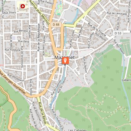
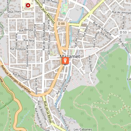
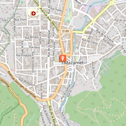
Via Ferrata in Mazamet
71 km

Via Ferrata in Mazamet

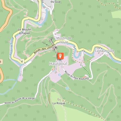
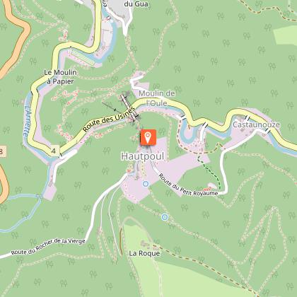
Looking for big thrills? Desire to surpass yourself? The via ferrata of Mazamet is for you! In the the Arnette gorges, in Mazame, via ferrata and giant zip line, under the footbridge. Acrobats and adventurers will enjoy this safe activity which completes, since 2022 the current tourist offer. This land is located in a protected natural site carried by an outstanding historic heritage (Cormouls-Houlès remarkabe gardens, St-Sauveur ruins, classified archeological site), and a rich and diverse wildlife. Nearby, after crossing the Mazamet's Hymalayan footbridge at 70 meters high over the Arnette river, you will find the medieval village of Hautpoul and its gardens, as well as, on the GR7, the House of Wood and Toy, its arboretum and its orchard. A nice wander along the 'Art Net' to picnic in th the shadows of chestnut trees. - Via Ferrata with ziplines : . Access: 20 mn . Drop : 90 m . Length: 880 ml . Difficulty: AD à D+ . Duration: 2 h 30 . Way back: 20 mn - Via Ferrata without zipline . Access: 30 mn . Drop: 110 m . Length: 370 ml . Difficulty: AD à D+ . Duration: 1 h 30 . Way back: 20 mn - Via Ferrata (upper part of Hautpoul) . Access: 20 mn . Drop: 60 m . Length: 130 ml . Difficulty: PD . Duration: 45 mn . Way back: 25 mn Minimum gear required: . Helmet . Harness . Closed shoes . Rest Karabiner & short lanyard . 2 wide aperture autoblock gate karabiners . Karabiner aerolink specifically for continuous safe line . Lanyard aeroline Ferrata . Double lanyard with shock absorber . Gloves General recommendations: Access to the Via Ferrata of Mazamet is prohibited: - to children measuring less than 1,35m and minors who are not accompanied by un experienced adult ; - outside opening hours and over night ; - in adverse weather conditions and especially when the route is slipppery and affected by snow, ice and stormy conditions. You agree to undertake this activity at your own risk. If you have little or no experience in this type of activity, please contact the services of a guide. Equipment rental: Mazamet Tourist Office Online booking: https://www.tourisme-castresmazamet.com/billetterie Rates: 18€/pers. Groups more than 5 persons: 16,50€/pers. Groups more than 10 persons : 15€/pers. Deposit: 400€ (on the day of the rental, chèque ou Crédit card) For beginners or persons needing a guide, you can contact: - Aude Escapades - Laurence Combes 06 03 50 00 85 - Axecime - Yannick Saulnier 06 08 42 27 13

95 rue de la Resse 81200 Mazamet
Book from 0 €Book
Show
Le moulin des Sittelles
89 km

Le moulin des Sittelles

The Moulin and the Pavillon d'Adélaïde seem to be in great discussion by the river. Located in the heart of a triangle Toulouse-Carcassonne-Albi, Castres doors and at the foot of the granitic massif du Sidobre, Burlats is a pretty responsible village of medieval history and Occitan culture. The Pavilion in Adelaide, the home of Adam, the Castle are evidence of a rich history. Along the River Valley floor village is surrounded by forest and forested mountains. The quality of water and improvements on the Agout make Burlats a privileged place for the practice of canoeing. The Moulin des Sittelles opens its windows on a green natural landscape and large spaces for approval. It has premises and equipment adapted for the reception of groups of children and adults, for all types of stays.Located in the heart of a triangle Toulouse-Carcassonne-Albi, Castres doors and at the foot of the granitic massif du Sidobre, Burlats is a pretty responsible village of medieval history and Occitan culture. The Pavilion in Adelaide, the home of Adam, the Castle are evidence of a rich histo Bed & Breakfast Group at the centre of Burlats, with terrace and walled garden, overlooking the village square and the banks of the river Agout. Total capacity of 94 beds, divided into rooms of different capacities: single rooms, double, four, five, six or even seven people in beds 90x190cm bunk or not. Rooms on the first and second floor, each with a washbasin. Many rooms with private shower. Ground floor: rooms activity or class, room multi-activity, two dining rooms, kitchen equipped for groups; room music with instrumentarium and recording studio, home computer with internet access. Approval of National Education, youth and Sports.gite's group at the centre of Burlats, with terrace and walled garden, overlooking the village square and the banks of the river Agout. Total capacity of 94 beds, divided into rooms of different capacities: single rooms, double, four, five, six or even seven people in beds 90x190cm bunk or not. Rooms on the first and second floor, each with a washbasi

9 places des Tisserands Village 81100 Burlats
Book from 0 €Book
Show

What to visit in LE RELAIS D'AGUILAR

See more suggestions
Take a boat tour around LE RELAIS D'AGUILAR.
See more suggestions

Where to eat in LE RELAIS D'AGUILAR

See more suggestions
Discover the local flavors of LE RELAIS D'AGUILAR.
See more suggestions

Where to sleep in LE RELAIS D'AGUILAR

See more suggestions
Discover popular accommodations in LE RELAIS D'AGUILAR.
See more suggestions
Caution!
We have no information on the difficulty of this circuit. You may encounter some surprises along the way. Before you go, please feel free to inquire more and take all necessary precautions. Have a good trip! 🌳🥾