Tours
Activities
Places of interest
Where to eat
Where to sleep
Discover camping LES GORGES DE LA BLANCHE in Rochebrune
Are you the owner?Welcome to Les Gorges de la Blanche, your gateway to uncovering the hidden gems of Rochebrune in the Hautes-Alpes. The region is brimming with exciting activities for all tastes. Begin your day with a hike in the surrounding majestic mountains, offering breathtaking views of the valley. For thrill-seekers, via ferrata and climbing routes are easily accessible.
Enjoy the cycling paths and mountain...See more
Enjoy the cycling paths and mountain...See more
Walking around LES GORGES DE LA BLANCHE
See more suggestionsEnjoy outdoor walks in LES GORGES DE LA BLANCHE.
See more suggestions")


What to do in LES GORGES DE LA BLANCHE
See more suggestionsBook your activities in LES GORGES DE LA BLANCHE now and get ready for adventure.
See more suggestions


IGN cards

3338ET - GAP MONTAGNE DE CÉÜSE
Editor : IGN
Collection : TOP 25 ET SÉRIE BLEUE
Scale : 1:25 000
13.90€
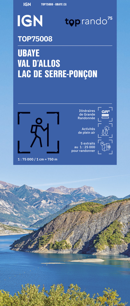
TOP75008 - UBAYE VAL D'ALLOS LAC DE SERRE-PONCON
Editor : IGN
Collection : TOP 75
Scale : 1:75 000
9.80€

TOP75006 - MASSIF DES ECRINS OISANS CHAMPSAUR
Editor : IGN
Collection : TOP 75
Scale : 1:75 000
9.80€

TOP100D04 - ALPES-DE-HAUTE-PROVENCE DIGNE MANOSQUE PNR DU VERDON LAC DE SERRE-PONÇON
Editor : IGN
Collection : TOP 100
Scale : 1:100 000
8.40€

D04-05 ALPES-DE-HAUTE-PROVENCE HAUTES-ALPES
Editor : IGN
Collection : CARTES DÉPARTEMENTALES IGN
Scale : 1:150 000
5.90€

NR15 AUVERGNE-RHÔNE-ALPES RECTO/VERSO MASSIF ALPIN
Editor : IGN
Collection : CARTES RÉGIONALES IGN
Scale : 1:250 000
6.80€

NR16 PROVENCE-ALPES-CÔTE D'AZUR
Editor : IGN
Collection : CARTES RÉGIONALES IGN
Scale : 1:250 000
6.80€

NR14 AUVERGNE-RHÔNE-ALPES RECTO/VERSO MASSIF CENTRAL
Editor : IGN
Collection : CARTES RÉGIONALES IGN
Scale : 1:250 000
6.80€

EUROPE
Editor : IGN
Collection : DÉCOUVERTE DES PAYS DU MONDE IGN
Scale : 1:2 500 000
7.00€
What to visit in LES GORGES DE LA BLANCHE
See more suggestionsEnjoy the green spaces of LES GORGES DE LA BLANCHE.
See more suggestions


Where to eat in LES GORGES DE LA BLANCHE
See more suggestionsChefs in LES GORGES DE LA BLANCHE will delight you.
See more suggestions


Where to sleep in LES GORGES DE LA BLANCHE
See more suggestionsStay at one of the many hotels in LES GORGES DE LA BLANCHE.
See more suggestions


")
