Tours
Activities
Places of interest
Where to eat
Where to sleep

Alpine Adventure at La Baita du Loup in Saint-Veran

Are you the owner?
Saint-Veran, the jewel of the Hautes-Alpes, welcomes you for a unique getaway. Nestled in the Queyras Regional Natural Park, explore breathtaking hiking trails like the Astragales trail. In winter, enjoy cross-country skiing or snowshoeing on pristine snow. Don’t miss the astronomical observatory for a starlit evening, or visit local craftsmen showcasing their ancestral skills. The high mountain f...See more

Walking around LA BAITA DU LOUP

See more suggestions
Discover the nature of LA BAITA DU LOUP on foot.
See more suggestions
SAINT-VÉRAN - Grand circuit de la mine
1.2 km

SAINT-VÉRAN - Grand circuit de la mine

De la préhistoire à notre époque, ce circuit nous propose un voyage dans le temps retraçant la relation entre l’homme et la montagne. Du parking, entrer dans le village de Saint Véran et traverser la rue principale. Passer devant le musée du Soum puis le four des Forannes qui abrite une exposition sur la mine de cuivre. Passer une première fontaine.1 - A la fontaine du Chatelet (reconnaissable par ses quatre sorties d’eau), tourner à gauche et remonter la rue. Prendre à droite, passer au dessus de l’hôtel Alta Peyra. Puis laisser le sentier de Sagnières (2 125 m) à droite et suivre cette montée régulière pendant 20 minutes pour atteindre le Grand Canal.2 - Prendre à droite et poursuivre jusqu'à la cabane de Labounnais. Deux variantes sont possibles. Soit suivre le canal qui rejoint directement la mine moderne en 20 minutes. Pour le Grand circuit de la mine, prendre à gauche et remonter une demi-heure la piste pour rejoindre le point Piniliere (2 530 m).3 - De là, le sentier est récent et moins bien marqué, il suit les balises jaunes ou rouge sur des piquets en bois. Prendre à droite en légère descente et rapidement arriver au point mine préhistorique. L’exploitation préhistorique commence 50 mètres au dessus. Descendre à droite et trouver la Tranchée des Anciens. Continuer de descendre sur ce même sentier traversant différents vestiges jusqu’au Grand Canal. Au croisement poursuivre la descente et arriver au cœur de la mine moderne puis rejoindre la route (en été il est possible de prendre une navette qui ramène à Saint Véran au départ de la carrière de marbre).4 - Rejoindre le bord de la rivière 50 mètres plus bas, tourner à droite jusqu’au pont vieux (1 953 m) GR®58. (Variante intéressante par le canal des Usclasses). Traverser la rivière, et poursuivre le sentier qui finit à Saint Véran. Remonter dans le village par la rue principale et traverser jusqu’au parking de départ. Il est possible de visiter la mine "moderne " par un sentier au départ de la carrière de marbre: 30 minutes.

5 h
16 km
Medium
Show
Sommet Bucher on mountain bike
6.6 km

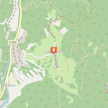
Sommet Bucher on mountain bike

A climb which makes you question why you're there but it's largely made up by a descent which makes you want to do it again and again. Cross the bridge at the end of the parking lot, turn right and follow the road. At the first intersection, go straight and go up. Follow the forest road for a climb on 11km until reaching the grazing meadows.1 - Turn right towards the Saint Simon chapel. Many cattle tracks were formed here, stay on the level as much as possible until you reach the Col des Prés de Fromage. From there, continue to the right towards the Col du Fromage. The trail is wide and smooth, on a descending false flat.2 - Reach a meadow with a fountain and a picnic table surrounded by a fence. Go across the fence, cross the stream and go back into the forest on a steep and narrow path. After a few curves, reach a peak and go left on an aerial path surrounded by sinkholes.3 - 300m before the Col Fromage, descend on the right (the detour at the Col Fromage still offers a spectacular view). Down a steep and technical single track with hairpin bends, steps, stony passages and passages much smoother over several kilometres. Leave a parking lot on the right and a bridge on the left and continue down. The descent becomes less demanding to end in a false flat to reach Montbardon.4 - Cross this hamlet and take a track that remains leveled. At the bridle, stay left and go down the track to access the road uphill. From there, turn left, go down slowly and turn right at the intersection. Follow the road to go back to the starting point.

5 h
28 km
Hard
Show

What to do in LA BAITA DU LOUP

See more suggestions
Explore the bookable activity options in LA BAITA DU LOUP for all tastes and ages.
See more suggestions

What to visit in LA BAITA DU LOUP

See more suggestions
Walk along the picturesque streets of LA BAITA DU LOUP.
See more suggestions

Where to eat in LA BAITA DU LOUP

See more suggestions
Explore the best dining spots in LA BAITA DU LOUP.
See more suggestions

Where to sleep in LA BAITA DU LOUP

See more suggestions
Explore hostels and hotels in LA BAITA DU LOUP.
See more suggestions
Caution!
We have no information on the difficulty of this circuit. You may encounter some surprises along the way. Before you go, please feel free to inquire more and take all necessary precautions. Have a good trip! 🌳🥾