Tours
Activities
Places of interest
Where to eat
Where to sleep

Villedubert, Aude, Languedoc-Roussillon

Are you in charge of the destination?
Villedubert, nestled in the Aude department of the Languedoc-Roussillon region, is a picturesque and charming destination waiting to be explored. This small French village is a haven of peace surrounded by vast landscapes of vineyards and lavender fields, offering an idyllic setting for nature and tranquility lovers. With its traditional architecture, narrow streets, and stone houses, Villedubert ...See more

Walking around Villedubert

See more suggestions
Accessible hikes near Villedubert.
See more suggestions
GR 78 Camin Romieu  from Azille to Carcassonne
5.1 km

GR 78 Camin Romieu from Azille to Carcassonne

Throughout medieval Occitania, the romieu, or romiu (sometimes francised as "roumieu"), is the pilgrim: both the one who goes to Rome and the one who takes the same paths but heads west, walking towards Santiago de Compostela. Between Azille and Carcassonne, a rare occurrence, the trace of these pilgrimages has been inscribed in the toponymy: an old path still bears the name of camin romieu. Towns crossed : Carcassonne, Villemoustaussou, Villalier, Villedubert, Bouilhonnac, Malves-en-Minervois, Laure-Minervois, Aigues-Vives, Saint-Frichoux, Peyriac-Minervois, Rieux-Minervois, Azille, Pépieux Signs : Red and white Itinéraire : * WARNING: This is a global description of the part from Azille to Carcassonne. For more details on this trail, the purchase of the IGN map or the guidebook is recommended. Passing by the lake of Jouarres and the village of Azille, reach Rieux Minervois and discover its heptagonal church and its sculptures by the Master of Cabestany as well as the statue of St Jacques, on the way to Compostela (pilgrim accommodation). From Azille to Peyriac-Minervois, the path follows the old railway line from Moux to Caunes-Minervois, which is now a shaded greenway. Once in Peyriac-Minervois, it bends southwards to reach Saint-Frichoux, a village on a small hill overlooking the depression of the Marseillette's swampland. From there, the path heads west again, towards Malves-en-Minervois (pilgrim accommodation) to Carcassonne along the canal du Midi  (shared route with the GR36.) You can then carry on the chemin de St Jacques de Compostelle (Way of St. James) to Fanjeaux, Mirepoix etc...

48 h
42 km
Easy
Show
Route from the Pyrenean Piedmont to Santiago de Compostela Carcassonne to Fanjeaux - GR 78
5.1 km

Route from the Pyrenean Piedmont to Santiago de Compostela Carcassonne to Fanjeaux - GR 78

In the Middle Ages, the journey along the Camino de Santiago was an important spiritual epic.Pilgrims took a route that led them through Carcassonne, the Camin romieu to Compostela. Signs : Red and white* WARNING: Global description of the itinerary. For more details on this trail, the purchase of the IGN map or the guidebook is recommended.Start of the hike at the Notre Dame de la Santé chapel at the beginning of the Pont Vieux which crosses the Aude, at the foot of the city of Carcassonne. This small chapel was adjacent to the Saint Jacques hospital, which has now disappeared. Leave Carcassonne along the river.You will pass through the hamlets of Maquens and Villalbe to the Taure lake in the middle of a pine forest. Then you reach the villages of Lavalette... join Alairac by the vineyars , a beautiful example of circular village ... then Arzens (Jacquaire stop: communal lodging), an old fortified village.You will enjoy the evening stopover in Montréal d'Aude (Jacquaire stopover: communal lodging), a village perched on a hill from which a magnificent 14th century collegiate church dominates.12.9 km further on is the charming village of Fanjeaux, also on a hilltop, a powerful castrum from the Cathar period. In Fanjeaux you can also follow in the footsteps of Saint Dominic, founder of the Dominican order.From Fanjeaux the GR78 merges with the GR7. The stage between Fanjeaux and Mirepoix (25,9 km) will offer you as many beautiful surprises.

48 h
41 km
Easy
Show
On the plateau de la Bade
6.3 km

On the plateau de la Bade

The omnipresent scrubland reminds of the pastoral activity or abandoned vineyards. One can easily imagine a few goats, passing by on calades (slopes), greeting grape-pickers while feasting on a few branches. Signs: Yellow markings Leaving from the cemetery in rue des Pyrénées. Go up towards the plateau by a rather steep path and pass in front of the water tower. Turn right onto the “chemin des hauts du Thou” and continue until you reach a grassy path. Follow it until you reach a crossroads: turn left and then immediately right. As you walk along the Bade Plateau, the dry-stone walls that once marked out the cultivated plots of land are still visible. On a clear day, the panorama of Carcassonne and its city is revealed with the Corbières and the Pyrenees in the background. After going down the slope, take the track to the right in order to join the asphalt road linking Pennautier to Villegailhenc. Once there, notice in front of you a grey cylindrical marker indicating the passage of the “Méridienne Verte”: a project aiming to materialize the line of the meridian of Paris in France by trees. Turn right for about 250m and then right again on a slightly uphill path. Follow the yellow marks up on the plateau, you will pass in front of a small well protected by a few stakes. A little further on, you will see the panorama of the Montagne Noire and its highest point marked by the Pic de Nore (red and white antenna). The village of Villegailhenc is at your feet. At the crossroads, take the left path which is paved with large pebbles and goes down to the outskirts of the village via “rue du Thou”. Turn right on rue de la Bade and turn right one last time on rue des Pyrénées to get back to the starting point of the loop.

2 h
5 km
Easy
Show
On the tracks of its castle
6.7 km

On the tracks of its castle

Nice loop with passages in the vineyards and in the undergrowth. Signs: Yellow Markings with a rectangle on top Start from the “Avenue du Stade” at the level of the tennis courts and the equestrian centre. Go towards the “Jean Manzanarès” stadium and take the downhill path opposite. At the bottom on the right, cross the two sports fields along the houses and, at the end, go out by the “chemin de Lardern”. At the crossroads, turn left then first right “rue des Troubadours” towards the old village. Continue straight ahead and cross the “Avenue Antoine Bardou”. Take opposite "Place du Château", leaving the church and the castle on your right. Then go down on the left “rue des Ecureuils” and at the bottom on the right along the “Fount Guilhen” stream and its gardens. At the corner of the fence, go up the track to the tarred road. At the tarred road turn left and walk along the houses. At the crossroads turn right and then immediately left “rue du Chenançon” and continue straight ahead. At the cemetery turn right towards the “Domaine d'Audène”. Continue on the track for 1.3 km towards the ridge, pass under the high-voltage lines.   At the top of the hill, turn left onto an earth track and pass between a power pole and a small stone hut. Go around the vineyard on the left to reach the undergrowth, which is very enjoyable in summer. You will then have a beautiful view of the village and its vineyard. As you progress along the edge of the woods, you will be able to enjoy, in good weather, a new viewpoint opening onto the plain with the Cité de Carcassonne, the Montagne Noire and the Pic de Nore. At the exit of the wood, take the track going down towards the road, at the level of the road turn left. You enter the village of Palaja. At the exit of the first bend, on the right at the first tree, enter the field and go along the edge. Then enter the woods, go along a meadow and continue your progress by going down a path. Observe a "marble column" on your right in the half-light. At the exit of the wood, leave the stone porch on your right and continue straight ahead on the road winding between the vines. After the bridge and at the top of the hill, just before the first crossroads, turn left through the vineyard but on the right side of the ditch towards the "Estagnère" estate. Going along the plot for about 600m, you will find on your right hand side a wide path in the middle of the vines. Follow it until you reach a grove of trees and turn left. About 120m further on, again on your right hand side, follow a small path going down through the vegetation. At the end of the bend, turn left on the steep hillside to reach the small bridge. Go up along the campsite. Arriving at the road, you can admire in front of you the "Priory of Saint Foulc". Return by the left to the village of Cazilhac while passing in front of the calvary.

3 h
7.2 km
Very easy
Show
Aribaud’s Walls - Les capitelles
7.8 km

Aribaud’s Walls - Les capitelles

In Conques-sur-Orbiel about thirty volunteers meet for half a day a week to restore these capitelles (dry stone hutS) which served as shelters for the winegrowers during the bad weather. Signs: Blue markings Departure to the right of the big sign going up the track for about 200m. Take on the right a path (small trail) following the blue arrows. Gradually go into the "Occitan garriga" scrubland to discover different “capitelles”. Arrival on a track, on the right for 50m then on the left where four visual supports will inform you about the Essences of the area, the Garrigue, the Alaric mountain and the Pyrenees. Resume the progression behind you by following the markings, you will pass in front of the capitelle des Jumelles. Then two capitelles further on, you will leave on your right the departure of the Cagarot (path N°4, 2km, with beautiful panoramas) and by taking on the left you will arrive at "l'embarrade", this place was restored and fitted out in picnic area by a local association of protection of the capitelles. The path continues on the right up to a track, turn left, slightly uphill for about 250m. On your right, you can see another construction, "l'assietadou" dry stone shelter for sitting. Then the signposts will take you to the left, the progression will take place in a rather dense garrigue, very pleasant and you will end up on a new track. Turn right for 50m and then turn left (do not go over the power line). You will fall back on the track of the departure, take on the left in light descent for the return. You are facing south towards the Pyrenees: admire the panorama... Return to the parking lot.

1 h
2.2 km
Very easy
Show
Around Miramont
9.2 km

Around Miramont

From the top of this headland, the view embraces a magnificent landscape formed by the Aude valley, the reliefs of the Minervois up to the borders of the Montagne Noire. Signs: Yellow markings topped by a circle of the same colour From the “Place du 14 Juillet” square take the rue de la Mairie, pass under the railway line and take the Côte à Cailloux (steep pebble path), a medieval track. Place de l'Eglise, take the rue du Carrayrat then turn left on rue de la Faichette. Turn right on rue de Miramont and follow the chemin de la Tuilerie to leave the village. Pass under the highway and turn right for about 200m/656ft. Turn left, then right, on a slightly steep path lined with low walls. Follow the Chemin du four à Chaux up to the parking lot of the plant nursery. Cross the D8008 and follow the path to the plant nursery for 200m/656ft. Turn right onto the Pas de Roland path, then a few dozen meters further on, this will take you to a viewpoint overlooking the Aude valley, the Minervois relief as far as the edge of the Montagne Noire. Carry on along  the path up to the "departmental" road. At this point, turn left for about 600m/1970ft. At the track intersection, turn left and go down the path on 200m/656ft. You are on the site of the remains of the Miramont castle. Then carry on going down by the same route towards the plant nursery, turn right to reach the village by taking the departmental road D8008 through the farmstead "metairie" towards the village.

3 h
7.7 km
Easy
Show
On the tracks of the thief
9.9 km

On the tracks of the thief

A breathtaking trail, take advantage of the many exceptional viewpoints over the woods and vineyards, then enjoy a panorama of the "Justices" massif and the foothills of the western Corbières and finish with a 360° horizon over all the massifs of the department! The name of the hike is in reference to the legend of Pierre Sourgnes, who spread terror in the villages in the 1800 Signs: Yellow markings with a triangle Departure in front of the town hall. Go into the rue des Sardes to the right of the War Memorial, along the "yellow rectangle surmounted by a triangle" signs. Turn onto rue Traversière, take the passage of the "Couvert du Roy" which will take you back in time. After a short passage on rue de la Mairie, turn right on rue Tortueuse, at the bottom of this street, turn towards rue du Passadou. The stroll carries on along a path that runs along the lower part of the village, after having passed the vegetable gardens, the first vines appear. At the crossroads of the D 304, turn left in the direction of the "Domaine du Bru". At the next crossroads, on the right, go down the gentle slope and pass the stream of "Préchanel". Go left on a semi-shaded path. Go along the small oak wood in the direction of the "pylône d'Eric" and enjoy the exceptional view of the woods and vineyards. Continue on the right on the Saint Martin path for about 650 metres, at the crossroads, go left and then cross the bridge over the stream "Quarantus". Go to the right, ford the stream "Le Toron", turn immediately to the left following the cement path. At the crossroads of tracks, in front of you, panorama on the massif "Des Justices" and the foothills of the western Corbières. Turn right (itinerary from the Chemin de La Cité to the Abbey of Saint Hilaire), after about 600 metres, go up the track on the left towards the crest line through a small wood. Surprise! 360° horizon on the Minervois, the Montagne Noire and its “Pic de Nore”, the Lauragais, the Malepère, the Haute-Vallée de l'Aude, a breathtaking view of the Pyrenees chain with its Monts d'Olmes, its Porteille d'Orlu, its Pérics, its Madre massif, its Canigou and finally the Corbières. Walk along the path the at the angle of a vineyard, turn right and cross the hedge. Go along the hedge on the left and you will come upon a track .Go up left , and at the hight of the water basin turn right and follow the track to the entrance of the village.

3 h
7.5 km
Very easy
Show

What to do in Villedubert

See more suggestions
Exciting adventures await you in Villedubert, book now.
See more suggestions
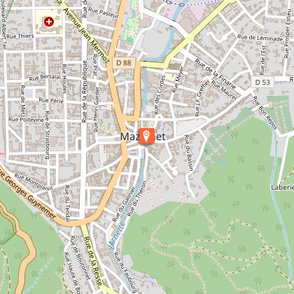
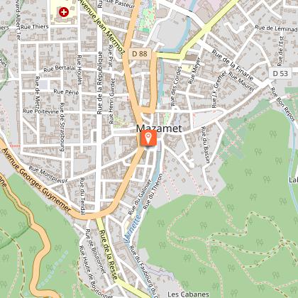
Via Ferrata in Mazamet
28 km

Via Ferrata in Mazamet

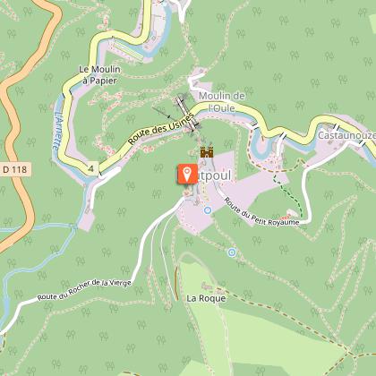
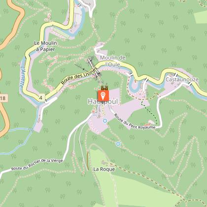
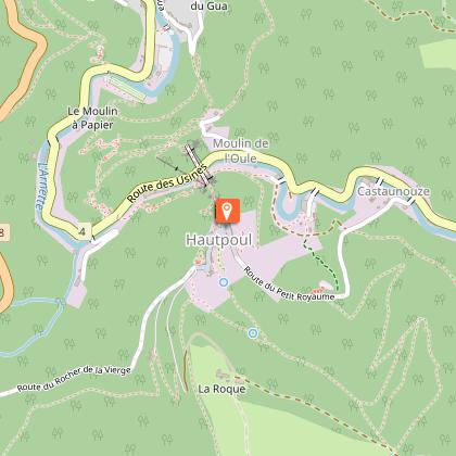
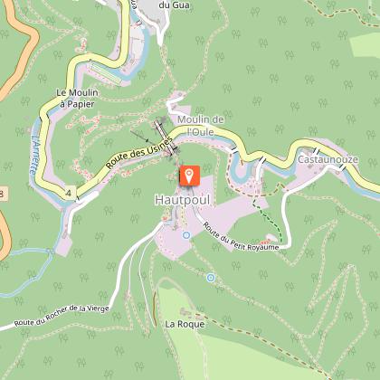
Looking for big thrills? Desire to surpass yourself? The via ferrata of Mazamet is for you! In the the Arnette gorges, in Mazame, via ferrata and giant zip line, under the footbridge. Acrobats and adventurers will enjoy this safe activity which completes, since 2022 the current tourist offer. This land is located in a protected natural site carried by an outstanding historic heritage (Cormouls-Houlès remarkabe gardens, St-Sauveur ruins, classified archeological site), and a rich and diverse wildlife. Nearby, after crossing the Mazamet's Hymalayan footbridge at 70 meters high over the Arnette river, you will find the medieval village of Hautpoul and its gardens, as well as, on the GR7, the House of Wood and Toy, its arboretum and its orchard. A nice wander along the 'Art Net' to picnic in th the shadows of chestnut trees. - Via Ferrata with ziplines : . Access: 20 mn . Drop : 90 m . Length: 880 ml . Difficulty: AD à D+ . Duration: 2 h 30 . Way back: 20 mn - Via Ferrata without zipline . Access: 30 mn . Drop: 110 m . Length: 370 ml . Difficulty: AD à D+ . Duration: 1 h 30 . Way back: 20 mn - Via Ferrata (upper part of Hautpoul) . Access: 20 mn . Drop: 60 m . Length: 130 ml . Difficulty: PD . Duration: 45 mn . Way back: 25 mn Minimum gear required: . Helmet . Harness . Closed shoes . Rest Karabiner & short lanyard . 2 wide aperture autoblock gate karabiners . Karabiner aerolink specifically for continuous safe line . Lanyard aeroline Ferrata . Double lanyard with shock absorber . Gloves General recommendations: Access to the Via Ferrata of Mazamet is prohibited: - to children measuring less than 1,35m and minors who are not accompanied by un experienced adult ; - outside opening hours and over night ; - in adverse weather conditions and especially when the route is slipppery and affected by snow, ice and stormy conditions. You agree to undertake this activity at your own risk. If you have little or no experience in this type of activity, please contact the services of a guide. Equipment rental: Mazamet Tourist Office Online booking: www.tourisme-castresmazamet.com/billetterie Rates: 18€/pers. Groups more than 5 persons: 16,50€/pers. Groups more than 10 persons : 15€/pers. Deposit: 400€ (on the day of the rental, chèque ou Crédit card) For beginners or persons needing a guide, you can contact: - Aude Escapades - Laurence Combes 06 03 50 00 85 - Axecime - Yannick Saulnier 06 08 42 27 13

95 rue de la Resse 81200 Mazamet
Book from 0 €Book
Show
Le moulin des Sittelles
46 km

Le moulin des Sittelles

The Moulin and the Pavillon d'Adélaïde seem to be in great discussion by the river. Located in the heart of a triangle Toulouse-Carcassonne-Albi, Castres doors and at the foot of the granitic massif du Sidobre, Burlats is a pretty responsible village of medieval history and Occitan culture. The Pavilion in Adelaide, the home of Adam, the Castle are evidence of a rich history. Along the River Valley floor village is surrounded by forest and forested mountains. The quality of water and improvements on the Agout make Burlats a privileged place for the practice of canoeing. The Moulin des Sittelles opens its windows on a green natural landscape and large spaces for approval. It has premises and equipment adapted for the reception of groups of children and adults, for all types of stays.Located in the heart of a triangle Toulouse-Carcassonne-Albi, Castres doors and at the foot of the granitic massif du Sidobre, Burlats is a pretty responsible village of medieval history and Occitan culture. The Pavilion in Adelaide, the home of Adam, the Castle are evidence of a rich histo Bed & Breakfast Group at the centre of Burlats, with terrace and walled garden, overlooking the village square and the banks of the river Agout. Total capacity of 94 beds, divided into rooms of different capacities: single rooms, double, four, five, six or even seven people in beds 90x190cm bunk or not. Rooms on the first and second floor, each with a washbasin. Many rooms with private shower. Ground floor: rooms activity or class, room multi-activity, two dining rooms, kitchen equipped for groups; room music with instrumentarium and recording studio, home computer with internet access. Approval of National Education, youth and Sports.gite's group at the centre of Burlats, with terrace and walled garden, overlooking the village square and the banks of the river Agout. Total capacity of 94 beds, divided into rooms of different capacities: single rooms, double, four, five, six or even seven people in beds 90x190cm bunk or not. Rooms on the first and second floor, each with a washbasi

9 places des Tisserands Village 81100 Burlats
Book from 0 €Book
Show

What to visit in Villedubert

See more suggestions
Take a boat tour around Villedubert.
See more suggestions

Where to eat in Villedubert

See more suggestions
Discover the culinary diversity of Villedubert.
See more suggestions

Where to sleep in Villedubert

See more suggestions
Discover the best lodging options in Villedubert.
See more suggestions
Résidence Midi
29 km

Résidence Midi

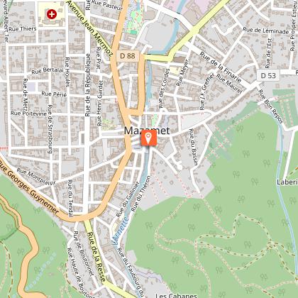
Residency for musicians, artists and software developer Residence Midi is primarily a residence space for musicians, artists and software developer but when our rooms are not occupied by artists they are open for regular bookings. We offer space to make music, host co-working sessions, organise workshops, do R&D, build installations, solder electronics, rehearse, and (most importantly) relax. Whatever it is, we got you covered. Nestled at the bottom of the Montagne Noire in southern France, Mazamet is a paradise for walking, cycling, swimming and just wandering around. Accomodation Our residency is situated on the first floor of our beautiful 1920’s Maison maitre, offering three bedrooms, two bathrooms, a kitchen, a living room and two balconies. Each bedroom has its own unique character and atmosphere. The Unit Our biggest and brightest room with a stunning view over the mountains and garden. It comes with a comfortable queen size bed and cozy rocking chair. It offers a personal en-suite bathroom, including bathtub and private toilet. It has airconditioning. The Blue room This room lends its name from the blue tapestry on the walls and stained glass windows. It has a comfortable queen size bed, work desk and en-suite toilet and sink. You share the communal shower. Le Maroc A bright and comfortable room with a cozy queen size bed. It comes with a small desk, couch (that serves as an extra bed) and a private balcony. You share the communal toilet and bathroom. The Kitchen Fully equipped with a stove, oven, dishwasher and fridge. Shopping facilities, regional markets and grocery stores are all in walking distance. The living room The wooden table seats 8 and is a great place to get work done. Sink in the couch to relax. You can see the garden and mountains from the balcony. The Garden We love our little park. Covered by trees and flowers: this 1 acre slab of greenery is the perfect place to relax. The garden is accessible through a private corridor that leads directly to the residency upstairs. There are multiple seating areas, an outside work space and even a shower for the hot summer days. Internet The whole house and even the garden has fast internet. Soon it will hopefully be even faster as we are getting fibre. Environment At Residence Midi we think of the environment. This is why most of our furniture is second hand vintage or repurposed, the linens and textiles are made of bio cotton, other natural material or fabricated out of recycled materials. All our cleaning products, detergents and beauty products are ecological, non toxic, biodegradable and often handmade and according to zero waste principles to avoid unnecessary packaging.
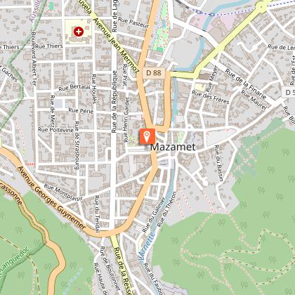
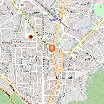
12 rue du Redondal 81200 Mazamet
Show
Caution!
We have no information on the difficulty of this circuit. You may encounter some surprises along the way. Before you go, please feel free to inquire more and take all necessary precautions. Have a good trip! 🌳🥾