Tours
Activities
Places of interest
Where to eat
Where to sleep

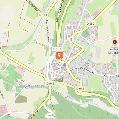
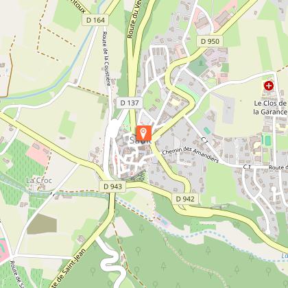
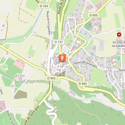
Discover CAMPING DU DEFENDS in Sault, Vaucluse

Are you the owner?
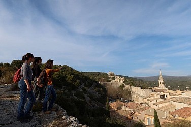
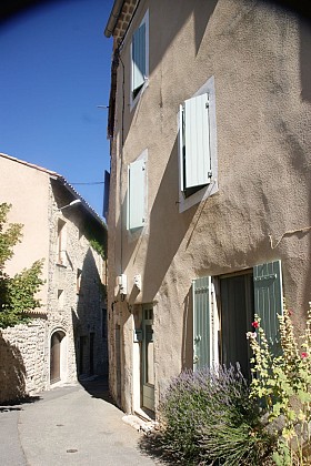
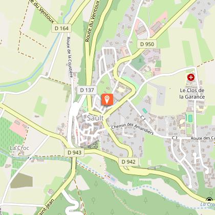
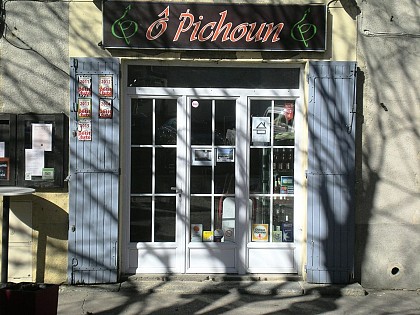
Welcome to Camping du Defends, nestled in the heart of the charming commune of Sault, in the Vaucluse, Provence-Alpes-Côte d'Azur. Your adventure starts here, surrounded by picturesque landscapes and a wealth of cultural richness. Sault is globally renowned for its lavender fields, turning hills into a purple, fragrant ocean during summer. Stroll through these enchanting fields or visit the local ...See more

Walking around CAMPING DU DEFENDS

See more suggestions
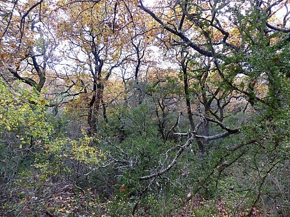
Explore the natural surroundings of CAMPING DU DEFENDS.
See more suggestions
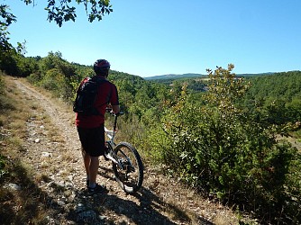
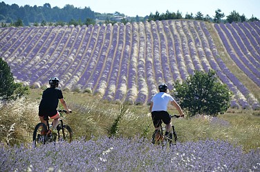
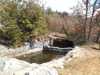
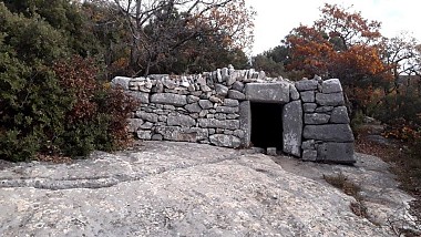
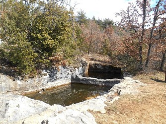
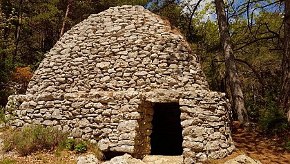
The Aiguiers (cistern from rock) of St-Saturnin-lès-Apt
14 km

The Aiguiers (cistern from rock) of St-Saturnin-lès-Apt

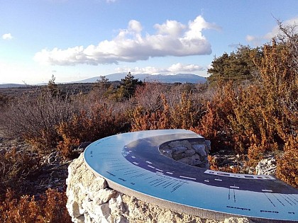
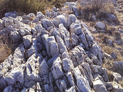
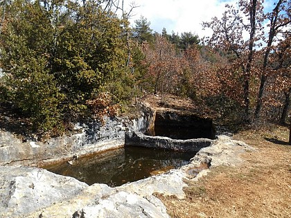
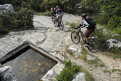
Short and clever combination of the "Sentier des Aiguiers'' which offers a beautiful glimpsecrafty and remarkable water supplies. Back facing the car park, go down across on the paved track. After the turn; go back up gently. At the 1st intersection, turn left and climbthe track. Leave behind several roads to the right then to the left leading to houses. Pass a sloping ledge and reach the Aiguiers Bessons.1- Rise to the right onto the path. At the 1st crossing, continue the winding paths across (new variant). At the path, still continue across. A little further, leave a track going to the right and continue on the rocky ledge. Reach a viewpoint and climb the edge to the east (marking hardly noticeable). Reach a small covered aiguier. Continue to the right, pass the orientation table and reach the Cluyer dome (mountain pass cycling milestone).2- From there, head right; 50 meters further on, turn right into the passage between the boxwood and serviceberry bushes (be sure to follow the green dots on the ground). Emerge onto the south face and descend 30 meters to a remarkable viewpoint. Then, retrace your steps to point 3. At the wooden marker post, go straight ahead and then turn right (green dots no. 5). Follow the path heading due north (green dot), continue under the pine trees, and emerge onto the La Liguière track. Turn left and follow the forest service track (DFCI) for about 250 meters to find the Barralier *aiguier* (stone water cistern), hidden in the undergrowth uphill from the track. Retrace your steps to point 5, then—this time at the junction—continue straight ahead for 150 meters (green dots no. 5 and no. 14). At the Y-junction, take the La Cassette path to the left, marked "Sentier des Aiguiers" (green dot marker no. 14). Be sure to stay on the marked path (green dot)—please respect the area, as this is a private path! Go around the house to the right (past the barrier), then take the track to the left, descend, and emerge onto another track. Follow this track to the right to reach the Gayéoux *aiguiers* (green dot marker no. 14).3- At the junction with the Travignon track, turn right and descend the track (following GR® markers and green dot #14). After 300 m, continue straight along the track; then, 100 m further on (at a wooden marker post), leave the track and the GR® route to head up the path to the left (marked with a green dot #14). Climb through the woods to reach the Collet de Travignon, then descend the southern slope. You will emerge at the Travignon *aiguiers* (traditional stone cisterns). Next, make your way along the rocky trail that cuts across two bends of the nearby wide track, reaching the first ruins of the hamlet of Travignon (marked with a green dot #14). Facing the wooden marker post, turn left and pass through the Travignon ruins (private property; risk of collapse—do not enter!).4- At the "Travignon" junction, turn right and immediately descend the old mule track to the left (GR® markers and green dot no. 14). Navigate four switchbacks; then, near two large rocks, leave the GR® trail to the left and descend the path to the right (green dot no. 14 marker). Climb slightly to reach the Romanet track. Follow it downhill to the left for 1 km (yellow PR markers and green dot no. 14). 5- Leave the track (at the 754 m point) and head up the path to the right (green dot no. 14 marker). 200 m further up (at a marker post), turn left and climb the trail. Continue along a level section, then a slight descent, before gradually climbing up to a track serving the Caulet farm (green dot no. 14 marker). Follow the track down to the left, climb slightly, then turn left (at a marker post). Descend the trail heading south (green dot no. 14 marker).6- After rounding a bend (marked by a boundary stone), continue straight down for another 50 m, then weave left between the oak trees to reach the secluded "Grognards" *aiguiers* (stone cisterns) (green dot marker no. 14). Retrace your steps to the boundary stone, then turn left (green dot marker no. 14). You will emerge at the corner of a fence. Turn left, follow the fence line, and come out onto the Romanes track. Head down to the left; 200 m further on, continue along the track to the right and return to the starting point by retracing the route taken on the way out. Discovery Route no. 14 from the Saturninoise Hiking Association (ARPS). 

5 h
16 km
Medium
Show
The Aiguiers (cistern from rock) of St-Saturnin-lès-Apt
14 km

The Aiguiers (cistern from rock) of St-Saturnin-lès-Apt

Short and clever combination of the "Sentier des Aiguiers'' which offers a beautiful glimpsecrafty and remarkable water supplies. Back facing the car park, go down across on the paved track. After the turn; go back up gently. At the 1st intersection, turn left and climbthe track. Leave behind several roads to the right then to the left leading to houses. Pass a sloping ledge and reach the Aiguiers Bessons. 1 - Rise to the right onto the path. At the 1st crossing, continue the winding paths across (new variant). At the path, still continue across. A little further, leave a track going to the right and continue on the rocky ledge. Reach a viewpoint and climb the edge to the east (marking hardly noticeable). Reach a small covered aiguier. Continue to the right, pass the orientation table and reach the Cluyer dome (mountain pass cycling milestone). 2 - Descend the trail due north, continue on the path under the pines and come out on La Liguière track. Follow right on 150m and take on the right the Lays track (ignore the sign'Sentier des Aiguiers'' to the left). Reach the Romanet track and go down to the right for 500m, then at the exit of a bend, turn left towards Travignon. After a ledge in the woods, turn left. 3  - Continue the path straight. Pass 2 turns and reach the Aiguiers upstream. Retrace your steps to point 3 by cutting through 2 turns by the stony path. Turn left and cross the ruins of Travignon. When leaving the hamlet, take a sharp right and immediately a left to go down the winding paths of the old mule track. When at the 2 large rocks, leave the GR® behind to the left and go down the path to the right. Go up slightly to come out on the Romanet track. Go down on the left for 1km / less than a mile. 4 - Do not miss the path that rises to the right (point 754m). 200m above, turn left and climb the path. Continue by following the marking carefully (private property!), then gradually rise to a track that leads to the Caulet farm. Go down to the left, go up slightly, then turn left (mountain pass cycling milestone).Go down the path to the south. Do not miss, at the exit of a corner, the trail rising to right and coming out on the corner of a fence. Turn left, walk along the fence and come out on the Romanes trail. Turn left to return to the starting point.

5 h
15 km
Medium
Show
The Aiguiers (cistern from rock) of St-Saturnin-lès-Apt
14 km

The Aiguiers (cistern from rock) of St-Saturnin-lès-Apt

Short and clever combination of the "Sentier des Aiguiers'' which offers a beautiful glimpsecrafty and remarkable water supplies. Back facing the car park, go down across on the paved track. After the turn; go back up gently. At the 1st intersection, turn left and climbthe track. Leave behind several roads to the right then to the left leading to houses. Pass a sloping ledge and reach the Aiguiers Bessons.1- Rise to the right onto the path. At the 1st crossing, continue the winding paths across (new variant). At the path, still continue across. A little further, leave a track going to the right and continue on the rocky ledge. Reach a viewpoint and climb the edge to the east (marking hardly noticeable). Reach a small covered aiguier. Continue to the right, pass the orientation table and reach the Cluyer dome (mountain pass cycling milestone).2- From there, head right; 50 meters further on, turn right into the passage between the boxwood and serviceberry bushes (be sure to follow the green dots on the ground). Emerge onto the south face and descend 30 meters to a remarkable viewpoint. Then, retrace your steps to point 3. At the wooden marker post, go straight ahead and then turn right (green dots no. 5). Follow the path heading due north (green dot), continue under the pine trees, and emerge onto the La Liguière track. Turn left and follow the forest service track (DFCI) for about 250 meters to find the Barralier *aiguier* (stone water cistern), hidden in the undergrowth uphill from the track. Retrace your steps to point 5, then—this time at the junction—continue straight ahead for 150 meters (green dots no. 5 and no. 14). At the Y-junction, take the La Cassette path to the left, marked "Sentier des Aiguiers" (green dot marker no. 14). Be sure to stay on the marked path (green dot)—please respect the area, as this is a private path! Go around the house to the right (past the barrier), then take the track to the left, descend, and emerge onto another track. Follow this track to the right to reach the Gayéoux *aiguiers* (green dot marker no. 14).3- At the junction with the Travignon track, turn right and descend the track (following GR® markers and green dot #14). After 300 m, continue straight along the track; then, 100 m further on (at a wooden marker post), leave the track and the GR® route to head up the path to the left (marked with a green dot #14). Climb through the woods to reach the Collet de Travignon, then descend the southern slope. You will emerge at the Travignon *aiguiers* (traditional stone cisterns). Next, make your way along the rocky trail that cuts across two bends of the nearby wide track, reaching the first ruins of the hamlet of Travignon (marked with a green dot #14). Facing the wooden marker post, turn left and pass through the Travignon ruins (private property; risk of collapse—do not enter!).4- At the "Travignon" junction, turn right and immediately descend the old mule track to the left (GR® markers and green dot no. 14). Navigate four switchbacks; then, near two large rocks, leave the GR® trail to the left and descend the path to the right (green dot no. 14 marker). Climb slightly to reach the Romanet track. Follow it downhill to the left for 1 km (yellow PR markers and green dot no. 14). 5- Leave the track (at the 754 m point) and head up the path to the right (green dot no. 14 marker). 200 m further up (at a marker post), turn left and climb the trail. Continue along a level section, then a slight descent, before gradually climbing up to a track serving the Caulet farm (green dot no. 14 marker). Follow the track down to the left, climb slightly, then turn left (at a marker post). Descend the trail heading south (green dot no. 14 marker).6- After rounding a bend (marked by a boundary stone), continue straight down for another 50 m, then weave left between the oak trees to reach the secluded "Grognards" *aiguiers* (stone cisterns) (green dot marker no. 14). Retrace your steps to the boundary stone, then turn left (green dot marker no. 14). You will emerge at the corner of a fence. Turn left, follow the fence line, and come out onto the Romanes track. Head down to the left; 200 m further on, continue along the track to the right and return to the starting point by retracing the route taken on the way out. Discovery Route no. 14 from the Saturninoise Hiking Association (ARPS). 

5 h
16 km
Medium
Show
The Aiguiers (cistern from rock) of St-Saturnin-lès-Apt
14 km

The Aiguiers (cistern from rock) of St-Saturnin-lès-Apt

Short and clever combination of the "Sentier des Aiguiers'' which offers a beautiful glimpsecrafty and remarkable water supplies. Back facing the car park, go down across on the paved track. After the turn; go back up gently. At the 1st intersection, turn left and climbthe track. Leave behind several roads to the right then to the left leading to houses. Pass a sloping ledge and reach the Aiguiers Bessons. 1 - Rise to the right onto the path. At the 1st crossing, continue the winding paths across (new variant). At the path, still continue across. A little further, leave a track going to the right and continue on the rocky ledge. Reach a viewpoint and climb the edge to the east (marking hardly noticeable). Reach a small covered aiguier. Continue to the right, pass the orientation table and reach the Cluyer dome (mountain pass cycling milestone). 2 - Descend the trail due north, continue on the path under the pines and come out on La Liguière track. Follow right on 150m and take on the right the Lays track (ignore the sign'Sentier des Aiguiers'' to the left). Reach the Romanet track and go down to the right for 500m, then at the exit of a bend, turn left towards Travignon. After a ledge in the woods, turn left. 3  - Continue the path straight. Pass 2 turns and reach the Aiguiers upstream. Retrace your steps to point 3 by cutting through 2 turns by the stony path. Turn left and cross the ruins of Travignon. When leaving the hamlet, take a sharp right and immediately a left to go down the winding paths of the old mule track. When at the 2 large rocks, leave the GR® behind to the left and go down the path to the right. Go up slightly to come out on the Romanet track. Go down on the left for 1km / less than a mile. 4 - Do not miss the path that rises to the right (point 754m). 200m above, turn left and climb the path. Continue by following the marking carefully (private property!), then gradually rise to a track that leads to the Caulet farm. Go down to the left, go up slightly, then turn left (mountain pass cycling milestone).Go down the path to the south. Do not miss, at the exit of a corner, the trail rising to right and coming out on the corner of a fence. Turn left, walk along the fence and come out on the Romanes trail. Turn left to return to the starting point.

5 h
15 km
Medium
Show
Underground water tanks in Travignon
18 km

Underground water tanks in Travignon

Starting at the hilltop village of Saint-Saturnin-lès-Apt, a great trip on the Sentier des Aiguiers, the top of Mount Cluyer and the ruins of Travignon. Back turned to the ''Information Point", next to the post office and pharmacy, go left then right onto the Rue Victor Hugo on 50m. Begin to the left on the Rue de la Combe and take a quick left under the puppet. Climb the cobblestone to the mill. Go up the path to the right on the edge of the plateau. Then take a right, cross the dam, pass through the castrum and turn left into the castle. Bypass the chapel on the left. 1 - At the crossroads, go straight across. Continue to the right and climb to the Chemin des Gavaniols. Continue straight. Leave several roads to your left and right leading to houses. Pass a sloping ledge and reach the Aiguiers Bessons. 2 - Rise to the right onto the path. At the 1st (new alternative route) then 2nd crossing, continue on the path in front. Leave a track going to the right and reach the rocky ledge. Climb the East ridge (markings barely visible), reach a small covered aiguier (Provençal underground water tank) and continue right to the Mount Cluyer dome. Pass the viewpoint and reach the summit plateau (milestone). 3 - Descend the trail due north, continue on the path under the pines and come out on La Liguière track. Follow the track for 150m and at the Y-like crossroad, continue left on the Chemin de la cassette (private pathway!). Bypass the farm to the right (gate) and reach the track below. Turn right (GR®) and after the aiguiers of Gayeoux, turn right. Go down 400m and leave a path to the left. 4 - Take a sharp left (milestone). Climb the small mountain pass of Travignon and switch to the aiguiers upstream the hamlet. Descend to the right on the rocky path, then turn left. Go through the ruins of Travignon, take a sharp right at the exit of the hamlet and immediately a left to go down the winding paths of the old mule track. 5 - Take a sharp left and immediately right (GR®). Hurtle down the trail which is very craggy down below. Continue at the valley bottom. Skip the narrow pass of the Rocher de la Cadière. At the crossroads "Puits du Geay", go straight. Pass the narrow gully of the Portes de Castor and go straight. 6 - look to the right for the 1st orchard along the track. Turn right, go up 100m along the field and climb the trail to the Bois du Defens. At the path, go across, descend and coming out of the scrubland, turn right. Go up the Rue de Fontaine de Guby to the right. Reach the Chemin de Romanet then the Cours de la Liberté to the left to go back to the village center.

6 h
20 km
Hard
Show

What to do in CAMPING DU DEFENDS

See more suggestions
Book your activities in CAMPING DU DEFENDS and experience memorable moments.
See more suggestions
Hostellerie du Val de Sault
924 m

Hostellerie du Val de Sault

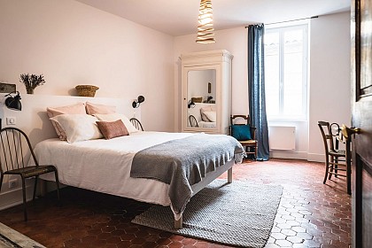
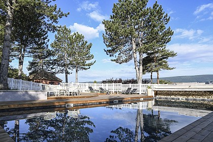
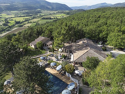
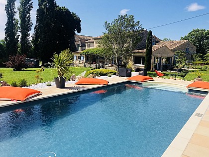
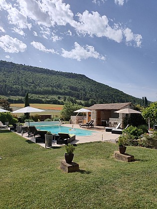
Charming hotel located in the heart of nature with a panoramic view, 2 km from the village. Offers 20 rooms, suites, and apartments, all with a terrace. Secure parking, heated pool, fitness room, sauna, and jacuzzi complete the offer. Located in an ideal setting facing the Mont Ventoux, one couldn't find a better location to savour the multiple colors of Provence, characterized by the lavender fields, this "Blue and Gold Garden" so dear to Jean Giono. It's in the heart of a natural and wild territory that we welcome you for a pure moment of relaxation. You'll enjoy sunny days around the pool or from your terrace, with an exceptional panorama of the plain of Sault and the Giant of Provence. Our relaxation area offers a variety of treatments that will provide you with a real sense of well-being. Massages (sports, relaxing, etc.) and beauty treatments are available by appointment. The site, privileged for relaxation, tranquility, space, and gastronomy, offers you 2 heated pools, one with a counter-current swimming option, a fitness room, a petanque court, a bicycle garage, and other amenities to enhance your stay. Our estate has 20 rooms and suites, equipped with bay windows and terraces, allowing you to fully enjoy the natural surroundings from your room. Let yourself be carried away by the gentle scent of Provence! "The Garden Rooms" Contemporary in style and on one level, they benefit from a large bay window that lets in light and opens onto the terrace with sun loungers and a parasol. These spacious, soundproofed rooms of 37m² can be arranged with either a king-size bed or two separate single beds. The bathroom, open to the room, has a jet shower with tropical rain and separate toilets. "Duplex Apartment" With 62 m² on two levels, the ground floor features a spacious living area open onto a private terrace, consisting of a kitchen/dining area, a breakfast nook, a bathroom with WC, walk-in shower, and a living area. The first floor offers a spacious bedroom with an unobstructed view of the garden and a large furnished balcony facing west to enjoy the sunset. The bedroom, equipped with a bathroom, separate WC, is air-conditioned and equipped with a flat-screen TV and a safe. "Family Suite" Spanning 70 m², it can accommodate up to 6 people. Overlooking the forest, it consists of two independent bedrooms whose beds can be converted into a king-size bed or two separate single beds. The spacious living room opens onto the private terrace, bordered by the scrubland. It is equipped with a sofa bed that converts into a large bed. The bathroom features a hydrojet steam shower and light therapy. The toilets are separate. "Ventoux Apartment" On one level, this spacious 70 m² apartment offers views of the Sault Valley and Mont Ventoux. Ideally oriented to admire the sunset and the lavender fields in season. Comprising 3 rooms, bedroom, living room, kitchen, a furnished terrace on the west side facing Mont Ventoux, and an east-facing terrace overlooking the garden. The bathroom features a steam shower cabin with hydromassage jets, double washbasin, and separate toilets. "Provence-Asia Suites" These 90 m² duplexes offer a true space dedicated to relaxation. They consist of a living room opening onto a bathroom equipped with a hydrojet steam shower and a bathtub, located in the glass pergola, offering a view of the plain of Sault, the lavender fields, and Mont Ventoux. A staircase leads to the large bedroom on the garden level furnished with a four-poster king-size bed. From there, access to the private terrace is provided. These suites are furnished and decorated in the style of Bali, a fusion of Provence and Asia, to prioritize space, rest, and the pleasure of self-care.

1167 Ancien chemin d'Aurel 84390 Sault
Book from 21 EURBook
Show

IGN cards

3240OT - BANON SAULT PLATEAU DE SAINT-CHRISTOL
Editor : IGN
Collection : TOP 25 ET SÉRIE BLEUE
Scale : 1:25 000
13.90€
TOP75034 - LUBERON  MONT VENTOUX
TOP75034 - LUBERON MONT VENTOUX
Editor : IGN
Collection : TOP 75
Scale : 1:75 000
9.80€
VEL01 - LA DRÔME A VELO
Editor : IGN
Collection : DECOUVERTE A VELO
Scale : 1:105 000
9.10€
VEL03 - LE VAUCLUSE A VÉLO
Editor : IGN
Collection : DECOUVERTE A VELO
Scale : 1:100 000
9.10€
TOP100D04 - ALPES-DE-HAUTE-PROVENCE DIGNE MANOSQUE PNR DU VERDON LAC DE SERRE-PONÇON
Editor : IGN
Collection : TOP 100
Scale : 1:100 000
8.40€
TOP100D84 - VAUCLUSE AVIGNON CARPENTRAS PARCS NATURELS RÉGIONAUX DU LUBERON ET DU MONT-VENTOUX
Editor : IGN
Collection : TOP 100
Scale : 1:100 000
8.40€
TOP100D26 - DRÔME VALENCE MONTÉLIMAR DIE PNR DES BARONNIES PROVENÇALES PNR DU VERCORS
Editor : IGN
Collection : TOP 100
Scale : 1:100 000
8.40€
D13-84 BOUCHES-DU-RHÔNE  VAUCLUSE
D13-84 BOUCHES-DU-RHÔNE VAUCLUSE
Editor : IGN
Collection : CARTES DÉPARTEMENTALES IGN
Scale : 1:150 000
5.90€
D04-05 ALPES-DE-HAUTE-PROVENCE HAUTES-ALPES
Editor : IGN
Collection : CARTES DÉPARTEMENTALES IGN
Scale : 1:150 000
5.90€
D07-26 ARDÈCHE DRÔME
Editor : IGN
Collection : CARTES DÉPARTEMENTALES IGN
Scale : 1:150 000
5.90€
D83 VAR
D83 VAR
Editor : IGN
Collection : CARTES DÉPARTEMENTALES IGN
Scale : 1:150 000
5.90€
NR14 AUVERGNE-RHÔNE-ALPES RECTO/VERSO MASSIF CENTRAL
Editor : IGN
Collection : CARTES RÉGIONALES IGN
Scale : 1:250 000
6.80€
NR16 PROVENCE-ALPES-CÔTE D'AZUR
Editor : IGN
Collection : CARTES RÉGIONALES IGN
Scale : 1:250 000
6.80€
NR15 AUVERGNE-RHÔNE-ALPES RECTO/VERSO MASSIF ALPIN
Editor : IGN
Collection : CARTES RÉGIONALES IGN
Scale : 1:250 000
6.80€
EUROPE
EUROPE
Editor : IGN
Collection : DÉCOUVERTE DES PAYS DU MONDE IGN
Scale : 1:2 500 000
7.00€

What to visit in CAMPING DU DEFENDS

See more suggestions
Discover the nightlife of CAMPING DU DEFENDS.
See more suggestions
Where to eat in CAMPING DU DEFENDS

See more suggestions
A wide selection of restaurants awaits you in CAMPING DU DEFENDS.
See more suggestions

Where to sleep in CAMPING DU DEFENDS

See more suggestions
Find lodging to suit your needs in CAMPING DU DEFENDS.
See more suggestions
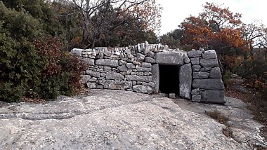
Caution!
We have no information on the difficulty of this circuit. You may encounter some surprises along the way. Before you go, please feel free to inquire more and take all necessary precautions. Have a good trip! 🌳🥾