Alert
Alerts
Hiking Trail: Boucle des Vignes Loop
Description
Nice hike that lead you through very differents environments : from vineyards located on the edge of Dranse river to dry forests on sunny sides or orchards and pastures.
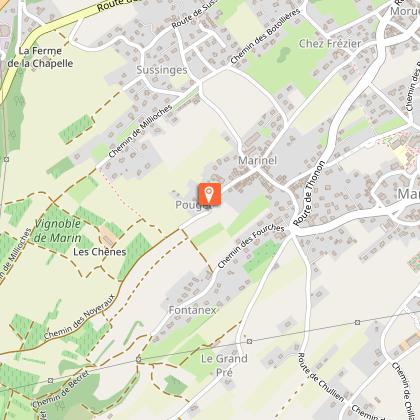
Departure : next to "Larry" area, Marin.
The route follows the western slope of the hill, which has no paved roads, and runs alongside the Dranse River through a deciduous forest before emerging at “Les Vignes de Pont,” a name dating back to the Middle Ages for the hamlet that was swept away several times by floods before being rebuilt a few kilometers further on to become Marin.
The vineyard loop surprises with its succession of starkly contrasting landscapes: vineyards and orchards, forests with a variety of tree species, fields, and crops. Located just outside Thonon, yet so wild and secluded, you’ll find your worries flying away like blackbirds beneath the pine trees.
Please be respectful of the vineyards and orchards.
Technical Information
Altimetric profile
Starting point
Points of interest



Additional information
Sustainable tourism
To help protect agricultural practices, natural areas, and wildlife, please keep your dogs on a leash and pick up after them. Please keep and sort your trash, stay on the trails, and close any gates behind you.
Updated by
Office de Tourisme Leman Mountains Explore - 15/10/2026
leman-mountains-explore.com
Report a problem
Environments
Mountain view
In the country
Lake view
Village -2 km away
Open period
All year round daily.
Check with the tourist offices in advance to find out the current access requirements.
Subject to favorable snow and weather conditions.
Contact
Phone : 04 50 73 60 72
Email : info@ot-peva.com
Website : https://leman-mountains-explore.com
Topo guides and map references
Topo guides references :
Hiking maps and guidebooks are available for purchase at tourist information offices in the Pays d'Evian-Vallée d'Abondance region.
Map references :
- Map and Guide: 65 Walks and Hikes in the Evian Region and Abondance Valley
- TOP 25 IGN No. 3528: Morzine, Chablais Massif, and Les Portes du Soleil
Type of land
Ground
Hard coating (tar, cement, flooring)
Grit
Not suitable for strollers
Reception complements
No matter what hike you’re planning, be sure to wear good hiking shoes and pack the following in your backpack: granola bars, plenty of water, sunglasses, sunscreen, a small first-aid kit, as well as clothing appropriate for your outing, depending on the season and the forecast.
Guidebook with maps/step-by-step
0/ Blue signs along the roadside mark the start of the hike.
1/ From the Larry parking lot, head toward Larry, then follow the signs for Le Pont.
2/ Continue toward Les Moulins du Maravant until you reach Aux Roinsettes, passing through Vignes de Pont, Fiogey, Bois de Pins, Sous les Chenies, and Lages des Dranses.
3/ At the Aux Roinsettes intersection, head back toward Larry to return to the Larry parking lot, this time passing through Cutlaz and Fontanex.
Animals
Yes. Dogs must be kept on a leash due to the presence of livestock and wildlife.
