Alert
Alerts
Le Chalet - Refuge de Coutarse


IGN cards


Description
Between the Nant d'Orgeval and Chéran rivers, in the shade of fayards and fir trees, this is an ideal summer hike. A cold drink awaits you at the Coutarse refuge! And even a bed if you want to extend the experience...
To begin your hike, you follow a track into the forest. It soon becomes a wide path, known as the "Chemin du Gros Fayard". Fayard is the local name for the Beech tree, so useful in the mountains for heating and making furniture. And it's true that there are some fine specimens here!
Below, you can hear the murmur of the Nant d'Orgeval, which you'll soon ford. From pebble to pebble, be careful not to get your shoes wet!
Then the slope becomes steeper to reach the Coutarse refuge. But once you've reached the top, you can take a short break and enjoy a refreshing drink on the terrace.
The return journey is through the Coutarse forest, on the opposite bank of the Nant d'Orgeval. Don't stray off the marked trails, as this is a protected area where wildlife must not be disturbed.
Then you'll reach the banks of the Chéran, a modest mountain stream at this altitude, which will lead you back to the parking lot.
Technical Information
Altimetric profile
Starting point
Steps
Date and time
- From 01/04/2026 to 31/10/2026
Additional information
Updated by
Agence alpine des territoires - 13/06/2025
www.agate-territoires.fr
Report a problem
Environments
Mountain location
Location complements
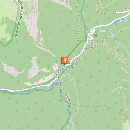
From Chambéry, reach Ecole via the Col du Frêne (D911). Turn right in the village, towards Jarsy, and at the exit take the Bellevaux valley road. Park at the end of the authorized road, at the "Nant Fourchu" parking lot. Start of the route upstream, on the road.
Open period
From 01/04 to 31/10.
Subject to favorable weather.
Type of land
Not suitable for strollers
Contact
Phone : 04 79 54 84 28
Email : accueil.bauges@chamberymontagnes.com
Website : https://www.chamberymontagnes.com
Guidebook with maps/step-by-step
Start: "Nant Fourchu" parking lot.
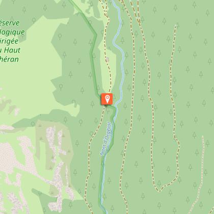
1/ Follow signs for "Chalets et Col d'Orgeval" (GRP markings), first on the track, then on the chemin du gros fayard.
2/ The steep climb through the forest leads into the Orgeval meadows at around 1,350 m altitude.
3/ At the next crossroads, called "Sous Orgeval - 1,400 m", turn right onto the track that leads down to the ford at Orgeval (approx. 1,370 m), then back up to the "Nant d'Orgeval - 1,388 m" crossroads.
From the "Sous Orgeval" junction, access to the Col d'Orgeval takes approx. 1 hr.
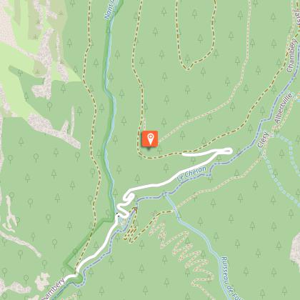
4/ Turn left up the winding track in the Coutarse forest to reach the "Chalet de Coutarse - 1,604 m". New guarded refuge, open from May to October (only from July in 2022).
Please note that this site is located in the Research Zone of the Bauges National Hunting and Wildlife Reserve. Here, only marked trails are permitted to avoid disturbing wildlife.
5/ Return along the same path to the "Nant d'Orgeval" crossroads. It is then possible to complete the loop by descending the Coutarse trail, which joins the Chèvrerie trail (1,198 m).
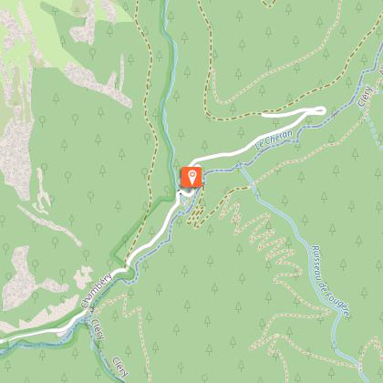
6/ Descend and follow the Chéran to the start.
Data author
