Alert
Alerts
4-day tour of Les Fiz


Description
Opposite Mont Blanc, cross the largest natural reserve in Haute-Savoie: Sixt-Passy. The trail combines minerals, its rare internationally-renowned geological features of limestone pavements, with alpine pastures and lakes (the Lac d'Anterne).
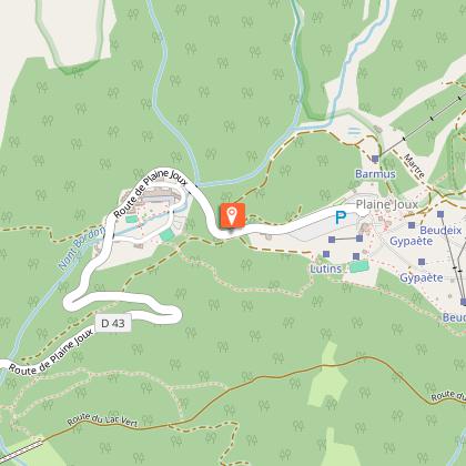
Stage 1: Passy Plaine Joux (1337 m) - Refuge Alfred Wills (1810m)
An itinerary full of surprises, skirting the "dérochoir" and the long rocky bar of the Fiz, before the view opens up at the Col d'Anterne, onto a magnificent lake (the largest mountain lake in Haute-Savoie) with blue-green reflections.
Passy Plaine Joux - Ayère des pierrires (1628 m): 1h15
Ayère des Pierrière - Col d'Anerne (2257m): 2h10
Col d'Anterne - Refuge Alfred Wills (1815m): 1h20
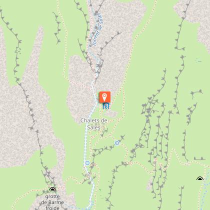
Stage 2: Refuge Alfred Wills - Refuge des Fonts - Refuge de Sales (1877m)
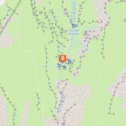
This trail overhangs the Sales torrent and is dotted with numerous waterfalls... bearing the names of La Pleureuse, La Sauffaz, Sales, Tarnant...
Refuge Alfred Wills - Petit Col d'Anterne (2038m) : 0h45
Petit Col d'Anterne - Chalet des Fonds (1380m): 2h10
Chalet des Fonds - Le Pelly de Serai (1063m): 0h55
Le Pelly de Serai - cascade de Sales (1580m): 2h15
cascades de Sales- Refuge de Sales (1877m): 0h50
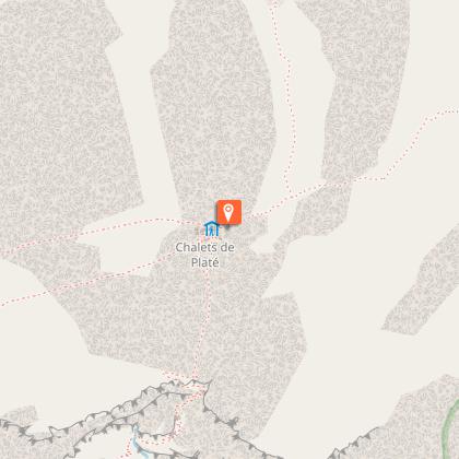
Stage 3: Refuge de Sales - Refuge de Platé (2032m)
Your stage is short. Take advantage of it to recuperate, stroll... your last stage will mark the ascent of Tête Colonney, a very pretty route at 2692 m altitude.
refuge de Sales- Col de Portette (2364m): 1h50
Col de Portette- Refuge de Platté (2032m): 0h40
Stage 4: Refuge de Platé - Plaine Joux (1337m)
We suggest this description in the direction of Tête Colonney, and advise you to set off at first light to take advantage of the morning colors.
Refuge de platé- Col du Colonney (2321m): 0h50
Col du Colonney- Tête de Monthieu (2479m): 0h30
Tête de Monthieu- Tête des Lindars (2560m): 0h20
Tête des Lindars - Tête Colonney (2692m): 0h30
Tête Colonney- refuge de platé (2032m): 1h40
refuge de Platé - Plaine Joux (1337): 2h30
Technical Information
Altimetric profile
Starting point
Points of interest


Date and time
- From 15/06/2026 to 30/09/2026
- From 15/06/2027 to 30/09/2027
Additional information
Open period
From 15/06 to 30/09 daily.
Updated by
Conseil Départemental de la Haute-Savoie - 07/04/2026
hautesavoiemontblanc-tourisme.com/
Report a problem
Environments
Close to GR footpath
Mountain view
Panoramic view
Lake view
Mountain location
In a nature reserve
Presence of livestock and guard dogs
Contact
Phone :
04 50 58 80 52
04 50 34 49 36
Email :
info@passy-mont-blanc.com
contact@haut-giffre-tourisme.fr
Facebook : https://www.facebook.com/Passymontblanc/
Type of land
Rock
Ground
Not suitable for strollers
Topo guides and map references
Map references :
IGN Top 25 map: 3530 ET
Location complements
Departure from Passy Plaine-Joux
Car access and parking :
Freeway A40 E 5 Annecy Chamonix axis. Exit 21 "Saint-Gervais-les-Bains, Passy, Le Fayet". At the traffic circle, take the 3rd exit Continue on : D339 towards : "Chedde, Passy, Plateau D'Assy". Take the D43, cross the Plateau d'Assy. Go to Plaine Joux parking lot.
It's also possible to do this circuit from Sixt-Fer-à-Cheval, on the other side of the Haut-Giffre massif. Car access and parking :
Freeway A40 E 5 Annecy Chamonix axis. Exit 18 "Scionzier-Cluses". Reach Sixt-Fer-à-Cheval via Châtillon sur Cluses and Samoëns. Then take the D29 towards Salvagny, as far as Parking du Lignon.
Tricky passages
The ascent of Tête Colonney is for good walkers only, not prone to vertigo. Crossing lapiaz can be dangerous when covered by a layer of snow. It is advisable to go around the névés. The crossing can also be tricky in fog, so be sure to check the weather forecast.
Swimming prohibited in high-altitude lakes.
Guidebook with maps/step-by-step
1/ Passy Plaine Joux (1337 m) - Refuge Alfred Wills (1810m)
An itinerary full of surprises, skirting the "dérochoir" and the long rocky bar of the Fiz, before the view opens up at the Col d'Anterne, onto a magnificent lake (the largest mountain lake in Haute-Savoie) with blue-green reflections.
Passy Plaine Joux - Ayère des pierrires (1628 m): 1h15
Ayère des Pierrière - Col d'Anerne (2257m): 2h10
Col d'Anterne - Refuge Alfred Wills (1815m): 1h20
2/ Refuge Alfred Wills - Refuge des Fonts - Refuge de Sales (1877 m)
This path overlooks the Sales torrent and is dotted with numerous waterfalls... bearing the names of La Pleureuse, La Sauffaz, Sales, Tarnant...
Refuge Alfred Wills - Petit Col d'Anterne (2038m) : 0h45
Petit Col d'Anterne - Chalet des Fonds (1380m): 2h10
Chalet des Fonds - Le Pelly de Serai (1063m): 0h55
Le Pelly de Serai - cascade de Sales (1580m): 2h15
cascades de Sales- Refuge de Sales (1877m): 0h50
3/ Refuge de Sales - Refuge de Platé (2032m)
Your stage is short. Take advantage of it to recuperate and stroll... your last stage will mark the ascent of Tête Colonney, a very pretty route at an altitude of 2692 m.
refuge de Sales- Col de Portette (2364m): 1h50
Col de Portette- Refuge de Platté (2032m): 0h40
4/ Refuge de Platé - Plaine Joux (1337m)
We offer this description in the direction of Tête Colonney, and advise you to set off at first light to take advantage of the morning colors.
Refuge de platé- Col du Colonney (2321m): 0h50
Col du Colonney- Tête de Monthieu (2479m): 0h30
Tête de Monthieu- Tête des Lindars (2560m): 0h20
Tête des Lindars - Tête Colonney (2692m): 0h30
Tête Colonney- refuge de platé (2032m): 1h40
refuge de Platé - Plaine Joux (1337): 2h30
Animals
No. Animals are forbidden in the Passy and Sixt-Passy nature reserves, even on a leash.
Data author
