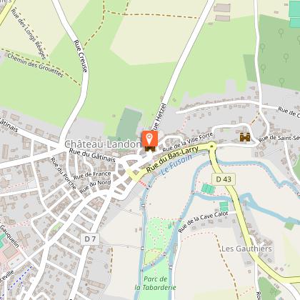
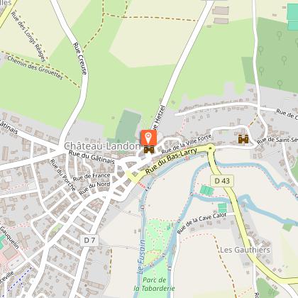
To see around
See more
Open
Close
Show
Show
Show
Show
Show
Show
Show
Show
Show
Show
Show

Oups... It would appear that Cirkwi does not have permission to use your location.

Description
Map
Steps
Points of interest
Cirkwi brief's
Ratings and reviews
See around

Fox circuit

Fox circuit

Description

It seems that on this course, the fox is inevitable. There are beliefs ... Anyway, the circuit takes you through the hamlets of Château-Landon on either side of the "Fusain" valley.

It ends with the discovery of the exceptional site of the city then, along its ramparts, overlooking the meander of the "Fusain", you will appreciate the spectacle of the viewpoints over the valley.

1 - Back to the Tourist Office, turn right, rue Hetzel (D207). Turn right, rue du Capitaine Antoine Chambon. Make a right-left to follow the rue des Chèvres.
2 - Turn left, rue de St Séverin, then right into the path (GR 13). Straight on, it comes out on rue du Pont Franc. Take it on the left. Enter the hamlet of the same name, pass the old Abbey and Leprosery on the left and the Pontfrault bridge on the right.
3 - Climb the grassy path to the left which enters the woods.
At the top, turn right at the edge of the wood for 1500m.
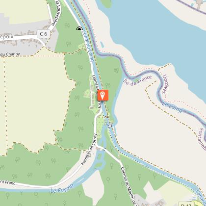
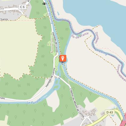
4 - Before Mocpoix down the path to the right in the undergrowth. Go along the Canal du Loing to the right. At the Néronville lock (canal bridge over the Fusain) continue along the towpath for 200m then fork to the right on the path. Continue by the road to the left. When entering Néronville, turn right onto the path on the edge of the woods. Then on the left the path of Aulnes.
5 - Cut the D43 to go up the Chemin de Toury opposite.
It climbs in the thalweg to the old Roman road "Chemin de César" and the A77 trench. Take the right twice. The path becomes a road.
6 - Cross Heurtebise and descend through the undergrowth, turn left onto the dirt track. At Fussellette turn right. The path runs alongside the Touvent farm, crosses the D 52 then turns right. Then fork into the path on the right.
7 - At the crossroads, take the road opposite, the next one on the left and the D7 on the right. Pass the two bridges (former post office) and turn right onto Chemin de la Haie de Banse for 500 m. Turn left, rue de la Tabarderie, and right, rue du Gal De Gaulle, to return to the city center. Continue straight ahead, rue Jean Galland (Notre Dame church and Hôtel-Dieu), until you reach the Place du Marché and the Tourist Office.
This route is marked in magenta by the Codérando.

Technical informations

This circuit was updated on: 25/02/2024
13 km
2 h 30 mn
max. 106 m
min. 68 m
161 m
Styles : HikingBaladeIn the country
Public : Occasional hikersExperienced hikers
Theme : Nature walk

Altimetric profile

Starting point

4 6 rue Hetzel , 77570 Château-Landon
Lat : 48.149892Lng : 2.703541

Steps

image du object
1

Départ

Partez de l'Office de Tourisme, rue Hetzel, prenez à droite, puis à droite rue du Capitaine Chambon, jusqu'au stop. Prenez en face la rue de Chèvres jusqu'à la route de Mocpoix, l'emprunter sur la gauche sur environ 200 mètres puis prenez à droite le chemin balisé GR13 qui mène à Pont Franc.

6 rue Hetzel 77570 Chateau-landon
- Office de Tourisme Gatinais Val de Loing -
Consulter
image du object
2

Étape 2

Arrivé à la route, prenez à gauche pendant environ 800 mètres en traversant Pont Franc (sur votre gauche l'ancienne Abbaye et Léproserie de Pontfrault et sur la droite le joli pont à deux arches dit Pont Franc.

33 Rue des Martins 77570 Chateau-landon
- Office de Tourisme Gatinais Val de Loing -
Consulter
image du object
3

Étape 3

30 mètres après ce pont, prenez à gauche le chemin de terre montant.

54 Rue de Pont Franc 77570 Chateau-landon
- Office de Tourisme Gatinais Val de Loing -
Consulter
image du object
4

Étape 4

En haut de ce chemin, tournez à droite et longez la lisière des bois pendant environ 1,5 km et preniez le chemin du Gourd à droite qui descend dans le sous-bois.

99-105 Rue de Pont Franc 77570 Chateau-landon
- Office de Tourisme Gatinais Val de Loing -
Consulter
image du object
5

Étape 5

A la sortie du sous-bois, prendre à droite et longez le canal du Loing. Passez le pont canal puis un second (déversoir).

6 La Butte Lorroy 77570 Chateau-landon
- Office de Tourisme Gatinais Val de Loing -
Consulter
image du object
6

Étape 6

Après le panneau d'information, prenez le chemin sur votre droite, et à la route, tournez à gauche. Après le panneau signalétique de Néronville, prenez à droite le chemin dit de Brisenelles puis à gauche le chemin des Aulnes.

66 Chemin du Moulin de Lorroy 77570 Chateau-landon
- Office de Tourisme Gatinais Val de Loing -
Consulter
image du object
7

Étape 7

A la route D43 (prudence), traversez et montez en face le chemin de Toury. Dans le bois, à l'intersection, prenez à gauche jusqu'à proximité de l'A77 et ensuite à droite (vous êtes sur ce qui reste du chemin de César) et à nouveau, prenez le chemin à droite puis continuez tout droit en traversant Heurtebise.

6250 Hameau de Neronville 77570 Chateau-landon
- Office de Tourisme Gatinais Val de Loing -
Consulter
image du object
8

Étape 8

Dans le bas de la descente, prenez à gauche le chemin de terre balisé GR13. A Fusselette, tournez à droite GR13. Longez les bois et à Touvent, traversez la route D52. Allez tout droit sur le chemin. A la deuxième intersection, obliquez à droite GR13 jusqu'à la route de Pithurin. Traversez et continue jusqu'à la route de la Cave Calot.

6 Rue du Pont de César 77570 Chateau-landon
- Office de Tourisme Gatinais Val de Loing -
Consulter
image du object
9

Étape 9

Prenez à gauche jusqu'à l'intersection (devant vous, les Scouts d'Europe. Vous êtes à Gasson. Tournez à droite et passez les deux ponts (sur votre gauche, vous pouvez voir ce qui reste d'une fenêtre à meneaux du 16ème siècle, reste d'un ancien Relais de Poste).

16 Rue de la Cave Calot 77570 Chateau-landon
- Office de Tourisme Gatinais Val de Loing -
Consulter
image du object
10

Étape 10

Prenez à droite le chemin de la Haie de Banse. Continuez ce chemin sur environ 500 mètres jusqu'à la rue de la Tabarderie. Prenez à gauche et puis à droite, la rue Charles de Gaulles vers le centre ville en passant rue Jean Galland ou vous avez sur votre gauche l'église Notre Dame de l'Assomption et à votre droite la Maison de la pierre/l'Hôtel-Dieu. Allez jusqu'à la place du Marché.

65 Chemin de la Haie de Banse 77570 Chateau-landon
- Office de Tourisme Gatinais Val de Loing -
Consulter
image du object
11

Étape 11

Sur votre droite, au Monument aux morts, vous avez une vue panoramique sur les monuments et la Vallée du Fusain.

3 Place du Marché 77570 Chateau-landon
- Office de Tourisme Gatinais Val de Loing -
Consulter

Points of interest

image du object

The Madeleine Tower and its ramparts

The Madeleine Tower is one of the towers of the rampart that Charles VI authorized to the bourgeois of Château-Landon.In spite of the looting, the fire and the passage of time, this one still shows appreciable vestiges; it serves in various places of support to constructions of a more recent past under which it disappears. It encloses the medieval administrative village, open, on the outside by four passages overlooking the 4 cardinal points. Only two remain: the North and the South. A round road lined it, quite rare, by a second underpass that went around the city. Towers regularly reinforced the wall as the best preserved Madeleine tower today. With a height of 9 metres and a diameter of 6.50 metres, this massive tower leaning against the ramparts communicates by its upper part with the circular path, visible on about 50 metres towards the East. With its 3 metres thick base, it is built of stone block and flint embedded in the mortar, pierced by 3 loopholes at half height. In 1926, the Madeleine Tower was listed as a Historic Monument.

6 rue Hetzel 77570 Château-Landon
- Office de Tourisme Gatinais Val de Loing -
Consulter
image du object

The Loing Canal

The Loing Canal located in the departments of Seine-et-Marne and Loiret measures 50 km and runs through 19 locks.All the work was carried out under the direction of the engineer Jean-Baptiste de Regemortes from 1719 to 1724. In 1809 the Orleans and Loing Canal Company became owner and it was in 1871 that the State took over. possession.

- Office de Tourisme Gatinais Val de Loing -
Consulter
image du object

The Neronville Canal Bridge

A nice curiosity on the Loing canal.A first canal bridge over the Charcoal was built at the beginning of the 18th century. Following the Freycinet law (1879), many structures were rebuilt. It was replaced in 1880 by the current canal bridge comprising 6 arches and measuring 12 meters.

Hameau de Lorroy 77570 Château-Landon
- Office de Tourisme Gatinais Val de Loing -
Consulter

Additional information

Open period

All year round.

Updated by

Office de Tourisme Gâtinais-Val de Loing - 23/10/2023
www.tourisme-gatinaisvaldeloing.fr
Report a problem

Data author

6 rue Hetzel 77570 Château-Landon France

The Cirkwi brief

Explore the Fox Trail in Château-Landon

Embark on a voyage of discovery through Château-Landon’s idyllic hamlets nestled on either side of the Fusain valley. Known affectionately as the Circuit du Renard, or Fox Trail, this route beckons with the promise of not just any encounter, but that of potentially spotting the elusive fox amidst breathtaking landscapes. Winding through historic sites and along ancient ramparts with stunning valley overlooks, this journey curated by the Office de tourisme de Château-Landon is more than a mere walk; it's an enchanting adventure into the heart of French countryside charm.

Brief Technical Overview of the Route

This meticulously planned route spans approximately 12.6 km, making it a manageable yet fulfilling outing for most. The path sees an elevation fluctuation between 68 to 106 meters, with a total positive elevation change round-trip of 161 meters. Highlighting the diversity of the terrain—from quaint village streets to lush woodland paths, and even alongside historical canals—this trek is designed for versatility, catering to a wide range of outdoor enthusiasts. Indeed, the Circuit du Renard provides an exemplary showcase of physical engagement and scenic allure.

Seasonal Tips and Safety Advice

Regardless of the season, the Circuit du Renard delivers unique charms and challenges. In spring and summer, the lush foliage and blooming fields provide a vivid backdrop, though it’s wise to pack sunscreen and ample water. Autumn transforms the landscape with a palette of warm colors, perfect for photographers, yet paths may become slippery with fallen leaves. Winter, with its stark beauty, demands caution for potential icy trails and requires warm, layered clothing. At all times, sturdy footwear is a must, as is keeping to marked paths to preserve both your safety and the integrity of the natural surroundings.

Historical Insights on Château-Landon and Region

Château-Landon, a treasure trove of history, sits at the heart of the French department of Seine-et-Marne. This medieval town's narrative intertwines deeply with the broader tapestry of French history, highlighted by landmarks such as the Tour Madeleine, a beacon of the past's enduring presence. Integrally, Château-Landon's fortifications speak of times when they were paramount to the town's survival. In exploring this region, visitors tread paths that echo with the footsteps of centuries, offering a palpable connection to the rich historical and cultural legacy that shapes the character of this enchanting part of France.

Weather Patterns and Ideal Visit Times

Seine-et-Marne’s climate, typified by mild springs, pleasant summers, crisp autumns, and cool winters, presents a welcoming window to explore year-round. However, to capture the essence of Château-Landon and its surroundings at their peak, aim for a visit between late spring to early autumn. This period promises not only the most temperate weather but also brings the landscape to life, making it the ideal setting for an unforgettable stroll along the Circuit du Renard.
Automatically generated.

Ratings and reviews

To see around
See more
Open
Close
Show
Show
Show
Show
Show
Show
Show
Show
Show
Show
Show